de Leon Empresario Colony. April 30, 1829

Print $20.00
de Leon Empresario Colony. April 30, 1829
2020
Size: 18.5 x 21.7 inches
95990
de Leon Empresario Colony. April 15, 1824

Print $20.00
de Leon Empresario Colony. April 15, 1824
2020
Size: 18.5 x 21.7 inches
95988
de Leon Empresario Colony. Absorbed by DeWitt Colony. April 15, 1825

Print $20.00
de Leon Empresario Colony. Absorbed by DeWitt Colony. April 15, 1825
2020
Size: 18.5 x 21.7 inches
95989
[Young Territory]

Print $40.00
- Digital $50.00
[Young Territory]
1875
Size: 49.0 x 87.4 inches
16784
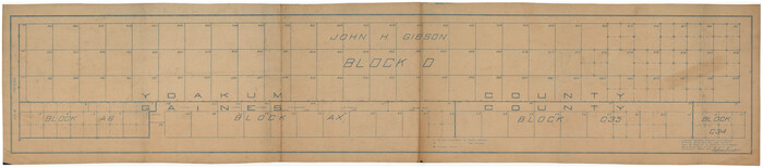
[Yoakum and Gaines County Line Along Block D in Yoakum and Blocks A6, AX, C35 and C34 in Gaines]
Print $40.00
- Digital $50.00
[Yoakum and Gaines County Line Along Block D in Yoakum and Blocks A6, AX, C35 and C34 in Gaines]
1924
Size: 54.9 x 12.3 inches
89691
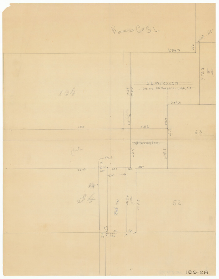
[Yates, just south of Runnels County School Land]
Print $20.00
- Digital $50.00
[Yates, just south of Runnels County School Land]
1928
Size: 17.7 x 22.7 inches
91653
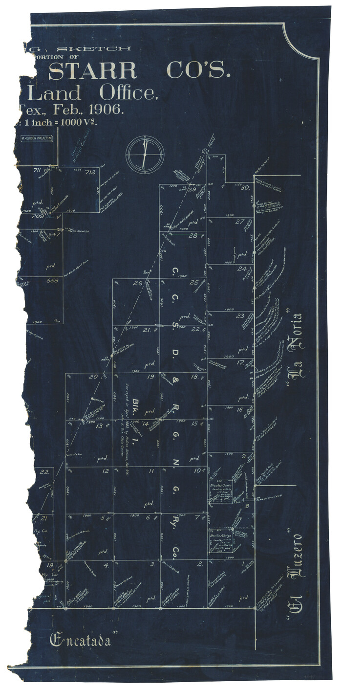
[Working Sketch of a portion of Hidalgo & Starr Co's.]
Print $20.00
- Digital $50.00
[Working Sketch of a portion of Hidalgo & Starr Co's.]
1906
Size: 27.8 x 13.8 inches
4447
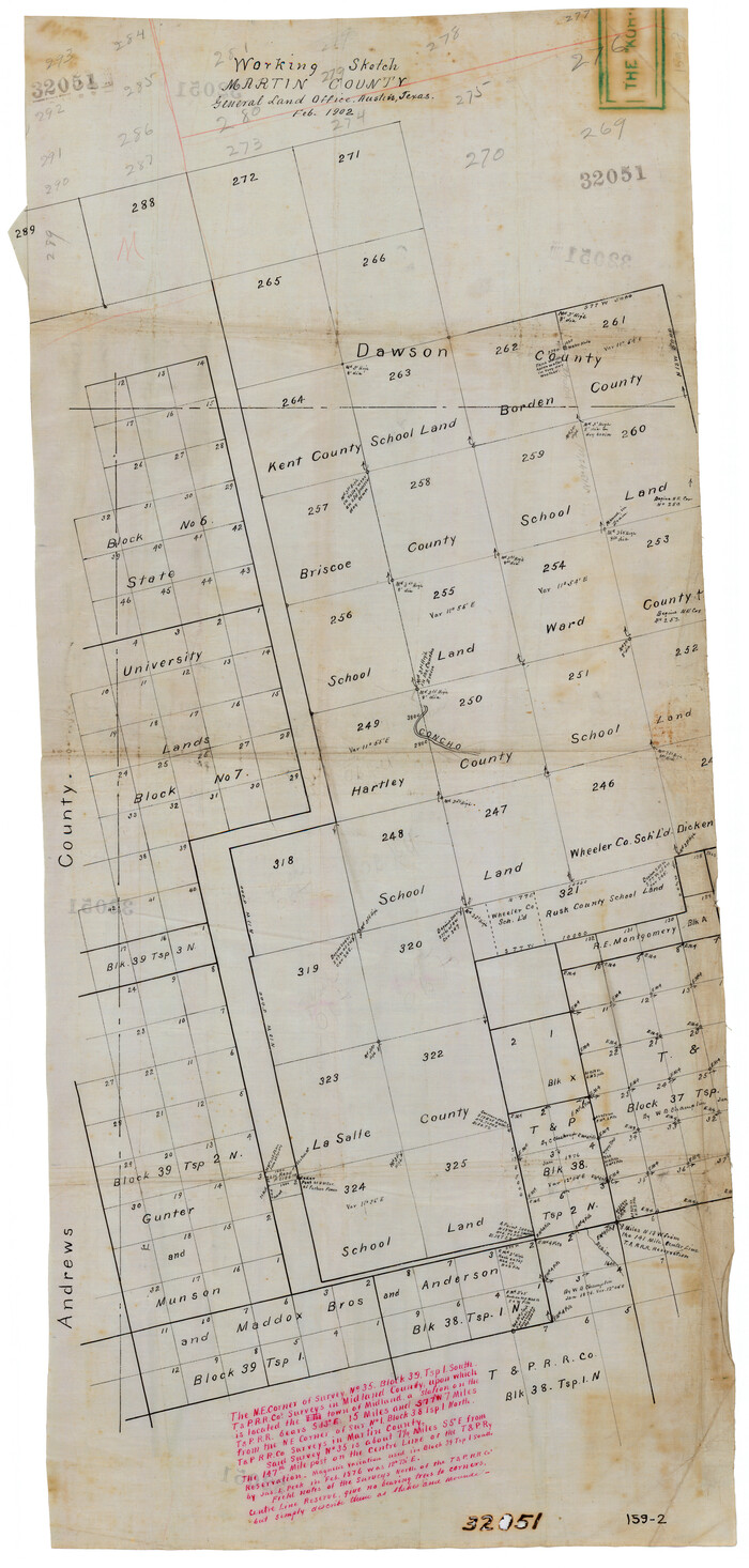
[Working Sketch in Martin County Showing Northwest Portion of County]
Print $20.00
- Digital $50.00
[Working Sketch in Martin County Showing Northwest Portion of County]
1902
Size: 17.1 x 36.0 inches
91355
[Working Sketch Showing Southwest Part of the County]
Print $2.00
- Digital $50.00
[Working Sketch Showing Southwest Part of the County]
1886
Size: 14.9 x 9.0 inches
91117
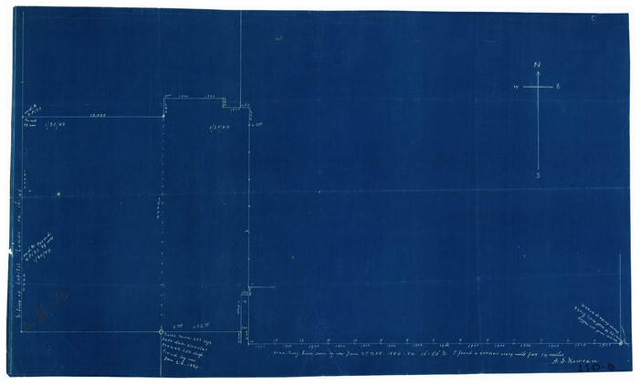
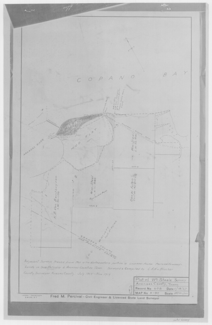
[William Steele Survey near Copano Bay]
Print $20.00
- Digital $50.00
[William Steele Survey near Copano Bay]
1927
Size: 26.1 x 18.4 inches
2082
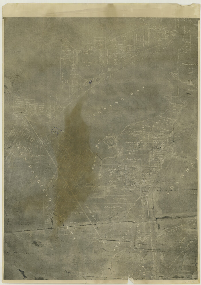
[William Steele Survey near Copano Bay]
Print $3.00
- Digital $50.00
[William Steele Survey near Copano Bay]
1927
Size: 15.5 x 9.5 inches
60284
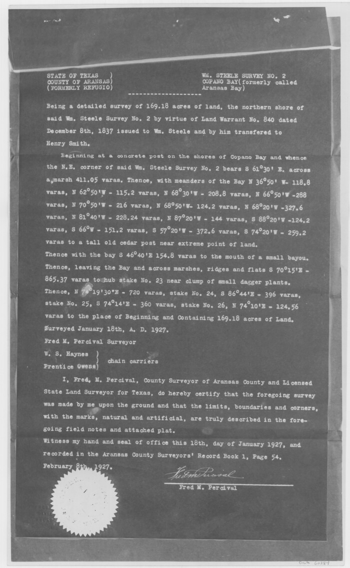
[William Steele Survey near Copano Bay]
Print $3.00
- Digital $50.00
[William Steele Survey near Copano Bay]
1927
Size: 14.9 x 9.8 inches
60285
[West half of county, south of John H. Stephens Block S2]

Print $2.00
- Digital $50.00
[West half of county, south of John H. Stephens Block S2]
1912
Size: 8.6 x 5.9 inches
92976
[West half of County]
Print $40.00
- Digital $50.00
[West half of County]
1914
Size: 40.0 x 62.5 inches
89961
[West half of County]
Print $40.00
- Digital $50.00
[West half of County]
1914
Size: 38.7 x 97.9 inches
93188
[West and North lines of the Panhandle]
Print $20.00
- Digital $50.00
[West and North lines of the Panhandle]
1885
Size: 22.0 x 32.1 inches
90576
[Washington County RR. Co. Block 1 and Cherokee Iron Furnace Co. Block 1]
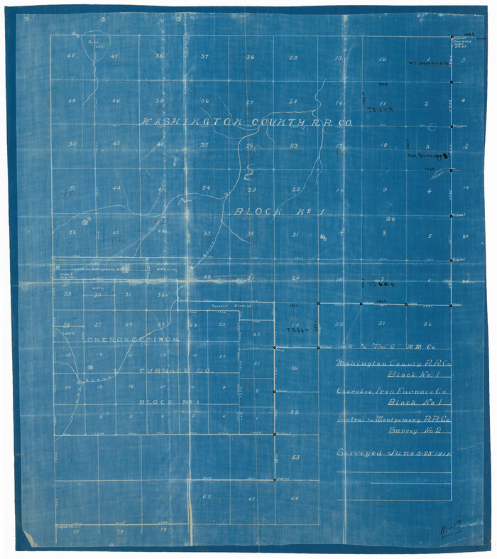
Print $20.00
- Digital $50.00
[Washington County RR. Co. Block 1 and Cherokee Iron Furnace Co. Block 1]
1911
Size: 22.4 x 25.4 inches
92065
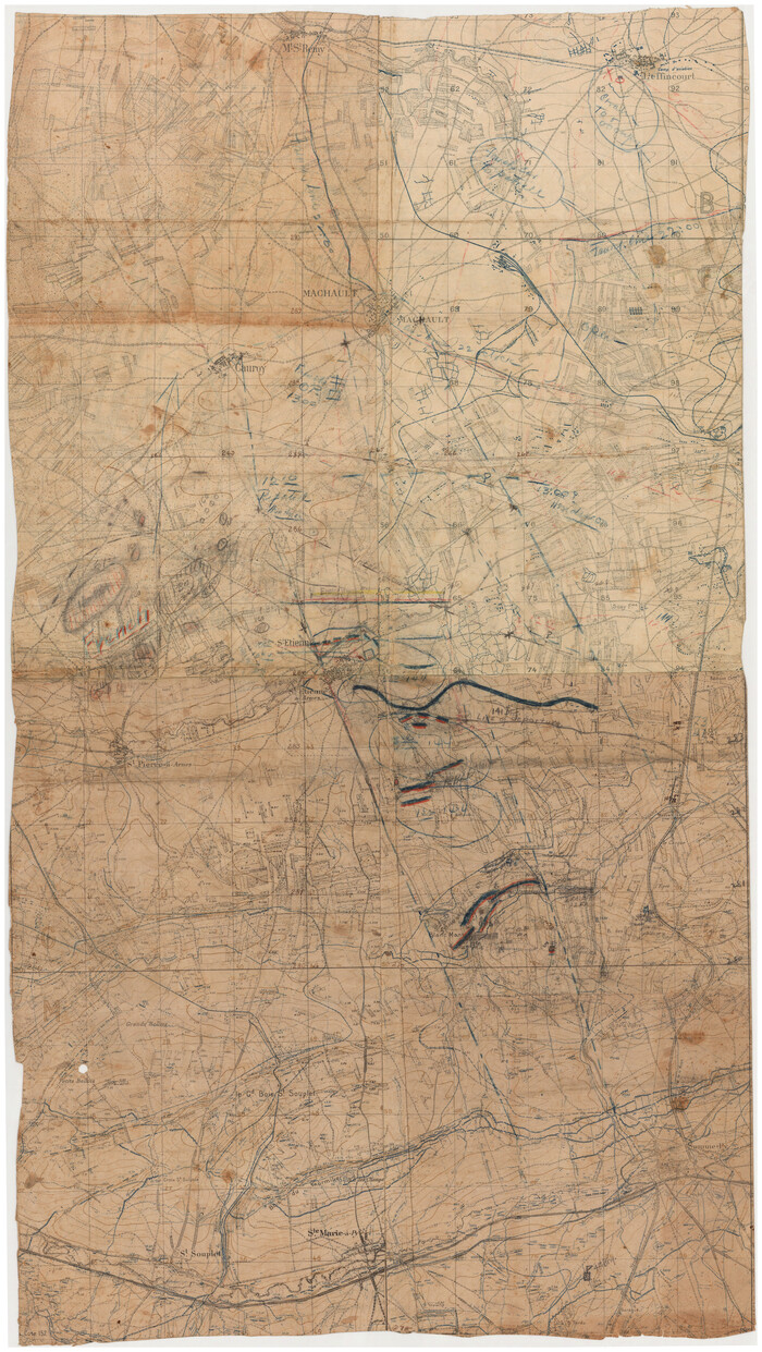
[WWI Topographic Planning Map of the Ardennes]
Print $20.00
[WWI Topographic Planning Map of the Ardennes]
1918
Size: 35.8 x 20.2 inches
94129
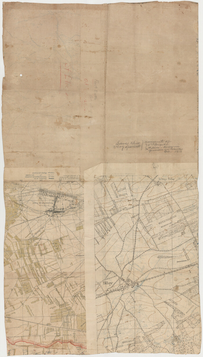
[WWI Topographic Planning Map of the Ardennes department] - Verso
Print $20.00
[WWI Topographic Planning Map of the Ardennes department] - Verso
1918
Size: 35.9 x 20.4 inches
94130
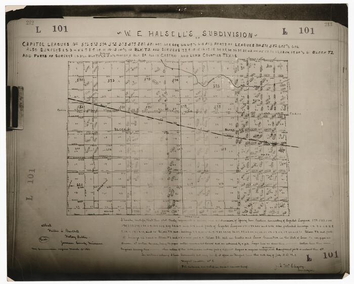
[W. E. Halsell's Subdivision of Capitol Leagues, Blocks T1,T2, T3, and S2]
Print $20.00
- Digital $50.00
[W. E. Halsell's Subdivision of Capitol Leagues, Blocks T1,T2, T3, and S2]
1907
Size: 20.5 x 16.5 inches
92164
[W. C. RR. Co. Blks. 1 & 2, I. & G. N. RR. Co. Blk. 1, in southeast part of County]
Print $2.00
- Digital $50.00
[W. C. RR. Co. Blks. 1 & 2, I. & G. N. RR. Co. Blk. 1, in southeast part of County]
1879
Size: 6.5 x 5.8 inches
90487
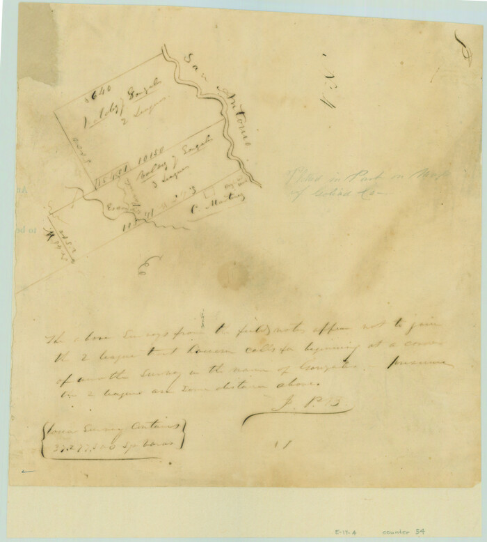
[Valdez and Martinez grants in the Goliad District]
Print $3.00
- Digital $50.00
[Valdez and Martinez grants in the Goliad District]
1842
Size: 10.6 x 9.5 inches
54
[Val Verde County]
Print $20.00
- Digital $50.00
[Val Verde County]
1898
Size: 39.1 x 32.4 inches
63095
[Val Verde County]
Print $20.00
- Digital $50.00
[Val Verde County]
1898
Size: 42.6 x 34.9 inches
63096
[Val Verde County]
Print $20.00
- Digital $50.00
[Val Verde County]
1898
Size: 41.1 x 37.1 inches
63097
[Vague Sketches in Brooks County, Texas]
Print $20.00
- Digital $50.00
[Vague Sketches in Brooks County, Texas]
1906
Size: 17.8 x 19.9 inches
83352
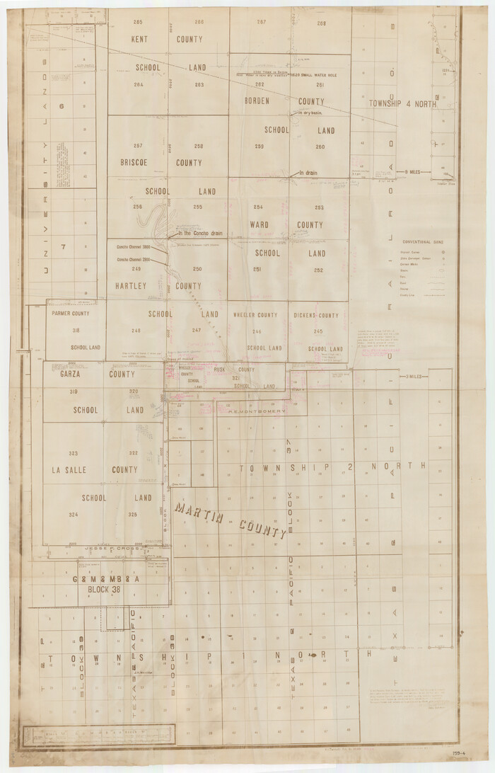
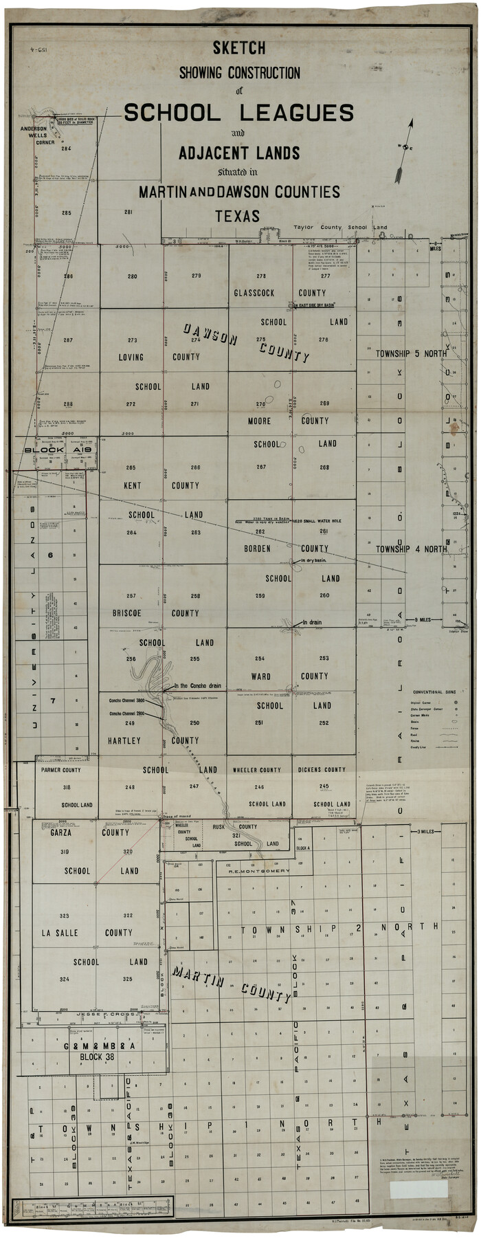
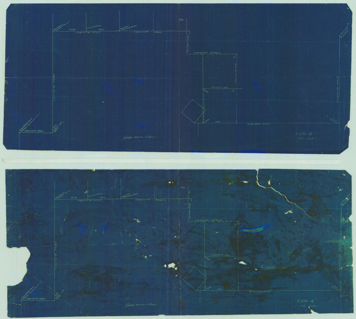
[Unorganized County School Land Leagues 284 - 317]
Print $20.00
- Digital $50.00
[Unorganized County School Land Leagues 284 - 317]
1902
Size: 29.2 x 21.3 inches
90854
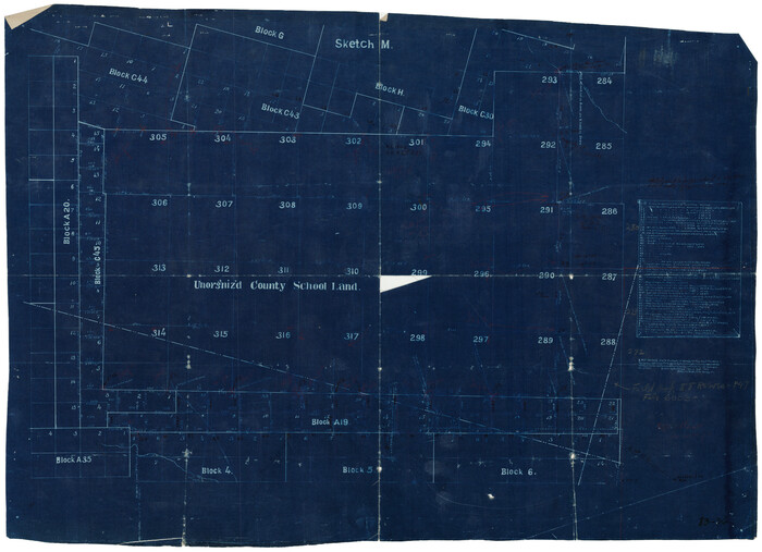
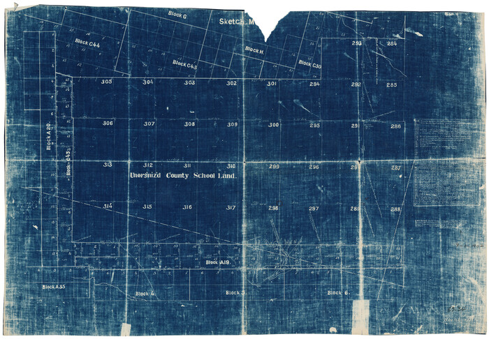
[Unorganized County School Land Leagues 284 - 317]
Print $20.00
- Digital $50.00
[Unorganized County School Land Leagues 284 - 317]
1902
Size: 30.2 x 20.6 inches
90856
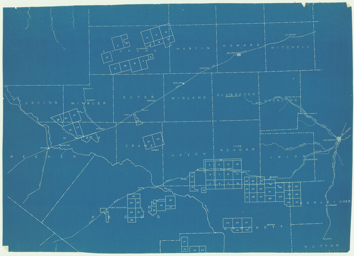
[University Lands]
Print $40.00
- Digital $50.00
[University Lands]
1885
Size: 52.9 x 39.5 inches
62966
[University Lands in West Texas]
Print $20.00
- Digital $50.00
[University Lands in West Texas]
1938
Size: 20.3 x 28.1 inches
2422
de Leon Empresario Colony. April 30, 1829
Print $20.00
de Leon Empresario Colony. April 30, 1829
2020
-
Size
18.5 x 21.7 inches
-
Map/Doc
95990
-
Creation Date
2020
de Leon Empresario Colony. April 15, 1824
Print $20.00
de Leon Empresario Colony. April 15, 1824
2020
-
Size
18.5 x 21.7 inches
-
Map/Doc
95988
-
Creation Date
2020
de Leon Empresario Colony. Absorbed by DeWitt Colony. April 15, 1825
Print $20.00
de Leon Empresario Colony. Absorbed by DeWitt Colony. April 15, 1825
2020
-
Size
18.5 x 21.7 inches
-
Map/Doc
95989
-
Creation Date
2020
[Young Territory]
Print $40.00
- Digital $50.00
[Young Territory]
1875
-
Size
49.0 x 87.4 inches
-
Map/Doc
16784
-
Creation Date
1875
[Yoakum and Gaines County Line Along Block D in Yoakum and Blocks A6, AX, C35 and C34 in Gaines]
Print $40.00
- Digital $50.00
[Yoakum and Gaines County Line Along Block D in Yoakum and Blocks A6, AX, C35 and C34 in Gaines]
1924
-
Size
54.9 x 12.3 inches
-
Map/Doc
89691
-
Creation Date
1924
[Yates, just south of Runnels County School Land]
Print $20.00
- Digital $50.00
[Yates, just south of Runnels County School Land]
1928
-
Size
17.7 x 22.7 inches
-
Map/Doc
91653
-
Creation Date
1928
[Working Sketch of a portion of Hidalgo & Starr Co's.]
Print $20.00
- Digital $50.00
[Working Sketch of a portion of Hidalgo & Starr Co's.]
1906
-
Size
27.8 x 13.8 inches
-
Map/Doc
4447
-
Creation Date
1906
[Working Sketch in Martin County Showing Northwest Portion of County]
Print $20.00
- Digital $50.00
[Working Sketch in Martin County Showing Northwest Portion of County]
1902
-
Size
17.1 x 36.0 inches
-
Map/Doc
91355
-
Creation Date
1902
[Working Sketch Showing Southwest Part of the County]
Print $2.00
- Digital $50.00
[Working Sketch Showing Southwest Part of the County]
1886
-
Size
14.9 x 9.0 inches
-
Map/Doc
91117
-
Creation Date
1886
[William Steele Survey near Copano Bay]
Print $20.00
- Digital $50.00
[William Steele Survey near Copano Bay]
1927
-
Size
26.1 x 18.4 inches
-
Map/Doc
2082
-
Creation Date
1927
[William Steele Survey near Copano Bay]
Print $3.00
- Digital $50.00
[William Steele Survey near Copano Bay]
1927
-
Size
15.5 x 9.5 inches
-
Map/Doc
60284
-
Creation Date
1927
[William Steele Survey near Copano Bay]
Print $3.00
- Digital $50.00
[William Steele Survey near Copano Bay]
1927
-
Size
14.9 x 9.8 inches
-
Map/Doc
60285
-
Creation Date
1927
[West half of county, south of John H. Stephens Block S2]
Print $2.00
- Digital $50.00
[West half of county, south of John H. Stephens Block S2]
1912
-
Size
8.6 x 5.9 inches
-
Map/Doc
92976
-
Creation Date
1912
[West half of County]
Print $40.00
- Digital $50.00
[West half of County]
1914
-
Size
40.0 x 62.5 inches
-
Map/Doc
89961
-
Creation Date
1914
[West half of County]
Print $40.00
- Digital $50.00
[West half of County]
1914
-
Size
38.7 x 97.9 inches
-
Map/Doc
93188
-
Creation Date
1914
[West and North lines of the Panhandle]
Print $20.00
- Digital $50.00
[West and North lines of the Panhandle]
1885
-
Size
22.0 x 32.1 inches
-
Map/Doc
90576
-
Creation Date
1885
[Washington County RR. Co. Block 1 and Cherokee Iron Furnace Co. Block 1]
Print $20.00
- Digital $50.00
[Washington County RR. Co. Block 1 and Cherokee Iron Furnace Co. Block 1]
1911
-
Size
22.4 x 25.4 inches
-
Map/Doc
92065
-
Creation Date
1911
[WWI Topographic Planning Map of the Ardennes]
Print $20.00
[WWI Topographic Planning Map of the Ardennes]
1918
-
Size
35.8 x 20.2 inches
-
Map/Doc
94129
-
Creation Date
1918
[WWI Topographic Planning Map of the Ardennes department] - Verso
Print $20.00
[WWI Topographic Planning Map of the Ardennes department] - Verso
1918
-
Size
35.9 x 20.4 inches
-
Map/Doc
94130
-
Creation Date
1918
[W. E. Halsell's Subdivision of Capitol Leagues, Blocks T1,T2, T3, and S2]
Print $20.00
- Digital $50.00
[W. E. Halsell's Subdivision of Capitol Leagues, Blocks T1,T2, T3, and S2]
1907
-
Size
20.5 x 16.5 inches
-
Map/Doc
92164
-
Creation Date
1907
[W. C. RR. Co. Blks. 1 & 2, I. & G. N. RR. Co. Blk. 1, in southeast part of County]
Print $2.00
- Digital $50.00
[W. C. RR. Co. Blks. 1 & 2, I. & G. N. RR. Co. Blk. 1, in southeast part of County]
1879
-
Size
6.5 x 5.8 inches
-
Map/Doc
90487
-
Creation Date
1879
[Valdez and Martinez grants in the Goliad District]
Print $3.00
- Digital $50.00
[Valdez and Martinez grants in the Goliad District]
1842
-
Size
10.6 x 9.5 inches
-
Map/Doc
54
-
Creation Date
1842
[Val Verde County]
Print $20.00
- Digital $50.00
[Val Verde County]
1898
-
Size
39.1 x 32.4 inches
-
Map/Doc
63095
-
Creation Date
1898
[Val Verde County]
Print $20.00
- Digital $50.00
[Val Verde County]
1898
-
Size
42.6 x 34.9 inches
-
Map/Doc
63096
-
Creation Date
1898
[Val Verde County]
Print $20.00
- Digital $50.00
[Val Verde County]
1898
-
Size
41.1 x 37.1 inches
-
Map/Doc
63097
-
Creation Date
1898
[Vague Sketches in Brooks County, Texas]
Print $20.00
- Digital $50.00
[Vague Sketches in Brooks County, Texas]
1906
-
Size
17.8 x 19.9 inches
-
Map/Doc
83352
-
Creation Date
1906
[Unorganized County School Land Leagues 284 - 317]
Print $20.00
- Digital $50.00
[Unorganized County School Land Leagues 284 - 317]
1902
-
Size
29.2 x 21.3 inches
-
Map/Doc
90854
-
Creation Date
1902
[Unorganized County School Land Leagues 284 - 317]
Print $20.00
- Digital $50.00
[Unorganized County School Land Leagues 284 - 317]
1902
-
Size
30.2 x 20.6 inches
-
Map/Doc
90856
-
Creation Date
1902
[University Lands]
Print $40.00
- Digital $50.00
[University Lands]
1885
-
Size
52.9 x 39.5 inches
-
Map/Doc
62966
-
Creation Date
1885
[University Lands in West Texas]
Print $20.00
- Digital $50.00
[University Lands in West Texas]
1938
-
Size
20.3 x 28.1 inches
-
Map/Doc
2422
-
Creation Date
1938