A Chart of the Internal Part of Louisiana

Print $20.00
A Chart of the Internal Part of Louisiana
1807
Size: 19.2 x 16.5 inches
79310
A Chart of the Internal Part of Louisiana

Print $20.00
- Digital $50.00
A Chart of the Internal Part of Louisiana
1810
Size: 19.0 x 17.3 inches
95155
A Compleat Map of the West Indies, containing the Coasts of Florida, Louisiana, New Spain, and Terra Firma: with all the Islands

Print $20.00
- Digital $50.00
A Compleat Map of the West Indies, containing the Coasts of Florida, Louisiana, New Spain, and Terra Firma: with all the Islands
1774
Size: 13.9 x 19.0 inches
97400
A Comprehensive Atlas Geographical, Historical & Commercial

A Comprehensive Atlas Geographical, Historical & Commercial
Size: 13.0 x 10.7 inches
95959
A General Map of North America drawn from the best surveys

Print $20.00
- Digital $50.00
A General Map of North America drawn from the best surveys
1795
93944
A General Map of North America; In which is Express'd the several New Roads, Forts, Engagements, & c. taken from Actual Surveys and Observations Made in the Army employ'd there

Print $20.00
- Digital $50.00
A General Map of North America; In which is Express'd the several New Roads, Forts, Engagements, & c. taken from Actual Surveys and Observations Made in the Army employ'd there
1761
Size: 37.6 x 38.6 inches
93827
A General Map of the Middle British Colonies, in America. containing Virginia, Maryland, the Delaware Counties, Pennsylvania and New Jersey. With the addition of New York and of the Greatest Part of New England

Print $20.00
- Digital $50.00
A General Map of the Middle British Colonies, in America. containing Virginia, Maryland, the Delaware Counties, Pennsylvania and New Jersey. With the addition of New York and of the Greatest Part of New England
1776
Size: 21.6 x 27.2 inches
97402
A General Map of the Northern British Colonies in America which comprehends the Province of Quebec, the Government of Newfoundland, Nova-Scotia, New England and New York

Print $20.00
- Digital $50.00
A General Map of the Northern British Colonies in America which comprehends the Province of Quebec, the Government of Newfoundland, Nova-Scotia, New England and New York
1776
Size: 21.3 x 27.3 inches
97401
A General Map of the Roman Empire Shewing the Situation of all its Provinces & ye Seats of ye Barbarous Nations on their Frontiers

Print $20.00
- Digital $50.00
A General Map of the Roman Empire Shewing the Situation of all its Provinces & ye Seats of ye Barbarous Nations on their Frontiers
Size: 10.8 x 20.5 inches
96644
A General Map of the Southern British Colonies, in America. comprehending North and South Carolina, Georgia, East and West Florida, with the Neighbouring Indian Countries

Print $20.00
- Digital $50.00
A General Map of the Southern British Colonies, in America. comprehending North and South Carolina, Georgia, East and West Florida, with the Neighbouring Indian Countries
1776
Size: 21.3 x 26.4 inches
97403
A Geological Map of the United States

Print $20.00
A Geological Map of the United States
Size: 10.2 x 15.9 inches
95281
A Map of Austin's Colony and adjacent country in Texas drawn principally from actual survey by Stephen F. Austin

A Map of Austin's Colony and adjacent country in Texas drawn principally from actual survey by Stephen F. Austin
1820
Size: 13.8 x 17.0 inches
93353
A Map of Gonzales County

Print $20.00
- Digital $50.00
A Map of Gonzales County
1838
Size: 34.7 x 39.2 inches
16838
A Map of Louisiana and Mexico

Print $20.00
A Map of Louisiana and Mexico
1820
Size: 43.0 x 32.6 inches
76218
A Map of Louisiana and Mexico

Print $20.00
- Digital $50.00
A Map of Louisiana and Mexico
1820
Size: 43.8 x 32.9 inches
94945
A Map of Matagorda Bay and County With the Adjacent County

Print $20.00
- Digital $50.00
A Map of Matagorda Bay and County With the Adjacent County
1839
Size: 33.9 x 43.1 inches
4855
A Map of Mexico, Louisiana and the Missouri Territory, including also the State of Mississippi, Alabama Territory, East & West Florida, Georgia, South Carolina & part of the Island of Cuba

Print $40.00
A Map of Mexico, Louisiana and the Missouri Territory, including also the State of Mississippi, Alabama Territory, East & West Florida, Georgia, South Carolina & part of the Island of Cuba
Size: 66.9 x 64.2 inches
95312
A Map of North America, constructed according to the latest information

Print $40.00
- Digital $50.00
A Map of North America, constructed according to the latest information
1822
Size: 44.4 x 59.6 inches
93845
A Map of Part of Panola County [Judicial District]
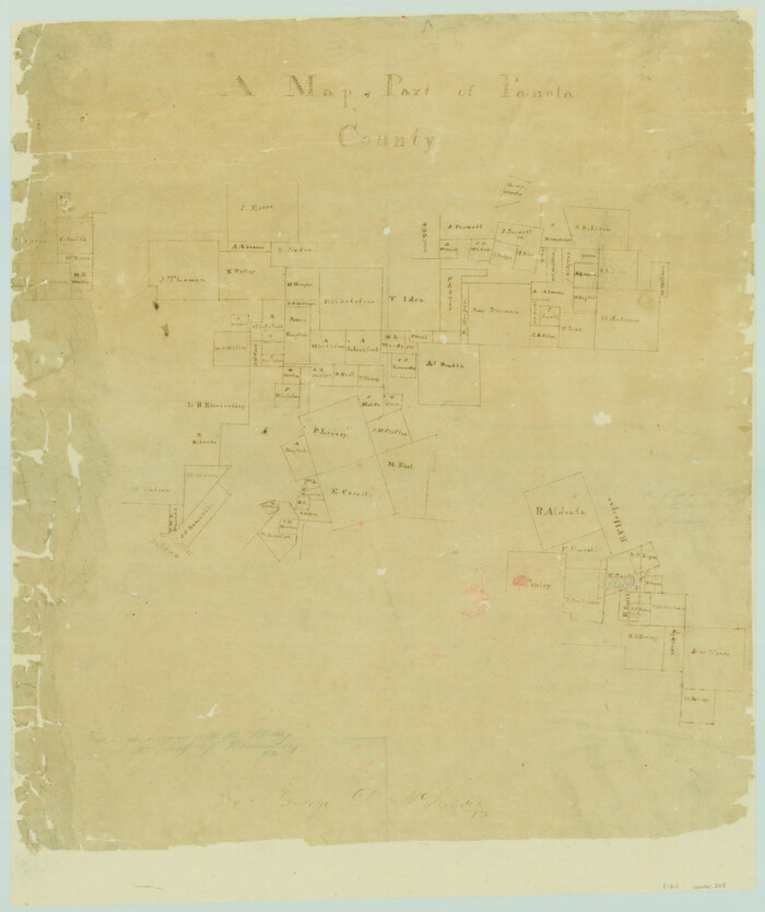
Print $20.00
- Digital $50.00
A Map of Part of Panola County [Judicial District]
1841
Size: 18.3 x 15.4 inches
328
A Map of the British Empire in America with the French and Spanish Settlements adjacent thereto

Print $20.00
- Digital $50.00
A Map of the British Empire in America with the French and Spanish Settlements adjacent thereto
Size: 20.7 x 20.6 inches
95704
A Map of the British Empire in North America

Print $20.00
- Digital $50.00
A Map of the British Empire in North America
1774
Size: 22.1 x 15.1 inches
93733
A Map of the Internal Provinces of New Spain

Print $20.00
A Map of the Internal Provinces of New Spain
1807
Size: 18.9 x 19.5 inches
76234
A Map of the Internal Provinces of New Spain

Print $20.00
- Digital $50.00
A Map of the Internal Provinces of New Spain
1810
Size: 19.8 x 21.0 inches
95156
A Map of the Internal Provinces of New Spain

Print $20.00
- Digital $50.00
A Map of the Internal Provinces of New Spain
1807
Size: 20.9 x 20.0 inches
97239
A Map of the Republic of Texas and the adjacent territories, indicating the grants of land conceded under the empresario system of Mexico

Print $20.00
- Digital $50.00
A Map of the Republic of Texas and the adjacent territories, indicating the grants of land conceded under the empresario system of Mexico
1841
Size: 13.8 x 16.6 inches
93752
A Map of the United States including Louisiana

Print $20.00
- Digital $50.00
A Map of the United States including Louisiana
1817
Size: 14.9 x 18.2 inches
95964
A Map of the United States of Mexico as organized and defined by the several Acts of the Congress of that Republic

Print $20.00
A Map of the United States of Mexico as organized and defined by the several Acts of the Congress of that Republic
1826
Size: 23.2 x 28.9 inches
93635
A Map of the United States of Mexico as organized and defined by the several Acts of the Congress of that Republic

Print $20.00
- Digital $50.00
A Map of the United States of Mexico as organized and defined by the several Acts of the Congress of that Republic
1826
Size: 23.9 x 31.2 inches
93939
A Map of the West-Indies & c., Mexico or New Spain. Also ye trade winds and ye several tracts made by ye Galeons and Flota from place to place

Print $20.00
- Digital $50.00
A Map of the West-Indies & c., Mexico or New Spain. Also ye trade winds and ye several tracts made by ye Galeons and Flota from place to place
1729
Size: 9.5 x 13.6 inches
94087
A New & Correct Map of the Trading Part of the West Indies, including the Seat of War between Gr. Britain and France Likewise the British Empire in America, with the French and Spanish Settlements adjacent thereto

Print $20.00
- Digital $50.00
A New & Correct Map of the Trading Part of the West Indies, including the Seat of War between Gr. Britain and France Likewise the British Empire in America, with the French and Spanish Settlements adjacent thereto
1759
Size: 27.4 x 41.4 inches
93826
A Chart of the Internal Part of Louisiana
Print $20.00
A Chart of the Internal Part of Louisiana
1807
-
Size
19.2 x 16.5 inches
-
Map/Doc
79310
-
Creation Date
1807
A Chart of the Internal Part of Louisiana
Print $20.00
- Digital $50.00
A Chart of the Internal Part of Louisiana
1810
-
Size
19.0 x 17.3 inches
-
Map/Doc
95155
-
Creation Date
1810
A Compleat Map of the West Indies, containing the Coasts of Florida, Louisiana, New Spain, and Terra Firma: with all the Islands
Print $20.00
- Digital $50.00
A Compleat Map of the West Indies, containing the Coasts of Florida, Louisiana, New Spain, and Terra Firma: with all the Islands
1774
-
Size
13.9 x 19.0 inches
-
Map/Doc
97400
-
Creation Date
1774
A Comprehensive Atlas Geographical, Historical & Commercial
A Comprehensive Atlas Geographical, Historical & Commercial
-
Size
13.0 x 10.7 inches
-
Map/Doc
95959
A General Map of North America drawn from the best surveys
Print $20.00
- Digital $50.00
A General Map of North America drawn from the best surveys
1795
-
Map/Doc
93944
-
Creation Date
1795
A General Map of North America; In which is Express'd the several New Roads, Forts, Engagements, & c. taken from Actual Surveys and Observations Made in the Army employ'd there
Print $20.00
- Digital $50.00
A General Map of North America; In which is Express'd the several New Roads, Forts, Engagements, & c. taken from Actual Surveys and Observations Made in the Army employ'd there
1761
-
Size
37.6 x 38.6 inches
-
Map/Doc
93827
-
Creation Date
1761
A General Map of the Middle British Colonies, in America. containing Virginia, Maryland, the Delaware Counties, Pennsylvania and New Jersey. With the addition of New York and of the Greatest Part of New England
Print $20.00
- Digital $50.00
A General Map of the Middle British Colonies, in America. containing Virginia, Maryland, the Delaware Counties, Pennsylvania and New Jersey. With the addition of New York and of the Greatest Part of New England
1776
-
Size
21.6 x 27.2 inches
-
Map/Doc
97402
-
Creation Date
1776
A General Map of the Northern British Colonies in America which comprehends the Province of Quebec, the Government of Newfoundland, Nova-Scotia, New England and New York
Print $20.00
- Digital $50.00
A General Map of the Northern British Colonies in America which comprehends the Province of Quebec, the Government of Newfoundland, Nova-Scotia, New England and New York
1776
-
Size
21.3 x 27.3 inches
-
Map/Doc
97401
-
Creation Date
1776
A General Map of the Roman Empire Shewing the Situation of all its Provinces & ye Seats of ye Barbarous Nations on their Frontiers
Print $20.00
- Digital $50.00
A General Map of the Roman Empire Shewing the Situation of all its Provinces & ye Seats of ye Barbarous Nations on their Frontiers
-
Size
10.8 x 20.5 inches
-
Map/Doc
96644
A General Map of the Southern British Colonies, in America. comprehending North and South Carolina, Georgia, East and West Florida, with the Neighbouring Indian Countries
Print $20.00
- Digital $50.00
A General Map of the Southern British Colonies, in America. comprehending North and South Carolina, Georgia, East and West Florida, with the Neighbouring Indian Countries
1776
-
Size
21.3 x 26.4 inches
-
Map/Doc
97403
-
Creation Date
1776
A Geological Map of the United States
Print $20.00
A Geological Map of the United States
-
Size
10.2 x 15.9 inches
-
Map/Doc
95281
A Map of Austin's Colony and adjacent country in Texas drawn principally from actual survey by Stephen F. Austin
A Map of Austin's Colony and adjacent country in Texas drawn principally from actual survey by Stephen F. Austin
1820
-
Size
13.8 x 17.0 inches
-
Map/Doc
93353
-
Creation Date
1820
A Map of Gonzales County
Print $20.00
- Digital $50.00
A Map of Gonzales County
1838
-
Size
34.7 x 39.2 inches
-
Map/Doc
16838
-
Creation Date
1838
A Map of Louisiana and Mexico
Print $20.00
A Map of Louisiana and Mexico
1820
-
Size
43.0 x 32.6 inches
-
Map/Doc
76218
-
Creation Date
1820
A Map of Louisiana and Mexico
Print $20.00
- Digital $50.00
A Map of Louisiana and Mexico
1820
-
Size
43.8 x 32.9 inches
-
Map/Doc
94945
-
Creation Date
1820
A Map of Matagorda Bay and County With the Adjacent County
Print $20.00
- Digital $50.00
A Map of Matagorda Bay and County With the Adjacent County
1839
-
Size
33.9 x 43.1 inches
-
Map/Doc
4855
-
Creation Date
1839
A Map of Mexico, Louisiana and the Missouri Territory, including also the State of Mississippi, Alabama Territory, East & West Florida, Georgia, South Carolina & part of the Island of Cuba
Print $40.00
A Map of Mexico, Louisiana and the Missouri Territory, including also the State of Mississippi, Alabama Territory, East & West Florida, Georgia, South Carolina & part of the Island of Cuba
-
Size
66.9 x 64.2 inches
-
Map/Doc
95312
A Map of North America, constructed according to the latest information
Print $40.00
- Digital $50.00
A Map of North America, constructed according to the latest information
1822
-
Size
44.4 x 59.6 inches
-
Map/Doc
93845
-
Creation Date
1822
A Map of Part of Panola County [Judicial District]
Print $20.00
- Digital $50.00
A Map of Part of Panola County [Judicial District]
1841
-
Size
18.3 x 15.4 inches
-
Map/Doc
328
-
Creation Date
1841
A Map of the British Empire in America with the French and Spanish Settlements adjacent thereto
Print $20.00
- Digital $50.00
A Map of the British Empire in America with the French and Spanish Settlements adjacent thereto
-
Size
20.7 x 20.6 inches
-
Map/Doc
95704
A Map of the British Empire in North America
Print $20.00
- Digital $50.00
A Map of the British Empire in North America
1774
-
Size
22.1 x 15.1 inches
-
Map/Doc
93733
-
Creation Date
1774
A Map of the Internal Provinces of New Spain
Print $20.00
A Map of the Internal Provinces of New Spain
1807
-
Size
18.9 x 19.5 inches
-
Map/Doc
76234
-
Creation Date
1807
A Map of the Internal Provinces of New Spain
Print $20.00
- Digital $50.00
A Map of the Internal Provinces of New Spain
1810
-
Size
19.8 x 21.0 inches
-
Map/Doc
95156
-
Creation Date
1810
A Map of the Internal Provinces of New Spain
Print $20.00
- Digital $50.00
A Map of the Internal Provinces of New Spain
1807
-
Size
20.9 x 20.0 inches
-
Map/Doc
97239
-
Creation Date
1807
A Map of the Republic of Texas and the adjacent territories, indicating the grants of land conceded under the empresario system of Mexico
Print $20.00
- Digital $50.00
A Map of the Republic of Texas and the adjacent territories, indicating the grants of land conceded under the empresario system of Mexico
1841
-
Size
13.8 x 16.6 inches
-
Map/Doc
93752
-
Creation Date
1841
A Map of the United States including Louisiana
Print $20.00
- Digital $50.00
A Map of the United States including Louisiana
1817
-
Size
14.9 x 18.2 inches
-
Map/Doc
95964
-
Creation Date
1817
A Map of the United States of Mexico as organized and defined by the several Acts of the Congress of that Republic
Print $20.00
A Map of the United States of Mexico as organized and defined by the several Acts of the Congress of that Republic
1826
-
Size
23.2 x 28.9 inches
-
Map/Doc
93635
-
Creation Date
1826
A Map of the United States of Mexico as organized and defined by the several Acts of the Congress of that Republic
Print $20.00
- Digital $50.00
A Map of the United States of Mexico as organized and defined by the several Acts of the Congress of that Republic
1826
-
Size
23.9 x 31.2 inches
-
Map/Doc
93939
-
Creation Date
1826
A Map of the West-Indies & c., Mexico or New Spain. Also ye trade winds and ye several tracts made by ye Galeons and Flota from place to place
Print $20.00
- Digital $50.00
A Map of the West-Indies & c., Mexico or New Spain. Also ye trade winds and ye several tracts made by ye Galeons and Flota from place to place
1729
-
Size
9.5 x 13.6 inches
-
Map/Doc
94087
-
Creation Date
1729
A New & Correct Map of the Trading Part of the West Indies, including the Seat of War between Gr. Britain and France Likewise the British Empire in America, with the French and Spanish Settlements adjacent thereto
Print $20.00
- Digital $50.00
A New & Correct Map of the Trading Part of the West Indies, including the Seat of War between Gr. Britain and France Likewise the British Empire in America, with the French and Spanish Settlements adjacent thereto
1759
-
Size
27.4 x 41.4 inches
-
Map/Doc
93826
-
Creation Date
1759