![89979, [Sketch showing various surveys south and along Holiday Creek], Twichell Survey Records](https://historictexasmaps.com/wmedia_w1800h1800/maps/89979-1.tif.jpg)
[Sketch showing various surveys south and along Holiday Creek]
5-4
-
Map/Doc
89979
-
Collection
Twichell Survey Records
-
Counties
Archer
-
Height x Width
36.1 x 30.1 inches
91.7 x 76.5 cm
Part of: Twichell Survey Records
Map of Block KS in Oldham and Hartley County, Texas

Print $20.00
- Digital $50.00
Map of Block KS in Oldham and Hartley County, Texas
1902
Size 16.7 x 21.5 inches
Map/Doc 90768
[Southwest Portion of Lynn County, Southeast Portion of Terry County]
![91305, [Southwest Portion of Lynn County, Southeast Portion of Terry County], Twichell Survey Records](https://historictexasmaps.com/wmedia_w700/maps/91305-1.tif.jpg)
Print $20.00
- Digital $50.00
[Southwest Portion of Lynn County, Southeast Portion of Terry County]
1952
Size 34.3 x 35.1 inches
Map/Doc 91305
[Hood, Rusk, Atascosa, Blanco, and Crosby County School Lands]
![91119, [Hood, Rusk, Atascosa, Blanco, and Crosby County School Lands], Twichell Survey Records](https://historictexasmaps.com/wmedia_w700/maps/91119-1.tif.jpg)
Print $20.00
- Digital $50.00
[Hood, Rusk, Atascosa, Blanco, and Crosby County School Lands]
Size 10.3 x 22.1 inches
Map/Doc 91119
Working Sketch in Hutchinson County

Print $20.00
- Digital $50.00
Working Sketch in Hutchinson County
1922
Size 16.9 x 13.6 inches
Map/Doc 91251
Jim Nix Farm NW 1/4 Section 40, Block 1 Halsell Subdivision

Print $20.00
- Digital $50.00
Jim Nix Farm NW 1/4 Section 40, Block 1 Halsell Subdivision
Size 12.1 x 13.9 inches
Map/Doc 92400
[Sections Surrounding Sections 111, 90, 112, 89]
![92131, [Sections Surrounding Sections 111, 90, 112, 89], Twichell Survey Records](https://historictexasmaps.com/wmedia_w700/maps/92131-1.tif.jpg)
Print $20.00
- Digital $50.00
[Sections Surrounding Sections 111, 90, 112, 89]
Size 15.5 x 26.2 inches
Map/Doc 92131
[H. & T. C. Block 47, Block 1PD, and Vicinity]
![91435, [H. & T. C. Block 47, Block 1PD, and Vicinity], Twichell Survey Records](https://historictexasmaps.com/wmedia_w700/maps/91435-1.tif.jpg)
Print $20.00
- Digital $50.00
[H. & T. C. Block 47, Block 1PD, and Vicinity]
1912
Size 31.8 x 33.5 inches
Map/Doc 91435
[Sketch showing B. S. & F. Block 9 and vicinity]
![89786, [Sketch showing B. S. & F. Block 9 and vicinity], Twichell Survey Records](https://historictexasmaps.com/wmedia_w700/maps/89786-1.tif.jpg)
Print $20.00
- Digital $50.00
[Sketch showing B. S. & F. Block 9 and vicinity]
Size 39.0 x 47.6 inches
Map/Doc 89786
Plat Showing Part of Block Y, W. D. and F. W. Johnson Subdivision Number 2; and Part of Block W, Edward K. Warren Subdivision Number 1

Print $20.00
- Digital $50.00
Plat Showing Part of Block Y, W. D. and F. W. Johnson Subdivision Number 2; and Part of Block W, Edward K. Warren Subdivision Number 1
1954
Size 23.3 x 17.4 inches
Map/Doc 92502
[Map of Portion of Pecos County as Surveyed by F. F. Friend]
![91562, [Map of Portion of Pecos County as Surveyed by F. F. Friend], Twichell Survey Records](https://historictexasmaps.com/wmedia_w700/maps/91562-1.tif.jpg)
Print $3.00
- Digital $50.00
[Map of Portion of Pecos County as Surveyed by F. F. Friend]
1926
Size 17.0 x 11.4 inches
Map/Doc 91562
Hemphill County Texas

Print $20.00
- Digital $50.00
Hemphill County Texas
Size 21.9 x 24.6 inches
Map/Doc 92183
St Francis situated in Potter and Carson Counties, Texas

Print $20.00
- Digital $50.00
St Francis situated in Potter and Carson Counties, Texas
Size 15.1 x 19.2 inches
Map/Doc 93084
You may also like
Burnet County Sketch File 6

Print $8.00
- Digital $50.00
Burnet County Sketch File 6
1854
Size 10.1 x 8.1 inches
Map/Doc 16682
Comal County Sketch File 17

Print $2.00
- Digital $50.00
Comal County Sketch File 17
Size 8.7 x 8.9 inches
Map/Doc 19036
Fractional Township No. 8 South Range No. 15 East of the Indian Meridian, Indian Territory

Print $20.00
- Digital $50.00
Fractional Township No. 8 South Range No. 15 East of the Indian Meridian, Indian Territory
1896
Size 19.1 x 24.3 inches
Map/Doc 75227
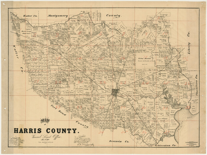
Map of Harris County
Print $20.00
- Digital $50.00
Map of Harris County
1893
Size 26.6 x 34.4 inches
Map/Doc 65810
Crockett County Working Sketch 27

Print $20.00
- Digital $50.00
Crockett County Working Sketch 27
1923
Size 29.4 x 27.2 inches
Map/Doc 68360
Ward County Working Sketch 52

Print $20.00
- Digital $50.00
Ward County Working Sketch 52
1980
Size 36.3 x 37.0 inches
Map/Doc 72358
Crockett County Working Sketch 40

Print $20.00
- Digital $50.00
Crockett County Working Sketch 40
1928
Size 29.5 x 23.7 inches
Map/Doc 68373
Val Verde County Working Sketch 28

Print $20.00
- Digital $50.00
Val Verde County Working Sketch 28
1937
Size 45.9 x 38.6 inches
Map/Doc 72163
Intracoastal Waterway in Texas - Corpus Christi to Point Isabel including Arroyo Colorado to Mo. Pac. R.R. Bridge Near Harlingen

Print $20.00
- Digital $50.00
Intracoastal Waterway in Texas - Corpus Christi to Point Isabel including Arroyo Colorado to Mo. Pac. R.R. Bridge Near Harlingen
1933
Size 28.4 x 41.2 inches
Map/Doc 61870
Frio County Rolled Sketch 8

Print $20.00
- Digital $50.00
Frio County Rolled Sketch 8
1940
Size 19.1 x 36.0 inches
Map/Doc 8901
East Line of Lipscomb County

Print $20.00
- Digital $50.00
East Line of Lipscomb County
Size 8.9 x 21.7 inches
Map/Doc 91317
Flight Mission No. BRA-16M, Frame 123, Jefferson County

Print $20.00
- Digital $50.00
Flight Mission No. BRA-16M, Frame 123, Jefferson County
1953
Size 18.6 x 22.5 inches
Map/Doc 85733