[Sketch showing H. & T. C. R. R. Co. Blk. 48, S. P. R. R. Co. Blk. I, and E. T. R. R. Co. Blk. I]

Print $40.00
- Digital $50.00
[Sketch showing H. & T. C. R. R. Co. Blk. 48, S. P. R. R. Co. Blk. I, and E. T. R. R. Co. Blk. I]
Size: 51.1 x 9.4 inches
89625
East Part of Blk. No. 1, H. &G. N. R. R. Co. Survey

Print $40.00
- Digital $50.00
East Part of Blk. No. 1, H. &G. N. R. R. Co. Survey
Size: 22.7 x 60.6 inches
89626
Plat Compiled by W.J. Williams, Plainview, Texas, and Sylvan Sanders, Lubbock, Texas Showing Position of Original and Re-Survey Corners in Lynn, Terry, Yoakum, Gaines, and Dawson Counties, Texas

Print $40.00
- Digital $50.00
Plat Compiled by W.J. Williams, Plainview, Texas, and Sylvan Sanders, Lubbock, Texas Showing Position of Original and Re-Survey Corners in Lynn, Terry, Yoakum, Gaines, and Dawson Counties, Texas
1946
Size: 56.6 x 22.6 inches
89628
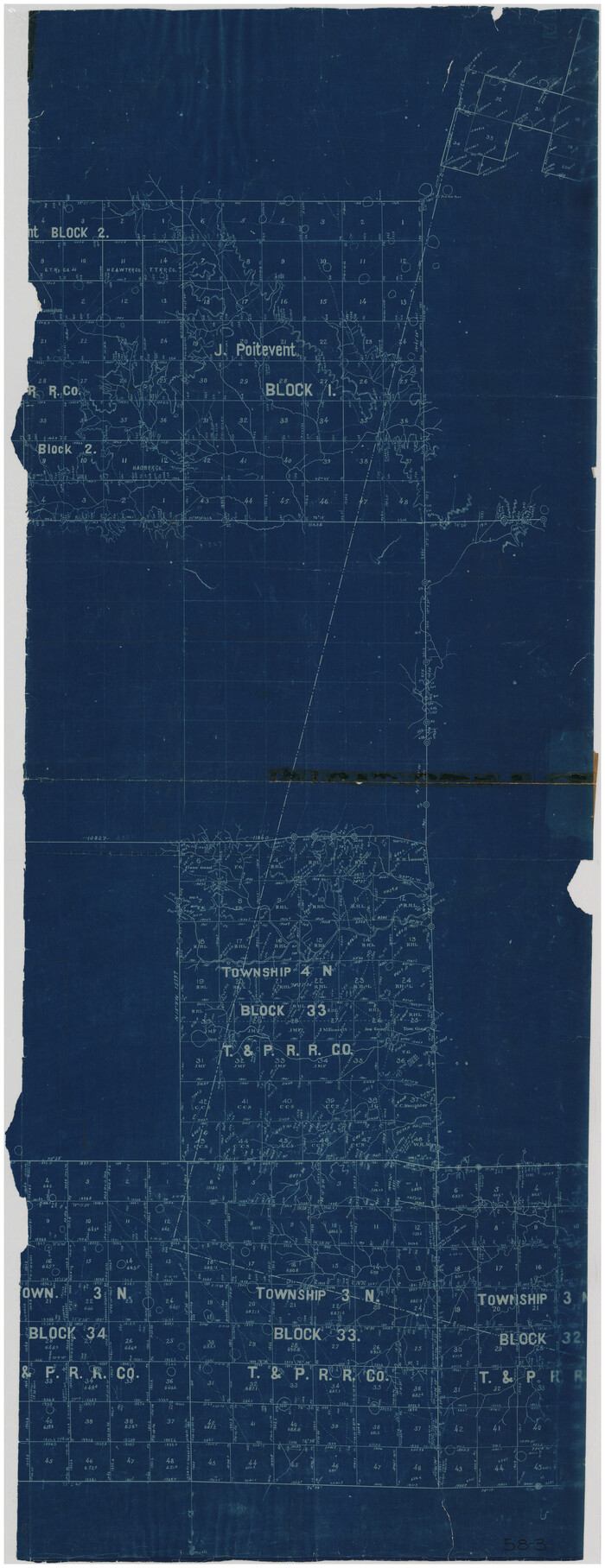
[Sketch showing T. &P. R. R. Co. Blks. 32, 33, 34 Township 4N, and J. Poitevent Block I]
Print $40.00
- Digital $50.00
[Sketch showing T. &P. R. R. Co. Blks. 32, 33, 34 Township 4N, and J. Poitevent Block I]
Size: 19.2 x 49.8 inches
89629
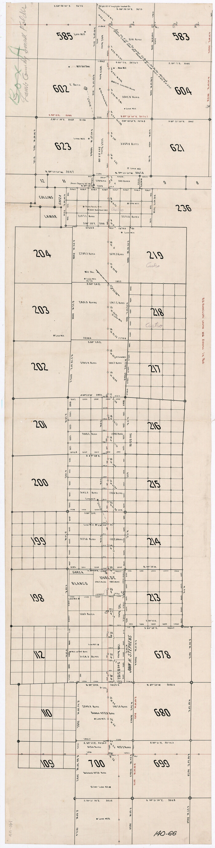
[Capitol Leagues along Bailey-Lamb County Line]
Print $40.00
- Digital $50.00
[Capitol Leagues along Bailey-Lamb County Line]
Size: 12.6 x 49.5 inches
89630
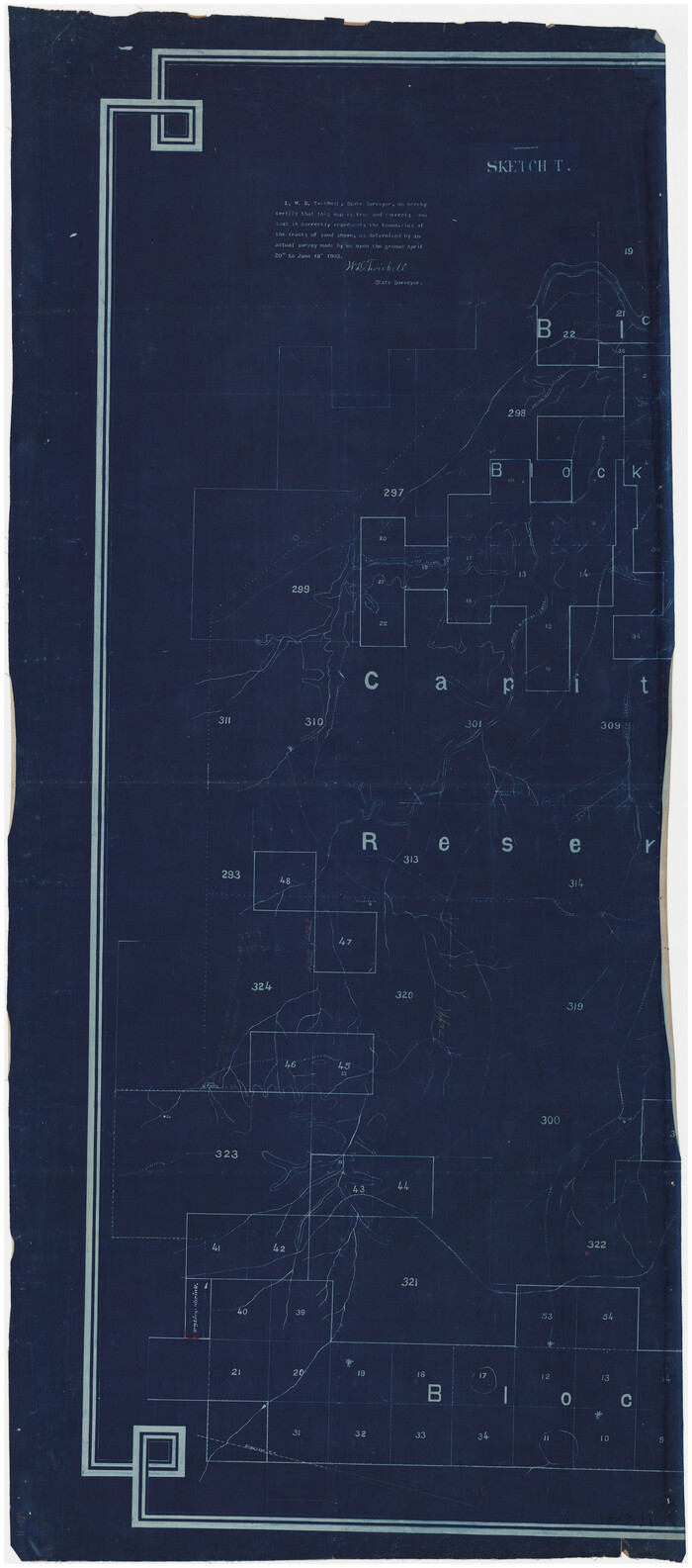
Sketch T [showing Capitol Reserve]
Print $40.00
- Digital $50.00
Sketch T [showing Capitol Reserve]
1903
Size: 22.0 x 48.9 inches
89631
G&H Blocks Gaines Co. Resurvey 1915

Print $40.00
- Digital $50.00
G&H Blocks Gaines Co. Resurvey 1915
1915
Size: 56.8 x 31.3 inches
89632
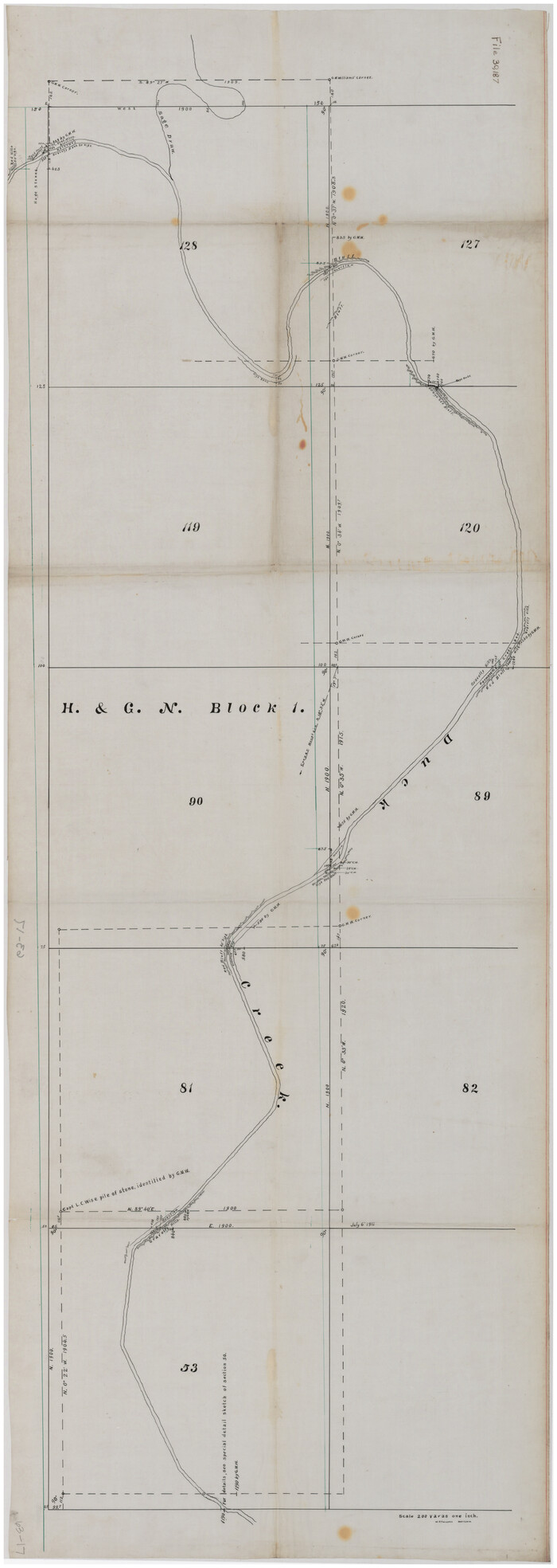
[Sketch showing part of H. & G. N. Block 1]
Print $40.00
- Digital $50.00
[Sketch showing part of H. & G. N. Block 1]
Size: 20.0 x 54.4 inches
89633
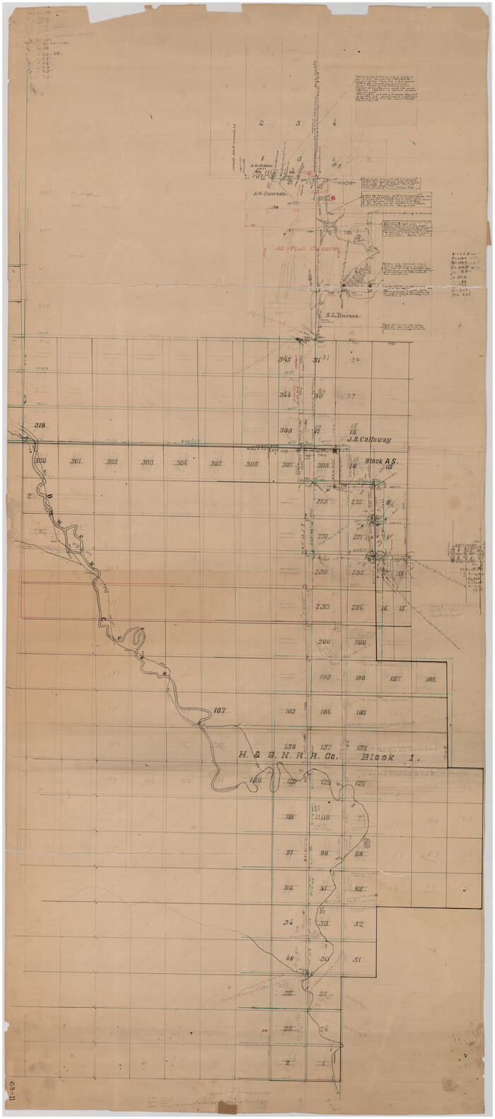
[Sketch showing H. & G. N. Blk. 1]
Print $40.00
- Digital $50.00
[Sketch showing H. & G. N. Blk. 1]
Size: 27.1 x 60.6 inches
89634
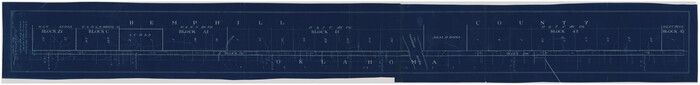
[Sketch Between Hemphill County and Oklahoma]
Print $40.00
- Digital $50.00
[Sketch Between Hemphill County and Oklahoma]
Size: 62.0 x 8.0 inches
89635
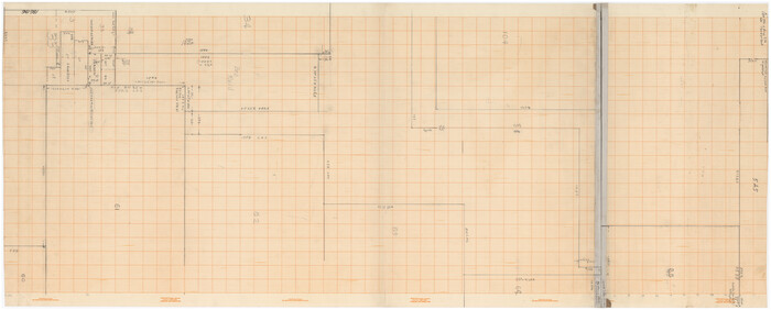
Lamb-Bailey County Line

Print $40.00
- Digital $50.00
Lamb-Bailey County Line
Size: 15.1 x 52.6 inches
89636
[Sketch of Blk. 1, I. & G. N., Secs. 61-65, 545, Pt. Blk. 194]
Print $40.00
- Digital $50.00
[Sketch of Blk. 1, I. & G. N., Secs. 61-65, 545, Pt. Blk. 194]
Size: 56.2 x 22.8 inches
89637
[Sketch of Blks. 2, 2B, 3B]
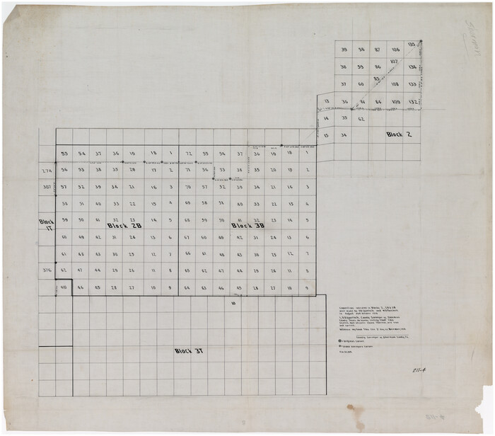
Print $20.00
- Digital $50.00
[Sketch of Blks. 2, 2B, 3B]
1918
Size: 38.0 x 33.2 inches
89638
[SE Pt. of Stephens County]
Print $20.00
- Digital $50.00
[SE Pt. of Stephens County]
Size: 38.1 x 35.9 inches
89639
Plat of Common Line of Baylor and Throckmorton Counties as Run by A.D. Kerr and F.B. Stribling

Print $40.00
- Digital $50.00
Plat of Common Line of Baylor and Throckmorton Counties as Run by A.D. Kerr and F.B. Stribling
Size: 63.0 x 9.0 inches
89640
[Sketch showing part of Blk. M6]
Print $40.00
- Digital $50.00
[Sketch showing part of Blk. M6]
1913
Size: 64.8 x 30.3 inches
89642
[Sketch of part of Blks. 4, 6, B5, 2Z, M6, M8, and M13]
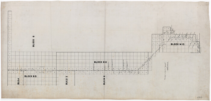
Print $40.00
- Digital $50.00
[Sketch of part of Blks. 4, 6, B5, 2Z, M6, M8, and M13]
Size: 55.2 x 26.8 inches
89643
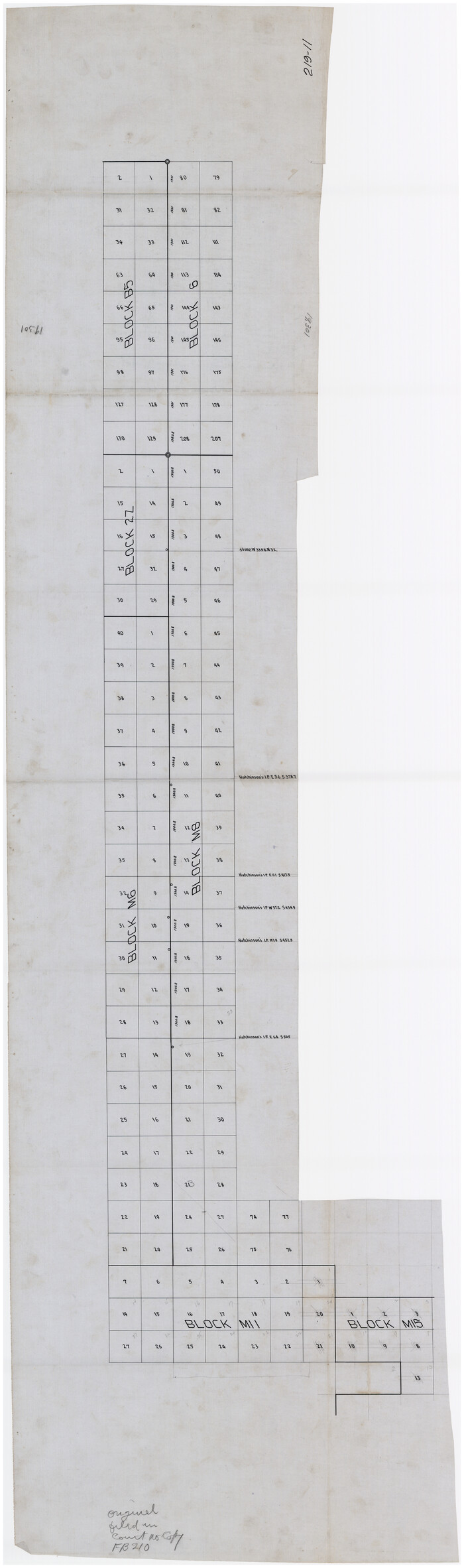
[Sketch of part of Blks. B5, 6, 2Z, M6, M8, M11 and M15]
Print $40.00
- Digital $50.00
[Sketch of part of Blks. B5, 6, 2Z, M6, M8, M11 and M15]
Size: 18.6 x 62.0 inches
89644
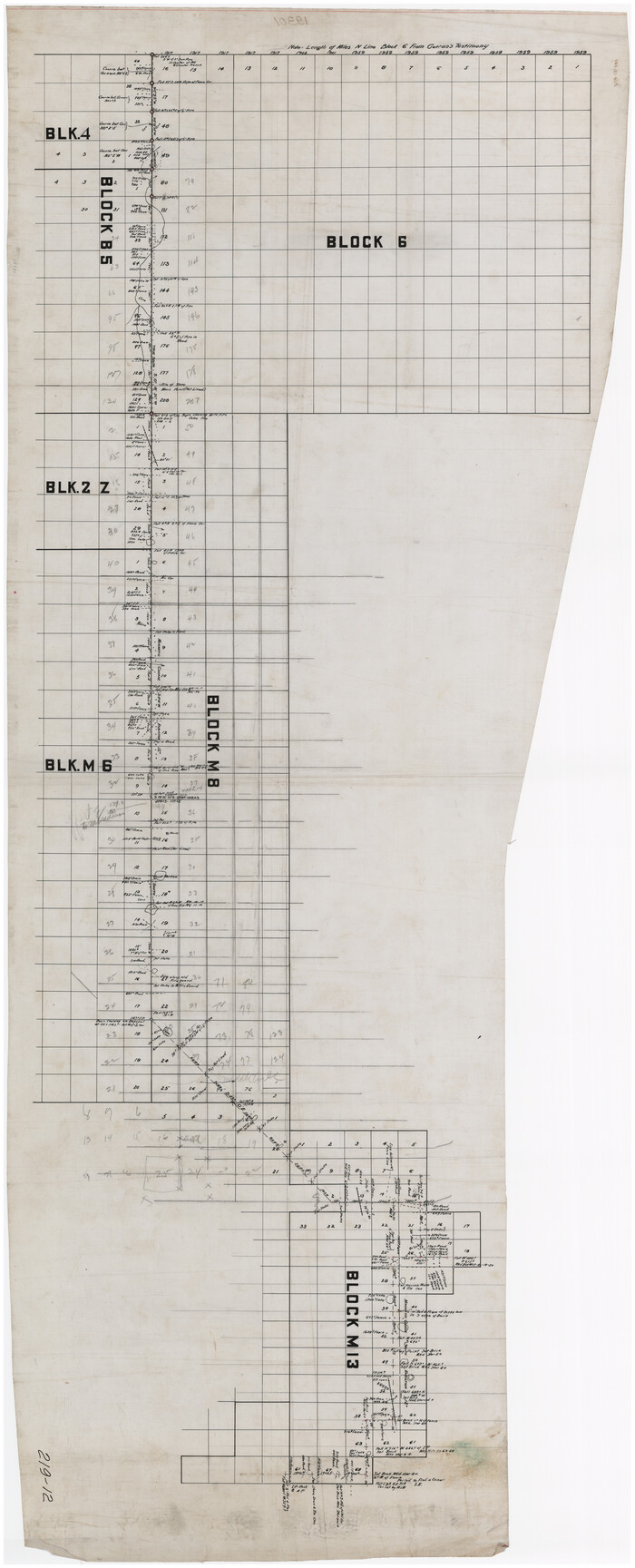
[Sketch of part of Blks. 4, B5, 6, 2Z, M6, M8, and M13]
Print $40.00
- Digital $50.00
[Sketch of part of Blks. 4, B5, 6, 2Z, M6, M8, and M13]
Size: 22.7 x 55.3 inches
89645
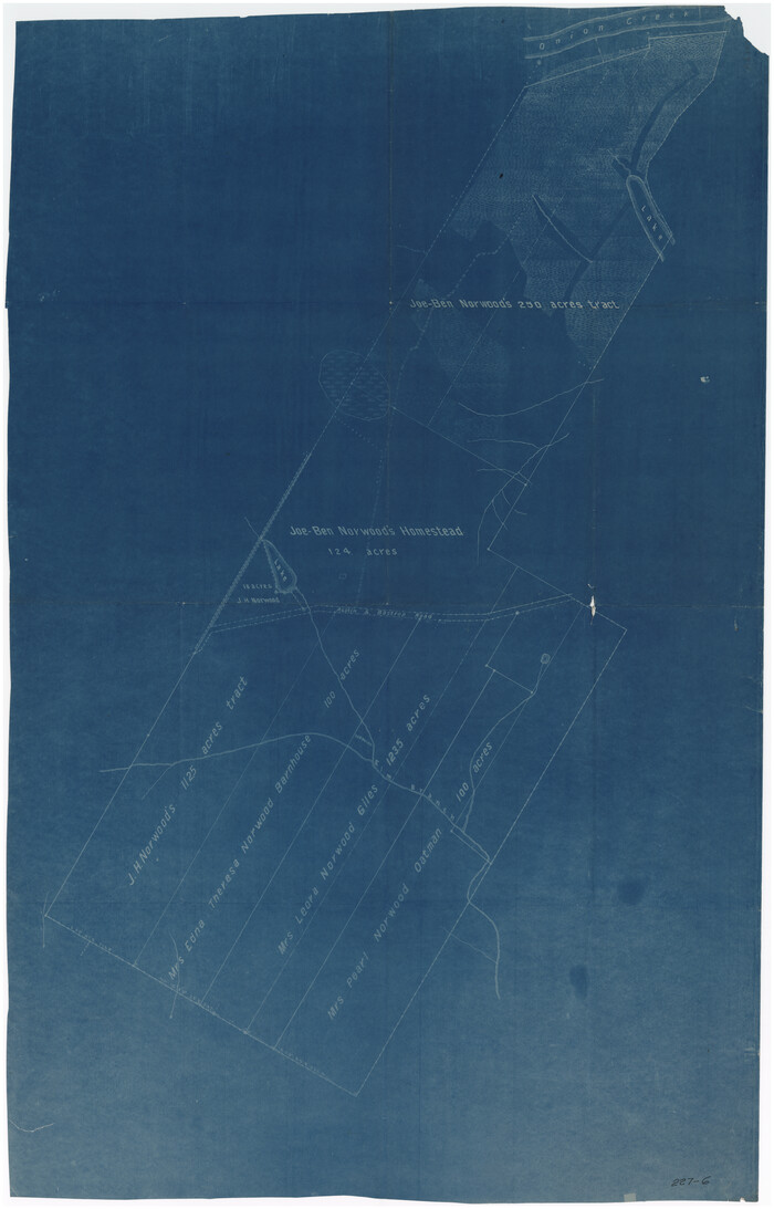
[Sketch of Norwood's Homestead]
Print $40.00
- Digital $50.00
[Sketch of Norwood's Homestead]
Size: 31.8 x 49.7 inches
89646
[Sketch showing H. & T. C. R. R. Co. Blk. 48, S. P. R. R. Co. Blk. I, and E. T. R. R. Co. Blk. I]
Print $40.00
- Digital $50.00
[Sketch showing H. & T. C. R. R. Co. Blk. 48, S. P. R. R. Co. Blk. I, and E. T. R. R. Co. Blk. I]
Size: 51.4 x 9.2 inches
89647
Wichita County, State of Texas 1889

Print $20.00
- Digital $50.00
Wichita County, State of Texas 1889
1889
Size: 44.3 x 32.6 inches
89649
Ward County, 1902

Print $40.00
- Digital $50.00
Ward County, 1902
1902
Size: 51.8 x 31.3 inches
89650
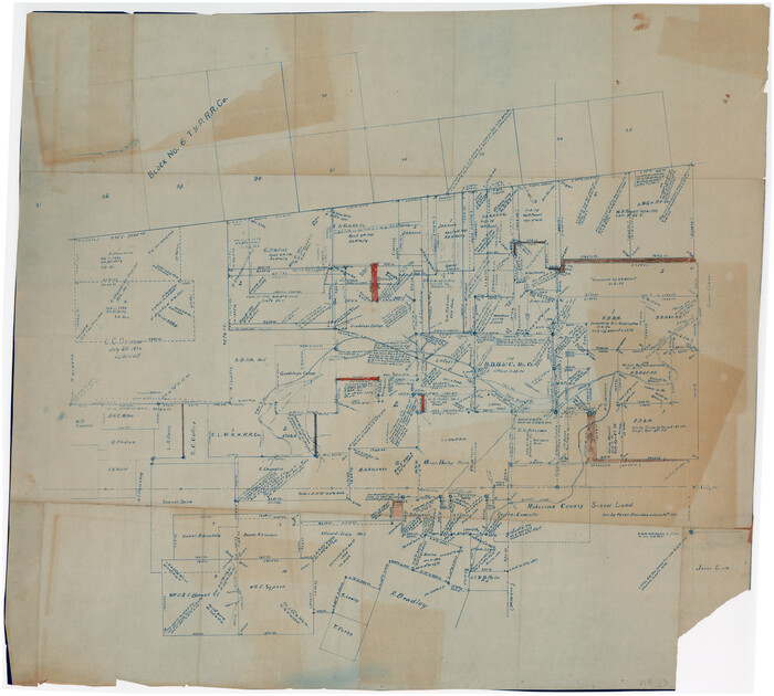
Navarro County, 1888

Print $20.00
- Digital $50.00
Navarro County, 1888
1888
Size: 43.8 x 32.2 inches
89651
Right-of-way & Track Map Dawson Railway Operated by the El Paso & Southwestern Company Station 1233+41 to Station 1444+61.7

Print $40.00
- Digital $50.00
Right-of-way & Track Map Dawson Railway Operated by the El Paso & Southwestern Company Station 1233+41 to Station 1444+61.7
1910
Size: 56.8 x 24.6 inches
89653
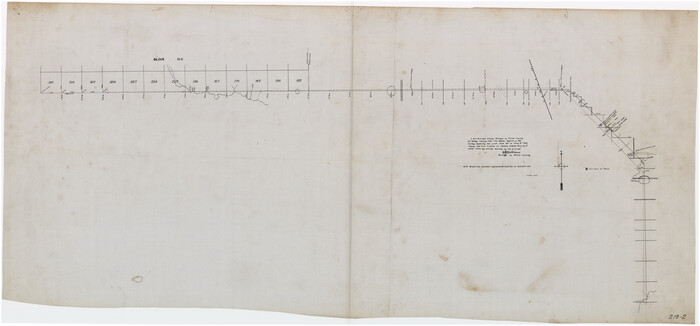
Right-of-way & Track Map Dawson Railway Operated by the El Paso & Southwestern Company Station 1444+61.7 to Station 1655+23.4

Print $40.00
- Digital $50.00
Right-of-way & Track Map Dawson Railway Operated by the El Paso & Southwestern Company Station 1444+61.7 to Station 1655+23.4
1910
Size: 56.7 x 24.8 inches
89655
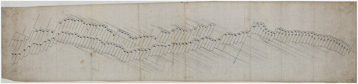
Right-of-way & Track Map Dawson Railway Operated by the El Paso & Southwestern Company Station 1655+23.4 to Station 1867+09.6

Print $40.00
- Digital $50.00
Right-of-way & Track Map Dawson Railway Operated by the El Paso & Southwestern Company Station 1655+23.4 to Station 1867+09.6
1910
Size: 56.7 x 24.6 inches
89657
Right-of-way & Track Map Dawson Railway Operated by the El Paso & Southwestern Company Station 1867+09.6 to Station 360+75.4

Print $40.00
- Digital $50.00
Right-of-way & Track Map Dawson Railway Operated by the El Paso & Southwestern Company Station 1867+09.6 to Station 360+75.4
1910
Size: 56.9 x 24.7 inches
89659
[Sketch showing H. & T. C. R. R. Co. Blk. 48, S. P. R. R. Co. Blk. I, and E. T. R. R. Co. Blk. I]
Print $40.00
- Digital $50.00
[Sketch showing H. & T. C. R. R. Co. Blk. 48, S. P. R. R. Co. Blk. I, and E. T. R. R. Co. Blk. I]
-
Size
51.1 x 9.4 inches
-
Map/Doc
89625
East Part of Blk. No. 1, H. &G. N. R. R. Co. Survey
Print $40.00
- Digital $50.00
East Part of Blk. No. 1, H. &G. N. R. R. Co. Survey
-
Size
22.7 x 60.6 inches
-
Map/Doc
89626
Plat Compiled by W.J. Williams, Plainview, Texas, and Sylvan Sanders, Lubbock, Texas Showing Position of Original and Re-Survey Corners in Lynn, Terry, Yoakum, Gaines, and Dawson Counties, Texas
Print $40.00
- Digital $50.00
Plat Compiled by W.J. Williams, Plainview, Texas, and Sylvan Sanders, Lubbock, Texas Showing Position of Original and Re-Survey Corners in Lynn, Terry, Yoakum, Gaines, and Dawson Counties, Texas
1946
-
Size
56.6 x 22.6 inches
-
Map/Doc
89628
-
Creation Date
1946
[Sketch showing T. &P. R. R. Co. Blks. 32, 33, 34 Township 4N, and J. Poitevent Block I]
Print $40.00
- Digital $50.00
[Sketch showing T. &P. R. R. Co. Blks. 32, 33, 34 Township 4N, and J. Poitevent Block I]
-
Size
19.2 x 49.8 inches
-
Map/Doc
89629
[Capitol Leagues along Bailey-Lamb County Line]
Print $40.00
- Digital $50.00
[Capitol Leagues along Bailey-Lamb County Line]
-
Size
12.6 x 49.5 inches
-
Map/Doc
89630
Sketch T [showing Capitol Reserve]
Print $40.00
- Digital $50.00
Sketch T [showing Capitol Reserve]
1903
-
Size
22.0 x 48.9 inches
-
Map/Doc
89631
-
Creation Date
1903
G&H Blocks Gaines Co. Resurvey 1915
Print $40.00
- Digital $50.00
G&H Blocks Gaines Co. Resurvey 1915
1915
-
Size
56.8 x 31.3 inches
-
Map/Doc
89632
-
Creation Date
1915
[Sketch showing part of H. & G. N. Block 1]
Print $40.00
- Digital $50.00
[Sketch showing part of H. & G. N. Block 1]
-
Size
20.0 x 54.4 inches
-
Map/Doc
89633
[Sketch showing H. & G. N. Blk. 1]
Print $40.00
- Digital $50.00
[Sketch showing H. & G. N. Blk. 1]
-
Size
27.1 x 60.6 inches
-
Map/Doc
89634
[Sketch Between Hemphill County and Oklahoma]
Print $40.00
- Digital $50.00
[Sketch Between Hemphill County and Oklahoma]
-
Size
62.0 x 8.0 inches
-
Map/Doc
89635
Lamb-Bailey County Line
Print $40.00
- Digital $50.00
Lamb-Bailey County Line
-
Size
15.1 x 52.6 inches
-
Map/Doc
89636
[Sketch of Blk. 1, I. & G. N., Secs. 61-65, 545, Pt. Blk. 194]
Print $40.00
- Digital $50.00
[Sketch of Blk. 1, I. & G. N., Secs. 61-65, 545, Pt. Blk. 194]
-
Size
56.2 x 22.8 inches
-
Map/Doc
89637
[Sketch of Blks. 2, 2B, 3B]
Print $20.00
- Digital $50.00
[Sketch of Blks. 2, 2B, 3B]
1918
-
Size
38.0 x 33.2 inches
-
Map/Doc
89638
-
Creation Date
1918
[SE Pt. of Stephens County]
Print $20.00
- Digital $50.00
[SE Pt. of Stephens County]
-
Size
38.1 x 35.9 inches
-
Map/Doc
89639
Plat of Common Line of Baylor and Throckmorton Counties as Run by A.D. Kerr and F.B. Stribling
Print $40.00
- Digital $50.00
Plat of Common Line of Baylor and Throckmorton Counties as Run by A.D. Kerr and F.B. Stribling
-
Size
63.0 x 9.0 inches
-
Map/Doc
89640
[Sketch showing part of Blk. M6]
Print $40.00
- Digital $50.00
[Sketch showing part of Blk. M6]
1913
-
Size
64.8 x 30.3 inches
-
Map/Doc
89642
-
Creation Date
1913
[Sketch of part of Blks. 4, 6, B5, 2Z, M6, M8, and M13]
Print $40.00
- Digital $50.00
[Sketch of part of Blks. 4, 6, B5, 2Z, M6, M8, and M13]
-
Size
55.2 x 26.8 inches
-
Map/Doc
89643
[Sketch of part of Blks. B5, 6, 2Z, M6, M8, M11 and M15]
Print $40.00
- Digital $50.00
[Sketch of part of Blks. B5, 6, 2Z, M6, M8, M11 and M15]
-
Size
18.6 x 62.0 inches
-
Map/Doc
89644
[Sketch of part of Blks. 4, B5, 6, 2Z, M6, M8, and M13]
Print $40.00
- Digital $50.00
[Sketch of part of Blks. 4, B5, 6, 2Z, M6, M8, and M13]
-
Size
22.7 x 55.3 inches
-
Map/Doc
89645
[Sketch of Norwood's Homestead]
Print $40.00
- Digital $50.00
[Sketch of Norwood's Homestead]
-
Size
31.8 x 49.7 inches
-
Map/Doc
89646
[Sketch showing H. & T. C. R. R. Co. Blk. 48, S. P. R. R. Co. Blk. I, and E. T. R. R. Co. Blk. I]
Print $40.00
- Digital $50.00
[Sketch showing H. & T. C. R. R. Co. Blk. 48, S. P. R. R. Co. Blk. I, and E. T. R. R. Co. Blk. I]
-
Size
51.4 x 9.2 inches
-
Map/Doc
89647
Wichita County, State of Texas 1889
Print $20.00
- Digital $50.00
Wichita County, State of Texas 1889
1889
-
Size
44.3 x 32.6 inches
-
Map/Doc
89649
-
Creation Date
1889
Ward County, 1902
Print $40.00
- Digital $50.00
Ward County, 1902
1902
-
Size
51.8 x 31.3 inches
-
Map/Doc
89650
-
Creation Date
1902
Navarro County, 1888
Print $20.00
- Digital $50.00
Navarro County, 1888
1888
-
Size
43.8 x 32.2 inches
-
Map/Doc
89651
-
Creation Date
1888
Hunt Co., 1894

Print $40.00
- Digital $50.00
Hunt Co., 1894
1894
-
Size
30.3 x 49.2 inches
-
Map/Doc
89652
-
Creation Date
1894
Right-of-way & Track Map Dawson Railway Operated by the El Paso & Southwestern Company Station 1233+41 to Station 1444+61.7
Print $40.00
- Digital $50.00
Right-of-way & Track Map Dawson Railway Operated by the El Paso & Southwestern Company Station 1233+41 to Station 1444+61.7
1910
-
Size
56.8 x 24.6 inches
-
Map/Doc
89653
-
Creation Date
1910
Right-of-way & Track Map Dawson Railway Operated by the El Paso & Southwestern Company Station 1444+61.7 to Station 1655+23.4
Print $40.00
- Digital $50.00
Right-of-way & Track Map Dawson Railway Operated by the El Paso & Southwestern Company Station 1444+61.7 to Station 1655+23.4
1910
-
Size
56.7 x 24.8 inches
-
Map/Doc
89655
-
Creation Date
1910
Right-of-way & Track Map Dawson Railway Operated by the El Paso & Southwestern Company Station 1655+23.4 to Station 1867+09.6
Print $40.00
- Digital $50.00
Right-of-way & Track Map Dawson Railway Operated by the El Paso & Southwestern Company Station 1655+23.4 to Station 1867+09.6
1910
-
Size
56.7 x 24.6 inches
-
Map/Doc
89657
-
Creation Date
1910
Right-of-way & Track Map Dawson Railway Operated by the El Paso & Southwestern Company Station 1867+09.6 to Station 360+75.4
Print $40.00
- Digital $50.00
Right-of-way & Track Map Dawson Railway Operated by the El Paso & Southwestern Company Station 1867+09.6 to Station 360+75.4
1910
-
Size
56.9 x 24.7 inches
-
Map/Doc
89659
-
Creation Date
1910