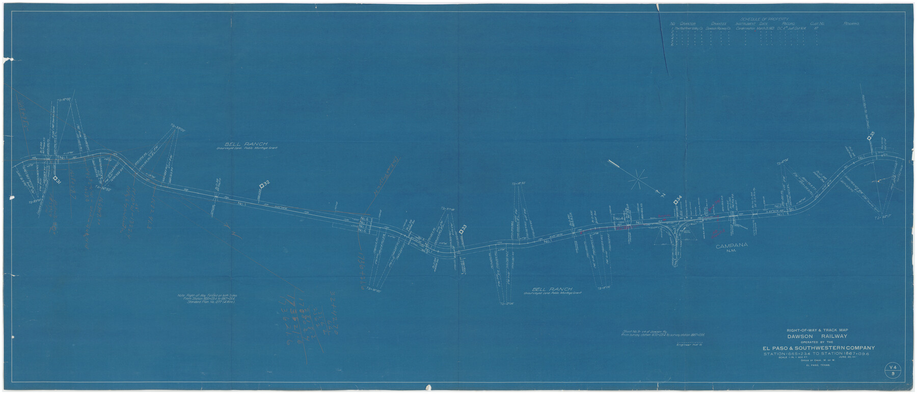
Right-of-way & Track Map Dawson Railway Operated by the El Paso & Southwestern Company Station 1655+23.4 to Station 1867+09.6
NM-12c
-
Map/Doc
89657
-
Collection
Twichell Survey Records
-
Object Dates
6/30/[1910-1919] (Creation Date)
-
Counties
San Miguel [New Mexico]
-
Height x Width
56.7 x 24.6 inches
144.0 x 62.5 cm
Part of: Twichell Survey Records
Map of Escarpment Section through Webb County, Texas (South half of Webb County)

Print $40.00
- Digital $50.00
Map of Escarpment Section through Webb County, Texas (South half of Webb County)
1925
Size 43.3 x 76.2 inches
Map/Doc 93163
[Blocks G, H, and M, North of the North boundary line of the T. &. O. Reservation]
![90809, [Blocks G, H, and M, North of the North boundary line of the T. &. O. Reservation], Twichell Survey Records](https://historictexasmaps.com/wmedia_w700/maps/90809-2.tif.jpg)
Print $20.00
- Digital $50.00
[Blocks G, H, and M, North of the North boundary line of the T. &. O. Reservation]
1880
Size 21.7 x 17.8 inches
Map/Doc 90809
[Sketch showing PSL Block AX and C. C. S. D. & R. G. N. G. RR. Co. Block G]
![90838, [Sketch showing PSL Block AX and C. C. S. D. & R. G. N. G. RR. Co. Block G], Twichell Survey Records](https://historictexasmaps.com/wmedia_w700/maps/90838-2.tif.jpg)
Print $20.00
- Digital $50.00
[Sketch showing PSL Block AX and C. C. S. D. & R. G. N. G. RR. Co. Block G]
Size 25.8 x 16.6 inches
Map/Doc 90838
[North half Dawson County, southwest quarter Lynn County, south half of Terry County, southeast quarter Yoakum County, north half Gaines County]
![93133, [North half Dawson County, southwest quarter Lynn County, south half of Terry County, southeast quarter Yoakum County, north half Gaines County], Twichell Survey Records](https://historictexasmaps.com/wmedia_w700/maps/93133-1.tif.jpg)
Print $40.00
- Digital $50.00
[North half Dawson County, southwest quarter Lynn County, south half of Terry County, southeast quarter Yoakum County, north half Gaines County]
Size 79.8 x 45.3 inches
Map/Doc 93133
[Blocks T1, T2, T3, S3, A, 05, 02 and vicinity]
![92196, [Blocks T1, T2, T3, S3, A, 05, 02 and vicinity], Twichell Survey Records](https://historictexasmaps.com/wmedia_w700/maps/92196-1.tif.jpg)
Print $20.00
- Digital $50.00
[Blocks T1, T2, T3, S3, A, 05, 02 and vicinity]
Size 20.3 x 22.9 inches
Map/Doc 92196
[Sketch of J.D. Brown survey and vicinity]
![89964, [Sketch of J.D. Brown survey and vicinity], Twichell Survey Records](https://historictexasmaps.com/wmedia_w700/maps/89964-1.tif.jpg)
Print $40.00
- Digital $50.00
[Sketch of J.D. Brown survey and vicinity]
Size 44.1 x 62.7 inches
Map/Doc 89964
[Sketch of surveys north of Jefferson County School Land]
![91890, [Sketch of surveys north of Jefferson County School Land], Twichell Survey Records](https://historictexasmaps.com/wmedia_w700/maps/91890-1.tif.jpg)
Print $3.00
- Digital $50.00
[Sketch of surveys north of Jefferson County School Land]
1891
Size 10.3 x 11.2 inches
Map/Doc 91890
[Castro, Lamb, Hockley, Swisher, Hale, and Lubbock Counties]
![91026, [Castro, Lamb, Hockley, Swisher, Hale, and Lubbock Counties], Twichell Survey Records](https://historictexasmaps.com/wmedia_w700/maps/91026-1.tif.jpg)
Print $20.00
- Digital $50.00
[Castro, Lamb, Hockley, Swisher, Hale, and Lubbock Counties]
Size 28.7 x 37.6 inches
Map/Doc 91026
Waco Manufacturing Company Block 1, G. H. & H. Block 5, Capitol Leagues 229, 230, 234-237]
![90726, Waco Manufacturing Company Block 1, G. H. & H. Block 5, Capitol Leagues 229, 230, 234-237], Twichell Survey Records](https://historictexasmaps.com/wmedia_w700/maps/90726-1.tif.jpg)
Print $20.00
- Digital $50.00
Waco Manufacturing Company Block 1, G. H. & H. Block 5, Capitol Leagues 229, 230, 234-237]
1902
Size 14.5 x 21.6 inches
Map/Doc 90726
[T.& P.R.R.Co., Block 1]
![92963, [T.& P.R.R.Co., Block 1], Twichell Survey Records](https://historictexasmaps.com/wmedia_w700/maps/92963-1.tif.jpg)
Print $20.00
- Digital $50.00
[T.& P.R.R.Co., Block 1]
Size 37.5 x 31.6 inches
Map/Doc 92963
[T. & P. RR. Lands and Surrounding surveys]
![91131, [T. & P. RR. Lands and Surrounding surveys], Twichell Survey Records](https://historictexasmaps.com/wmedia_w700/maps/91131.tif.jpg)
Print $20.00
- Digital $50.00
[T. & P. RR. Lands and Surrounding surveys]
1900
Size 16.4 x 12.2 inches
Map/Doc 91131
Magnetic Declination in the United States - Epoch 1980

Print $20.00
- Digital $50.00
Magnetic Declination in the United States - Epoch 1980
1980
Size 41.4 x 33.3 inches
Map/Doc 92368
You may also like
Galveston Bay and Approaches

Print $20.00
- Digital $50.00
Galveston Bay and Approaches
1933
Size 46.0 x 34.9 inches
Map/Doc 69874
Texas Land Commissioner George P. Bush's Energy Map of Texas Showing Significant Events and Well & Pipeline Locations Between 1543 and 2015

Print $20.00
- Digital $50.00
Texas Land Commissioner George P. Bush's Energy Map of Texas Showing Significant Events and Well & Pipeline Locations Between 1543 and 2015
2015
Size 33.3 x 36.3 inches
Map/Doc 93978
Freestone County Sketch File 18

Print $4.00
- Digital $50.00
Freestone County Sketch File 18
1854
Size 9.7 x 8.2 inches
Map/Doc 23076
Spanish Province of Texas compiled from map on file among archives at Saltillo

Print $20.00
- Digital $50.00
Spanish Province of Texas compiled from map on file among archives at Saltillo
1897
Size 13.6 x 16.0 inches
Map/Doc 93412
Wilson County Boundary File 5a

Print $20.00
- Digital $50.00
Wilson County Boundary File 5a
Size 12.0 x 28.0 inches
Map/Doc 60118
Stephens County Sketch File 14

Print $6.00
- Digital $50.00
Stephens County Sketch File 14
Size 8.2 x 5.9 inches
Map/Doc 37065
Leon County Working Sketch 21

Print $20.00
- Digital $50.00
Leon County Working Sketch 21
1964
Size 20.9 x 22.9 inches
Map/Doc 70420
Schleicher County Sketch File 29

Print $44.00
- Digital $50.00
Schleicher County Sketch File 29
1940
Size 31.9 x 23.7 inches
Map/Doc 12306
Langtree's New Sectional Map of the State of Arkansas

Print $20.00
- Digital $50.00
Langtree's New Sectional Map of the State of Arkansas
Size 34.6 x 38.4 inches
Map/Doc 93987
Presidio County Working Sketch 138

Print $20.00
- Digital $50.00
Presidio County Working Sketch 138
1990
Size 17.4 x 41.2 inches
Map/Doc 71816
San Augustine County Sketch File 7

Print $4.00
San Augustine County Sketch File 7
1858
Size 7.0 x 8.2 inches
Map/Doc 35646
Preliminary Survey of the Entrance to the Rio Grande, Texas

Print $20.00
Preliminary Survey of the Entrance to the Rio Grande, Texas
1854
Size 14.2 x 14.9 inches
Map/Doc 95283