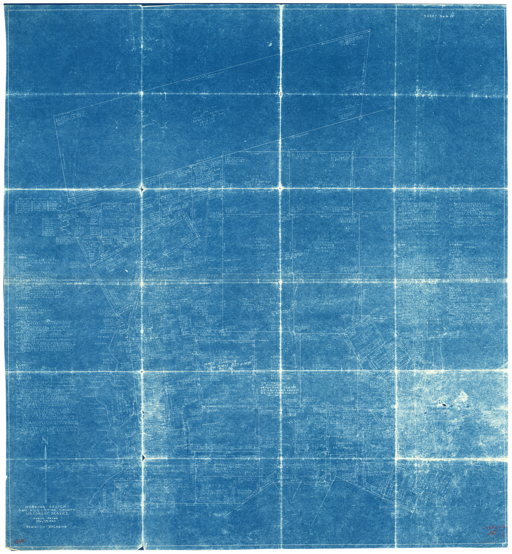
San Augustine County Working Sketch 10
-
Map/Doc
63697
-
Collection
General Map Collection
-
Object Dates
5/29/1935 (Creation Date)
-
Counties
San Augustine
-
Subjects
Surveying Working Sketch
-
Height x Width
35.0 x 32.2 inches
88.9 x 81.8 cm
-
Scale
1" = 20 chains
Part of: General Map Collection
Photostat of section of hydrographic surveys H-5399, H-4822, H-470

Print $20.00
- Digital $50.00
Photostat of section of hydrographic surveys H-5399, H-4822, H-470
1933
Size 18.4 x 25.8 inches
Map/Doc 61160
Flight Mission No. BQR-9K, Frame 15, Brazoria County

Print $20.00
- Digital $50.00
Flight Mission No. BQR-9K, Frame 15, Brazoria County
1952
Size 18.8 x 22.5 inches
Map/Doc 84044
Jim Hogg County Working Sketch 6

Print $40.00
- Digital $50.00
Jim Hogg County Working Sketch 6
1961
Size 63.3 x 42.8 inches
Map/Doc 66592
Llano County Working Sketch 3

Print $20.00
- Digital $50.00
Llano County Working Sketch 3
1949
Size 23.6 x 24.0 inches
Map/Doc 70621
Edwards County Sketch File 5

Print $5.00
- Digital $50.00
Edwards County Sketch File 5
Size 9.0 x 3.9 inches
Map/Doc 21682
Flight Mission No. BRA-7M, Frame 146, Jefferson County

Print $20.00
- Digital $50.00
Flight Mission No. BRA-7M, Frame 146, Jefferson County
1953
Size 16.1 x 16.1 inches
Map/Doc 85540
Val Verde County Rolled Sketch 77

Print $20.00
- Digital $50.00
Val Verde County Rolled Sketch 77
1981
Size 36.2 x 37.4 inches
Map/Doc 10087
Hemphill County Rolled Sketch 19

Print $20.00
- Digital $50.00
Hemphill County Rolled Sketch 19
Size 31.2 x 32.2 inches
Map/Doc 9158
Collin County Boundary File 18f

Print $22.00
- Digital $50.00
Collin County Boundary File 18f
Size 12.9 x 8.2 inches
Map/Doc 51757
Gonzales County Boundary File 34 (9)

Print $18.00
- Digital $50.00
Gonzales County Boundary File 34 (9)
Size 8.5 x 3.9 inches
Map/Doc 53836
[Surveys in the Liberty District]
![273, [Surveys in the Liberty District], General Map Collection](https://historictexasmaps.com/wmedia_w700/maps/273.tif.jpg)
Print $2.00
- Digital $50.00
[Surveys in the Liberty District]
1841
Size 7.0 x 10.7 inches
Map/Doc 273
Harris County Sketch File B

Print $4.00
- Digital $50.00
Harris County Sketch File B
1860
Size 8.0 x 5.5 inches
Map/Doc 25309
You may also like
[Sketch showing Blocks B5 and B6 and Capitol Land Reservation]
![89973, [Sketch showing Blocks B5 and B6 and Capitol Land Reservation], Twichell Survey Records](https://historictexasmaps.com/wmedia_w700/maps/89973-1.tif.jpg)
Print $20.00
- Digital $50.00
[Sketch showing Blocks B5 and B6 and Capitol Land Reservation]
Size 46.3 x 41.9 inches
Map/Doc 89973
Galveston County Sketch File 54

Print $14.00
- Digital $50.00
Galveston County Sketch File 54
1838
Size 12.8 x 8.2 inches
Map/Doc 23584
[T. & P. Surveys in Crane, Upton, Coke Counties]
![90464, [T. & P. Surveys in Crane, Upton, Coke Counties], Twichell Survey Records](https://historictexasmaps.com/wmedia_w700/maps/90464-1.tif.jpg)
Print $20.00
- Digital $50.00
[T. & P. Surveys in Crane, Upton, Coke Counties]
Size 19.2 x 21.2 inches
Map/Doc 90464
Harris County Sketch File 78

Print $32.00
- Digital $50.00
Harris County Sketch File 78
1955
Size 8.7 x 9.0 inches
Map/Doc 25549
[St. L. S-W. Ry. of Texas Map of Lufkin Branch in Cherokee County Texas]
![64018, [St. L. S-W. Ry. of Texas Map of Lufkin Branch in Cherokee County Texas], General Map Collection](https://historictexasmaps.com/wmedia_w700/maps/64018.tif.jpg)
Print $40.00
- Digital $50.00
[St. L. S-W. Ry. of Texas Map of Lufkin Branch in Cherokee County Texas]
1912
Size 22.3 x 121.1 inches
Map/Doc 64018
Map of Located Land of Gulf, Colorado & Santa Fe Ry. Co. through Denton

Print $40.00
- Digital $50.00
Map of Located Land of Gulf, Colorado & Santa Fe Ry. Co. through Denton
Size 55.5 x 25.8 inches
Map/Doc 64341
[Map of North Carolina and South Carolina]
![96621, [Map of North Carolina and South Carolina], Cobb Digital Map Collection](https://historictexasmaps.com/wmedia_w700/maps/96621.tif.jpg)
Print $20.00
- Digital $50.00
[Map of North Carolina and South Carolina]
1869
Size 8.9 x 9.2 inches
Map/Doc 96621
San Augustine Co.

Print $20.00
- Digital $50.00
San Augustine Co.
1949
Size 45.7 x 28.6 inches
Map/Doc 77414
Right of Way Map, Belton Branch of the M.K.&T. RR.

Print $20.00
- Digital $50.00
Right of Way Map, Belton Branch of the M.K.&T. RR.
1896
Size 14.5 x 42.1 inches
Map/Doc 64219
Cochran County

Print $20.00
- Digital $50.00
Cochran County
1946
Size 33.3 x 25.5 inches
Map/Doc 95456
Hutchinson County, 1922

Print $20.00
- Digital $50.00
Hutchinson County, 1922
1922
Size 36.5 x 47.6 inches
Map/Doc 89699
Map of the County of Cameron

Print $40.00
- Digital $50.00
Map of the County of Cameron
1884
Size 57.0 x 33.2 inches
Map/Doc 78646