Surveys on the Coleto Creek, Goliad County

Print $20.00
- Digital $50.00
Surveys on the Coleto Creek, Goliad County
1841
Size: 13.8 x 14.9 inches
10
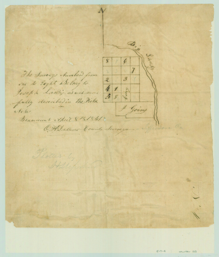
[Surveys in the Jefferson District along Big Sandy Creek]
Print $2.00
- Digital $50.00
[Surveys in the Jefferson District along Big Sandy Creek]
1841
Size: 9.5 x 8.1 inches
100
Tom Green County Rolled Sketch 12

Print $40.00
- Digital $50.00
Tom Green County Rolled Sketch 12
1951
Size: 51.0 x 42.5 inches
10000
Tom Green County Rolled Sketch 15

Print $20.00
- Digital $50.00
Tom Green County Rolled Sketch 15
Size: 38.7 x 43.1 inches
10002
Tom Green County Rolled Sketch 12A

Print $40.00
- Digital $50.00
Tom Green County Rolled Sketch 12A
1951
Size: 42.9 x 50.4 inches
10003
Tom Green County Rolled Sketch 16

Print $20.00
- Digital $50.00
Tom Green County Rolled Sketch 16
1954
Size: 38.2 x 44.6 inches
10004
Tom Green County Rolled Sketch 17

Print $40.00
- Digital $50.00
Tom Green County Rolled Sketch 17
Size: 49.2 x 37.8 inches
10005
Tom Green County Rolled Sketch 22

Print $20.00
- Digital $50.00
Tom Green County Rolled Sketch 22
1966
Size: 38.0 x 43.6 inches
10006
Tom Green County Rolled Sketch 26

Print $40.00
- Digital $50.00
Tom Green County Rolled Sketch 26
Size: 40.0 x 48.3 inches
10007
Tom Green County Rolled Sketch 27

Print $20.00
- Digital $50.00
Tom Green County Rolled Sketch 27
Size: 36.1 x 45.4 inches
10008
Travis County Rolled Sketch 3

Print $40.00
- Digital $50.00
Travis County Rolled Sketch 3
1902
Size: 37.2 x 48.0 inches
10009
Travis County Rolled Sketch 15

Print $20.00
- Digital $50.00
Travis County Rolled Sketch 15
1939
Size: 25.4 x 37.6 inches
10011
Travis County Rolled Sketch 19

Print $20.00
- Digital $50.00
Travis County Rolled Sketch 19
1940
Size: 34.4 x 37.8 inches
10012
Travis County Rolled Sketch 32A

Print $40.00
- Digital $50.00
Travis County Rolled Sketch 32A
Size: 57.6 x 37.3 inches
10013
Travis County Rolled Sketch 37

Print $20.00
- Digital $50.00
Travis County Rolled Sketch 37
1942
Size: 36.1 x 35.6 inches
10014
Travis County Rolled Sketch 47

Print $40.00
- Digital $50.00
Travis County Rolled Sketch 47
1925
Size: 24.9 x 56.8 inches
10016
Travis County Rolled Sketch 49

Print $20.00
- Digital $50.00
Travis County Rolled Sketch 49
Size: 43.0 x 39.9 inches
10017
Travis County Rolled Sketch 55

Print $40.00
- Digital $50.00
Travis County Rolled Sketch 55
Size: 43.1 x 50.5 inches
10020
Trinity County Rolled Sketch 2

Print $20.00
- Digital $50.00
Trinity County Rolled Sketch 2
1948
Size: 34.5 x 34.9 inches
10024
Trinity County Rolled Sketch 3

Print $40.00
- Digital $50.00
Trinity County Rolled Sketch 3
1948
Size: 33.8 x 50.3 inches
10025
Trinity County Rolled Sketch 4

Print $20.00
- Digital $50.00
Trinity County Rolled Sketch 4
1948
Size: 38.5 x 42.4 inches
10026
Tyler County Rolled Sketch 3

Print $20.00
- Digital $50.00
Tyler County Rolled Sketch 3
1946
Size: 45.5 x 35.6 inches
10027
Tyler County Rolled Sketch 4

Print $20.00
- Digital $50.00
Tyler County Rolled Sketch 4
1952
Size: 38.9 x 44.0 inches
10028
Tyler County Rolled Sketch 6

Print $40.00
- Digital $50.00
Tyler County Rolled Sketch 6
1956
Size: 76.1 x 43.2 inches
10029
Tyler County Rolled Sketch 7

Print $20.00
- Digital $50.00
Tyler County Rolled Sketch 7
1960
Size: 40.0 x 46.5 inches
10030
Tyler County Rolled Sketch 10

Print $40.00
- Digital $50.00
Tyler County Rolled Sketch 10
1982
Size: 48.7 x 35.4 inches
10032
Tyler County Rolled Sketch 11

Print $20.00
- Digital $50.00
Tyler County Rolled Sketch 11
Size: 34.2 x 36.4 inches
10033
Upton County Rolled Sketch 8

Print $40.00
- Digital $50.00
Upton County Rolled Sketch 8
1912
Size: 17.8 x 61.4 inches
10034
Upton County Rolled Sketch 10

Print $20.00
- Digital $50.00
Upton County Rolled Sketch 10
1911
Size: 41.2 x 43.0 inches
10035
Upton County Rolled Sketch 12

Print $20.00
- Digital $50.00
Upton County Rolled Sketch 12
Size: 30.3 x 38.3 inches
10036
Surveys on the Coleto Creek, Goliad County
Print $20.00
- Digital $50.00
Surveys on the Coleto Creek, Goliad County
1841
-
Size
13.8 x 14.9 inches
-
Map/Doc
10
-
Creation Date
1841
[Surveys in the Jefferson District along Big Sandy Creek]
Print $2.00
- Digital $50.00
[Surveys in the Jefferson District along Big Sandy Creek]
1841
-
Size
9.5 x 8.1 inches
-
Map/Doc
100
-
Creation Date
1841
Tom Green County Rolled Sketch 12
Print $40.00
- Digital $50.00
Tom Green County Rolled Sketch 12
1951
-
Size
51.0 x 42.5 inches
-
Map/Doc
10000
-
Creation Date
1951
Tom Green County Rolled Sketch 15
Print $20.00
- Digital $50.00
Tom Green County Rolled Sketch 15
-
Size
38.7 x 43.1 inches
-
Map/Doc
10002
Tom Green County Rolled Sketch 12A
Print $40.00
- Digital $50.00
Tom Green County Rolled Sketch 12A
1951
-
Size
42.9 x 50.4 inches
-
Map/Doc
10003
-
Creation Date
1951
Tom Green County Rolled Sketch 16
Print $20.00
- Digital $50.00
Tom Green County Rolled Sketch 16
1954
-
Size
38.2 x 44.6 inches
-
Map/Doc
10004
-
Creation Date
1954
Tom Green County Rolled Sketch 17
Print $40.00
- Digital $50.00
Tom Green County Rolled Sketch 17
-
Size
49.2 x 37.8 inches
-
Map/Doc
10005
Tom Green County Rolled Sketch 22
Print $20.00
- Digital $50.00
Tom Green County Rolled Sketch 22
1966
-
Size
38.0 x 43.6 inches
-
Map/Doc
10006
-
Creation Date
1966
Tom Green County Rolled Sketch 26
Print $40.00
- Digital $50.00
Tom Green County Rolled Sketch 26
-
Size
40.0 x 48.3 inches
-
Map/Doc
10007
Tom Green County Rolled Sketch 27
Print $20.00
- Digital $50.00
Tom Green County Rolled Sketch 27
-
Size
36.1 x 45.4 inches
-
Map/Doc
10008
Travis County Rolled Sketch 3
Print $40.00
- Digital $50.00
Travis County Rolled Sketch 3
1902
-
Size
37.2 x 48.0 inches
-
Map/Doc
10009
-
Creation Date
1902
Travis County Rolled Sketch 15
Print $20.00
- Digital $50.00
Travis County Rolled Sketch 15
1939
-
Size
25.4 x 37.6 inches
-
Map/Doc
10011
-
Creation Date
1939
Travis County Rolled Sketch 19
Print $20.00
- Digital $50.00
Travis County Rolled Sketch 19
1940
-
Size
34.4 x 37.8 inches
-
Map/Doc
10012
-
Creation Date
1940
Travis County Rolled Sketch 32A
Print $40.00
- Digital $50.00
Travis County Rolled Sketch 32A
-
Size
57.6 x 37.3 inches
-
Map/Doc
10013
Travis County Rolled Sketch 37
Print $20.00
- Digital $50.00
Travis County Rolled Sketch 37
1942
-
Size
36.1 x 35.6 inches
-
Map/Doc
10014
-
Creation Date
1942
Travis County Rolled Sketch 47
Print $40.00
- Digital $50.00
Travis County Rolled Sketch 47
1925
-
Size
24.9 x 56.8 inches
-
Map/Doc
10016
-
Creation Date
1925
Travis County Rolled Sketch 49
Print $20.00
- Digital $50.00
Travis County Rolled Sketch 49
-
Size
43.0 x 39.9 inches
-
Map/Doc
10017
Travis County Rolled Sketch 55
Print $40.00
- Digital $50.00
Travis County Rolled Sketch 55
-
Size
43.1 x 50.5 inches
-
Map/Doc
10020
Trinity County Rolled Sketch 2
Print $20.00
- Digital $50.00
Trinity County Rolled Sketch 2
1948
-
Size
34.5 x 34.9 inches
-
Map/Doc
10024
-
Creation Date
1948
Trinity County Rolled Sketch 3
Print $40.00
- Digital $50.00
Trinity County Rolled Sketch 3
1948
-
Size
33.8 x 50.3 inches
-
Map/Doc
10025
-
Creation Date
1948
Trinity County Rolled Sketch 4
Print $20.00
- Digital $50.00
Trinity County Rolled Sketch 4
1948
-
Size
38.5 x 42.4 inches
-
Map/Doc
10026
-
Creation Date
1948
Tyler County Rolled Sketch 3
Print $20.00
- Digital $50.00
Tyler County Rolled Sketch 3
1946
-
Size
45.5 x 35.6 inches
-
Map/Doc
10027
-
Creation Date
1946
Tyler County Rolled Sketch 4
Print $20.00
- Digital $50.00
Tyler County Rolled Sketch 4
1952
-
Size
38.9 x 44.0 inches
-
Map/Doc
10028
-
Creation Date
1952
Tyler County Rolled Sketch 6
Print $40.00
- Digital $50.00
Tyler County Rolled Sketch 6
1956
-
Size
76.1 x 43.2 inches
-
Map/Doc
10029
-
Creation Date
1956
Tyler County Rolled Sketch 7
Print $20.00
- Digital $50.00
Tyler County Rolled Sketch 7
1960
-
Size
40.0 x 46.5 inches
-
Map/Doc
10030
-
Creation Date
1960
Tyler County Rolled Sketch 10
Print $40.00
- Digital $50.00
Tyler County Rolled Sketch 10
1982
-
Size
48.7 x 35.4 inches
-
Map/Doc
10032
-
Creation Date
1982
Tyler County Rolled Sketch 11
Print $20.00
- Digital $50.00
Tyler County Rolled Sketch 11
-
Size
34.2 x 36.4 inches
-
Map/Doc
10033
Upton County Rolled Sketch 8
Print $40.00
- Digital $50.00
Upton County Rolled Sketch 8
1912
-
Size
17.8 x 61.4 inches
-
Map/Doc
10034
-
Creation Date
1912
Upton County Rolled Sketch 10
Print $20.00
- Digital $50.00
Upton County Rolled Sketch 10
1911
-
Size
41.2 x 43.0 inches
-
Map/Doc
10035
-
Creation Date
1911
Upton County Rolled Sketch 12
Print $20.00
- Digital $50.00
Upton County Rolled Sketch 12
-
Size
30.3 x 38.3 inches
-
Map/Doc
10036