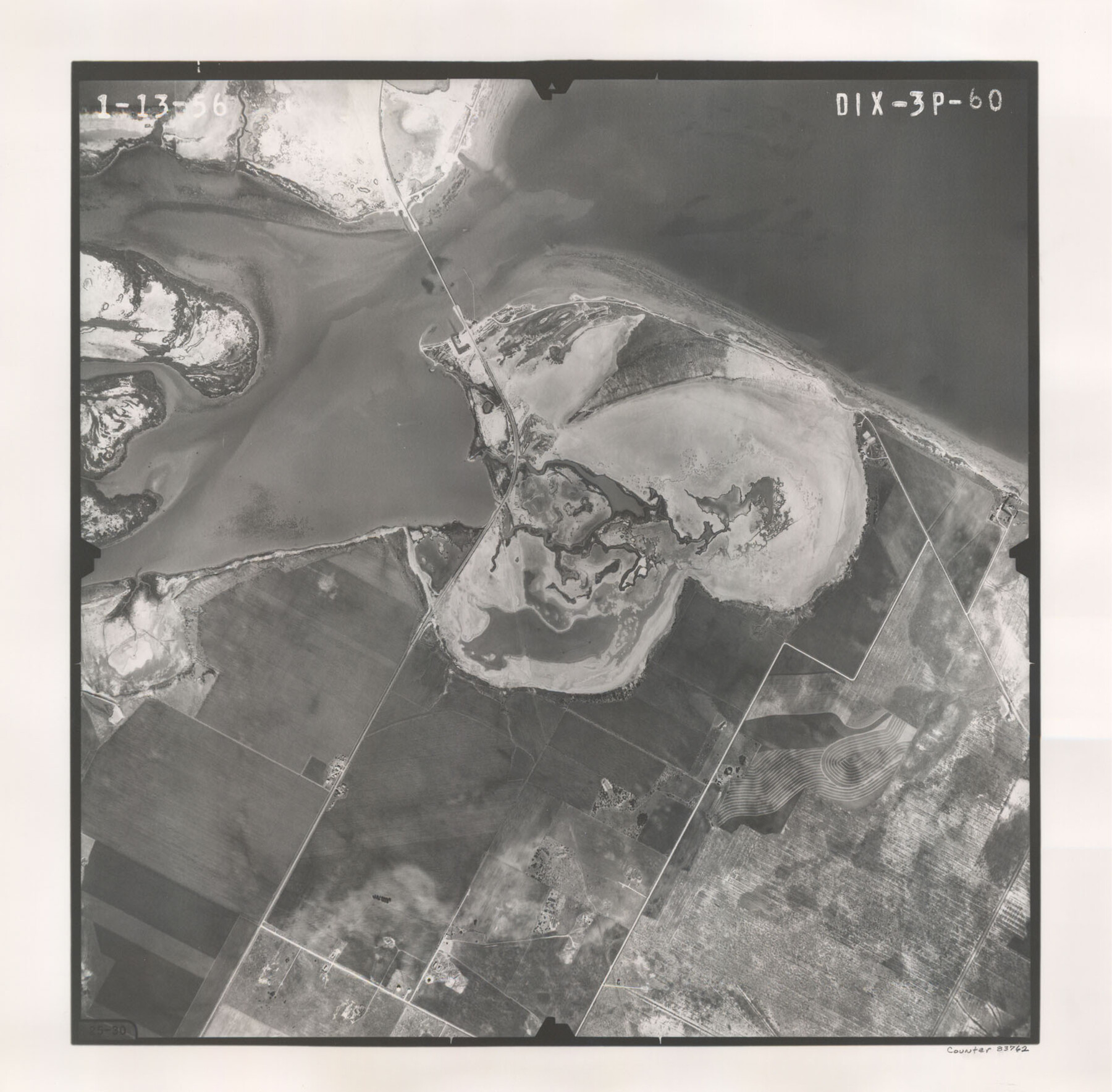
Flight Mission No. DIX-3P, Frame 60, Aransas County
DIX-3P-60
-
Map/Doc
83762
-
Collection
General Map Collection
-
Object Dates
1956/1/13 (Creation Date)
-
People and Organizations
U. S. Department of Agriculture (Publisher)
-
Counties
Aransas
-
Subjects
Aerial Photograph
-
Height x Width
17.6 x 18.0 inches
44.7 x 45.7 cm
-
Comments
Flown by V. L. Beavers and Associates of San Antonio, Texas.
Part of: General Map Collection
San Jacinto County Sketch File 18

Print $20.00
San Jacinto County Sketch File 18
1934
Size 43.6 x 18.1 inches
Map/Doc 10599
United States - Gulf Coast Texas - Southern part of Laguna Madre

Print $20.00
- Digital $50.00
United States - Gulf Coast Texas - Southern part of Laguna Madre
1941
Size 26.5 x 18.3 inches
Map/Doc 72955

Oldham County Working Sketch 11

Print $20.00
- Digital $50.00
Oldham County Working Sketch 11
2014
Size 26.6 x 32.7 inches
Map/Doc 93686
Van Zandt County Sketch File 35

Print $4.00
- Digital $50.00
Van Zandt County Sketch File 35
1862
Size 12.7 x 8.2 inches
Map/Doc 39474
Calhoun County Working Sketch 8

Print $20.00
- Digital $50.00
Calhoun County Working Sketch 8
1943
Size 33.9 x 34.8 inches
Map/Doc 67824
Lipscomb County Rolled Sketch 6

Print $20.00
- Digital $50.00
Lipscomb County Rolled Sketch 6
1941
Size 44.8 x 21.8 inches
Map/Doc 42260
Hardeman County Working Sketch 16

Print $20.00
- Digital $50.00
Hardeman County Working Sketch 16
1982
Size 35.7 x 45.1 inches
Map/Doc 63397
Stephens County Working Sketch 38

Print $20.00
- Digital $50.00
Stephens County Working Sketch 38
1988
Size 24.3 x 32.7 inches
Map/Doc 63981
Sterling County Rolled Sketch 9

Print $20.00
- Digital $50.00
Sterling County Rolled Sketch 9
1929
Size 29.3 x 24.3 inches
Map/Doc 7845
Galveston County Working Sketch Graphic Index

Print $40.00
- Digital $50.00
Galveston County Working Sketch Graphic Index
1939
Size 42.8 x 55.4 inches
Map/Doc 76551
Carson County Rolled Sketch 1

Print $20.00
- Digital $50.00
Carson County Rolled Sketch 1
Size 31.2 x 33.4 inches
Map/Doc 8580
You may also like
[H. & T. C. Block 47 and Vicinity]
![91423, [H. & T. C. Block 47 and Vicinity], Twichell Survey Records](https://historictexasmaps.com/wmedia_w700/maps/91423-1.tif.jpg)
Print $20.00
- Digital $50.00
[H. & T. C. Block 47 and Vicinity]
1887
Size 16.3 x 18.8 inches
Map/Doc 91423
Goliad County Working Sketch 8

Print $20.00
- Digital $50.00
Goliad County Working Sketch 8
1937
Size 29.7 x 36.0 inches
Map/Doc 63198
Medina County Sketch File 17

Print $40.00
- Digital $50.00
Medina County Sketch File 17
1949
Size 13.1 x 13.3 inches
Map/Doc 31480
[Surveys in the Bexar District along the Frio and Leona Rivers]
![136, [Surveys in the Bexar District along the Frio and Leona Rivers], General Map Collection](https://historictexasmaps.com/wmedia_w700/maps/136.tif.jpg)
Print $20.00
- Digital $50.00
[Surveys in the Bexar District along the Frio and Leona Rivers]
1842
Size 16.2 x 12.2 inches
Map/Doc 136
A.R. Roessler's Latest Map of the State of Texas Exhibiting Mineral and Agricultural Districts, Post Offices and Mailroutes, Railroads projected and finished, Timber, Prairie, Swamp Lands, etc. etc. etc.

Print $20.00
A.R. Roessler's Latest Map of the State of Texas Exhibiting Mineral and Agricultural Districts, Post Offices and Mailroutes, Railroads projected and finished, Timber, Prairie, Swamp Lands, etc. etc. etc.
1874
Size 39.7 x 46.8 inches
Map/Doc 76254
Harris County NRC Article 33.136 Sketch 2

Print $30.00
- Digital $50.00
Harris County NRC Article 33.136 Sketch 2
2000
Size 30.6 x 42.2 inches
Map/Doc 61596
Hall County Sketch File 2

Print $12.00
- Digital $50.00
Hall County Sketch File 2
1880
Size 17.1 x 8.4 inches
Map/Doc 42261
Wise County Sketch File 53

Print $12.00
- Digital $50.00
Wise County Sketch File 53
2007
Size 8.5 x 14.0 inches
Map/Doc 87360
Bandera County Rolled Sketch 7

Print $20.00
- Digital $50.00
Bandera County Rolled Sketch 7
Size 42.7 x 29.0 inches
Map/Doc 5118
Flight Mission No. DCL-7C, Frame 119, Kenedy County

Print $20.00
- Digital $50.00
Flight Mission No. DCL-7C, Frame 119, Kenedy County
1943
Size 18.5 x 22.3 inches
Map/Doc 86084
Kleberg County Rolled Sketch 13

Print $20.00
- Digital $50.00
Kleberg County Rolled Sketch 13
1995
Size 39.3 x 33.8 inches
Map/Doc 6554
Enoch's Land Situated in Bailey and Cochran Counties, Texas

Print $20.00
- Digital $50.00
Enoch's Land Situated in Bailey and Cochran Counties, Texas
1925
Size 29.1 x 35.7 inches
Map/Doc 92515