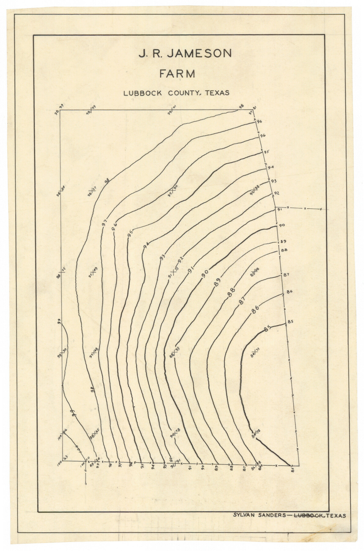
J. R. Jameson Farm
-
Map/Doc
92327
-
Collection
Twichell Survey Records
-
People and Organizations
Sylvan Sanders (Surveyor/Engineer)
-
Counties
Lubbock
-
Height x Width
9.1 x 13.9 inches
23.1 x 35.3 cm
Part of: Twichell Survey Records
[I. M. Bolton, L. S. Thacker, and R. C. Poteet Subdivisions]
![92579, [I. M. Bolton, L. S. Thacker, and R. C. Poteet Subdivisions], Twichell Survey Records](https://historictexasmaps.com/wmedia_w700/maps/92579-1.tif.jpg)
Print $20.00
- Digital $50.00
[I. M. Bolton, L. S. Thacker, and R. C. Poteet Subdivisions]
1924
Size 18.3 x 24.8 inches
Map/Doc 92579
[Part of H. & G. N. Blocks 2 and D-13]
![90490, [Part of H. & G. N. Blocks 2 and D-13], Twichell Survey Records](https://historictexasmaps.com/wmedia_w700/maps/90490-1.tif.jpg)
Print $20.00
- Digital $50.00
[Part of H. & G. N. Blocks 2 and D-13]
1907
Size 14.1 x 17.7 inches
Map/Doc 90490
Working Sketch in Lubbock and Crosby Cos.

Print $20.00
- Digital $50.00
Working Sketch in Lubbock and Crosby Cos.
1903
Size 35.6 x 26.6 inches
Map/Doc 90504
[Blocks XO2, Z, and a Portion of Block 47]
![91252, [Blocks XO2, Z, and a Portion of Block 47], Twichell Survey Records](https://historictexasmaps.com/wmedia_w700/maps/91252-1.tif.jpg)
Print $20.00
- Digital $50.00
[Blocks XO2, Z, and a Portion of Block 47]
1923
Size 19.5 x 9.0 inches
Map/Doc 91252
[Blocks C-19 and C-20]
![93029, [Blocks C-19 and C-20], Twichell Survey Records](https://historictexasmaps.com/wmedia_w700/maps/93029-2.tif.jpg)
Print $40.00
- Digital $50.00
[Blocks C-19 and C-20]
Size 48.7 x 20.2 inches
Map/Doc 93029
[W. T. Brewer: M. McDonald, Ralph Gilpin, A. Vanhooser, John Baker, John R. Taylor Surveys]
![90957, [W. T. Brewer: M. McDonald, Ralph Gilpin, A. Vanhooser, John Baker, John R. Taylor Surveys], Twichell Survey Records](https://historictexasmaps.com/wmedia_w700/maps/90957-1.tif.jpg)
Print $2.00
- Digital $50.00
[W. T. Brewer: M. McDonald, Ralph Gilpin, A. Vanhooser, John Baker, John R. Taylor Surveys]
Size 8.7 x 11.3 inches
Map/Doc 90957
[Plat showing traverse line run from I. R. Rock at southeast corner survey 58 northerly to the I. R. Rock corner at the northeast 60]
![91597, [Plat showing traverse line run from I. R. Rock at southeast corner survey 58 northerly to the I. R. Rock corner at the northeast 60], Twichell Survey Records](https://historictexasmaps.com/wmedia_w700/maps/91597-1.tif.jpg)
Print $20.00
- Digital $50.00
[Plat showing traverse line run from I. R. Rock at southeast corner survey 58 northerly to the I. R. Rock corner at the northeast 60]
1935
Size 22.5 x 18.1 inches
Map/Doc 91597
[W. T. Brewer: M. McDonald, Ralph Gilpin, A. Vanhooser, John Baker, John R. Taylor Surveys]
![90961, [W. T. Brewer: M. McDonald, Ralph Gilpin, A. Vanhooser, John Baker, John R. Taylor Surveys], Twichell Survey Records](https://historictexasmaps.com/wmedia_w700/maps/90961-1.tif.jpg)
Print $2.00
- Digital $50.00
[W. T. Brewer: M. McDonald, Ralph Gilpin, A. Vanhooser, John Baker, John R. Taylor Surveys]
Size 8.8 x 11.2 inches
Map/Doc 90961
Working Sketch in Lynn County

Print $20.00
- Digital $50.00
Working Sketch in Lynn County
1921
Size 15.3 x 18.6 inches
Map/Doc 91338
[Sketch showing west part of county]
![91712, [Sketch showing west part of county], Twichell Survey Records](https://historictexasmaps.com/wmedia_w700/maps/91712-1.tif.jpg)
Print $3.00
- Digital $50.00
[Sketch showing west part of county]
1907
Size 16.4 x 11.1 inches
Map/Doc 91712
[Blocks R31E-R34E Township 11-13]
![92039, [Blocks R31E-R34E Township 11-13], Twichell Survey Records](https://historictexasmaps.com/wmedia_w700/maps/92039-1.tif.jpg)
Print $20.00
- Digital $50.00
[Blocks R31E-R34E Township 11-13]
Size 21.7 x 16.7 inches
Map/Doc 92039
[Connecting line from southwest corner of S. K. & K. Blk M6 to southwest corner I. & G. N. Blk. 6]
![90411, [Connecting line from southwest corner of S. K. & K. Blk M6 to southwest corner I. & G. N. Blk. 6], Twichell Survey Records](https://historictexasmaps.com/wmedia_w700/maps/90411-1.tif.jpg)
Print $20.00
- Digital $50.00
[Connecting line from southwest corner of S. K. & K. Blk M6 to southwest corner I. & G. N. Blk. 6]
Size 26.4 x 26.9 inches
Map/Doc 90411
You may also like
Flight Mission No. BRE-2P, Frame 99, Nueces County

Print $20.00
- Digital $50.00
Flight Mission No. BRE-2P, Frame 99, Nueces County
1956
Size 18.5 x 22.3 inches
Map/Doc 86784
Calhoun County Rolled Sketch 29A

Print $20.00
- Digital $50.00
Calhoun County Rolled Sketch 29A
Size 30.4 x 33.5 inches
Map/Doc 8557
[H. & G. N. Block 1, G. C. & S. F. Block Z]
![91168, [H. & G. N. Block 1, G. C. & S. F. Block Z], Twichell Survey Records](https://historictexasmaps.com/wmedia_w700/maps/91168-1.tif.jpg)
Print $3.00
- Digital $50.00
[H. & G. N. Block 1, G. C. & S. F. Block Z]
Size 16.8 x 10.5 inches
Map/Doc 91168
Map of Surveys Made for the T&PRR in Martin & Tom Green Counties, Blocks 34-39, Reserve West of the Colorado River

Print $20.00
- Digital $50.00
Map of Surveys Made for the T&PRR in Martin & Tom Green Counties, Blocks 34-39, Reserve West of the Colorado River
1876
Size 41.9 x 43.7 inches
Map/Doc 2226
Presidio County Rolled Sketch 82

Print $20.00
- Digital $50.00
Presidio County Rolled Sketch 82
1943
Size 35.5 x 26.1 inches
Map/Doc 7369
Map of T. C. Spearman's Lands in Gaines, Terry and Yoakum Counties, Texas

Print $3.00
- Digital $50.00
Map of T. C. Spearman's Lands in Gaines, Terry and Yoakum Counties, Texas
1917
Size 12.4 x 10.2 inches
Map/Doc 92002
Sterling County Sketch File 7

Print $25.00
- Digital $50.00
Sterling County Sketch File 7
1926
Size 11.7 x 12.1 inches
Map/Doc 37121
Current Miscellaneous File 42

Print $4.00
- Digital $50.00
Current Miscellaneous File 42
Size 11.2 x 8.7 inches
Map/Doc 73981
Hansford County Working Sketch 1

Print $40.00
- Digital $50.00
Hansford County Working Sketch 1
1934
Size 43.0 x 54.1 inches
Map/Doc 63373
Chambers County Sketch File 15

Print $4.00
- Digital $50.00
Chambers County Sketch File 15
Size 8.3 x 12.4 inches
Map/Doc 17563
Map of the United States showing the Texas & Pacific Railway and its connections

Print $20.00
- Digital $50.00
Map of the United States showing the Texas & Pacific Railway and its connections
1875
Size 11.9 x 16.8 inches
Map/Doc 93960
