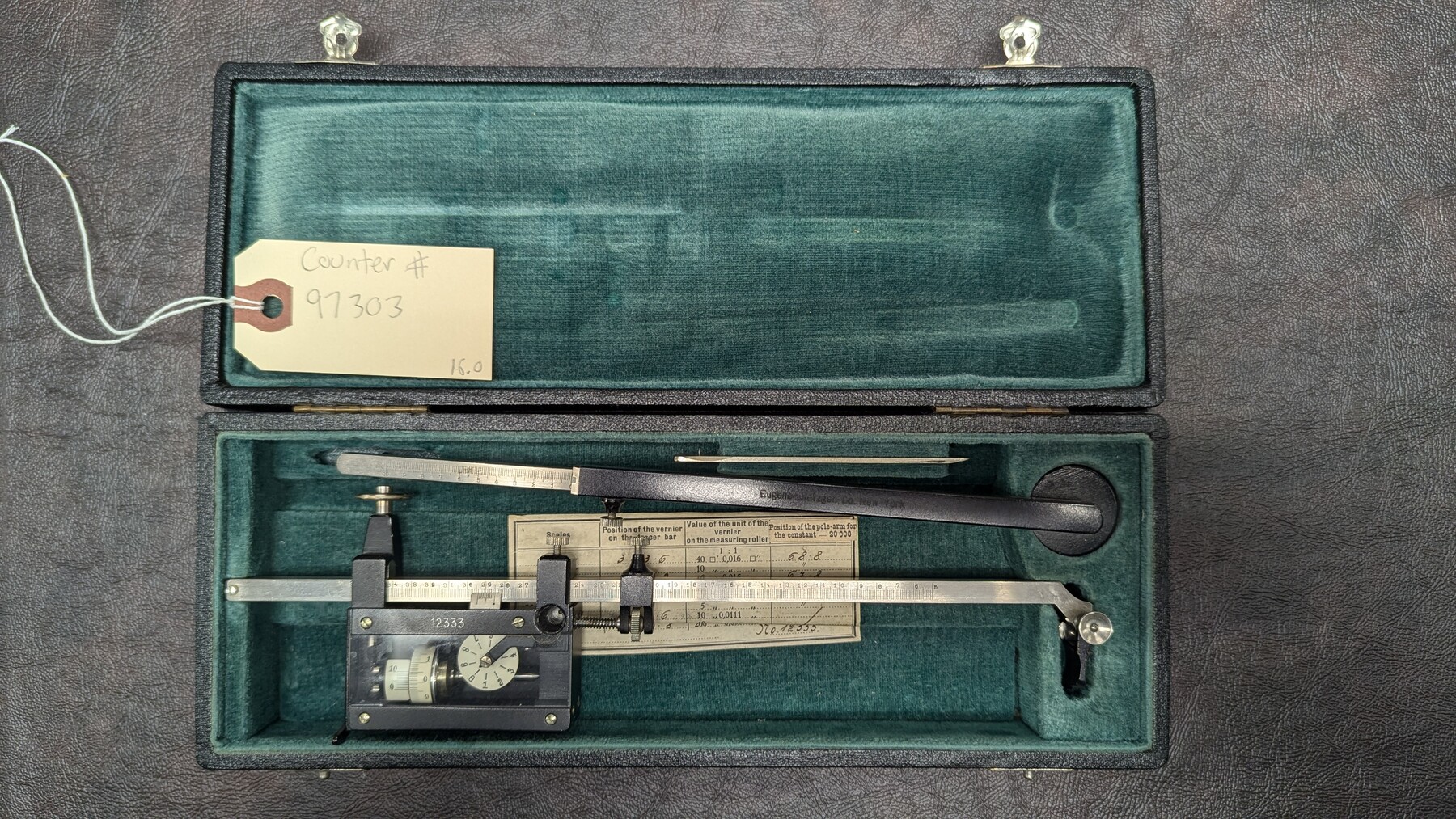
Dietzgen Planimeter
Manufacturer: Eugene Dietzgen Co. Serial Number: 12333 Case: Velvet-lined box Manufacture Location: New York
-
Map/Doc
97303
-
Collection
Equipment and Tools
-
Height x Width
1.8 x 10.3 inches
4.4 x 26.0 cm
Part of: Equipment and Tools


Hewlett-Packard 32E scientific calculator

Hewlett-Packard 32E scientific calculator
1978
Map/Doc 97318
Keuffel and Esser Co. odometer in leather case and wagon wheel

Keuffel and Esser Co. odometer in leather case and wagon wheel
Map/Doc 97376
K&E Both's Patent Section Liner and Scale Divider #1160

K&E Both's Patent Section Liner and Scale Divider #1160
Size 2.4 x 15.5 inches
Map/Doc 97304


You may also like
Bandera County Rolled Sketch 2

Print $20.00
- Digital $50.00
Bandera County Rolled Sketch 2
1945
Size 19.1 x 24.0 inches
Map/Doc 5114
Midland County Rolled Sketch 12

Print $40.00
- Digital $50.00
Midland County Rolled Sketch 12
Size 97.0 x 42.6 inches
Map/Doc 9520
Flight Mission No. BRA-8M, Frame 80, Jefferson County

Print $20.00
- Digital $50.00
Flight Mission No. BRA-8M, Frame 80, Jefferson County
1953
Size 15.9 x 15.6 inches
Map/Doc 85600
Stephens County Sketch File 15

Print $4.00
- Digital $50.00
Stephens County Sketch File 15
1890
Size 9.1 x 6.7 inches
Map/Doc 37068
Hansford County Boundary File 1a

Print $2.00
- Digital $50.00
Hansford County Boundary File 1a
Size 11.2 x 8.8 inches
Map/Doc 54244
Amèrica noviter delineata

Print $20.00
- Digital $50.00
Amèrica noviter delineata
1630
Size 21.5 x 24.7 inches
Map/Doc 93814
Hutchinson County

Print $20.00
- Digital $50.00
Hutchinson County
1922
Size 14.8 x 17.9 inches
Map/Doc 92168
Flight Mission No. DIX-6P, Frame 132, Aransas County

Print $20.00
- Digital $50.00
Flight Mission No. DIX-6P, Frame 132, Aransas County
1956
Size 19.3 x 23.2 inches
Map/Doc 83838
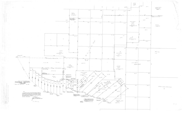
Presidio County Rolled Sketch D3
Print $40.00
- Digital $50.00
Presidio County Rolled Sketch D3
1909
Size 35.1 x 56.3 inches
Map/Doc 9776
Montgomery County Working Sketch 16

Print $20.00
- Digital $50.00
Montgomery County Working Sketch 16
1934
Size 28.9 x 33.7 inches
Map/Doc 71123
Real County Sketch File 18

Print $28.00
- Digital $50.00
Real County Sketch File 18
1964
Size 14.3 x 8.9 inches
Map/Doc 35076
Presidio County Sketch File 65

Print $6.00
- Digital $50.00
Presidio County Sketch File 65
1940
Size 11.0 x 15.3 inches
Map/Doc 34654