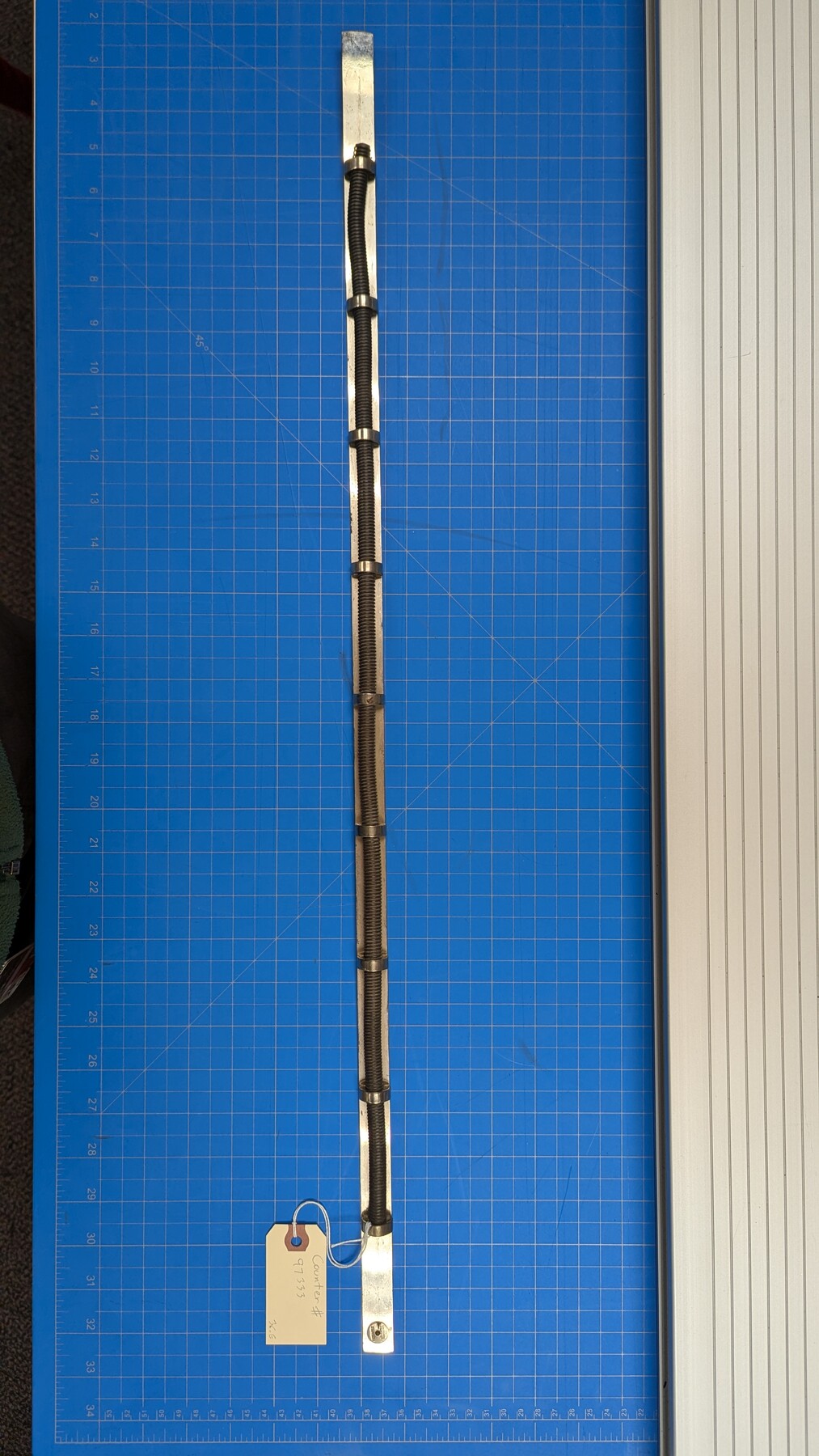
Flexible Curve Tool
Manufacturer: F.W. Davenport Manufacture Location: Providence, RI
-
Map/Doc
97333
-
Collection
Equipment and Tools
-
Height x Width
30.0 x 0.8 inches
76.2 x 1.9 cm
Part of: Equipment and Tools

Bow compass with ruling pen attachment

Bow compass with ruling pen attachment
Size 6.5 x 3.3 inches
Map/Doc 97316


K&E Leroy Lettering Set - 3240

K&E Leroy Lettering Set - 3240
1944
Size 1.8 x 15.5 inches
Map/Doc 97314

Dietzgen Globe Wooden 42" T Square

Dietzgen Globe Wooden 42" T Square
Size 44.5 x 13.8 inches
Map/Doc 97329
Wooden Arrow with metal arrowhead

Wooden Arrow with metal arrowhead
Size 31.5 x 0.0 inches
Map/Doc 97334

You may also like
Flight Mission No. BQY-4M, Frame 43, Harris County

Print $20.00
- Digital $50.00
Flight Mission No. BQY-4M, Frame 43, Harris County
1953
Size 18.6 x 22.3 inches
Map/Doc 85258
Alexander's Subdivision Tract 2, League 64 Midland County School Land, Cochran County, Texas

Print $20.00
- Digital $50.00
Alexander's Subdivision Tract 2, League 64 Midland County School Land, Cochran County, Texas
1937
Size 19.1 x 22.7 inches
Map/Doc 92518
Hansford County, Texas

Print $20.00
- Digital $50.00
Hansford County, Texas
1880
Size 21.4 x 18.0 inches
Map/Doc 519
Newton County Sketch File 8

Print $4.00
- Digital $50.00
Newton County Sketch File 8
Size 11.0 x 9.0 inches
Map/Doc 32376
Houston County Working Sketch 25

Print $40.00
- Digital $50.00
Houston County Working Sketch 25
1983
Size 43.6 x 89.0 inches
Map/Doc 66255
Abstract of Land Titles in the Spanish Department of the General Land Office of the State of Texas - 1824-36

Abstract of Land Titles in the Spanish Department of the General Land Office of the State of Texas - 1824-36
1857
Size 17.6 x 11.9 inches
Map/Doc 94535
Liberty County Working Sketch 3

Print $20.00
- Digital $50.00
Liberty County Working Sketch 3
1891
Size 16.2 x 13.2 inches
Map/Doc 70462
Montgomery County Working Sketch 60

Print $20.00
- Digital $50.00
Montgomery County Working Sketch 60
1963
Size 24.3 x 42.7 inches
Map/Doc 71167
Matagorda County Working Sketch 20

Print $20.00
- Digital $50.00
Matagorda County Working Sketch 20
1961
Size 26.1 x 37.7 inches
Map/Doc 70878
Map of Kaufman County, Texas

Print $20.00
- Digital $50.00
Map of Kaufman County, Texas
Size 29.7 x 38.7 inches
Map/Doc 91029
Cooke County Sketch File 13

Print $20.00
- Digital $50.00
Cooke County Sketch File 13
1859
Size 27.1 x 19.0 inches
Map/Doc 11171
[Blocks W and Z with tie lines]
![90451, [Blocks W and Z with tie lines], Twichell Survey Records](https://historictexasmaps.com/wmedia_w700/maps/90451-1.tif.jpg)
Print $20.00
- Digital $50.00
[Blocks W and Z with tie lines]
1949
Size 14.4 x 14.2 inches
Map/Doc 90451