[T. & N. O. RR. Co and H. & T. C. RR. Co. Blocks]
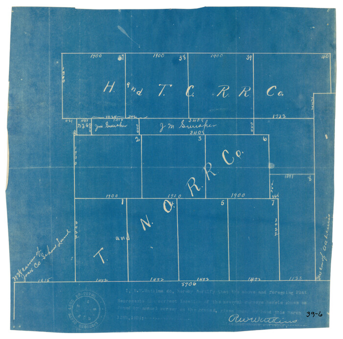
Print $2.00
- Digital $50.00
[T. & N. O. RR. Co and H. & T. C. RR. Co. Blocks]
1924
Size: 8.3 x 8.2 inches
90430
[Sketch showing the area around the state line in Roberts and Clay Counties, along the north bank of the Canadian River]
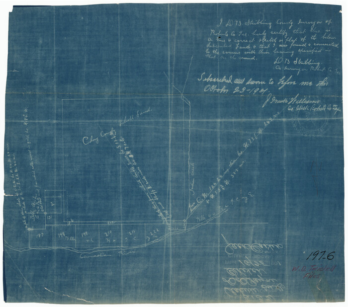
Print $20.00
- Digital $50.00
[Sketch showing the area around the state line in Roberts and Clay Counties, along the north bank of the Canadian River]
1901
Size: 14.3 x 12.7 inches
91762
[Sketch showing J.S. Brooks, W.B. Aldredge, Madison County School Land and Others]
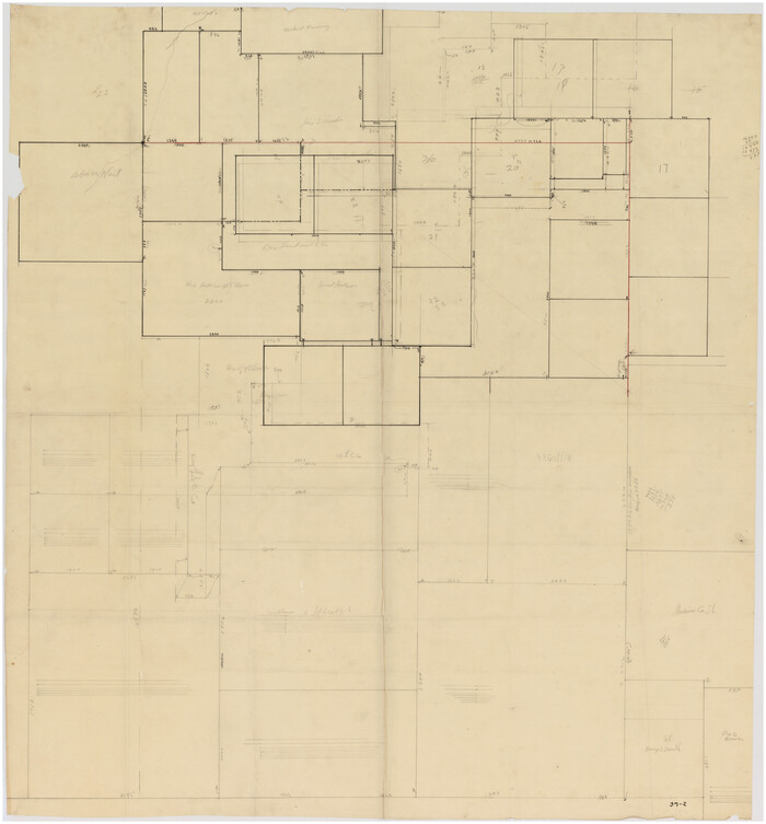
Print $20.00
- Digital $50.00
[Sketch showing J.S. Brooks, W.B. Aldredge, Madison County School Land and Others]
Size: 37.1 x 39.9 inches
89730
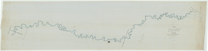
[Sketch for Mineral Application 21493 - Clay County]
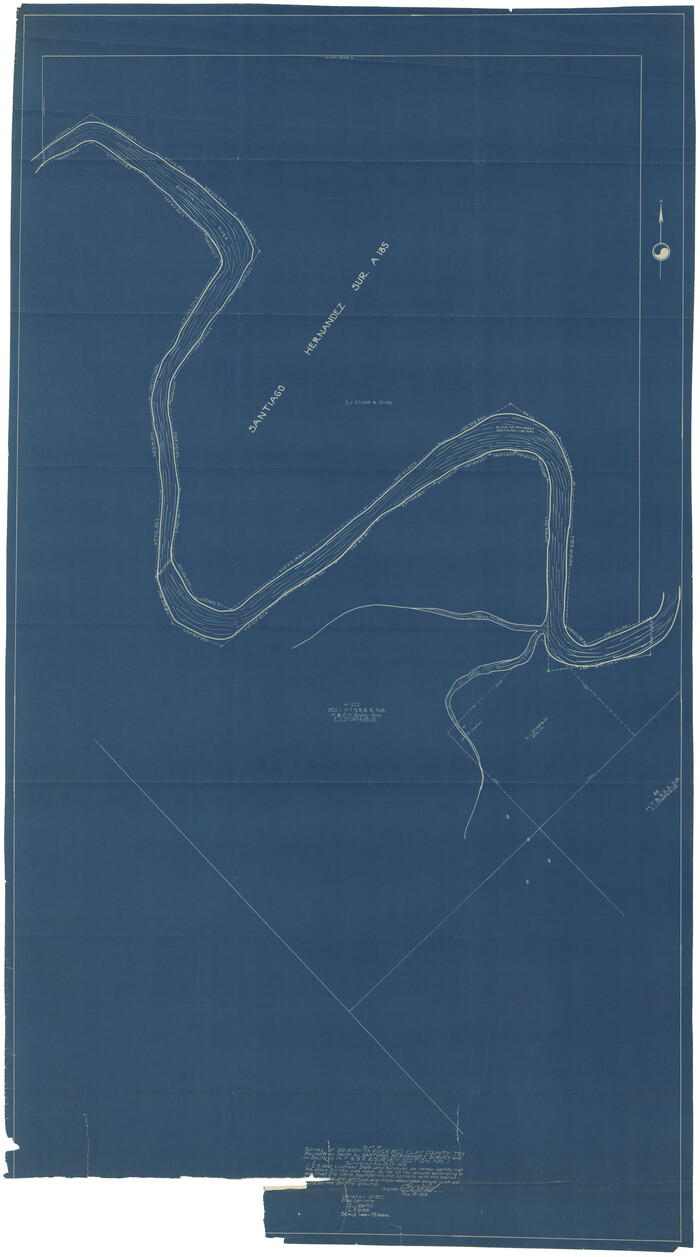
Print $40.00
- Digital $50.00
[Sketch for Mineral Application 21493 - Clay County]
Size: 62.4 x 34.8 inches
65625
[Sketch for Mineral Application 21493 - Clay County]
Print $40.00
- Digital $50.00
[Sketch for Mineral Application 21493 - Clay County]
Size: 63.1 x 35.3 inches
65626
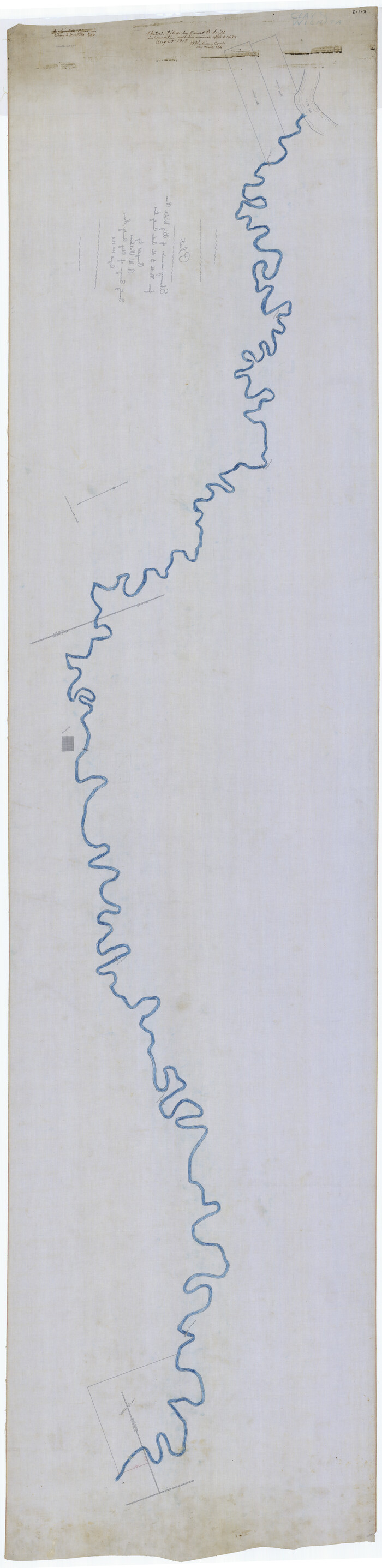
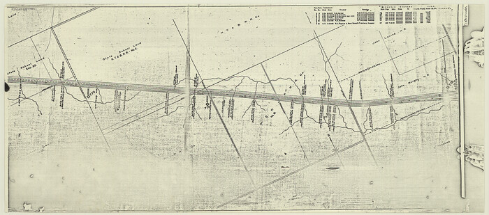
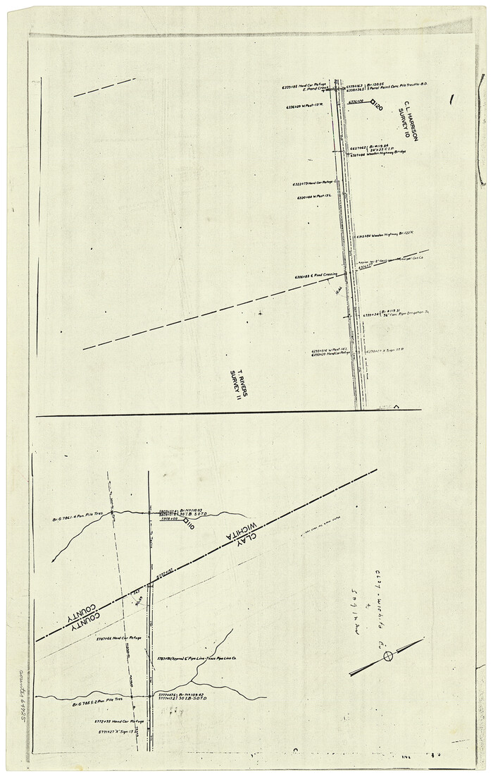
[Sketch for Mineral Application 1487 -Big Wichita River, Ernest R. Smith]
Print $40.00
- Digital $50.00
[Sketch for Mineral Application 1487 -Big Wichita River, Ernest R. Smith]
1918
Size: 32.2 x 130.1 inches
65684
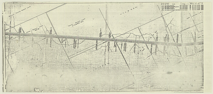
[Sketch for Mineral Application 1487 -Big Wichita River, Ernest R. Smith]
Print $40.00
- Digital $50.00
[Sketch for Mineral Application 1487 -Big Wichita River, Ernest R. Smith]
1918
Size: 129.3 x 31.5 inches
65685
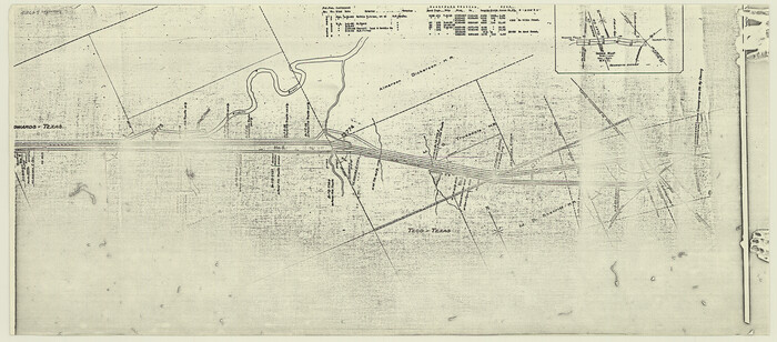
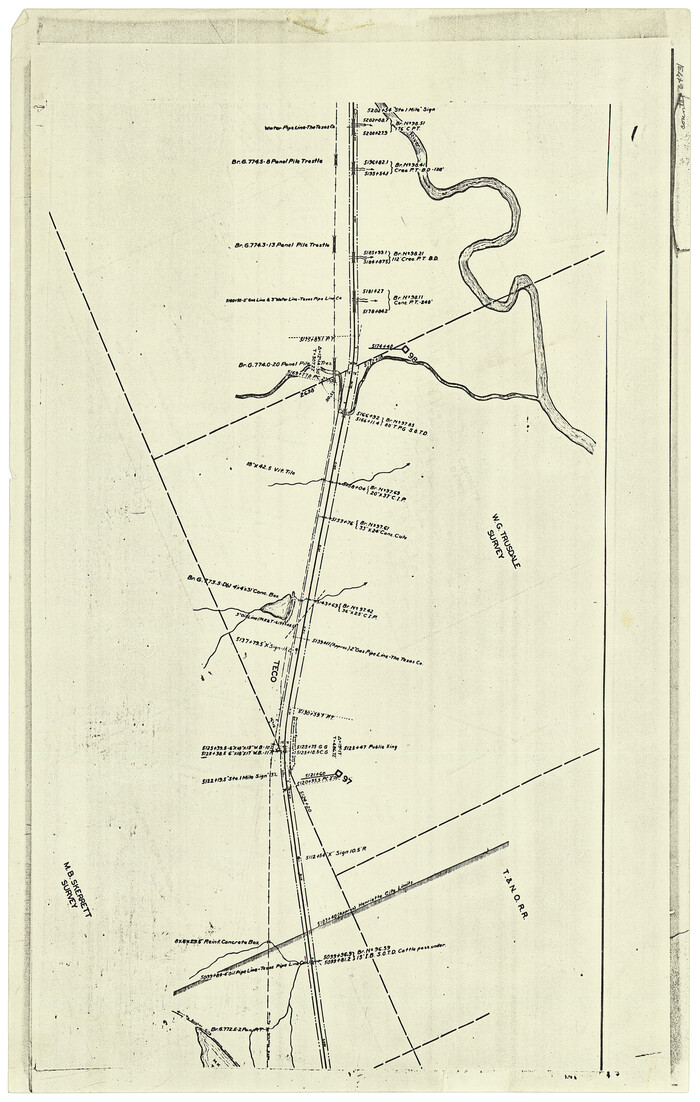
[Right of Way and Track Map, the Missouri, Kansas and Texas Ry. of Texas - Henrietta Division]
Print $20.00
- Digital $50.00
[Right of Way and Track Map, the Missouri, Kansas and Texas Ry. of Texas - Henrietta Division]
1918
Size: 11.8 x 26.9 inches
64757
[Right of Way and Track Map, the Missouri, Kansas and Texas Ry. of Texas - Henrietta Division]
Print $20.00
- Digital $50.00
[Right of Way and Track Map, the Missouri, Kansas and Texas Ry. of Texas - Henrietta Division]
1918
Size: 11.8 x 26.8 inches
64758
[Right of Way and Track Map, the Missouri, Kansas and Texas Ry. of Texas - Henrietta Division]
Print $20.00
- Digital $50.00
[Right of Way and Track Map, the Missouri, Kansas and Texas Ry. of Texas - Henrietta Division]
1918
Size: 11.9 x 26.8 inches
64759
[Right of Way and Track Map, the Missouri, Kansas and Texas Ry. of Texas - Henrietta Division]
Print $20.00
- Digital $50.00
[Right of Way and Track Map, the Missouri, Kansas and Texas Ry. of Texas - Henrietta Division]
1918
Size: 11.8 x 26.9 inches
64760
[Right of Way and Track Map, the Missouri, Kansas and Texas Ry. of Texas - Henrietta Division]
Print $20.00
- Digital $50.00
[Right of Way and Track Map, the Missouri, Kansas and Texas Ry. of Texas - Henrietta Division]
1918
Size: 11.8 x 26.9 inches
64766
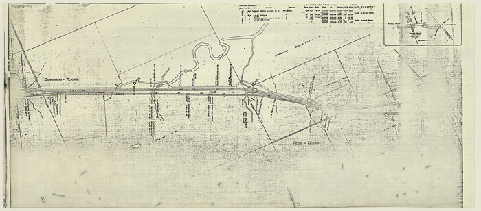
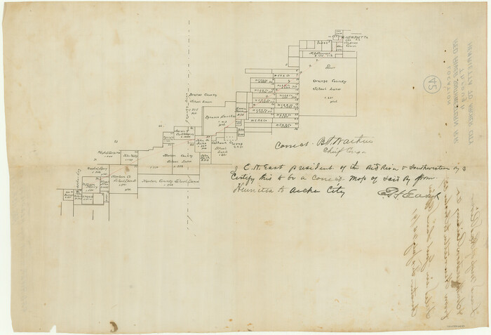
[Red River & Southwestern Ry. Co. from Henrietta to Archer City]
Print $20.00
- Digital $50.00
[Red River & Southwestern Ry. Co. from Henrietta to Archer City]
Size: 14.3 x 21.1 inches
64147
[McLennan County School Land Leagues 3 and 4 and surrounding surveys/blocks]
Print $20.00
- Digital $50.00
[McLennan County School Land Leagues 3 and 4 and surrounding surveys/blocks]
Size: 12.0 x 14.8 inches
90434
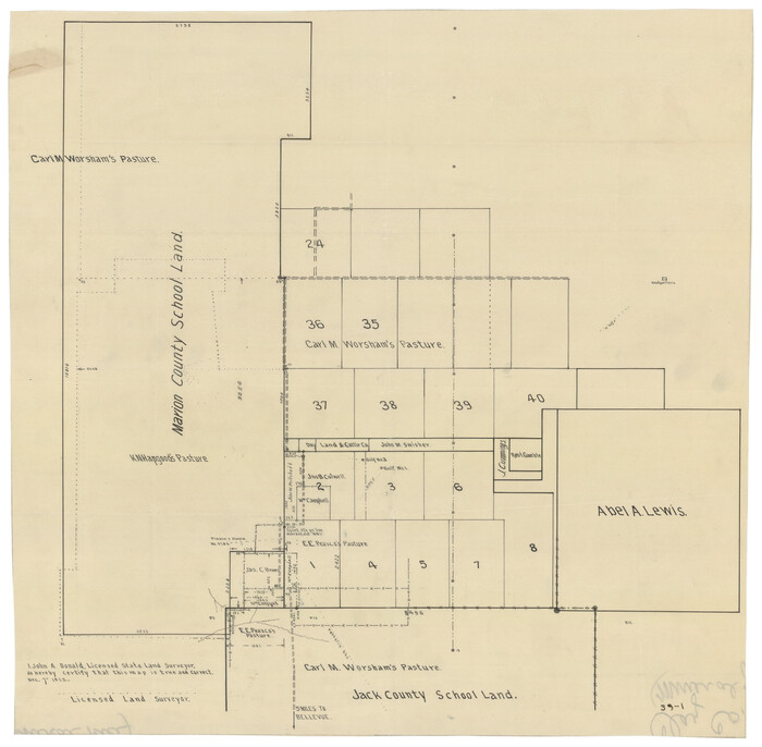
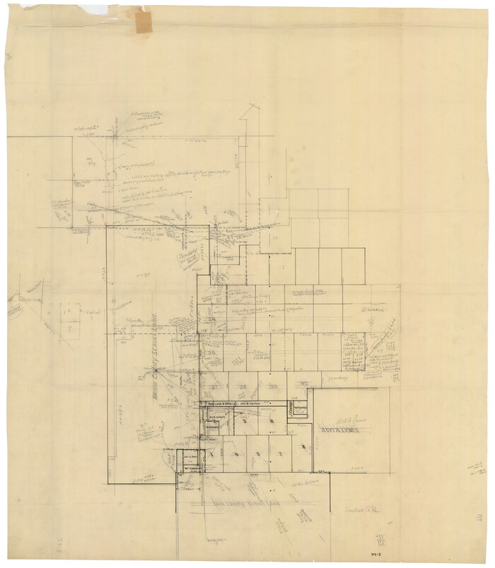
[Marion County School Land, Jack County School Land, Abel A. Lewis and other surveys in vicinity]
Print $20.00
- Digital $50.00
[Marion County School Land, Jack County School Land, Abel A. Lewis and other surveys in vicinity]
1922
Size: 14.0 x 13.8 inches
90426
[Marion County School Land, Jack County School Land, Abel A. Lewis and other surveys in vicinity]
Print $20.00
- Digital $50.00
[Marion County School Land, Jack County School Land, Abel A. Lewis and other surveys in vicinity]
Size: 22.0 x 25.1 inches
90427
[Map of Clay County]
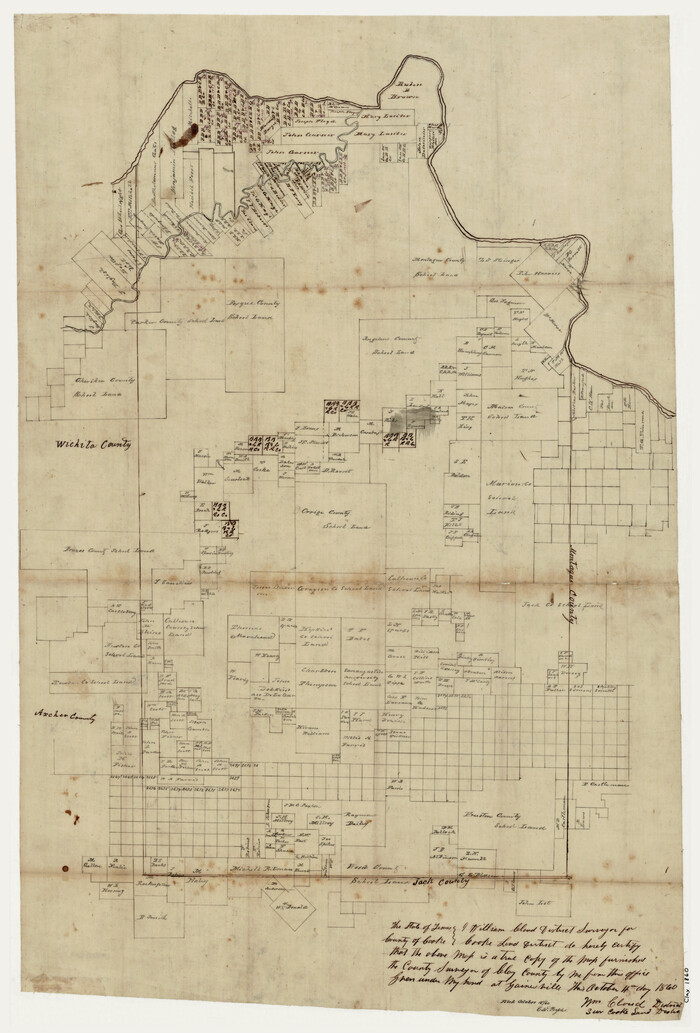
Print $20.00
- Digital $50.00
[Map of Clay County]
1860
Size: 28.3 x 19.1 inches
3402
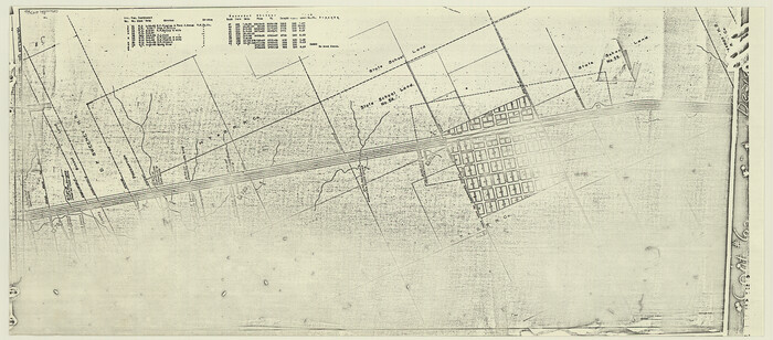
[Madison County School Land, W. Perry and other surveys to the East]
Print $20.00
- Digital $50.00
[Madison County School Land, W. Perry and other surveys to the East]
Size: 12.9 x 18.0 inches
90428
[Madison County School Land, W. Perry and other surveys to the East]

Print $20.00
- Digital $50.00
[Madison County School Land, W. Perry and other surveys to the East]
Size: 13.8 x 16.3 inches
90429
[K. N. Hapgood's Pasture and surrounding surveys]
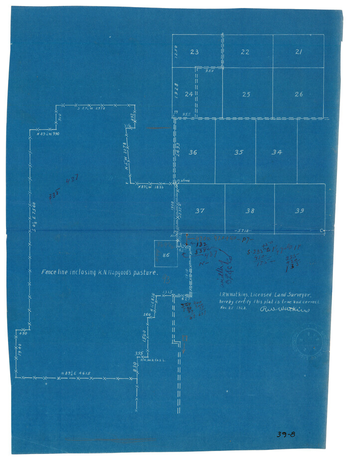
Print $2.00
- Digital $50.00
[K. N. Hapgood's Pasture and surrounding surveys]
1923
Size: 8.7 x 11.5 inches
90432
[Jack County School Land, Limestone County School Land and surveys in vicinity]
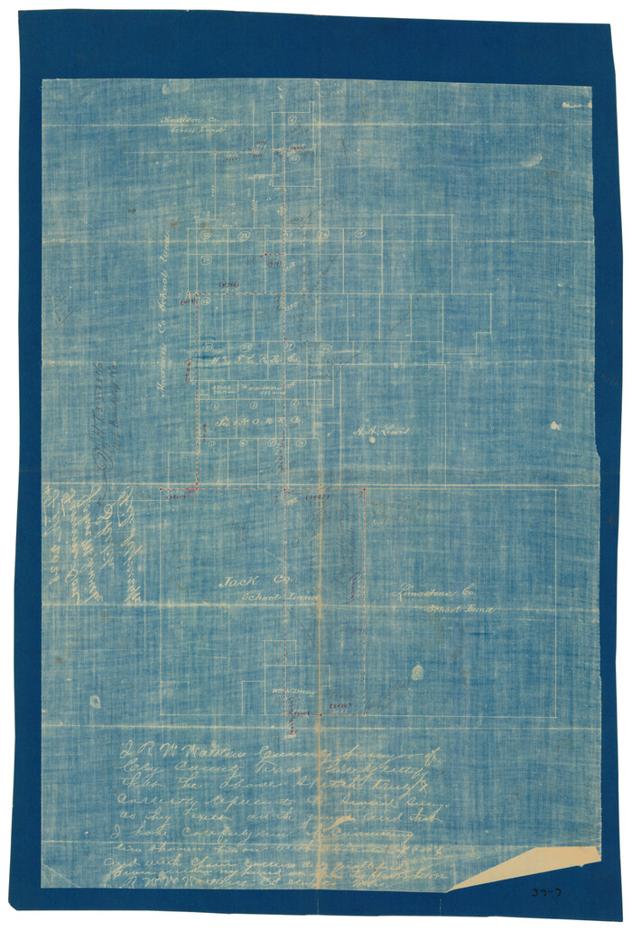
Print $3.00
- Digital $50.00
[Jack County School Land, Limestone County School Land and surveys in vicinity]
1892
Size: 10.2 x 15.1 inches
90433
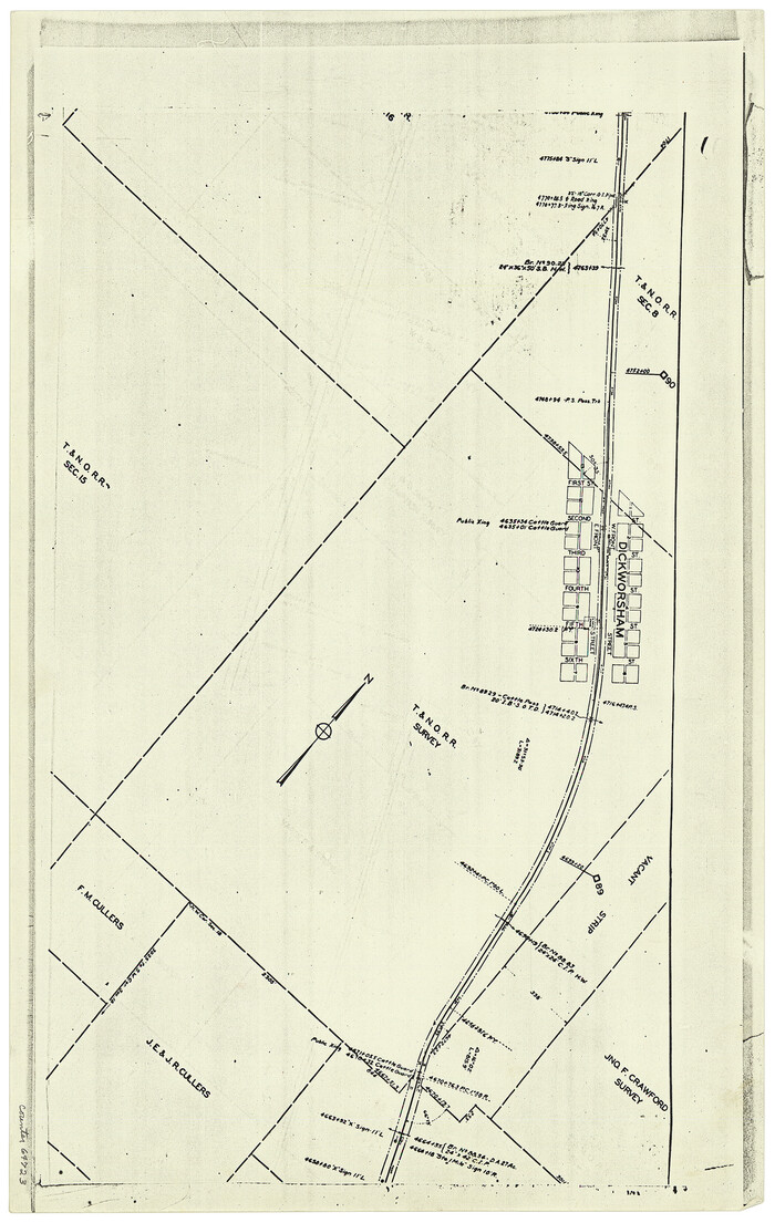
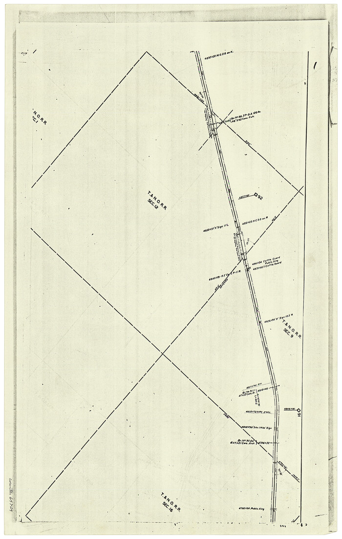
[F. W. & D. C. Ry. Co. Alignment and Right of Way Map, Clay County]
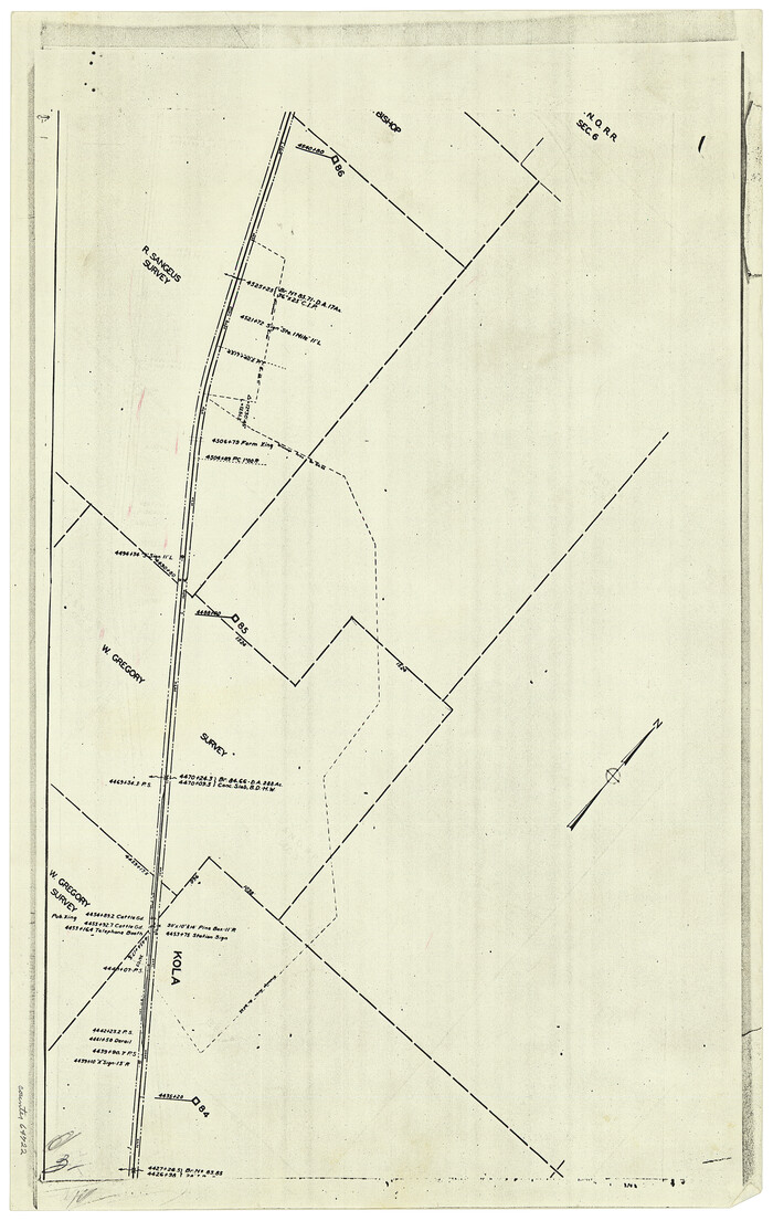
Print $20.00
- Digital $50.00
[F. W. & D. C. Ry. Co. Alignment and Right of Way Map, Clay County]
1927
Size: 18.7 x 11.7 inches
64722
[F. W. & D. C. Ry. Co. Alignment and Right of Way Map, Clay County]
Print $20.00
- Digital $50.00
[F. W. & D. C. Ry. Co. Alignment and Right of Way Map, Clay County]
1927
Size: 18.6 x 11.8 inches
64723
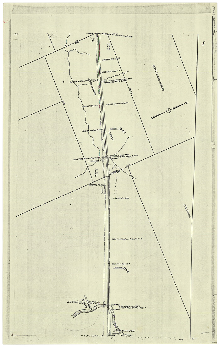
[F. W. & D. C. Ry. Co. Alignment and Right of Way Map, Clay County]
Print $20.00
- Digital $50.00
[F. W. & D. C. Ry. Co. Alignment and Right of Way Map, Clay County]
1927
Size: 18.5 x 11.7 inches
64724
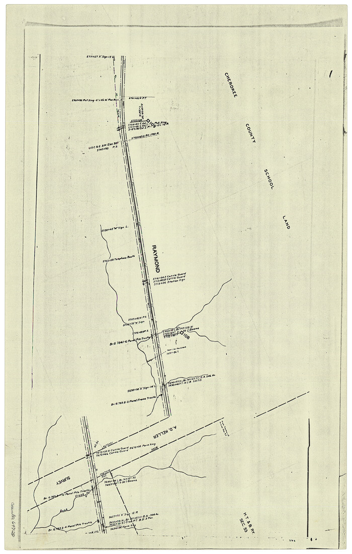
[F. W. & D. C. Ry. Co. Alignment and Right of Way Map, Clay County]
Print $20.00
- Digital $50.00
[F. W. & D. C. Ry. Co. Alignment and Right of Way Map, Clay County]
1927
Size: 18.6 x 11.7 inches
64725
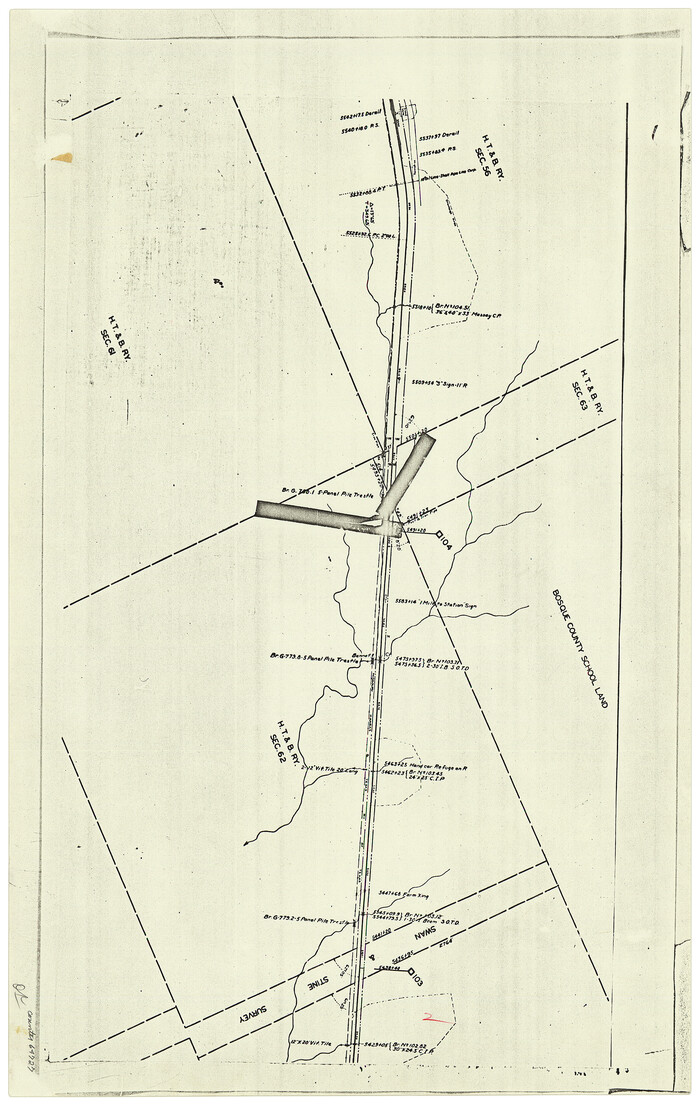
[F. W. & D. C. Ry. Co. Alignment and Right of Way Map, Clay County]
Print $20.00
- Digital $50.00
[F. W. & D. C. Ry. Co. Alignment and Right of Way Map, Clay County]
1927
Size: 18.6 x 11.8 inches
64726
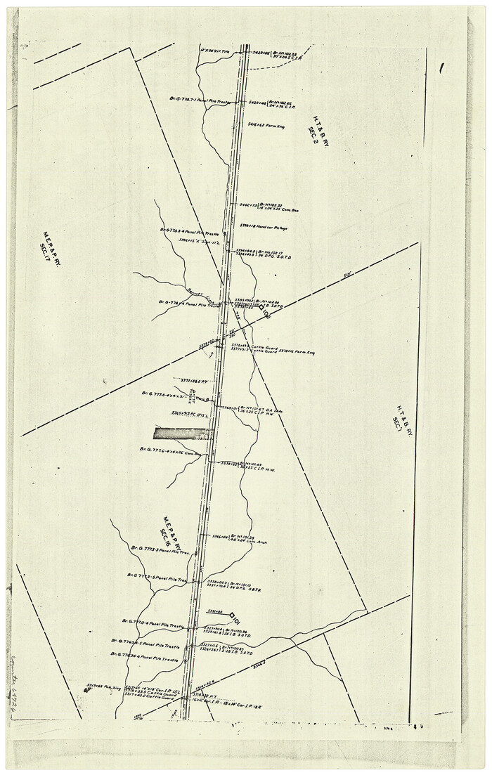
[F. W. & D. C. Ry. Co. Alignment and Right of Way Map, Clay County]
Print $20.00
- Digital $50.00
[F. W. & D. C. Ry. Co. Alignment and Right of Way Map, Clay County]
1927
Size: 18.6 x 11.7 inches
64727
[F. W. & D. C. Ry. Co. Alignment and Right of Way Map, Clay County]
Print $20.00
- Digital $50.00
[F. W. & D. C. Ry. Co. Alignment and Right of Way Map, Clay County]
1927
Size: 18.8 x 11.7 inches
64728
[F. W. & D. C. Ry. Co. Alignment and Right of Way Map, Clay County]
Print $20.00
- Digital $50.00
[F. W. & D. C. Ry. Co. Alignment and Right of Way Map, Clay County]
1927
Size: 18.5 x 11.7 inches
64729
[F. W. & D. C. Ry. Co. Alignment and Right of Way Map, Clay County]
Print $20.00
- Digital $50.00
[F. W. & D. C. Ry. Co. Alignment and Right of Way Map, Clay County]
1927
Size: 18.7 x 11.8 inches
64731
[T. & N. O. RR. Co and H. & T. C. RR. Co. Blocks]
Print $2.00
- Digital $50.00
[T. & N. O. RR. Co and H. & T. C. RR. Co. Blocks]
1924
-
Size
8.3 x 8.2 inches
-
Map/Doc
90430
-
Creation Date
1924
[Sketch showing the area around the state line in Roberts and Clay Counties, along the north bank of the Canadian River]
Print $20.00
- Digital $50.00
[Sketch showing the area around the state line in Roberts and Clay Counties, along the north bank of the Canadian River]
1901
-
Size
14.3 x 12.7 inches
-
Map/Doc
91762
-
Creation Date
1901
[Sketch showing J.S. Brooks, W.B. Aldredge, Madison County School Land and Others]
Print $20.00
- Digital $50.00
[Sketch showing J.S. Brooks, W.B. Aldredge, Madison County School Land and Others]
-
Size
37.1 x 39.9 inches
-
Map/Doc
89730
[Sketch for Mineral Application 21493 - Clay County]
Print $40.00
- Digital $50.00
[Sketch for Mineral Application 21493 - Clay County]
-
Size
62.4 x 34.8 inches
-
Map/Doc
65625
[Sketch for Mineral Application 21493 - Clay County]
Print $40.00
- Digital $50.00
[Sketch for Mineral Application 21493 - Clay County]
-
Size
63.1 x 35.3 inches
-
Map/Doc
65626
[Sketch for Mineral Application 1487 -Big Wichita River, Ernest R. Smith]
Print $40.00
- Digital $50.00
[Sketch for Mineral Application 1487 -Big Wichita River, Ernest R. Smith]
1918
-
Size
32.2 x 130.1 inches
-
Map/Doc
65684
-
Creation Date
1918
[Sketch for Mineral Application 1487 -Big Wichita River, Ernest R. Smith]
Print $40.00
- Digital $50.00
[Sketch for Mineral Application 1487 -Big Wichita River, Ernest R. Smith]
1918
-
Size
129.3 x 31.5 inches
-
Map/Doc
65685
-
Creation Date
1918
[Right of Way and Track Map, the Missouri, Kansas and Texas Ry. of Texas - Henrietta Division]
Print $20.00
- Digital $50.00
[Right of Way and Track Map, the Missouri, Kansas and Texas Ry. of Texas - Henrietta Division]
1918
-
Size
11.8 x 26.9 inches
-
Map/Doc
64757
-
Creation Date
1918
[Right of Way and Track Map, the Missouri, Kansas and Texas Ry. of Texas - Henrietta Division]
Print $20.00
- Digital $50.00
[Right of Way and Track Map, the Missouri, Kansas and Texas Ry. of Texas - Henrietta Division]
1918
-
Size
11.8 x 26.8 inches
-
Map/Doc
64758
-
Creation Date
1918
[Right of Way and Track Map, the Missouri, Kansas and Texas Ry. of Texas - Henrietta Division]
Print $20.00
- Digital $50.00
[Right of Way and Track Map, the Missouri, Kansas and Texas Ry. of Texas - Henrietta Division]
1918
-
Size
11.9 x 26.8 inches
-
Map/Doc
64759
-
Creation Date
1918
[Right of Way and Track Map, the Missouri, Kansas and Texas Ry. of Texas - Henrietta Division]
Print $20.00
- Digital $50.00
[Right of Way and Track Map, the Missouri, Kansas and Texas Ry. of Texas - Henrietta Division]
1918
-
Size
11.8 x 26.9 inches
-
Map/Doc
64760
-
Creation Date
1918
[Right of Way and Track Map, the Missouri, Kansas and Texas Ry. of Texas - Henrietta Division]
Print $20.00
- Digital $50.00
[Right of Way and Track Map, the Missouri, Kansas and Texas Ry. of Texas - Henrietta Division]
1918
-
Size
11.8 x 26.9 inches
-
Map/Doc
64766
-
Creation Date
1918
[Red River & Southwestern Ry. Co. from Henrietta to Archer City]
Print $20.00
- Digital $50.00
[Red River & Southwestern Ry. Co. from Henrietta to Archer City]
-
Size
14.3 x 21.1 inches
-
Map/Doc
64147
[McLennan County School Land Leagues 3 and 4 and surrounding surveys/blocks]
Print $20.00
- Digital $50.00
[McLennan County School Land Leagues 3 and 4 and surrounding surveys/blocks]
-
Size
12.0 x 14.8 inches
-
Map/Doc
90434
[Marion County School Land, Jack County School Land, Abel A. Lewis and other surveys in vicinity]
Print $20.00
- Digital $50.00
[Marion County School Land, Jack County School Land, Abel A. Lewis and other surveys in vicinity]
1922
-
Size
14.0 x 13.8 inches
-
Map/Doc
90426
-
Creation Date
1922
[Marion County School Land, Jack County School Land, Abel A. Lewis and other surveys in vicinity]
Print $20.00
- Digital $50.00
[Marion County School Land, Jack County School Land, Abel A. Lewis and other surveys in vicinity]
-
Size
22.0 x 25.1 inches
-
Map/Doc
90427
[Map of Clay County]
Print $20.00
- Digital $50.00
[Map of Clay County]
1860
-
Size
28.3 x 19.1 inches
-
Map/Doc
3402
-
Creation Date
1860
[Madison County School Land, W. Perry and other surveys to the East]
Print $20.00
- Digital $50.00
[Madison County School Land, W. Perry and other surveys to the East]
-
Size
12.9 x 18.0 inches
-
Map/Doc
90428
[Madison County School Land, W. Perry and other surveys to the East]
Print $20.00
- Digital $50.00
[Madison County School Land, W. Perry and other surveys to the East]
-
Size
13.8 x 16.3 inches
-
Map/Doc
90429
[K. N. Hapgood's Pasture and surrounding surveys]
Print $2.00
- Digital $50.00
[K. N. Hapgood's Pasture and surrounding surveys]
1923
-
Size
8.7 x 11.5 inches
-
Map/Doc
90432
-
Creation Date
1923
[Jack County School Land, Limestone County School Land and surveys in vicinity]
Print $3.00
- Digital $50.00
[Jack County School Land, Limestone County School Land and surveys in vicinity]
1892
-
Size
10.2 x 15.1 inches
-
Map/Doc
90433
-
Creation Date
1892
[F. W. & D. C. Ry. Co. Alignment and Right of Way Map, Clay County]
Print $20.00
- Digital $50.00
[F. W. & D. C. Ry. Co. Alignment and Right of Way Map, Clay County]
1927
-
Size
18.7 x 11.7 inches
-
Map/Doc
64722
-
Creation Date
1927
[F. W. & D. C. Ry. Co. Alignment and Right of Way Map, Clay County]
Print $20.00
- Digital $50.00
[F. W. & D. C. Ry. Co. Alignment and Right of Way Map, Clay County]
1927
-
Size
18.6 x 11.8 inches
-
Map/Doc
64723
-
Creation Date
1927
[F. W. & D. C. Ry. Co. Alignment and Right of Way Map, Clay County]
Print $20.00
- Digital $50.00
[F. W. & D. C. Ry. Co. Alignment and Right of Way Map, Clay County]
1927
-
Size
18.5 x 11.7 inches
-
Map/Doc
64724
-
Creation Date
1927
[F. W. & D. C. Ry. Co. Alignment and Right of Way Map, Clay County]
Print $20.00
- Digital $50.00
[F. W. & D. C. Ry. Co. Alignment and Right of Way Map, Clay County]
1927
-
Size
18.6 x 11.7 inches
-
Map/Doc
64725
-
Creation Date
1927
[F. W. & D. C. Ry. Co. Alignment and Right of Way Map, Clay County]
Print $20.00
- Digital $50.00
[F. W. & D. C. Ry. Co. Alignment and Right of Way Map, Clay County]
1927
-
Size
18.6 x 11.8 inches
-
Map/Doc
64726
-
Creation Date
1927
[F. W. & D. C. Ry. Co. Alignment and Right of Way Map, Clay County]
Print $20.00
- Digital $50.00
[F. W. & D. C. Ry. Co. Alignment and Right of Way Map, Clay County]
1927
-
Size
18.6 x 11.7 inches
-
Map/Doc
64727
-
Creation Date
1927
[F. W. & D. C. Ry. Co. Alignment and Right of Way Map, Clay County]
Print $20.00
- Digital $50.00
[F. W. & D. C. Ry. Co. Alignment and Right of Way Map, Clay County]
1927
-
Size
18.8 x 11.7 inches
-
Map/Doc
64728
-
Creation Date
1927
[F. W. & D. C. Ry. Co. Alignment and Right of Way Map, Clay County]
Print $20.00
- Digital $50.00
[F. W. & D. C. Ry. Co. Alignment and Right of Way Map, Clay County]
1927
-
Size
18.5 x 11.7 inches
-
Map/Doc
64729
-
Creation Date
1927
[F. W. & D. C. Ry. Co. Alignment and Right of Way Map, Clay County]
Print $20.00
- Digital $50.00
[F. W. & D. C. Ry. Co. Alignment and Right of Way Map, Clay County]
1927
-
Size
18.7 x 11.8 inches
-
Map/Doc
64731
-
Creation Date
1927