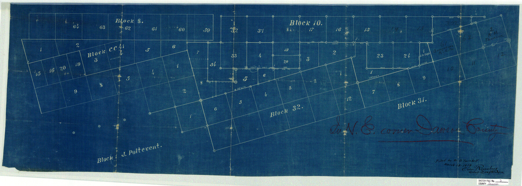
Dawson County Sketch File 3
N. E. Corner of Dawson Co.
-
Map/Doc
11290
-
Collection
General Map Collection
-
Object Dates
1914/3/18 (File Date)
-
People and Organizations
W.D. Twichell (Surveyor/Engineer)
E. von Rosenberg (Draftsman)
-
Counties
Dawson Borden
-
Subjects
Surveying Sketch File
-
Height x Width
13.5 x 37.8 inches
34.3 x 96.0 cm
-
Medium
blueprint/diazo
Part of: General Map Collection
Hunt County Sketch File 34a

Print $4.00
- Digital $50.00
Hunt County Sketch File 34a
1873
Size 8.0 x 10.1 inches
Map/Doc 27146
Flight Mission No. CGI-3N, Frame 135, Cameron County

Print $20.00
- Digital $50.00
Flight Mission No. CGI-3N, Frame 135, Cameron County
1954
Size 18.7 x 22.1 inches
Map/Doc 84608
Mills County Boundary File 8

Print $10.00
- Digital $50.00
Mills County Boundary File 8
Size 14.2 x 8.7 inches
Map/Doc 57313
Crockett County Sketch File 52

Print $4.00
- Digital $50.00
Crockett County Sketch File 52
Size 9.5 x 8.8 inches
Map/Doc 19817
Controlled Mosaic by Jack Amman Photogrammetric Engineers, Inc - Sheet 19

Print $20.00
- Digital $50.00
Controlled Mosaic by Jack Amman Photogrammetric Engineers, Inc - Sheet 19
1954
Size 19.3 x 24.0 inches
Map/Doc 83465
Andrews County Rolled Sketch 30

Print $20.00
- Digital $50.00
Andrews County Rolled Sketch 30
Size 20.6 x 18.1 inches
Map/Doc 77174
Leon County Working Sketch 23

Print $20.00
- Digital $50.00
Leon County Working Sketch 23
1965
Size 14.2 x 29.7 inches
Map/Doc 70422
Winkler County Sketch File 6

Print $22.00
- Digital $50.00
Winkler County Sketch File 6
1927
Size 4.4 x 9.8 inches
Map/Doc 40475
Houston County Sketch File 14

Print $6.00
- Digital $50.00
Houston County Sketch File 14
1886
Size 8.8 x 13.0 inches
Map/Doc 26778
Dallas County Boundary File 6g

Print $6.00
- Digital $50.00
Dallas County Boundary File 6g
Size 11.2 x 8.7 inches
Map/Doc 52275
Kimble County Working Sketch 6

Print $20.00
- Digital $50.00
Kimble County Working Sketch 6
1915
Size 24.4 x 26.5 inches
Map/Doc 70074
Blanco County Sketch File 49

Print $12.00
- Digital $50.00
Blanco County Sketch File 49
Size 14.3 x 8.8 inches
Map/Doc 14691
You may also like
Flight Mission No. DAG-24K, Frame 54, Matagorda County

Print $20.00
- Digital $50.00
Flight Mission No. DAG-24K, Frame 54, Matagorda County
1953
Size 17.2 x 19.1 inches
Map/Doc 86541
Flight Mission No. BRA-16M, Frame 162, Jefferson County

Print $20.00
- Digital $50.00
Flight Mission No. BRA-16M, Frame 162, Jefferson County
1953
Size 18.6 x 22.3 inches
Map/Doc 85760
Orange County Sketch File B1

Print $22.00
- Digital $50.00
Orange County Sketch File B1
Size 14.3 x 8.9 inches
Map/Doc 33288
Plats of the Resurvey of Clark's Texas-New Mexico Boundary by the U. S. Boundary Commission, 1911

Print $180.00
Plats of the Resurvey of Clark's Texas-New Mexico Boundary by the U. S. Boundary Commission, 1911
1911
Map/Doc 81690
Chapman and Farlin Producing Co. Cogdell Ranch Kent County, Texas

Print $20.00
- Digital $50.00
Chapman and Farlin Producing Co. Cogdell Ranch Kent County, Texas
1951
Size 12.6 x 16.6 inches
Map/Doc 92193

Travis County Sketch File 12

Print $4.00
- Digital $50.00
Travis County Sketch File 12
1850
Size 12.7 x 8.2 inches
Map/Doc 38304
Bosque County Sketch File 15

Print $14.00
- Digital $50.00
Bosque County Sketch File 15
1863
Size 12.3 x 7.7 inches
Map/Doc 14774
Flight Mission No. CRC-4R, Frame 107, Chambers County

Print $20.00
- Digital $50.00
Flight Mission No. CRC-4R, Frame 107, Chambers County
1956
Size 18.8 x 22.4 inches
Map/Doc 84904
Edwards County Working Sketch 69

Print $20.00
- Digital $50.00
Edwards County Working Sketch 69
1957
Size 20.3 x 22.5 inches
Map/Doc 68945
Crockett County Working Sketch 69

Print $20.00
- Digital $50.00
Crockett County Working Sketch 69
1962
Size 34.8 x 45.5 inches
Map/Doc 68402
Uvalde County Working Sketch 11

Print $20.00
- Digital $50.00
Uvalde County Working Sketch 11
1943
Size 17.6 x 16.6 inches
Map/Doc 72081