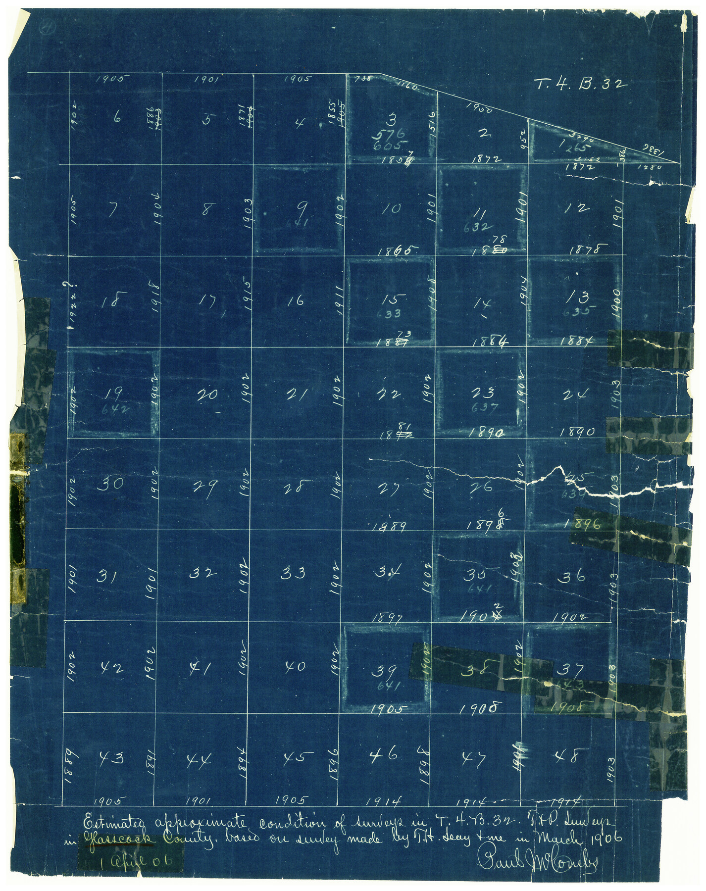
Glasscock County Rolled Sketch 2
[Sketch of Block 32, Tsp. 4 South, Glasscock County, Texas]
-
Map/Doc
6013
-
Collection
General Map Collection
-
Object Dates
4/1/1906 (Creation Date)
-
People and Organizations
Paul McCombs (Surveyor/Engineer)
T.H. Seay (Surveyor/Engineer)
-
Counties
Glasscock
-
Subjects
Surveying Rolled Sketch
-
Height x Width
19.6 x 14.8 inches
49.8 x 37.6 cm
-
Medium
blueprint/diazo
Part of: General Map Collection
Leon County Rolled Sketch 28

Print $20.00
- Digital $50.00
Leon County Rolled Sketch 28
1993
Size 35.8 x 46.6 inches
Map/Doc 9438
Fannin County Rolled Sketch 18G

Print $20.00
- Digital $50.00
Fannin County Rolled Sketch 18G
Size 27.9 x 36.0 inches
Map/Doc 5874
Segunda parte del Mapa, que comprende la Frontera, de los Dominios del Rey, en la America Septentrional

Print $40.00
- Digital $50.00
Segunda parte del Mapa, que comprende la Frontera, de los Dominios del Rey, en la America Septentrional
1769
Size 26.7 x 63.8 inches
Map/Doc 4667
Edwards County Working Sketch 97

Print $20.00
- Digital $50.00
Edwards County Working Sketch 97
1969
Size 25.5 x 27.6 inches
Map/Doc 68973
Atascosa County Working Sketch 21

Print $20.00
- Digital $50.00
Atascosa County Working Sketch 21
1954
Size 26.0 x 22.4 inches
Map/Doc 67217
Presidio County Sketch File 101

Print $20.00
- Digital $50.00
Presidio County Sketch File 101
1888
Size 21.1 x 20.3 inches
Map/Doc 11725
Edwards County Sketch File 28

Print $5.00
- Digital $50.00
Edwards County Sketch File 28
Size 27.3 x 25.6 inches
Map/Doc 11431
Briscoe County Boundary File 4

Print $66.00
- Digital $50.00
Briscoe County Boundary File 4
Size 8.7 x 7.1 inches
Map/Doc 50780
Panola County Sketch File 20

Print $22.00
- Digital $50.00
Panola County Sketch File 20
Size 8.3 x 14.6 inches
Map/Doc 33485
Montgomery County Sketch File 40

Print $8.00
- Digital $50.00
Montgomery County Sketch File 40
1914
Size 11.3 x 8.8 inches
Map/Doc 31925
Flight Mission No. DQN-2K, Frame 45, Calhoun County

Print $20.00
- Digital $50.00
Flight Mission No. DQN-2K, Frame 45, Calhoun County
1953
Size 18.4 x 22.2 inches
Map/Doc 84250
Presidio County Rolled Sketch 37

Print $20.00
- Digital $50.00
Presidio County Rolled Sketch 37
Size 15.6 x 22.6 inches
Map/Doc 7335
You may also like
Kimble County Working Sketch 66

Print $20.00
- Digital $50.00
Kimble County Working Sketch 66
1965
Size 31.1 x 27.2 inches
Map/Doc 70134
Flight Mission No. BRE-1P, Frame 75, Nueces County

Print $20.00
- Digital $50.00
Flight Mission No. BRE-1P, Frame 75, Nueces County
1956
Size 18.4 x 22.2 inches
Map/Doc 86657

Flight Mission No. BRA-16M, Frame 56, Jefferson County

Print $20.00
- Digital $50.00
Flight Mission No. BRA-16M, Frame 56, Jefferson County
1953
Size 18.6 x 22.5 inches
Map/Doc 85673
Presidio County Rolled Sketch 66

Print $20.00
- Digital $50.00
Presidio County Rolled Sketch 66
1920
Size 19.4 x 37.5 inches
Map/Doc 7357
Crane County Rolled Sketch 2

Print $40.00
- Digital $50.00
Crane County Rolled Sketch 2
1888
Size 55.3 x 29.0 inches
Map/Doc 8676
Jeff Davis County Boundary File 2a

Print $40.00
- Digital $50.00
Jeff Davis County Boundary File 2a
Size 11.1 x 36.7 inches
Map/Doc 55512
Hidalgo County Rolled Sketch 12

Print $20.00
- Digital $50.00
Hidalgo County Rolled Sketch 12
1908
Size 21.3 x 27.9 inches
Map/Doc 6211
Rhyne Simpson Quirt Ave. Addition to the City of Lubbock

Print $20.00
- Digital $50.00
Rhyne Simpson Quirt Ave. Addition to the City of Lubbock
1951
Size 17.2 x 21.2 inches
Map/Doc 92878
Waller County Working Sketch 1

Print $20.00
- Digital $50.00
Waller County Working Sketch 1
1899
Size 16.2 x 21.2 inches
Map/Doc 72300
Webb County Sketch File 11a

Print $4.00
- Digital $50.00
Webb County Sketch File 11a
1883
Size 11.2 x 8.7 inches
Map/Doc 39779
Aransas County Rolled Sketch 8

Print $20.00
- Digital $50.00
Aransas County Rolled Sketch 8
Size 41.0 x 43.5 inches
Map/Doc 8408