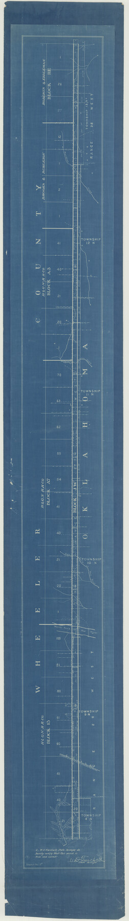
Texas Panhandle East Boundary Line
Texas Oklahoma Boundary
-
Map/Doc
65380
-
Collection
General Map Collection
-
People and Organizations
W.D. Twichell (Surveyor/Engineer)
-
Counties
Wheeler
-
Subjects
Texas Boundaries
-
Height x Width
66.1 x 9.3 inches
167.9 x 23.6 cm
-
Medium
blueprint
-
Comments
Texas Oklahoma Boundary
Part of: General Map Collection
Orange County Working Sketch 3

Print $20.00
- Digital $50.00
Orange County Working Sketch 3
1917
Size 12.7 x 20.3 inches
Map/Doc 71335
Armstrong County Sketch File 7

Print $6.00
- Digital $50.00
Armstrong County Sketch File 7
1902
Size 11.1 x 8.6 inches
Map/Doc 13702
Flight Mission No. CUG-1P, Frame 106, Kleberg County

Print $20.00
- Digital $50.00
Flight Mission No. CUG-1P, Frame 106, Kleberg County
1956
Size 18.8 x 22.3 inches
Map/Doc 86156
Jefferson County Sketch File 4

Print $4.00
- Digital $50.00
Jefferson County Sketch File 4
Size 13.0 x 8.3 inches
Map/Doc 28101
Mills County Working Sketch Graphic Index

Print $20.00
- Digital $50.00
Mills County Working Sketch Graphic Index
1976
Size 35.6 x 45.1 inches
Map/Doc 76643
Gillespie County Working Sketch 3

Print $20.00
- Digital $50.00
Gillespie County Working Sketch 3
1960
Size 23.0 x 21.7 inches
Map/Doc 63166
Flight Mission No. DQN-7K, Frame 14, Calhoun County

Print $20.00
- Digital $50.00
Flight Mission No. DQN-7K, Frame 14, Calhoun County
1953
Size 17.2 x 19.1 inches
Map/Doc 84465
Current Miscellaneous File 96

Print $92.00
- Digital $50.00
Current Miscellaneous File 96
Size 8.8 x 13.6 inches
Map/Doc 74283
Kimble County Sketch File B

Print $22.00
- Digital $50.00
Kimble County Sketch File B
Size 14.3 x 12.7 inches
Map/Doc 28963
Fayette County Working Sketch 3

Print $20.00
- Digital $50.00
Fayette County Working Sketch 3
1980
Size 29.0 x 36.3 inches
Map/Doc 69167
Winkler County Rolled Sketch 16

Print $20.00
- Digital $50.00
Winkler County Rolled Sketch 16
1927
Size 22.5 x 32.6 inches
Map/Doc 8276
Map of the United States and Texas Boundary Line and adjacent territory determined & surveyed in 1857-8-9-60 by J.H. Clark, U.S. Commissioner, &ca. &ca. under the direction of the Departement [sic] of the Interior
![94063, Map of the United States and Texas Boundary Line and adjacent territory determined & surveyed in 1857-8-9-60 by J.H. Clark, U.S. Commissioner, &ca. &ca. under the direction of the Departement [sic] of the Interior, General Map Collection](https://historictexasmaps.com/wmedia_w700/maps/94063.tif.jpg)
Print $20.00
- Digital $50.00
Map of the United States and Texas Boundary Line and adjacent territory determined & surveyed in 1857-8-9-60 by J.H. Clark, U.S. Commissioner, &ca. &ca. under the direction of the Departement [sic] of the Interior
1902
Size 27.9 x 41.8 inches
Map/Doc 94063
You may also like
Harris County Rolled Sketch F

Print $40.00
- Digital $50.00
Harris County Rolled Sketch F
1933
Size 56.6 x 44.6 inches
Map/Doc 9121
Harris County Working Sketch 59

Print $20.00
- Digital $50.00
Harris County Working Sketch 59
1953
Size 36.9 x 24.8 inches
Map/Doc 65951
Calhoun County Rolled Sketch 7

Print $20.00
- Digital $50.00
Calhoun County Rolled Sketch 7
Size 17.0 x 22.1 inches
Map/Doc 5363
Collingsworth County

Print $20.00
- Digital $50.00
Collingsworth County
1899
Size 42.7 x 39.7 inches
Map/Doc 4915
San Saba County Working Sketch 8

Print $20.00
- Digital $50.00
San Saba County Working Sketch 8
1979
Size 13.3 x 17.2 inches
Map/Doc 63796
Brazos River, Sandpit Special Sheet

Print $6.00
- Digital $50.00
Brazos River, Sandpit Special Sheet
1936
Size 33.8 x 24.7 inches
Map/Doc 65279

Flight Mission No. BRA-7M, Frame 83, Jefferson County

Print $20.00
- Digital $50.00
Flight Mission No. BRA-7M, Frame 83, Jefferson County
1953
Size 16.1 x 16.1 inches
Map/Doc 85505
San Patricio County Rolled Sketch 46E

Print $20.00
- Digital $50.00
San Patricio County Rolled Sketch 46E
1983
Size 17.4 x 46.3 inches
Map/Doc 8376
Harris County Rolled Sketch 93

Print $20.00
- Digital $50.00
Harris County Rolled Sketch 93
1983
Size 45.0 x 40.2 inches
Map/Doc 9142

Conoco Official Road Map New Mexico

Print $20.00
- Digital $50.00
Conoco Official Road Map New Mexico
1934
Size 18.5 x 24.5 inches
Map/Doc 92437