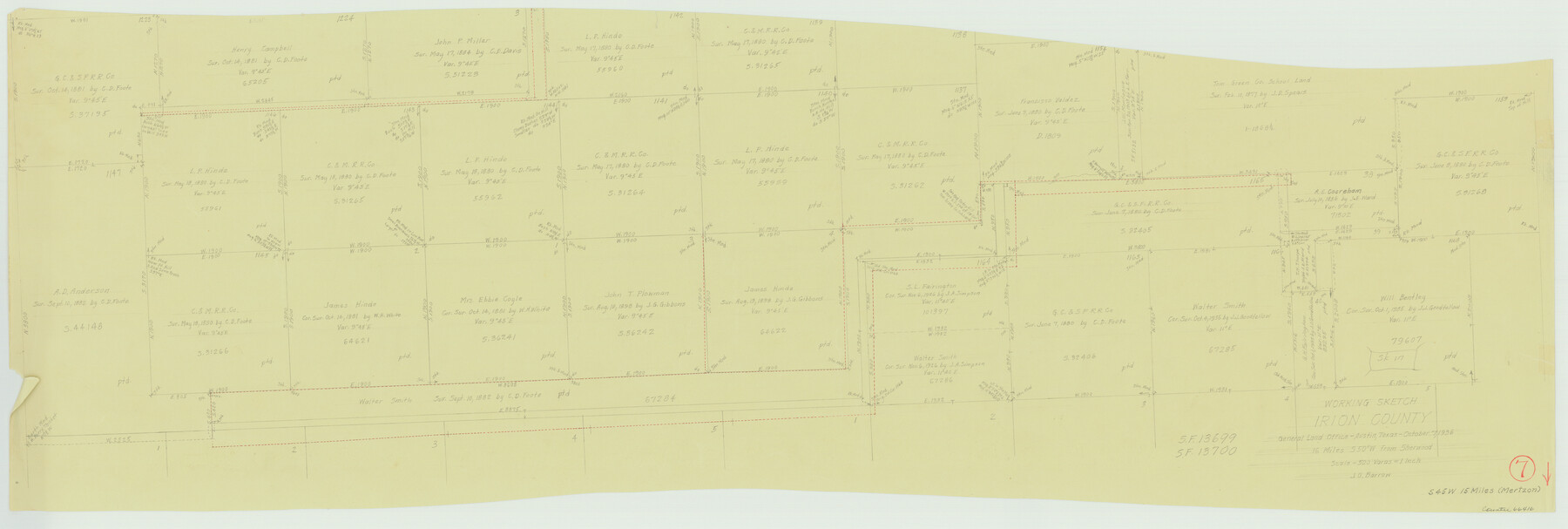
Irion County Working Sketch 7
-
Map/Doc
66416
-
Collection
General Map Collection
-
Object Dates
10/7/1936 (Creation Date)
-
People and Organizations
J.O. Barrow (Draftsman)
-
Counties
Irion
-
Subjects
Surveying Working Sketch
-
Height x Width
14.4 x 42.7 inches
36.6 x 108.5 cm
-
Scale
1" = 500 varas
Part of: General Map Collection

Kenedy County Rolled Sketch 3

Print $40.00
- Digital $50.00
Kenedy County Rolled Sketch 3
1904
Size 40.1 x 57.4 inches
Map/Doc 9329
Baie de Galvez-Town

Print $20.00
- Digital $50.00
Baie de Galvez-Town
1820
Size 10.3 x 12.9 inches
Map/Doc 95832
Brazos River, Brazos River Sheet 3

Print $6.00
- Digital $50.00
Brazos River, Brazos River Sheet 3
1926
Size 21.8 x 34.6 inches
Map/Doc 65296
Mason County Working Sketch 10

Print $40.00
- Digital $50.00
Mason County Working Sketch 10
1949
Size 42.4 x 49.7 inches
Map/Doc 70846
Grayson County Working Sketch 26

Print $20.00
- Digital $50.00
Grayson County Working Sketch 26
1984
Size 27.7 x 38.8 inches
Map/Doc 63265

Harris County Historic Topographic C

Print $20.00
- Digital $50.00
Harris County Historic Topographic C
1916
Size 25.5 x 19.1 inches
Map/Doc 65851
Chambers County Working Sketch 1

Print $20.00
- Digital $50.00
Chambers County Working Sketch 1
1895
Size 29.4 x 24.9 inches
Map/Doc 67984
La Salle County Working Sketch 53

Print $20.00
- Digital $50.00
La Salle County Working Sketch 53
Size 14.3 x 15.9 inches
Map/Doc 67362
Kinney County Working Sketch 1

Print $20.00
- Digital $50.00
Kinney County Working Sketch 1
Size 22.6 x 24.0 inches
Map/Doc 70183
Galveston County Sketch File 74

Print $12.00
- Digital $50.00
Galveston County Sketch File 74
2002
Size 11.3 x 8.7 inches
Map/Doc 77526
You may also like
Greater Texas - the Lower Coast Country and the Lower Rio Grande Valley

Greater Texas - the Lower Coast Country and the Lower Rio Grande Valley
1910
Map/Doc 96726
Terrell County Rolled Sketch 51A

Print $20.00
- Digital $50.00
Terrell County Rolled Sketch 51A
1957
Size 29.1 x 20.6 inches
Map/Doc 7968
Galveston County Rolled Sketch 25

Print $20.00
- Digital $50.00
Galveston County Rolled Sketch 25
1965
Size 18.7 x 24.5 inches
Map/Doc 5959
Map showing A. & N. W., Raymond Word #3, S.S. Hervey #496, and M. Farley #495 corrected to conform to the judgement in Cause #2888, Travis County District Court, State of Texas versus D. Sullivan, et al

Print $20.00
- Digital $50.00
Map showing A. & N. W., Raymond Word #3, S.S. Hervey #496, and M. Farley #495 corrected to conform to the judgement in Cause #2888, Travis County District Court, State of Texas versus D. Sullivan, et al
1915
Size 18.5 x 30.0 inches
Map/Doc 75812
Cameron County Rolled Sketch 19

Print $20.00
- Digital $50.00
Cameron County Rolled Sketch 19
Size 27.1 x 24.3 inches
Map/Doc 5388
Map of Lee County

Print $20.00
- Digital $50.00
Map of Lee County
1888
Size 42.1 x 39.8 inches
Map/Doc 16876
Bastrop County Rolled Sketch 1A

Print $20.00
- Digital $50.00
Bastrop County Rolled Sketch 1A
Size 37.0 x 24.5 inches
Map/Doc 5122
Cottle County Sketch File 3a

Print $14.00
- Digital $50.00
Cottle County Sketch File 3a
Size 12.9 x 8.8 inches
Map/Doc 19459
Flight Mission No. DIX-3P, Frame 168, Aransas County

Print $20.00
- Digital $50.00
Flight Mission No. DIX-3P, Frame 168, Aransas County
1956
Size 17.7 x 18.3 inches
Map/Doc 83774
[Rio Grande & Eagle Pass - Stockdale to Cuero]
![64049, [Rio Grande & Eagle Pass - Stockdale to Cuero], General Map Collection](https://historictexasmaps.com/wmedia_w700/maps/64049.tif.jpg)
Print $40.00
- Digital $50.00
[Rio Grande & Eagle Pass - Stockdale to Cuero]
Size 19.1 x 98.7 inches
Map/Doc 64049
Waco, Tex., County Seat of McLennan Co.

Print $20.00
Waco, Tex., County Seat of McLennan Co.
1886
Size 23.1 x 32.7 inches
Map/Doc 89212
[Blocks K5-K7]
![90538, [Blocks K5-K7], Twichell Survey Records](https://historictexasmaps.com/wmedia_w700/maps/90538-1.tif.jpg)
Print $3.00
- Digital $50.00
[Blocks K5-K7]
1902
Size 12.5 x 11.5 inches
Map/Doc 90538