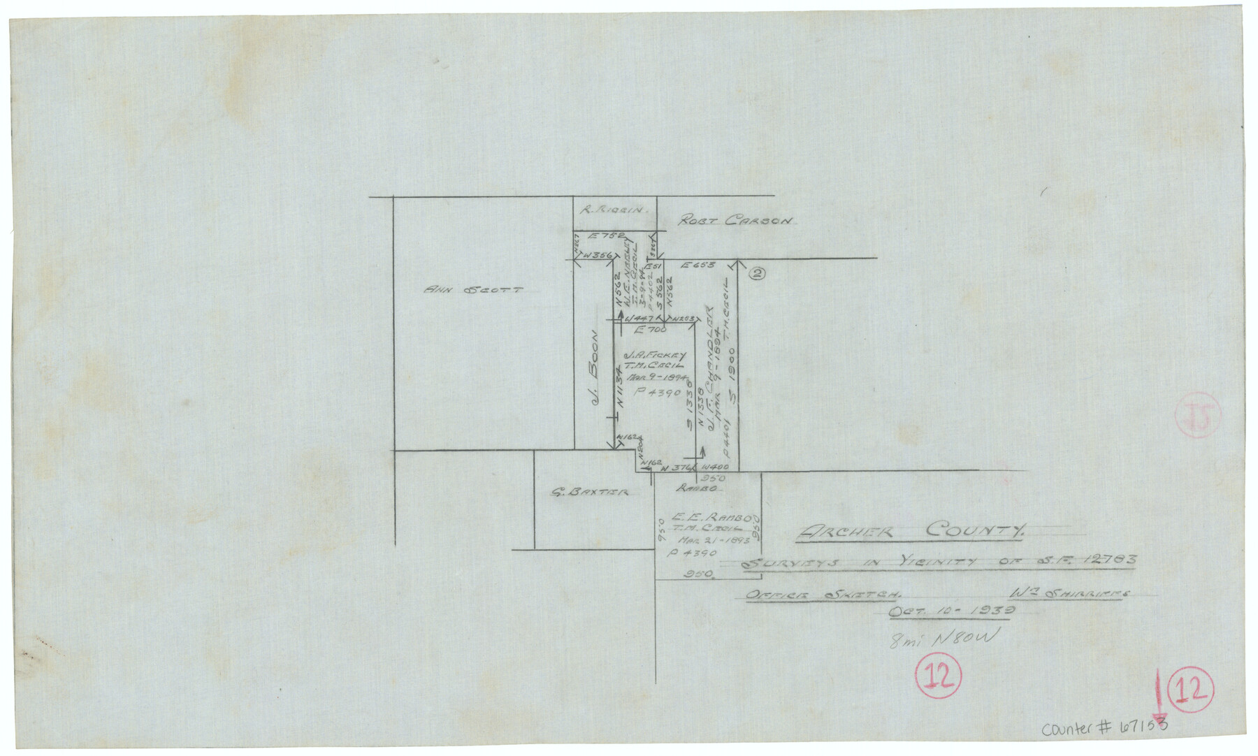
Archer County Working Sketch 12
Office Sketch of Surveys in Vicinity of Scrap File 12783
-
Map/Doc
67153
-
Collection
General Map Collection
-
Object Dates
10/10/1939 (Creation Date)
-
People and Organizations
William Shirriffs (Draftsman)
-
Counties
Archer
-
Subjects
Surveying Working Sketch
-
Height x Width
11.2 x 18.7 inches
28.5 x 47.5 cm
-
Comments
Surveys located about eight miles South 80 degrees West of Archer City, Texas.
Part of: General Map Collection
Edwards County Sketch File 10b

Print $20.00
- Digital $50.00
Edwards County Sketch File 10b
1903
Size 17.0 x 18.9 inches
Map/Doc 11423
Kimble County Rolled Sketch 38

Print $20.00
- Digital $50.00
Kimble County Rolled Sketch 38
1986
Size 28.3 x 21.7 inches
Map/Doc 6528
Ellis County Working Sketch 1

Print $20.00
- Digital $50.00
Ellis County Working Sketch 1
1939
Size 19.1 x 19.3 inches
Map/Doc 69017
Map of Bexar County

Print $20.00
- Digital $50.00
Map of Bexar County
1879
Size 24.2 x 27.6 inches
Map/Doc 4508
El Paso County Sketch File 35 (5)

Print $6.00
- Digital $50.00
El Paso County Sketch File 35 (5)
1886
Size 14.6 x 8.9 inches
Map/Doc 22218
Sutton County Working Sketch 22

Print $20.00
- Digital $50.00
Sutton County Working Sketch 22
1981
Size 33.7 x 33.4 inches
Map/Doc 62365
Ochiltree County

Print $20.00
- Digital $50.00
Ochiltree County
1958
Size 43.4 x 34.4 inches
Map/Doc 73253
Bee County Working Sketch 7

Print $20.00
- Digital $50.00
Bee County Working Sketch 7
1939
Size 17.8 x 20.6 inches
Map/Doc 67257
Crockett County Rolled Sketch 67

Print $20.00
- Digital $50.00
Crockett County Rolled Sketch 67
1948
Size 34.2 x 21.7 inches
Map/Doc 5610
Kimble County Working Sketch 88

Print $20.00
- Digital $50.00
Kimble County Working Sketch 88
1976
Size 31.5 x 30.8 inches
Map/Doc 70156
Blanco County Sketch File 50

Print $6.00
- Digital $50.00
Blanco County Sketch File 50
1995
Size 11.5 x 8.8 inches
Map/Doc 14695
Lavaca County Working Sketch Graphic Index

Print $40.00
- Digital $50.00
Lavaca County Working Sketch Graphic Index
1946
Size 49.9 x 41.5 inches
Map/Doc 76616
You may also like
Brown County Sketch File 32

Print $84.00
- Digital $50.00
Brown County Sketch File 32
2018
Size 11.0 x 8.5 inches
Map/Doc 95206
Motley County Sketch File B3 (N)

Print $10.00
- Digital $50.00
Motley County Sketch File B3 (N)
1900
Size 6.5 x 11.9 inches
Map/Doc 31974
Robertson & Scott V Ranch situated in Crosby County, Texas

Print $40.00
- Digital $50.00
Robertson & Scott V Ranch situated in Crosby County, Texas
Size 42.0 x 50.3 inches
Map/Doc 89753
Hays County State Real Property Sketch 2

Print $20.00
- Digital $50.00
Hays County State Real Property Sketch 2
2006
Size 24.3 x 34.4 inches
Map/Doc 88619
Lipscomb County Boundary File 11

Print $8.00
- Digital $50.00
Lipscomb County Boundary File 11
Size 11.1 x 8.7 inches
Map/Doc 56347
Bowie County Sketch File 6c

Print $40.00
- Digital $50.00
Bowie County Sketch File 6c
1927
Size 20.1 x 16.1 inches
Map/Doc 10942
Navarro County Boundary File 2

Print $12.00
- Digital $50.00
Navarro County Boundary File 2
Size 8.8 x 3.9 inches
Map/Doc 57608
Saline Ranch in Mason, Kimble and Menard Counties

Print $20.00
- Digital $50.00
Saline Ranch in Mason, Kimble and Menard Counties
1916
Size 28.6 x 27.4 inches
Map/Doc 75808
Hutchinson County Rolled Sketch 44-12

Print $20.00
- Digital $50.00
Hutchinson County Rolled Sketch 44-12
2002
Size 24.0 x 36.0 inches
Map/Doc 77548
McLennan County Working Sketch Graphic Index

Print $20.00
- Digital $50.00
McLennan County Working Sketch Graphic Index
1946
Size 41.8 x 44.8 inches
Map/Doc 76637
Jefferson County Rolled Sketch 3

Print $20.00
- Digital $50.00
Jefferson County Rolled Sketch 3
1909
Size 36.0 x 16.2 inches
Map/Doc 6384
Map of Panola County

Print $20.00
- Digital $50.00
Map of Panola County
1882
Size 20.9 x 22.0 inches
Map/Doc 4504