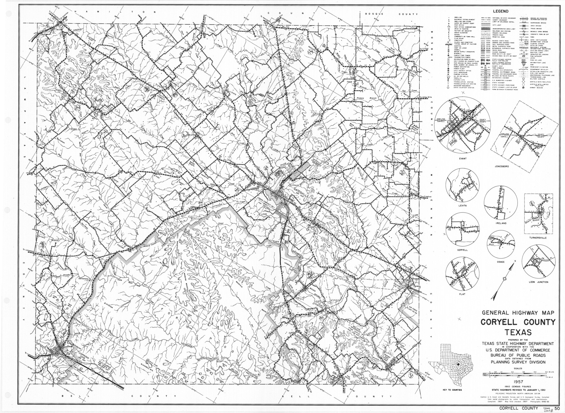
General Highway Map, Coryell County, Texas
-
Map/Doc
79422
-
Collection
Texas State Library and Archives
-
Object Dates
1961 (Creation Date)
-
People and Organizations
Texas State Highway Department (Publisher)
-
Counties
Coryell
-
Subjects
County
-
Height x Width
18.1 x 24.8 inches
46.0 x 63.0 cm
-
Comments
Prints available courtesy of the Texas State Library and Archives.
More info can be found here: TSLAC Map 05098
Part of: Texas State Library and Archives
General Highway Map. Detail of Cities and Towns in El Paso County, Texas [El Paso and vicinity]
![79085, General Highway Map. Detail of Cities and Towns in El Paso County, Texas [El Paso and vicinity], Texas State Library and Archives](https://historictexasmaps.com/wmedia_w700/maps/79085.tif.jpg)
Print $20.00
General Highway Map. Detail of Cities and Towns in El Paso County, Texas [El Paso and vicinity]
1940
Size 24.7 x 18.3 inches
Map/Doc 79085
Map of the Texas and Pacific Railway and Connections

Print $20.00
Map of the Texas and Pacific Railway and Connections
1897
Size 17.6 x 36.3 inches
Map/Doc 76299
General Highway Map. Detail of Cities and Towns in Bexar County, Texas [San Antonio and vicinity]
![79019, General Highway Map. Detail of Cities and Towns in Bexar County, Texas [San Antonio and vicinity], Texas State Library and Archives](https://historictexasmaps.com/wmedia_w700/maps/79019.tif.jpg)
Print $20.00
General Highway Map. Detail of Cities and Towns in Bexar County, Texas [San Antonio and vicinity]
1940
Size 18.6 x 25.0 inches
Map/Doc 79019
General Highway Map, Castro County, Texas

Print $20.00
General Highway Map, Castro County, Texas
1940
Size 18.5 x 25.1 inches
Map/Doc 79043
Revised Edition of Murphy and Bolanz Official Map of the City of Dallas and Suburbs

Print $20.00
Revised Edition of Murphy and Bolanz Official Map of the City of Dallas and Suburbs
1891
Size 37.9 x 30.6 inches
Map/Doc 76274
General Highway Map, Archer County, Texas

Print $20.00
General Highway Map, Archer County, Texas
1940
Size 18.2 x 24.8 inches
Map/Doc 79005
Preliminary Chart of the Sea Coast of Texas in the Vicinity of Galveston

Print $20.00
Preliminary Chart of the Sea Coast of Texas in the Vicinity of Galveston
1856
Size 26.3 x 19.7 inches
Map/Doc 76256
General Highway Map. Detail of Cities and Towns in Tarrant County, Texas. City Map, Fort Worth and vicinity, Tarrant County, Texas

Print $20.00
General Highway Map. Detail of Cities and Towns in Tarrant County, Texas. City Map, Fort Worth and vicinity, Tarrant County, Texas
1961
Size 18.4 x 25.1 inches
Map/Doc 79666
General Highway Map. Detail of Cities and Towns in Bexar County, Texas. City Map of San Antonio, Alamo Heights, Olmos Park, Terrell Hills, Castle Hills, Balcones Heights, and vicinity, Bexar County, Texas

Print $20.00
General Highway Map. Detail of Cities and Towns in Bexar County, Texas. City Map of San Antonio, Alamo Heights, Olmos Park, Terrell Hills, Castle Hills, Balcones Heights, and vicinity, Bexar County, Texas
1961
Size 18.1 x 25.1 inches
Map/Doc 79373
General Highway Map, Kleberg County, Texas

Print $20.00
General Highway Map, Kleberg County, Texas
1961
Size 24.6 x 18.3 inches
Map/Doc 79559
General Highway Map, Frio County, Texas

Print $20.00
General Highway Map, Frio County, Texas
1940
Size 18.4 x 24.9 inches
Map/Doc 79095
Geological Petroleum Corporation Map of North Central Texas

Print $20.00
Geological Petroleum Corporation Map of North Central Texas
1920
Size 37.4 x 28.4 inches
Map/Doc 79305
You may also like
Map of Littlefield's Subdivision of State Capitol Leagues 657- 687

Print $20.00
- Digital $50.00
Map of Littlefield's Subdivision of State Capitol Leagues 657- 687
Size 38.0 x 29.2 inches
Map/Doc 91025
Jim Wells County Working Sketch 14

Print $20.00
- Digital $50.00
Jim Wells County Working Sketch 14
1981
Size 18.1 x 30.0 inches
Map/Doc 66612
Nine Central Panhandle Counties, Texas

Print $20.00
- Digital $50.00
Nine Central Panhandle Counties, Texas
1899
Size 41.3 x 35.3 inches
Map/Doc 89790
Potter County Working Sketch 14

Print $20.00
- Digital $50.00
Potter County Working Sketch 14
1982
Size 33.7 x 32.6 inches
Map/Doc 71674
A Map of Part of Panola County [Judicial District]
![328, A Map of Part of Panola County [Judicial District], General Map Collection](https://historictexasmaps.com/wmedia_w700/maps/328.tif.jpg)
Print $20.00
- Digital $50.00
A Map of Part of Panola County [Judicial District]
1841
Size 18.3 x 15.4 inches
Map/Doc 328
Austin, Texas Congress Ave. Drainage

Print $20.00
- Digital $50.00
Austin, Texas Congress Ave. Drainage
1903
Size 15.3 x 15.4 inches
Map/Doc 75798
Matagorda County Working Sketch 32

Print $20.00
- Digital $50.00
Matagorda County Working Sketch 32
1993
Size 28.4 x 33.5 inches
Map/Doc 70890
Bell County Sketch File 5

Print $4.00
- Digital $50.00
Bell County Sketch File 5
1849
Size 12.9 x 8.5 inches
Map/Doc 14371
Maps of Gulf Intracoastal Waterway, Texas - Sabine River to the Rio Grande and connecting waterways including ship channels

Print $20.00
- Digital $50.00
Maps of Gulf Intracoastal Waterway, Texas - Sabine River to the Rio Grande and connecting waterways including ship channels
1966
Size 14.5 x 22.2 inches
Map/Doc 61940
Supreme Court of the United States, October Term, 1923, No. 15, Original - The State of Oklahoma, Complainant vs. The State of Texas, Defendant, The United States, Intervener; Report of Medial Line Survey

Print $28.00
- Digital $50.00
Supreme Court of the United States, October Term, 1923, No. 15, Original - The State of Oklahoma, Complainant vs. The State of Texas, Defendant, The United States, Intervener; Report of Medial Line Survey
1924
Size 5.9 x 9.1 inches
Map/Doc 3055
Survey of the Mexican Lines of Defence at Cerro Gordo, and the lines of attack of the American Army under Major General Scott, on the 17th and 18th of April, 1847

Print $20.00
- Digital $50.00
Survey of the Mexican Lines of Defence at Cerro Gordo, and the lines of attack of the American Army under Major General Scott, on the 17th and 18th of April, 1847
1847
Size 15.3 x 21.6 inches
Map/Doc 95830
Burleson County Working Sketch 24

Print $20.00
- Digital $50.00
Burleson County Working Sketch 24
1980
Size 18.5 x 35.9 inches
Map/Doc 67743