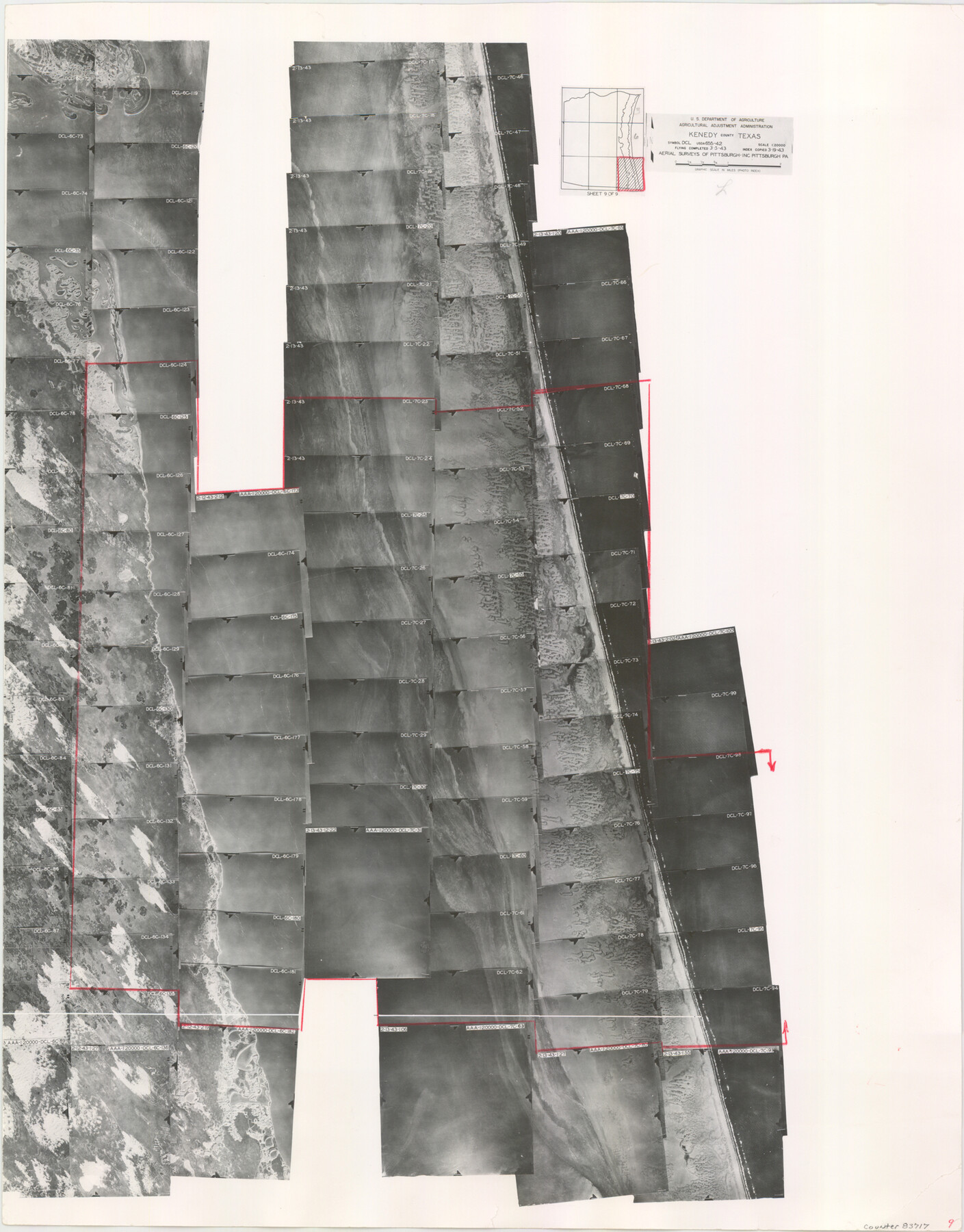
Kenedy County Aerial Photograph Index Sheet 9
Kenedy County Aerial Photograph Index 9
-
Map/Doc
83717
-
Collection
General Map Collection
-
Object Dates
1943/3/19 (Creation Date)
-
People and Organizations
U. S. Department of Agriculture (Publisher)
-
Counties
Kenedy
-
Subjects
Aerial Photograph
-
Height x Width
23.6 x 18.5 inches
59.9 x 47.0 cm
-
Comments
Flying completed March 5, 1943 by Aerial Surveys of Pittsburgh, Inc. of Pittsburgh, Pennsylvania.
Part of: General Map Collection
[Right of Way Map, Belton Branch of the M.K.&T. RR.]
![64227, [Right of Way Map, Belton Branch of the M.K.&T. RR.], General Map Collection](https://historictexasmaps.com/wmedia_w700/maps/64227.tif.jpg)
Print $20.00
- Digital $50.00
[Right of Way Map, Belton Branch of the M.K.&T. RR.]
1896
Size 22.0 x 7.2 inches
Map/Doc 64227
Webb County Working Sketch 4

Print $20.00
- Digital $50.00
Webb County Working Sketch 4
1907
Size 45.6 x 42.5 inches
Map/Doc 72369
Flight Mission No. CRK-5P, Frame 157, Refugio County

Print $20.00
- Digital $50.00
Flight Mission No. CRK-5P, Frame 157, Refugio County
1956
Size 18.8 x 22.6 inches
Map/Doc 86938
Bandera County Working Sketch 45

Print $20.00
- Digital $50.00
Bandera County Working Sketch 45
1981
Size 42.4 x 35.5 inches
Map/Doc 67641
Flight Mission No. CRC-3R, Frame 38, Chambers County

Print $20.00
- Digital $50.00
Flight Mission No. CRC-3R, Frame 38, Chambers County
1956
Size 18.7 x 22.4 inches
Map/Doc 84811
Tarrant County Sketch File 26

Print $24.00
- Digital $50.00
Tarrant County Sketch File 26
1874
Size 12.7 x 8.4 inches
Map/Doc 37739
Henderson County Rolled Sketch 11

Print $20.00
- Digital $50.00
Henderson County Rolled Sketch 11
1915
Size 29.1 x 42.2 inches
Map/Doc 76150
Navarro County Working Sketch 12

Print $40.00
- Digital $50.00
Navarro County Working Sketch 12
1979
Size 37.2 x 48.8 inches
Map/Doc 71242
Copy of Surveyor's Field Book, Morris Browning - In Blocks 7, 5 & 4, I&GNRRCo., Hutchinson and Carson Counties, Texas

Print $2.00
- Digital $50.00
Copy of Surveyor's Field Book, Morris Browning - In Blocks 7, 5 & 4, I&GNRRCo., Hutchinson and Carson Counties, Texas
1888
Size 7.0 x 8.8 inches
Map/Doc 62286
Limestone County Working Sketch 24

Print $20.00
- Digital $50.00
Limestone County Working Sketch 24
1980
Size 28.9 x 31.6 inches
Map/Doc 70574

Fort Bend County Rolled Sketch A

Print $20.00
- Digital $50.00
Fort Bend County Rolled Sketch A
1900
Size 19.8 x 29.7 inches
Map/Doc 5903
You may also like
Pecos County Sketch File 111

Print $18.00
- Digital $50.00
Pecos County Sketch File 111
Size 13.3 x 8.8 inches
Map/Doc 34052
Flight Mission No. DQN-2K, Frame 128, Calhoun County

Print $20.00
- Digital $50.00
Flight Mission No. DQN-2K, Frame 128, Calhoun County
1953
Size 18.6 x 22.3 inches
Map/Doc 84302
Parker County

Print $20.00
- Digital $50.00
Parker County
1942
Size 42.4 x 35.5 inches
Map/Doc 77391

Orange County Working Sketch 36

Print $20.00
- Digital $50.00
Orange County Working Sketch 36
1960
Size 23.9 x 29.9 inches
Map/Doc 71368
Grayson County Working Sketch 27

Print $20.00
- Digital $50.00
Grayson County Working Sketch 27
1988
Size 29.8 x 35.9 inches
Map/Doc 63266
Schleicher County Sketch File 23a

Print $4.00
- Digital $50.00
Schleicher County Sketch File 23a
1937
Size 11.3 x 8.8 inches
Map/Doc 36514
Frio County Sketch File 16

Print $8.00
- Digital $50.00
Frio County Sketch File 16
1949
Size 11.3 x 8.8 inches
Map/Doc 23148
Fort Bend County Working Sketch 5

Print $20.00
- Digital $50.00
Fort Bend County Working Sketch 5
1915
Size 14.5 x 20.9 inches
Map/Doc 69211
Bell County Working Sketch 12

Print $20.00
- Digital $50.00
Bell County Working Sketch 12
1956
Size 17.2 x 22.0 inches
Map/Doc 67352
Borden County Sketch File 7

Print $8.00
- Digital $50.00
Borden County Sketch File 7
1909
Size 13.3 x 8.4 inches
Map/Doc 14723
Edwards County Rolled Sketch JFW1

Print $53.00
- Digital $50.00
Edwards County Rolled Sketch JFW1
1935
Size 10.3 x 15.5 inches
Map/Doc 44398