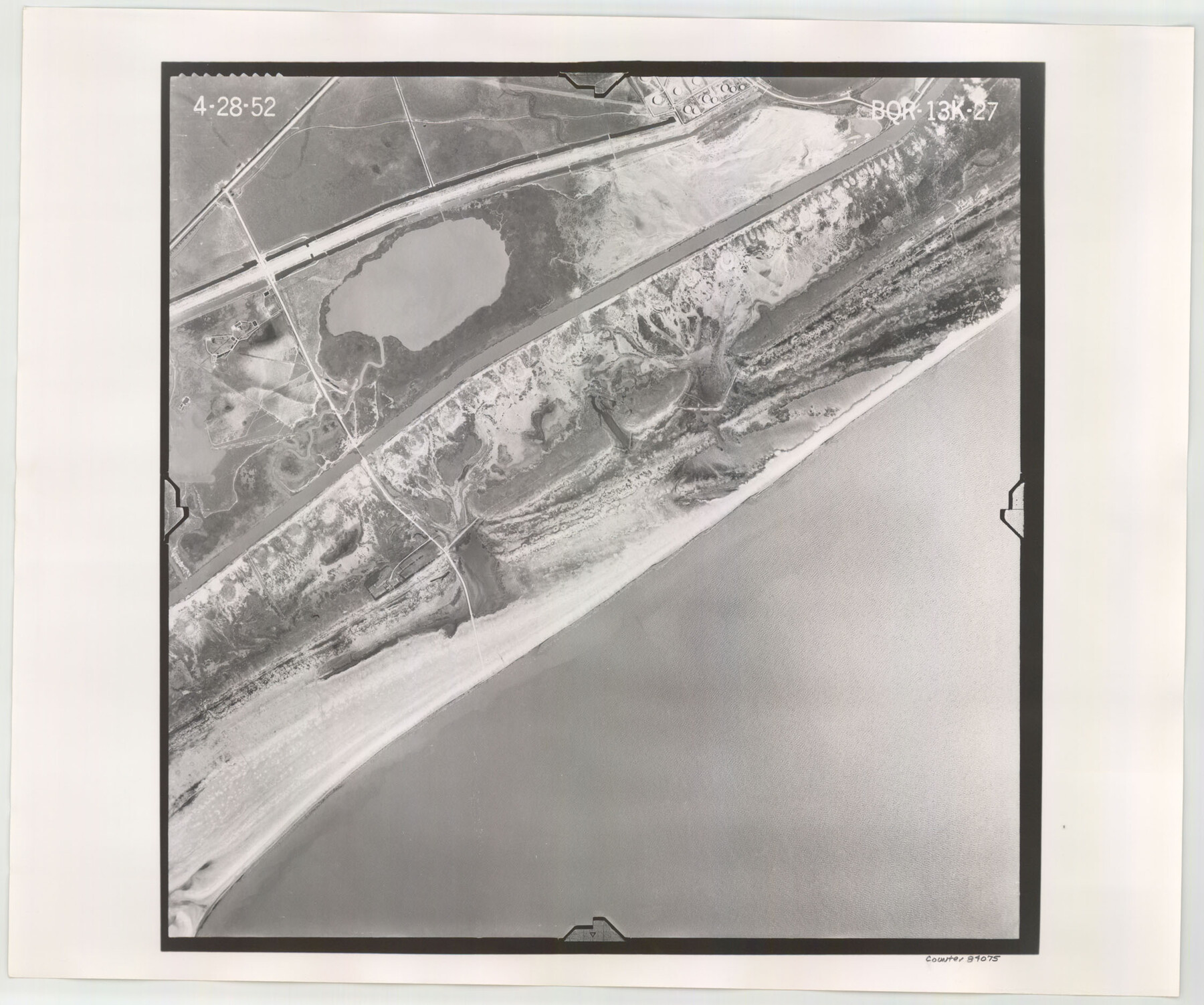
Flight Mission No. BQR-13K, Frame 27, Brazoria County
BQR-13K-27
-
Map/Doc
84075
-
Collection
General Map Collection
-
Object Dates
1952/4/28 (Creation Date)
-
People and Organizations
U. S. Department of Agriculture (Publisher)
-
Counties
Brazoria
-
Subjects
Aerial Photograph
-
Height x Width
18.7 x 22.5 inches
47.5 x 57.2 cm
-
Comments
Flown by Aero Exploration Company of Tulsa, Oklahoma.
Part of: General Map Collection
Archer County Sketch File 12

Print $4.00
- Digital $50.00
Archer County Sketch File 12
Size 7.9 x 10.2 inches
Map/Doc 13646
McCulloch County Sketch File 15, 15a, 15b

Print $34.00
- Digital $50.00
McCulloch County Sketch File 15, 15a, 15b
1993
Size 11.2 x 8.8 inches
Map/Doc 31207
Uvalde County Working Sketch 48

Print $20.00
- Digital $50.00
Uvalde County Working Sketch 48
1980
Size 15.6 x 17.9 inches
Map/Doc 72118
Reeves County Working Sketch 55

Print $20.00
- Digital $50.00
Reeves County Working Sketch 55
1978
Size 36.1 x 34.7 inches
Map/Doc 63498
Briscoe County Rolled Sketch 17

Print $20.00
- Digital $50.00
Briscoe County Rolled Sketch 17
1946
Size 36.7 x 28.7 inches
Map/Doc 5331
Gaines County Working Sketch 26

Print $20.00
- Digital $50.00
Gaines County Working Sketch 26
1983
Size 34.1 x 39.7 inches
Map/Doc 69326
Gillespie County Rolled Sketch 7

Print $20.00
- Digital $50.00
Gillespie County Rolled Sketch 7
2008
Size 18.9 x 18.8 inches
Map/Doc 88818
DeWitt County Sketch File 3

Print $20.00
- Digital $50.00
DeWitt County Sketch File 3
1871
Size 23.2 x 33.1 inches
Map/Doc 11312
Eastland County Working Sketch 29

Print $20.00
- Digital $50.00
Eastland County Working Sketch 29
1952
Size 21.1 x 22.3 inches
Map/Doc 68810
Galveston County NRC Article 33.136 Sketch 48

Print $22.00
- Digital $50.00
Galveston County NRC Article 33.136 Sketch 48
2006
Size 24.4 x 36.7 inches
Map/Doc 88611
Harris County Rolled Sketch 88

Print $20.00
- Digital $50.00
Harris County Rolled Sketch 88
1936
Size 35.0 x 22.8 inches
Map/Doc 6125
Edwards County Working Sketch 24

Print $20.00
- Digital $50.00
Edwards County Working Sketch 24
1942
Size 19.1 x 34.1 inches
Map/Doc 68900
You may also like
Kaufman County Working Sketch 3

Print $2.00
- Digital $50.00
Kaufman County Working Sketch 3
1922
Size 11.9 x 8.0 inches
Map/Doc 66666
Hunt County Boundary File 4

Print $16.00
- Digital $50.00
Hunt County Boundary File 4
Size 14.3 x 8.6 inches
Map/Doc 55214
Garza County Sketch File 15

Print $20.00
- Digital $50.00
Garza County Sketch File 15
1902
Size 16.8 x 14.7 inches
Map/Doc 11545
[Sketch showing correct location of the North and East lines of the Nave McCord pasture fence]
![90896, [Sketch showing correct location of the North and East lines of the Nave McCord pasture fence], Twichell Survey Records](https://historictexasmaps.com/wmedia_w700/maps/90896-1.tif.jpg)
Print $20.00
- Digital $50.00
[Sketch showing correct location of the North and East lines of the Nave McCord pasture fence]
1900
Size 20.3 x 11.8 inches
Map/Doc 90896
Randall County

Print $20.00
- Digital $50.00
Randall County
1958
Size 46.2 x 39.9 inches
Map/Doc 95620
Travis County Rolled Sketch 11

Print $20.00
- Digital $50.00
Travis County Rolled Sketch 11
Size 23.3 x 37.9 inches
Map/Doc 8014
Red River County Working Sketch 29

Print $20.00
- Digital $50.00
Red River County Working Sketch 29
1961
Size 29.5 x 33.3 inches
Map/Doc 72012
Crockett County Rolled Sketch 42

Print $20.00
- Digital $50.00
Crockett County Rolled Sketch 42
Size 24.4 x 24.7 inches
Map/Doc 5592
![91447, [Block K5], Twichell Survey Records](https://historictexasmaps.com/wmedia_w700/maps/91447-1.tif.jpg)
Reconnaissance for Triangulation along the Rio Grande from El Paso to the Gulf of Mexico

Print $20.00
- Digital $50.00
Reconnaissance for Triangulation along the Rio Grande from El Paso to the Gulf of Mexico
Size 16.9 x 22.6 inches
Map/Doc 96558
McMullen County Rolled Sketch 6

Print $20.00
- Digital $50.00
McMullen County Rolled Sketch 6
Size 32.1 x 27.0 inches
Map/Doc 6724
Liberty County Sketch File 3

Print $2.00
- Digital $50.00
Liberty County Sketch File 3
1847
Size 13.7 x 8.3 inches
Map/Doc 29884