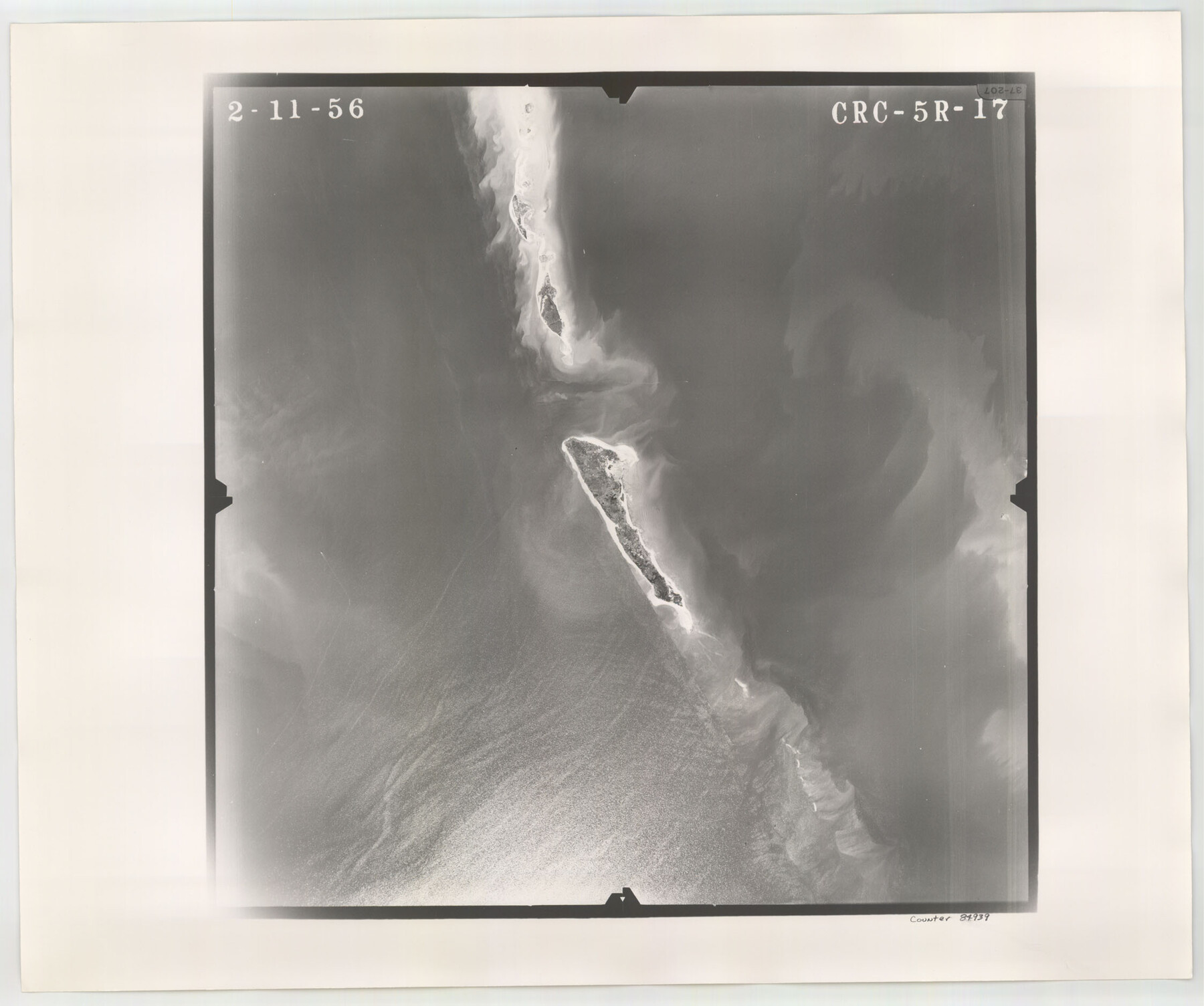
Flight Mission No. CRC-5R, Frame 17, Chambers County
CRC-5R-17
-
Map/Doc
84939
-
Collection
General Map Collection
-
Object Dates
1956/2/11 (Creation Date)
-
People and Organizations
U. S. Department of Agriculture (Publisher)
-
Counties
Chambers
-
Subjects
Aerial Photograph
-
Height x Width
18.8 x 22.5 inches
47.8 x 57.2 cm
-
Comments
Flown by Jack Ammann Photogrammetric Engineers, Inc. of San Antonio, Texas.
Part of: General Map Collection
Flight Mission No. CRC-2R, Frame 179, Chambers County

Print $20.00
- Digital $50.00
Flight Mission No. CRC-2R, Frame 179, Chambers County
1956
Size 18.6 x 22.3 inches
Map/Doc 84757
Kleberg County Rolled Sketch 10-22

Print $20.00
- Digital $50.00
Kleberg County Rolled Sketch 10-22
1952
Size 35.1 x 36.8 inches
Map/Doc 9376
Flight Mission No. CGI-1N, Frame 134, Cameron County

Print $20.00
- Digital $50.00
Flight Mission No. CGI-1N, Frame 134, Cameron County
1955
Size 18.5 x 22.1 inches
Map/Doc 84490
Bastrop County Sketch File 10

Print $4.00
- Digital $50.00
Bastrop County Sketch File 10
1979
Size 14.3 x 8.8 inches
Map/Doc 14056
Hardin County Rolled Sketch 10

Print $20.00
- Digital $50.00
Hardin County Rolled Sketch 10
1948
Size 23.7 x 33.0 inches
Map/Doc 6082
Lynn County Rolled Sketch 15

Print $20.00
- Digital $50.00
Lynn County Rolled Sketch 15
1986
Size 36.4 x 24.5 inches
Map/Doc 6651
Montgomery County Sketch File 36

Print $40.00
- Digital $50.00
Montgomery County Sketch File 36
1953
Size 51.7 x 34.9 inches
Map/Doc 10551
Orange County Working Sketch 6

Print $20.00
- Digital $50.00
Orange County Working Sketch 6
1922
Size 16.2 x 20.1 inches
Map/Doc 71338
Presidio County Sketch File 44

Print $15.00
- Digital $50.00
Presidio County Sketch File 44
1913
Size 11.1 x 9.5 inches
Map/Doc 34525

Brewster County Sketch File NS-11

Print $4.00
- Digital $50.00
Brewster County Sketch File NS-11
1948
Size 14.2 x 8.7 inches
Map/Doc 16218
Mitchell County Rolled Sketch 4

Print $20.00
- Digital $50.00
Mitchell County Rolled Sketch 4
Size 32.6 x 41.4 inches
Map/Doc 6785
You may also like
Wichita County Sketch File 19

Print $20.00
- Digital $50.00
Wichita County Sketch File 19
Size 21.9 x 22.5 inches
Map/Doc 12681
Waller County, Texas

Print $20.00
- Digital $50.00
Waller County, Texas
1879
Size 22.8 x 17.7 inches
Map/Doc 764
A general map of Great Britain and Ireland with part of Holland, Flanders, France & agreable to modern history

Print $20.00
A general map of Great Britain and Ireland with part of Holland, Flanders, France & agreable to modern history
1750
Size 21.6 x 25.7 inches
Map/Doc 97435
[Jose Antonio Sepulveda grant]
![349, [Jose Antonio Sepulveda grant], General Map Collection](https://historictexasmaps.com/wmedia_w700/maps/349.tif.jpg)
Print $2.00
- Digital $50.00
[Jose Antonio Sepulveda grant]
Size 5.9 x 5.7 inches
Map/Doc 349
San Jacinto County Working Sketch 30

Print $20.00
- Digital $50.00
San Jacinto County Working Sketch 30
Size 18.2 x 24.4 inches
Map/Doc 63743
Burleson County Sketch File 2

Print $4.00
- Digital $50.00
Burleson County Sketch File 2
1847
Size 10.7 x 8.0 inches
Map/Doc 16645
Hudspeth County Sketch File 4-5-6

Print $2.00
- Digital $50.00
Hudspeth County Sketch File 4-5-6
Size 8.8 x 8.1 inches
Map/Doc 26891
Upton County Rolled Sketch JSP

Print $40.00
- Digital $50.00
Upton County Rolled Sketch JSP
1937
Size 39.2 x 68.0 inches
Map/Doc 10042
Angelina County Sketch File 4

Print $4.00
- Digital $50.00
Angelina County Sketch File 4
1854
Size 8.3 x 9.0 inches
Map/Doc 12926
Kinney County Working Sketch 9

Print $20.00
- Digital $50.00
Kinney County Working Sketch 9
1918
Size 20.4 x 20.4 inches
Map/Doc 70191
Wichita County Working Sketch 17

Print $20.00
- Digital $50.00
Wichita County Working Sketch 17
1940
Size 25.6 x 26.1 inches
Map/Doc 72527
Orange County Boundary File 9

Print $16.00
- Digital $50.00
Orange County Boundary File 9
Size 11.2 x 8.7 inches
Map/Doc 57782