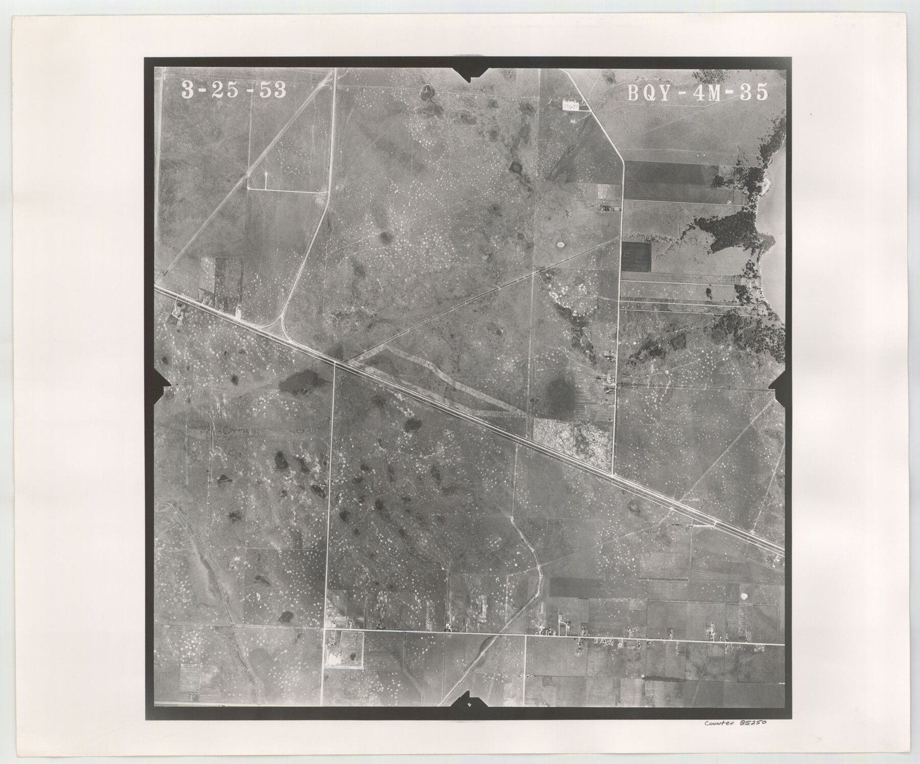
Flight Mission No. BQY-4M, Frame 35, Harris County
BQY-4M-35
-
Map/Doc
85250
-
Collection
General Map Collection
-
Object Dates
1953/3/25 (Creation Date)
-
People and Organizations
U. S. Department of Agriculture (Publisher)
-
Counties
Harris
-
Subjects
Aerial Photograph
-
Height x Width
18.7 x 22.5 inches
47.5 x 57.2 cm
-
Comments
Flown by Jack Ammann Photogrammetric Engineers of San Antonio, Texas.
Part of: General Map Collection
Harris County Working Sketch 10

Print $20.00
- Digital $50.00
Harris County Working Sketch 10
1912
Size 25.7 x 18.1 inches
Map/Doc 65902
Terrell County Working Sketch 34

Print $20.00
- Digital $50.00
Terrell County Working Sketch 34
1945
Size 26.3 x 37.7 inches
Map/Doc 62126
Calhoun County Rolled Sketch 30

Print $20.00
- Digital $50.00
Calhoun County Rolled Sketch 30
1974
Size 18.6 x 27.2 inches
Map/Doc 5497
Flight Mission No. DIX-6P, Frame 134, Aransas County

Print $20.00
- Digital $50.00
Flight Mission No. DIX-6P, Frame 134, Aransas County
1956
Size 18.8 x 22.4 inches
Map/Doc 83840
Donley County Sketch File B11

Print $4.00
- Digital $50.00
Donley County Sketch File B11
1952
Size 11.5 x 9.0 inches
Map/Doc 21274
Nueces County Sketch File 42

Print $24.00
- Digital $50.00
Nueces County Sketch File 42
1950
Size 11.0 x 8.6 inches
Map/Doc 32633
Archer County Boundary File 7

Print $10.00
- Digital $50.00
Archer County Boundary File 7
Size 8.2 x 5.2 inches
Map/Doc 50116
Hood County Working Sketch 11

Print $20.00
- Digital $50.00
Hood County Working Sketch 11
1976
Size 19.7 x 25.2 inches
Map/Doc 66205
Crockett County Rolled Sketch 53

Print $20.00
- Digital $50.00
Crockett County Rolled Sketch 53
1942
Size 17.5 x 36.8 inches
Map/Doc 5598
Bastrop County Working Sketch 12

Print $40.00
- Digital $50.00
Bastrop County Working Sketch 12
1978
Size 44.1 x 54.3 inches
Map/Doc 67312
Panola County Working Sketch 13

Print $40.00
- Digital $50.00
Panola County Working Sketch 13
1945
Map/Doc 71422
Val Verde County Working Sketch 114

Print $20.00
- Digital $50.00
Val Verde County Working Sketch 114
1993
Size 25.9 x 40.9 inches
Map/Doc 72249
You may also like
Baylor County Rolled Sketch 12

Print $20.00
- Digital $50.00
Baylor County Rolled Sketch 12
1986
Size 22.4 x 36.0 inches
Map/Doc 5129
Fannin County Boundary File 7

Print $42.00
- Digital $50.00
Fannin County Boundary File 7
Size 5.3 x 31.1 inches
Map/Doc 53313
Map of San Patricio County

Print $20.00
- Digital $50.00
Map of San Patricio County
1863
Size 17.9 x 26.3 inches
Map/Doc 4018
Travis County State Real Property Sketch 8

Print $20.00
- Digital $50.00
Travis County State Real Property Sketch 8
1996
Size 30.5 x 42.6 inches
Map/Doc 77192
Pecos County Rolled Sketch Q

Print $20.00
- Digital $50.00
Pecos County Rolled Sketch Q
Size 18.7 x 12.2 inches
Map/Doc 7311
Surveys made on La Parita, March 1847

Print $2.00
- Digital $50.00
Surveys made on La Parita, March 1847
1847
Size 10.1 x 7.5 inches
Map/Doc 222
Texas map showing principal forts

Print $20.00
- Digital $50.00
Texas map showing principal forts
1852
Size 34.7 x 25.1 inches
Map/Doc 2125
El Paso County Rolled Sketch 2A

Print $20.00
- Digital $50.00
El Paso County Rolled Sketch 2A
1889
Size 24.1 x 32.8 inches
Map/Doc 5821
[Township 5 North, Blocks 33 and 34]
![92568, [Township 5 North, Blocks 33 and 34], Twichell Survey Records](https://historictexasmaps.com/wmedia_w700/maps/92568-1.tif.jpg)
Print $20.00
- Digital $50.00
[Township 5 North, Blocks 33 and 34]
Size 26.3 x 18.7 inches
Map/Doc 92568
Knox County Sketch File 12

Print $13.00
- Digital $50.00
Knox County Sketch File 12
1889
Size 9.8 x 8.5 inches
Map/Doc 29225
[I. & G. N. Block 1, sections 57-70]
![91668, [I. & G. N. Block 1, sections 57-70], Twichell Survey Records](https://historictexasmaps.com/wmedia_w700/maps/91668-1.tif.jpg)
Print $20.00
- Digital $50.00
[I. & G. N. Block 1, sections 57-70]
Size 28.8 x 22.1 inches
Map/Doc 91668
Lamar County State Real Property Sketch 1

Print $20.00
- Digital $50.00
Lamar County State Real Property Sketch 1
2013
Size 24.0 x 36.0 inches
Map/Doc 93660