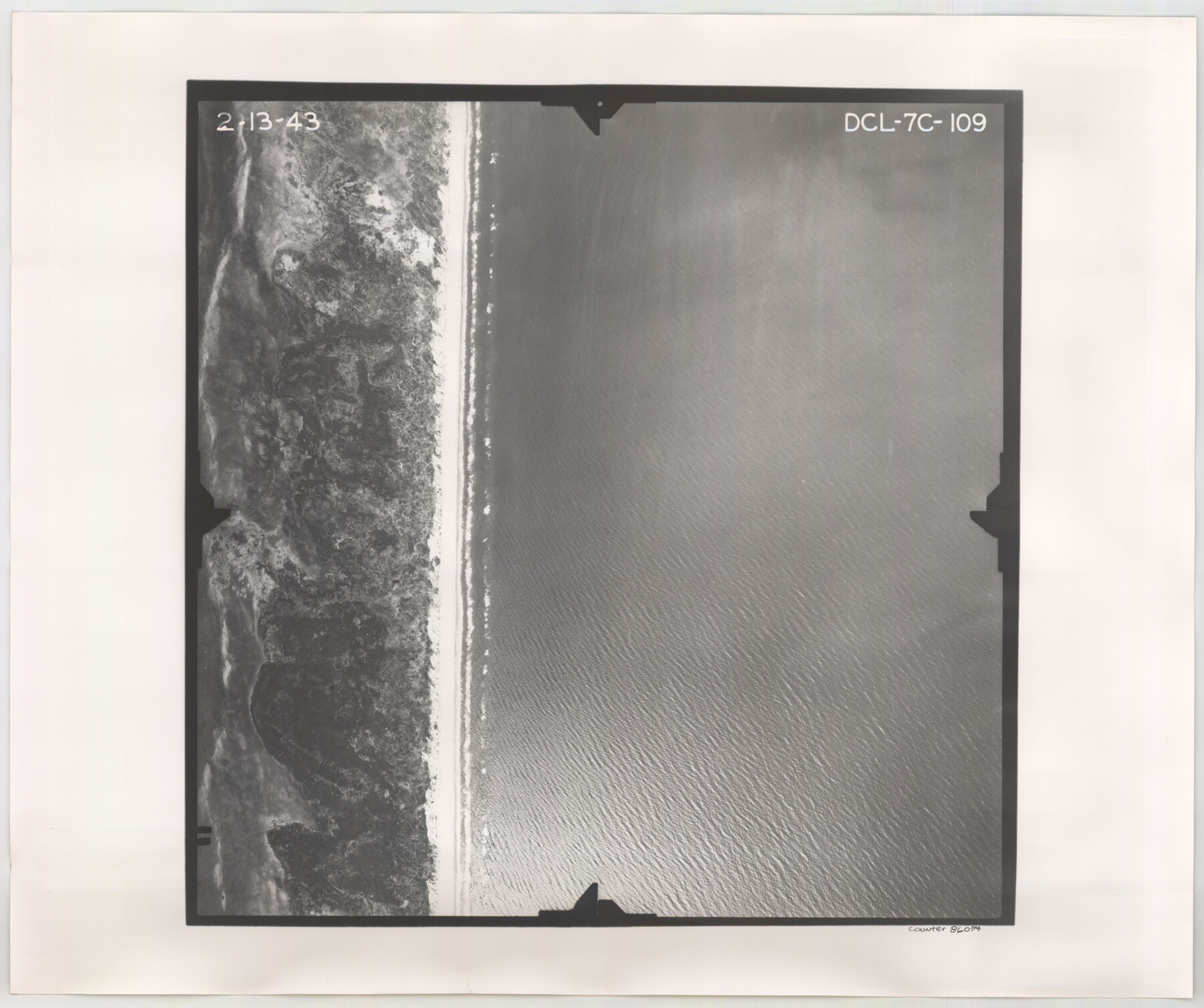
Flight Mission No. DCL-7C, Frame 109, Kenedy County
DCL-7C-109
- 
                          Map/Doc86074
- 
                            CollectionGeneral Map Collection
- 
                            Object Dates1943/2/13 (Creation Date)
- 
                            People and OrganizationsU. S. Department of Agriculture (Publisher)
- 
                            CountiesKenedy
- 
                            SubjectsAerial Photograph
- 
                            Height x Width18.6 x 22.2 inches47.2 x 56.4 cm
- 
                            CommentsFlown by Aerial Surveys of Pittsburgh, Inc. of Pittsburgh, Pennsylvania.
Part of: General Map Collection
            Nueces County Sketch File 65


                                            Print $18.00                    
                                             -                         Digital $50.00                                    
                Nueces County Sketch File 65
1981
Size 11.2 x 8.6 inches
                                Map/Doc 32980
            
            Burnet County Sketch File 39


                                            Print $40.00                    
                                             -                         Digital $50.00                                    
                Burnet County Sketch File 39
Size 9.6 x 24.1 inches
                                Map/Doc 11028
            
            State Prison Lands Transferred to A&M College, Forest Division, Cherokee County


                                            Print $4.00                    
                                             -                         Digital $50.00                                    
                State Prison Lands Transferred to A&M College, Forest Division, Cherokee County
1932
Size 11.1 x 20.1 inches
                                Map/Doc 65086
            
            Aransas County Sketch File 10


                                            Print $4.00                    
                                             -                         Digital $50.00                                    
                Aransas County Sketch File 10
1871
Size 7.3 x 9.4 inches
                                Map/Doc 13116
            
            Pecos County Rolled Sketch 51


                                            Print $20.00                    
                                             -                         Digital $50.00                                    
                Pecos County Rolled Sketch 51
1914
Size 8.6 x 35.5 inches
                                Map/Doc 7227
            
            Collin County Working Sketch 2


                                            Print $20.00                    
                                             -                         Digital $50.00                                    
                Collin County Working Sketch 2
1926
Size 15.2 x 17.7 inches
                                Map/Doc 68096
            
            Nueces County Aerial Photograph Index Sheet 23


                                            Print $20.00                    
                                             -                         Digital $50.00                                    
                Nueces County Aerial Photograph Index Sheet 23
1938
Size 24.4 x 20.3 inches
                                Map/Doc 86844
            
            Aransas County NRC Article 33.136 Sketch 5


                                            Print $20.00                    
                                             -                         Digital $50.00                                    
                Aransas County NRC Article 33.136 Sketch 5
2005
Size 18.5 x 24.7 inches
                                Map/Doc 83521
            
            Flight Mission No. BQY-15M, Frame 8, Harris County


                                            Print $20.00                    
                                             -                         Digital $50.00                                    
                Flight Mission No. BQY-15M, Frame 8, Harris County
1953
Size 18.7 x 22.4 inches
                                Map/Doc 85306
            
            Dawson County Sketch File 5


                                            Print $38.00                    
                                             -                         Digital $50.00                                    
                Dawson County Sketch File 5
1924
Size 13.4 x 8.9 inches
                                Map/Doc 20509
            
            Maps of Gulf Intracoastal Waterway, Texas - Sabine River to the Rio Grande and connecting waterways including ship channels


                                            Print $20.00                    
                                             -                         Digital $50.00                                    
                Maps of Gulf Intracoastal Waterway, Texas - Sabine River to the Rio Grande and connecting waterways including ship channels
1966
Size 14.4 x 22.2 inches
                                Map/Doc 61943
            
            Crane County Working Sketch 12


                                            Print $20.00                    
                                             -                         Digital $50.00                                    
                Crane County Working Sketch 12
1941
Size 18.6 x 18.1 inches
                                Map/Doc 68289
            You may also like
            Houston, Texas (Looking South)


                                            Print $20.00                    
                                    
                Houston, Texas (Looking South)
1891
Size 41.1 x 25.3 inches
                                Map/Doc 93465
            
            Liberty County Sketch File 58


                                            Print $2.00                    
                                             -                         Digital $50.00                                    
                Liberty County Sketch File 58
Size 8.9 x 7.7 inches
                                Map/Doc 30060
            
            Matagorda County NRC Article 33.136 Sketch 22


                                            Print $24.00                    
                                    
                Matagorda County NRC Article 33.136 Sketch 22
2025
Map/Doc 97486
            
            Brazoria County NRC Article 33.136 Sketch 26


                                            Print $24.00                    
                                    
                Brazoria County NRC Article 33.136 Sketch 26
2025
Map/Doc 97471
            
            McCulloch County Rolled Sketch 6


                                            Print $20.00                    
                                             -                         Digital $50.00                                    
                McCulloch County Rolled Sketch 6
1982
Size 27.9 x 33.9 inches
                                Map/Doc 6717
            
            Hemphill County Working Sketch 26


                                            Print $40.00                    
                                             -                         Digital $50.00                                    
                Hemphill County Working Sketch 26
1974
Size 57.2 x 48.3 inches
                                Map/Doc 66121
            
            Jeff Davis County Sketch File 28


                                            Print $30.00                    
                                             -                         Digital $50.00                                    
                Jeff Davis County Sketch File 28
1916
Size 7.2 x 8.7 inches
                                Map/Doc 28003
            
            Hopkins County


                                            Print $20.00                    
                                             -                         Digital $50.00                                    
                Hopkins County
1942
Size 39.6 x 37.6 inches
                                Map/Doc 77315
            
            [Surveys along Trinity River]
            
                                    ![7, [Surveys along Trinity River], General Map Collection](https://historictexasmaps.com/wmedia_w700/maps/7.tif.jpg) 


    ![7, [Surveys along Trinity River], General Map Collection](https://historictexasmaps.com/wmedia_w700/maps/7.tif.jpg) 
                                
            
                                            Print $20.00                    
                                             -                         Digital $50.00                                    
                [Surveys along Trinity River]
1844
Size 21.4 x 12.6 inches
                                Map/Doc 7
            
            Montague County Working Sketch 16


                                            Print $20.00                    
                                             -                         Digital $50.00                                    
                Montague County Working Sketch 16
1946
Size 44.1 x 40.8 inches
                                Map/Doc 71082
            
            John DePauw Lands


                                            Print $20.00                    
                                             -                         Digital $50.00                                    
                John DePauw Lands
1954
Size 22.0 x 18.8 inches
                                Map/Doc 92503
            
            Culberson County Rolled Sketch 40


                                            Print $20.00                    
                                             -                         Digital $50.00                                    
                Culberson County Rolled Sketch 40
Size 32.1 x 25.0 inches
                                Map/Doc 8751
            