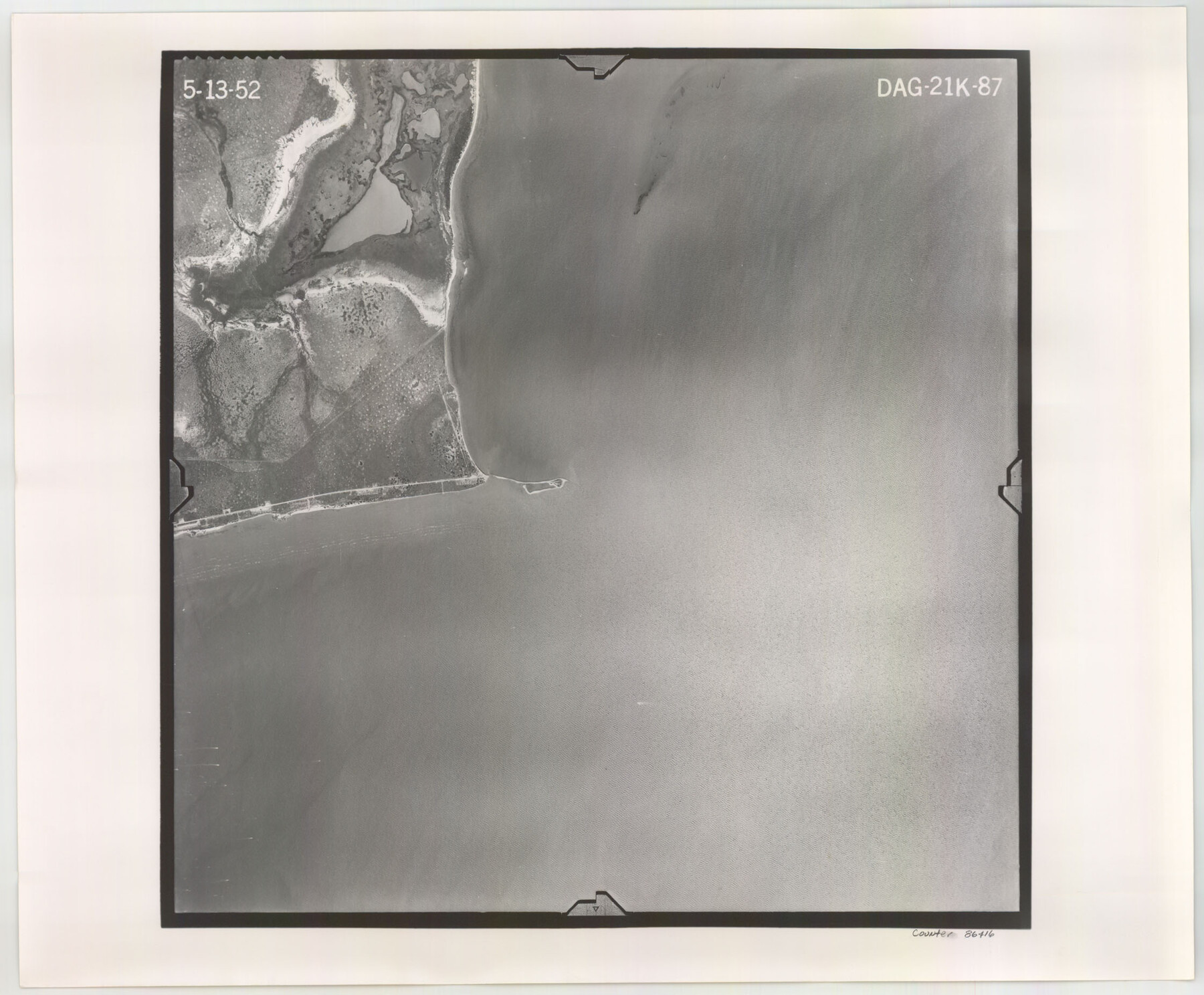
Flight Mission No. DAG-21K, Frame 87, Matagorda County
DAG-21K-87
-
Map/Doc
86416
-
Collection
General Map Collection
-
Object Dates
1952/5/13 (Creation Date)
-
People and Organizations
U. S. Department of Agriculture (Publisher)
-
Counties
Matagorda
-
Subjects
Aerial Photograph
-
Height x Width
18.5 x 22.4 inches
47.0 x 56.9 cm
-
Comments
Flown by Aero Exploration Company of Tulsa, Oklahoma.
Part of: General Map Collection
Upton County Rolled Sketch 7

Print $62.00
- Digital $50.00
Upton County Rolled Sketch 7
1911
Size 10.5 x 15.0 inches
Map/Doc 49398
Johnson County Working Sketch 4

Print $20.00
- Digital $50.00
Johnson County Working Sketch 4
1948
Size 26.5 x 24.6 inches
Map/Doc 66617
Cass County Rolled Sketch OF

Print $20.00
- Digital $50.00
Cass County Rolled Sketch OF
1937
Size 16.2 x 24.3 inches
Map/Doc 5414
Map of Texas Gulf Coast and Continental Shelf showing Natural Gas Pipe Lines

Print $40.00
- Digital $50.00
Map of Texas Gulf Coast and Continental Shelf showing Natural Gas Pipe Lines
1979
Size 40.9 x 59.3 inches
Map/Doc 75905
Leon County Sketch File 11

Print $4.00
- Digital $50.00
Leon County Sketch File 11
1858
Size 10.1 x 8.0 inches
Map/Doc 29761
Taylor County Rolled Sketch 30

Print $20.00
- Digital $50.00
Taylor County Rolled Sketch 30
1999
Size 29.7 x 29.7 inches
Map/Doc 7923
Mills County Sketch File 28

Print $8.00
- Digital $50.00
Mills County Sketch File 28
2000
Size 14.3 x 8.7 inches
Map/Doc 31684
Houston, (Capital de Tejas)

Print $20.00
- Digital $50.00
Houston, (Capital de Tejas)
1845
Size 6.8 x 10.0 inches
Map/Doc 97238
Gaines County Working Sketch 11

Print $40.00
- Digital $50.00
Gaines County Working Sketch 11
1953
Size 68.4 x 33.4 inches
Map/Doc 69311
San Luis Pass to Matagorda Bay

Print $20.00
- Digital $50.00
San Luis Pass to Matagorda Bay
1946
Size 34.7 x 46.5 inches
Map/Doc 69961
Medina County Working Sketch 17

Print $20.00
- Digital $50.00
Medina County Working Sketch 17
1979
Size 26.8 x 34.5 inches
Map/Doc 70932
Knox County Working Sketch 11

Print $20.00
- Digital $50.00
Knox County Working Sketch 11
1950
Size 16.8 x 29.0 inches
Map/Doc 70253
You may also like
Val Verde County Working Sketch 41

Print $20.00
- Digital $50.00
Val Verde County Working Sketch 41
1943
Size 27.8 x 30.2 inches
Map/Doc 72176
[Field Notes attached to Sketch of North Line of Deaf Smith County and South Line of Oldham County]
![91407, [Field Notes attached to Sketch of North Line of Deaf Smith County and South Line of Oldham County], Twichell Survey Records](https://historictexasmaps.com/wmedia_w700/maps/91407-1.tif.jpg)
Print $20.00
- Digital $50.00
[Field Notes attached to Sketch of North Line of Deaf Smith County and South Line of Oldham County]
1894
Size 40.6 x 20.0 inches
Map/Doc 91407
Township No. 5 South, Range No. 14 West, Indian Meridian, Oklahoma

Print $4.00
- Digital $50.00
Township No. 5 South, Range No. 14 West, Indian Meridian, Oklahoma
1928
Size 18.0 x 22.6 inches
Map/Doc 75141
Oldham County Working Sketch 8

Print $20.00
- Digital $50.00
Oldham County Working Sketch 8
1982
Size 33.4 x 35.8 inches
Map/Doc 71330
Live Oak County Working Sketch 11

Print $20.00
- Digital $50.00
Live Oak County Working Sketch 11
1949
Size 29.7 x 25.7 inches
Map/Doc 70596
Sutton County Rolled Sketch 43

Print $20.00
- Digital $50.00
Sutton County Rolled Sketch 43
1939
Size 18.7 x 26.8 inches
Map/Doc 7885
Jasper County Sketch File 8 and 9

Print $80.00
- Digital $50.00
Jasper County Sketch File 8 and 9
Size 8.2 x 6.9 inches
Map/Doc 27777
Red River, Bois D'Arc Creek Floodway Sheet No. 7

Print $20.00
- Digital $50.00
Red River, Bois D'Arc Creek Floodway Sheet No. 7
1917
Size 29.0 x 23.8 inches
Map/Doc 69662
![91800, [Block M-19], Twichell Survey Records](https://historictexasmaps.com/wmedia_w700/maps/91800-1.tif.jpg)
O'Neall Terrace, a Re-Subdivision of Blocks 37-38-39-40-43-44-45-46-110-112-113-114 and Parts of Blocks 111 and 115, McCrummens Second Addition to the City of Lubbock, Texas

Print $20.00
- Digital $50.00
O'Neall Terrace, a Re-Subdivision of Blocks 37-38-39-40-43-44-45-46-110-112-113-114 and Parts of Blocks 111 and 115, McCrummens Second Addition to the City of Lubbock, Texas
Size 22.6 x 27.5 inches
Map/Doc 92743
Flight Mission No. DCL-7C, Frame 14, Kenedy County

Print $20.00
- Digital $50.00
Flight Mission No. DCL-7C, Frame 14, Kenedy County
1943
Size 15.3 x 15.2 inches
Map/Doc 86006
Hutchinson County Working Sketch 31

Print $20.00
- Digital $50.00
Hutchinson County Working Sketch 31
1978
Size 27.0 x 22.2 inches
Map/Doc 66391