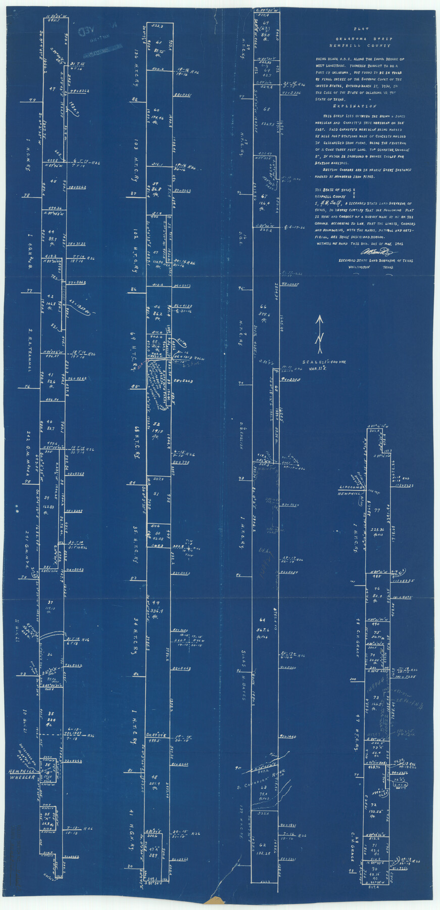
Hemphill County Rolled Sketch 11
Block OS2 Along 100th Deg. Of West Long., Hemphill County, Texas
-
Map/Doc
9153
-
Collection
General Map Collection
-
Object Dates
1941/5/8 (File Date)
1941/5/5 (Creation Date)
-
People and Organizations
A.B. Smith (Surveyor/Engineer)
-
Counties
Hemphill
-
Subjects
Surveying Rolled Sketch
-
Height x Width
45.1 x 21.8 inches
114.6 x 55.4 cm
-
Medium
blueprint/diazo
-
Scale
1" = 400 varas
Part of: General Map Collection
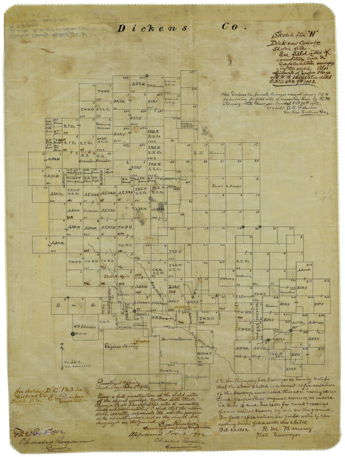
Dickens County Rolled Sketch H
Print $20.00
- Digital $50.00
Dickens County Rolled Sketch H
1902
Size 26.4 x 19.1 inches
Map/Doc 5712
Calhoun County Rolled Sketch 26

Print $20.00
- Digital $50.00
Calhoun County Rolled Sketch 26
1941
Size 10.9 x 39.9 inches
Map/Doc 5374
Maverick County Sketch File 10a

Print $19.00
- Digital $50.00
Maverick County Sketch File 10a
1878
Size 15.4 x 10.0 inches
Map/Doc 31083
Flight Mission No. DAG-23K, Frame 166, Matagorda County

Print $20.00
- Digital $50.00
Flight Mission No. DAG-23K, Frame 166, Matagorda County
1953
Size 15.9 x 19.1 inches
Map/Doc 86504
Houston County Sketch File 22

Print $8.00
- Digital $50.00
Houston County Sketch File 22
1852
Size 12.6 x 8.2 inches
Map/Doc 26789
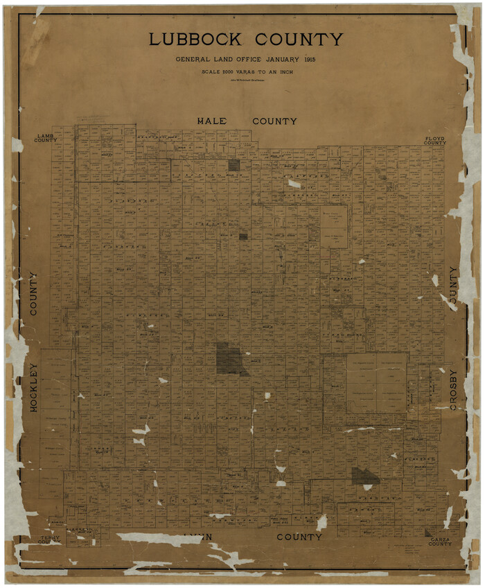
Lubbock County
Print $40.00
- Digital $50.00
Lubbock County
1915
Size 49.0 x 40.6 inches
Map/Doc 895
Montgomery County Working Sketch 55

Print $20.00
- Digital $50.00
Montgomery County Working Sketch 55
1961
Size 23.8 x 34.6 inches
Map/Doc 71162
Hunt County Sketch File 49

Print $4.00
- Digital $50.00
Hunt County Sketch File 49
1852
Size 7.3 x 8.9 inches
Map/Doc 27168
Throckmorton County Sketch File 7b

Print $4.00
- Digital $50.00
Throckmorton County Sketch File 7b
Size 13.0 x 6.5 inches
Map/Doc 38097
Baylor County Rolled Sketch 12

Print $20.00
- Digital $50.00
Baylor County Rolled Sketch 12
1986
Size 22.4 x 36.0 inches
Map/Doc 5129
Mitchell County Working Sketch 2

Print $20.00
- Digital $50.00
Mitchell County Working Sketch 2
1922
Size 14.8 x 18.1 inches
Map/Doc 71059
Motley County Sketch File 6B (S)

Print $20.00
- Digital $50.00
Motley County Sketch File 6B (S)
Size 24.5 x 20.7 inches
Map/Doc 42139
You may also like
Val Verde County Sketch File XXX3

Print $6.00
- Digital $50.00
Val Verde County Sketch File XXX3
Size 11.0 x 16.8 inches
Map/Doc 39096

Brewster County Working Sketch 103

Print $40.00
- Digital $50.00
Brewster County Working Sketch 103
1980
Size 48.4 x 31.1 inches
Map/Doc 67703
Crockett County Rolled Sketch 82

Print $20.00
- Digital $50.00
Crockett County Rolled Sketch 82
1959
Size 22.4 x 21.2 inches
Map/Doc 5622
Kent County Working Sketch 22

Print $20.00
- Digital $50.00
Kent County Working Sketch 22
1987
Size 42.7 x 43.1 inches
Map/Doc 70029
Maverick County Rolled Sketch 24

Print $20.00
- Digital $50.00
Maverick County Rolled Sketch 24
1975
Size 31.4 x 30.7 inches
Map/Doc 6715
Flight Mission No. DQO-7K, Frame 75, Galveston County

Print $20.00
- Digital $50.00
Flight Mission No. DQO-7K, Frame 75, Galveston County
1952
Size 18.9 x 22.4 inches
Map/Doc 85102
Galveston County NRC Article 33.136 Location Key Sheet

Print $20.00
- Digital $50.00
Galveston County NRC Article 33.136 Location Key Sheet
1974
Size 27.0 x 23.0 inches
Map/Doc 77022
Sutton County Working Sketch 50

Print $20.00
- Digital $50.00
Sutton County Working Sketch 50
1955
Size 27.4 x 22.2 inches
Map/Doc 62393
General Highway Map, Washington County, Texas

Print $20.00
General Highway Map, Washington County, Texas
1961
Size 18.1 x 24.7 inches
Map/Doc 79703
Andrews County

Print $40.00
- Digital $50.00
Andrews County
1951
Size 42.7 x 54.4 inches
Map/Doc 73067
[Boundary Survey of County]
![89735, [Boundary Survey of County], Twichell Survey Records](https://historictexasmaps.com/wmedia_w700/maps/89735-1.tif.jpg)
Print $40.00
- Digital $50.00
[Boundary Survey of County]
Size 64.9 x 37.0 inches
Map/Doc 89735