![91530, [Blotter for Roads in Moore County], Twichell Survey Records](https://historictexasmaps.com/wmedia_w1800h1800/maps/91530-1.tif.jpg)
[Blotter for Roads in Moore County]
171-27
-
Map/Doc
91530
-
Collection
Twichell Survey Records
-
Counties
Moore
-
Height x Width
32.5 x 32.0 inches
82.6 x 81.3 cm
Part of: Twichell Survey Records
[Blocks 53, 54, 55, 56, 57, and 76]
![91314, [Blocks 53, 54, 55, 56, 57, and 76], Twichell Survey Records](https://historictexasmaps.com/wmedia_w700/maps/91314-2.tif.jpg)
Print $20.00
- Digital $50.00
[Blocks 53, 54, 55, 56, 57, and 76]
Size 36.4 x 21.4 inches
Map/Doc 91314
EL&RR S2, HE&WT K3, Pt.L&SV K, C4 & C3

Print $20.00
- Digital $50.00
EL&RR S2, HE&WT K3, Pt.L&SV K, C4 & C3
Size 23.3 x 17.5 inches
Map/Doc 90416
Working Sketch Hemphill County

Print $20.00
- Digital $50.00
Working Sketch Hemphill County
1910
Size 6.9 x 39.1 inches
Map/Doc 90730
J. B. McCauley Irrigated Farm SW Quarter Section 20, Block E

Print $20.00
- Digital $50.00
J. B. McCauley Irrigated Farm SW Quarter Section 20, Block E
1944
Size 20.7 x 23.5 inches
Map/Doc 92335
Terry County Memorial Cemetery

Print $20.00
- Digital $50.00
Terry County Memorial Cemetery
Size 35.3 x 14.4 inches
Map/Doc 92931
Cecil Stein Drilling Block

Print $3.00
- Digital $50.00
Cecil Stein Drilling Block
1933
Size 11.2 x 16.2 inches
Map/Doc 92281
[Hall, Luce, Aimaguie, and surrounding surveys]
![91191, [Hall, Luce, Aimaguie, and surrounding surveys], Twichell Survey Records](https://historictexasmaps.com/wmedia_w700/maps/91191-1.tif.jpg)
Print $20.00
- Digital $50.00
[Hall, Luce, Aimaguie, and surrounding surveys]
Size 21.0 x 29.1 inches
Map/Doc 91191
[Texas Boundary Line]
![92071, [Texas Boundary Line], Twichell Survey Records](https://historictexasmaps.com/wmedia_w700/maps/92071-1.tif.jpg)
Print $20.00
- Digital $50.00
[Texas Boundary Line]
Size 21.5 x 12.0 inches
Map/Doc 92071
Map of Blocks No. 46 and 47 made in the name of Houston and Texas Central RR. Co. in Oldham District

Print $20.00
- Digital $50.00
Map of Blocks No. 46 and 47 made in the name of Houston and Texas Central RR. Co. in Oldham District
1884
Size 40.8 x 27.0 inches
Map/Doc 91818
Wellman Townsite Showing Survey 17

Print $3.00
- Digital $50.00
Wellman Townsite Showing Survey 17
Size 12.4 x 11.9 inches
Map/Doc 92885
Wonderland, Randolph Place, and Deer Wood

Print $20.00
- Digital $50.00
Wonderland, Randolph Place, and Deer Wood
Size 18.9 x 24.8 inches
Map/Doc 92742
[PSL Block A-12]
![93230, [PSL Block A-12], Twichell Survey Records](https://historictexasmaps.com/wmedia_w700/maps/93230-1.tif.jpg)
Print $20.00
- Digital $50.00
[PSL Block A-12]
Size 23.8 x 20.3 inches
Map/Doc 93230
You may also like
Schleicher County Sketch File 41

Print $6.00
- Digital $50.00
Schleicher County Sketch File 41
1963
Size 16.2 x 9.9 inches
Map/Doc 36544
Colorado County Working Sketch 32
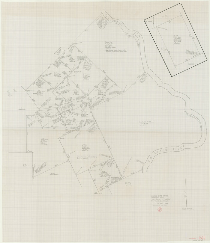
Print $20.00
- Digital $50.00
Colorado County Working Sketch 32
1985
Size 42.7 x 36.8 inches
Map/Doc 68132
[PSL Block A7, Sections 1 and 10]
![90831, [PSL Block A7, Sections 1 and 10], Twichell Survey Records](https://historictexasmaps.com/wmedia_w700/maps/90831-2.tif.jpg)
Print $3.00
- Digital $50.00
[PSL Block A7, Sections 1 and 10]
Size 11.9 x 9.3 inches
Map/Doc 90831
Presidio County Working Sketch Graphic Index, Northeast Part

Print $20.00
- Digital $50.00
Presidio County Working Sketch Graphic Index, Northeast Part
1973
Size 40.3 x 32.2 inches
Map/Doc 76674
Current Miscellaneous File 33

Print $6.00
- Digital $50.00
Current Miscellaneous File 33
1953
Size 10.8 x 8.2 inches
Map/Doc 73939
Childress Co.

Print $20.00
- Digital $50.00
Childress Co.
1978
Size 47.3 x 36.0 inches
Map/Doc 95454
Texas Gulf Coast Map from the Sabine River to the Rio Grande as subdivided for mineral development

Print $40.00
- Digital $50.00
Texas Gulf Coast Map from the Sabine River to the Rio Grande as subdivided for mineral development
1948
Size 60.9 x 36.7 inches
Map/Doc 2909
Tyler County Sketch File 26

Print $26.00
- Digital $50.00
Tyler County Sketch File 26
1955
Size 14.5 x 8.8 inches
Map/Doc 38693
Dimmit County

Print $40.00
- Digital $50.00
Dimmit County
1976
Size 43.2 x 51.7 inches
Map/Doc 95483

Erath County Working Sketch 41

Print $20.00
- Digital $50.00
Erath County Working Sketch 41
Size 25.5 x 29.0 inches
Map/Doc 69122
[Sketches in McMullen County, San Patricio District]
![69747, [Sketches in McMullen County, San Patricio District], General Map Collection](https://historictexasmaps.com/wmedia_w700/maps/69747.tif.jpg)
Print $2.00
- Digital $50.00
[Sketches in McMullen County, San Patricio District]
1842
Size 10.5 x 8.0 inches
Map/Doc 69747