![93110, [Letter from T. F. Pinckney to W. D. Twichell accompanying sketch showing Blocks 14, 341, and G5], Twichell Survey Records](https://historictexasmaps.com/wmedia_w1800h1800/maps/93110-1.tif.jpg)
[Letter from T. F. Pinckney to W. D. Twichell accompanying sketch showing Blocks 14, 341, and G5]
189-3
-
Map/Doc
93110
-
Collection
Twichell Survey Records
-
Object Dates
10/2/1911 (Creation Date)
-
Counties
Presidio
-
Height x Width
8.0 x 9.5 inches
20.3 x 24.1 cm
Part of: Twichell Survey Records
McLean, Texas Section 22, Block R

Print $20.00
- Digital $50.00
McLean, Texas Section 22, Block R
Size 16.0 x 16.1 inches
Map/Doc 90721
Plat of Common Line of Baylor and Throckmorton Counties as Run by A.D. Kerr and F.B. Stribling

Print $40.00
- Digital $50.00
Plat of Common Line of Baylor and Throckmorton Counties as Run by A.D. Kerr and F.B. Stribling
Size 63.0 x 9.0 inches
Map/Doc 89640
[Part of North line of County, North of Block G]
![90805, [Part of North line of County, North of Block G], Twichell Survey Records](https://historictexasmaps.com/wmedia_w700/maps/90805-1.tif.jpg)
Print $20.00
- Digital $50.00
[Part of North line of County, North of Block G]
Size 17.6 x 12.1 inches
Map/Doc 90805
[T. & P. Block 36, Townships 3N - 5N]
![90552, [T. & P. Block 36, Townships 3N - 5N], Twichell Survey Records](https://historictexasmaps.com/wmedia_w700/maps/90552.tif.jpg)
Print $20.00
- Digital $50.00
[T. & P. Block 36, Townships 3N - 5N]
Size 15.5 x 47.8 inches
Map/Doc 90552

[Sketch of Randall County]
![91757, [Sketch of Randall County], Twichell Survey Records](https://historictexasmaps.com/wmedia_w700/maps/91757-1.tif.jpg)
Print $20.00
- Digital $50.00
[Sketch of Randall County]
Size 21.4 x 18.5 inches
Map/Doc 91757
Map No. 2 - Surveys Corrected in 1882 as they appear on the ground

Print $20.00
- Digital $50.00
Map No. 2 - Surveys Corrected in 1882 as they appear on the ground
Size 30.8 x 18.5 inches
Map/Doc 91891
The Espuela Land and Cattle Co. L'd. West Pastures of the Spur Ranch

Print $20.00
- Digital $50.00
The Espuela Land and Cattle Co. L'd. West Pastures of the Spur Ranch
1904
Size 41.2 x 44.3 inches
Map/Doc 89947
Stonewall County

Print $20.00
- Digital $50.00
Stonewall County
1889
Size 19.6 x 24.3 inches
Map/Doc 91883
[Pencil sketch of Wm. Rivers survey]
![91968, [Pencil sketch of Wm. Rivers survey], Twichell Survey Records](https://historictexasmaps.com/wmedia_w700/maps/91968-1.tif.jpg)
Print $3.00
- Digital $50.00
[Pencil sketch of Wm. Rivers survey]
Size 10.1 x 16.5 inches
Map/Doc 91968
[Section 25, H. & G. N. Block 1 showing Duck Creek]
![90936, [Section 25, H. & G. N. Block 1 showing Duck Creek], Twichell Survey Records](https://historictexasmaps.com/wmedia_w700/maps/90936-1.tif.jpg)
Print $20.00
- Digital $50.00
[Section 25, H. & G. N. Block 1 showing Duck Creek]
Size 24.9 x 27.9 inches
Map/Doc 90936
[Map showing J. H. Gibson Blocks D and DD and Double Lake Corner]
![92014, [Map showing J. H. Gibson Blocks D and DD and Double Lake Corner], Twichell Survey Records](https://historictexasmaps.com/wmedia_w700/maps/92014-1.tif.jpg)
Print $20.00
- Digital $50.00
[Map showing J. H. Gibson Blocks D and DD and Double Lake Corner]
Size 31.4 x 20.4 inches
Map/Doc 92014
You may also like
Map of Nolan County

Print $20.00
- Digital $50.00
Map of Nolan County
1902
Size 47.4 x 37.5 inches
Map/Doc 5021
Maverick County Sketch File 23

Print $7.00
- Digital $50.00
Maverick County Sketch File 23
Size 9.1 x 8.5 inches
Map/Doc 31142
Pecos County Working Sketch 50

Print $20.00
- Digital $50.00
Pecos County Working Sketch 50
1947
Size 21.1 x 13.4 inches
Map/Doc 71522
Brewster County Working Sketch 83

Print $20.00
- Digital $50.00
Brewster County Working Sketch 83
1973
Size 43.6 x 41.1 inches
Map/Doc 67683
Newton County Rolled Sketch 6A

Digital $50.00
Newton County Rolled Sketch 6A
Size 10.3 x 15.4 inches
Map/Doc 46838
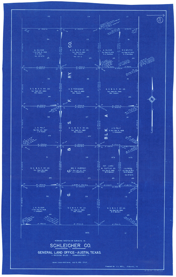
Schleicher County Working Sketch 20
Print $20.00
- Digital $50.00
Schleicher County Working Sketch 20
1951
Size 33.8 x 21.2 inches
Map/Doc 63822
Presidio County Rolled Sketch 34

Print $20.00
- Digital $50.00
Presidio County Rolled Sketch 34
1890
Size 46.1 x 32.9 inches
Map/Doc 9773
Nueces County Rolled Sketch 128 A-E

Print $10.00
- Digital $50.00
Nueces County Rolled Sketch 128 A-E
1998
Size 11.0 x 8.5 inches
Map/Doc 41611

Medina County

Print $40.00
- Digital $50.00
Medina County
1976
Size 53.5 x 44.2 inches
Map/Doc 95587
Moore County Rolled Sketch 16

Print $20.00
- Digital $50.00
Moore County Rolled Sketch 16
1981
Size 21.8 x 27.8 inches
Map/Doc 6833
Borden County Rolled Sketch 7

Print $20.00
- Digital $50.00
Borden County Rolled Sketch 7
Size 16.9 x 18.5 inches
Map/Doc 5157