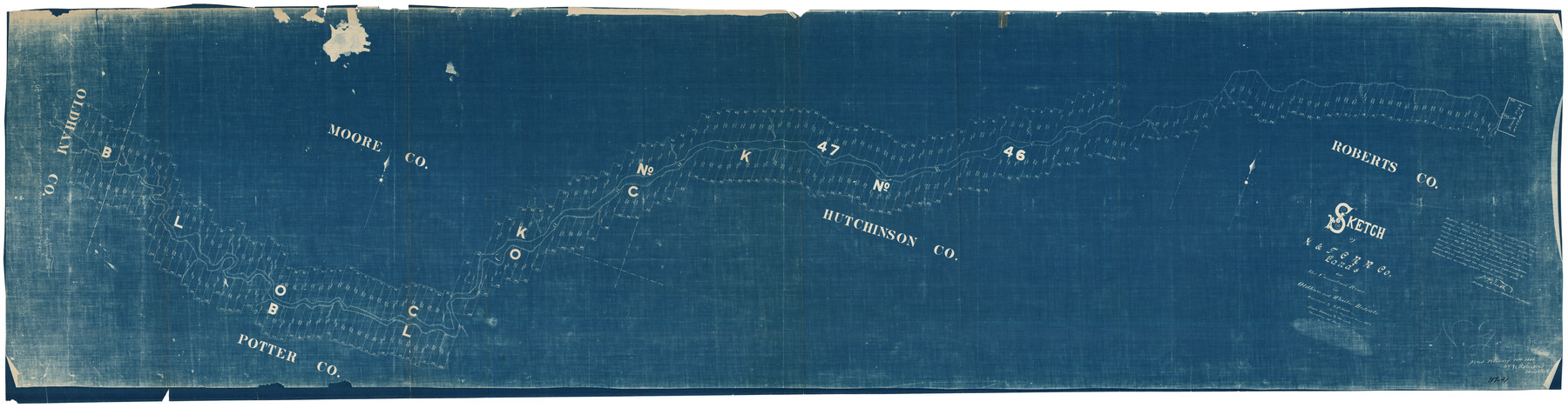
Sketch of H. & T. C. RR. Co. Lands on the Canadian River in Oldham and Wheeler Districts
117-91
-
Map/Doc
93193
-
Collection
Twichell Survey Records
-
Object Dates
6/1884 (Creation Date)
-
People and Organizations
L.P. Tutt (Surveyor/Engineer)
-
Counties
Hutchinson Oldham Potter Moore Roberts
-
Height x Width
88.9 x 23.8 inches
225.8 x 60.5 cm
Part of: Twichell Survey Records
[Sketch Showing Blocks O18 and B11]
![93108, [Sketch Showing Blocks O18 and B11], Twichell Survey Records](https://historictexasmaps.com/wmedia_w700/maps/93108-1.tif.jpg)
Print $3.00
- Digital $50.00
[Sketch Showing Blocks O18 and B11]
Size 15.5 x 11.9 inches
Map/Doc 93108
Carden L. Green Farm Part Sections 13 & 22, Block JS

Print $20.00
- Digital $50.00
Carden L. Green Farm Part Sections 13 & 22, Block JS
Size 14.0 x 24.1 inches
Map/Doc 92324
Sketch showing Block R situated in Counties of Castro, Deaf Smith, Randall & Swisher

Print $20.00
- Digital $50.00
Sketch showing Block R situated in Counties of Castro, Deaf Smith, Randall & Swisher
1908
Size 29.0 x 34.4 inches
Map/Doc 90408
Working Sketch Bastrop County

Print $20.00
- Digital $50.00
Working Sketch Bastrop County
1923
Size 16.9 x 13.3 inches
Map/Doc 90146
[Yates Field showing well locations]
![91670, [Yates Field showing well locations], Twichell Survey Records](https://historictexasmaps.com/wmedia_w700/maps/91670-1.tif.jpg)
Print $3.00
- Digital $50.00
[Yates Field showing well locations]
Size 14.4 x 11.3 inches
Map/Doc 91670
Map of Dalhart

Print $20.00
- Digital $50.00
Map of Dalhart
1905
Size 23.5 x 32.0 inches
Map/Doc 92146

Map of Stephens County, Texas

Print $20.00
- Digital $50.00
Map of Stephens County, Texas
Size 36.8 x 40.1 inches
Map/Doc 93026
[Gunter & Munson, Maddox Bros. & Anderson Block F] / [PSL Block B19]
![91849, [Gunter & Munson, Maddox Bros. & Anderson Block F] / [PSL Block B19], Twichell Survey Records](https://historictexasmaps.com/wmedia_w700/maps/91849-1.tif.jpg)
Print $20.00
- Digital $50.00
[Gunter & Munson, Maddox Bros. & Anderson Block F] / [PSL Block B19]
Size 18.6 x 22.0 inches
Map/Doc 91849
Sketch in Floyd County

Print $20.00
- Digital $50.00
Sketch in Floyd County
1911
Size 25.3 x 41.8 inches
Map/Doc 90916
Richland Hills Addition to Muleshoe, Bailey County, Texas

Print $20.00
- Digital $50.00
Richland Hills Addition to Muleshoe, Bailey County, Texas
1957
Size 22.7 x 31.7 inches
Map/Doc 92461
[Block C-41, Section 37, Dawson County, Texas]
![92629, [Block C-41, Section 37, Dawson County, Texas], Twichell Survey Records](https://historictexasmaps.com/wmedia_w700/maps/92629-1.tif.jpg)
Print $20.00
- Digital $50.00
[Block C-41, Section 37, Dawson County, Texas]
1950
Size 14.3 x 12.6 inches
Map/Doc 92629
You may also like
[Sketch for Mineral Application 16700 - Pecos River Bed]
![2806, [Sketch for Mineral Application 16700 - Pecos River Bed], General Map Collection](https://historictexasmaps.com/wmedia_w700/maps/2806.tif.jpg)
Print $20.00
- Digital $50.00
[Sketch for Mineral Application 16700 - Pecos River Bed]
1927
Size 20.3 x 29.1 inches
Map/Doc 2806
Burnet County Boundary File 3

Print $18.00
- Digital $50.00
Burnet County Boundary File 3
Size 12.8 x 8.2 inches
Map/Doc 50863
Map of section no. 3 of a survey of Padre Island made for the Office of the Attorney General of the State of Texas

Print $40.00
- Digital $50.00
Map of section no. 3 of a survey of Padre Island made for the Office of the Attorney General of the State of Texas
1941
Size 49.6 x 40.2 inches
Map/Doc 2259
Webb County Sketch File 64

Print $20.00
- Digital $50.00
Webb County Sketch File 64
1948
Size 23.1 x 30.6 inches
Map/Doc 12654
Potter County Sketch File 21

Print $6.00
- Digital $50.00
Potter County Sketch File 21
1930
Size 14.1 x 9.7 inches
Map/Doc 34413
Harris County Sketch File 20

Print $6.00
- Digital $50.00
Harris County Sketch File 20
1862
Size 8.6 x 7.9 inches
Map/Doc 25368
Lynn County Boundary File 13

Print $40.00
- Digital $50.00
Lynn County Boundary File 13
Size 36.1 x 8.2 inches
Map/Doc 56752
Terry County Sketch File 20

Print $4.00
- Digital $50.00
Terry County Sketch File 20
2001
Size 11.1 x 8.8 inches
Map/Doc 76365
Railroad and County Map of Texas prepared and published as a supplement to the Texas Almanac and State Industrial Guide

Print $20.00
- Digital $50.00
Railroad and County Map of Texas prepared and published as a supplement to the Texas Almanac and State Industrial Guide
1910
Size 22.2 x 23.1 inches
Map/Doc 95353
Johnson's New Map of the State of Texas

Print $20.00
- Digital $50.00
Johnson's New Map of the State of Texas
1859
Size 18.6 x 26.8 inches
Map/Doc 89254
Orange County Working Sketch 54a

Print $40.00
- Digital $50.00
Orange County Working Sketch 54a
2008
Size 22.9 x 48.0 inches
Map/Doc 88742
Brazoria County Rolled Sketch 49

Print $20.00
- Digital $50.00
Brazoria County Rolled Sketch 49
1948
Size 23.8 x 36.1 inches
Map/Doc 5182