
Chart of the Antarctic Continent shewing the icy barrier attached to it discovered by the U.S. Ex. Ex.
-
Map/Doc
94059
-
Collection
Rees-Jones Digital Map Collection
-
Object Dates
1840 (Creation Date)
-
People and Organizations
Sherman & Smith (Printer)
Charles Wilkes (Author)
-
Subjects
Nautical Charts
-
Height x Width
26.5 x 37.2 inches
67.3 x 94.5 cm
-
Medium
digital image
-
Comments
Courtesy of the Rees-Jones Collection, Dallas, TX
Part of: Rees-Jones Digital Map Collection
Sabine Pass and mouth of the River Sabine in the sea

Print $20.00
- Digital $50.00
Sabine Pass and mouth of the River Sabine in the sea
1842
Size 24.0 x 19.1 inches
Map/Doc 93766
Mapa de los Estados Unidos de Méjico, Segun lo organizado y definido por las varias actas del Congreso de dicha Republica: y construido por las mejores autoridades

Print $20.00
- Digital $50.00
Mapa de los Estados Unidos de Méjico, Segun lo organizado y definido por las varias actas del Congreso de dicha Republica: y construido por las mejores autoridades
1847
Size 31.2 x 42.9 inches
Map/Doc 93763
Map of West Hickory Creek, Venango & Warren Cos., Pa.

Print $20.00
- Digital $50.00
Map of West Hickory Creek, Venango & Warren Cos., Pa.
1866
Size 45.7 x 24.7 inches
Map/Doc 94056
Map of the Oregon Territory by the U.S. Ex. Ex.

Print $20.00
- Digital $50.00
Map of the Oregon Territory by the U.S. Ex. Ex.
1841
Size 26.2 x 37.3 inches
Map/Doc 94060
Part of the boundary between the United States and Texas; north of Sabine River, from the 72nd mile mound to the Red River

Print $3.00
- Digital $50.00
Part of the boundary between the United States and Texas; north of Sabine River, from the 72nd mile mound to the Red River
1842
Size 12.8 x 8.1 inches
Map/Doc 93771
Chart of the Antarctic Continent shewing the icy barrier attached to it discovered by the U.S. Ex. Ex.

Print $20.00
- Digital $50.00
Chart of the Antarctic Continent shewing the icy barrier attached to it discovered by the U.S. Ex. Ex.
1840
Size 26.5 x 37.2 inches
Map/Doc 94058

Plan of the cities of Denver, Auraria and Highland, Jefferson Terr.

Print $20.00
- Digital $50.00
Plan of the cities of Denver, Auraria and Highland, Jefferson Terr.
1859
Size 23.7 x 29.8 inches
Map/Doc 94053
Morley's Map of New Mexico compiled from the latest government surveys and other reliable sources

Print $20.00
- Digital $50.00
Morley's Map of New Mexico compiled from the latest government surveys and other reliable sources
1873
Size 26.2 x 28.0 inches
Map/Doc 94052
Guide map of the Great Texas Cattle Trail from Red River crossing to the Old Reliable Kansas Pacific Railway

Print $20.00
- Digital $50.00
Guide map of the Great Texas Cattle Trail from Red River crossing to the Old Reliable Kansas Pacific Railway
1873
Size 23.4 x 17.6 inches
Map/Doc 93938
Nouvelle carte du Mexique, du Texas et d'une partie des États Limitrophes

Print $20.00
- Digital $50.00
Nouvelle carte du Mexique, du Texas et d'une partie des États Limitrophes
1834
Size 39.5 x 27.2 inches
Map/Doc 93764
A Map of the United States of Mexico as organized and defined by the several Acts of the Congress of that Republic

Print $20.00
- Digital $50.00
A Map of the United States of Mexico as organized and defined by the several Acts of the Congress of that Republic
1846
Size 24.0 x 31.7 inches
Map/Doc 93760
You may also like
Erath County Sketch File 16a

Print $4.00
- Digital $50.00
Erath County Sketch File 16a
1874
Size 12.7 x 8.1 inches
Map/Doc 22296
Galveston County Sketch File 74

Print $12.00
- Digital $50.00
Galveston County Sketch File 74
2002
Size 11.3 x 8.7 inches
Map/Doc 77526
Hill County Sketch File 3

Print $2.00
- Digital $50.00
Hill County Sketch File 3
Size 8.3 x 10.4 inches
Map/Doc 26463
[Drawings of individual counties for Pressler and Langermann's 1879 Map of Texas]
![[Drawings of individual counties for Pressler and Langermann's 1879 Map of Texas]](https://historictexasmaps.com/wmedia_w700/maps/4864.tif.jpg)
Print $20.00
- Digital $50.00
[Drawings of individual counties for Pressler and Langermann's 1879 Map of Texas]
1878
Size 38.3 x 26.8 inches
Map/Doc 4864
Wilbarger County Sketch File A

Print $6.00
- Digital $50.00
Wilbarger County Sketch File A
Size 8.3 x 14.1 inches
Map/Doc 40231
McMullen County Rolled Sketch 5

Print $20.00
- Digital $50.00
McMullen County Rolled Sketch 5
Size 46.4 x 26.8 inches
Map/Doc 6723
Lampasas County

Print $20.00
- Digital $50.00
Lampasas County
1972
Size 34.4 x 43.4 inches
Map/Doc 73214
Travis County Appraisal District Plat Map 3_0206

Print $20.00
- Digital $50.00
Travis County Appraisal District Plat Map 3_0206
Size 21.4 x 26.4 inches
Map/Doc 94225
San Augustine and Sabine Counties

Print $20.00
- Digital $50.00
San Augustine and Sabine Counties
1881
Size 23.7 x 26.3 inches
Map/Doc 4012
Smith County Sketch File 7

Print $4.00
- Digital $50.00
Smith County Sketch File 7
1848
Size 12.7 x 8.2 inches
Map/Doc 36759
Boundary and Ownership map, Laguna Atascosa National Wildlife Refuge, Cameron and Willacy Counties, Texas

Print $40.00
- Digital $50.00
Boundary and Ownership map, Laguna Atascosa National Wildlife Refuge, Cameron and Willacy Counties, Texas
1968
Size 73.9 x 43.2 inches
Map/Doc 60395
Map of the O-X Ranch in Cottle County, Texas
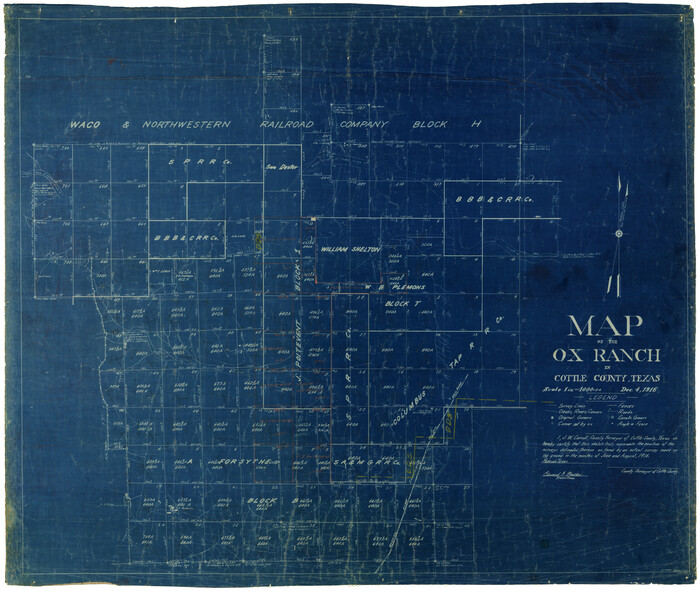
Print $20.00
- Digital $50.00
Map of the O-X Ranch in Cottle County, Texas
1916
Size 30.4 x 35.0 inches
Map/Doc 4438