Edwards County Sketch File 9

Print $20.00
- Digital $50.00
Edwards County Sketch File 9
Size: 16.9 x 37.8 inches
10443
Edwards County Sketch File A13

Print $20.00
- Digital $50.00
Edwards County Sketch File A13
1901
Size: 22.8 x 46.6 inches
10444
Edwards County Sketch File 6

Print $20.00
- Digital $50.00
Edwards County Sketch File 6
1880
Size: 11.7 x 19.6 inches
11419
Edwards County Sketch File 8

Print $20.00
- Digital $50.00
Edwards County Sketch File 8
Size: 36.7 x 18.5 inches
11420
Edwards County Sketch File A

Print $20.00
- Digital $50.00
Edwards County Sketch File A
Size: 25.3 x 35.5 inches
11448
Real County Sketch File 5

Print $20.00
- Digital $50.00
Real County Sketch File 5
Size: 16.9 x 20.9 inches
12228
Real County Sketch File 6

Print $20.00
- Digital $50.00
Real County Sketch File 6
1931
Size: 17.3 x 19.6 inches
12229
Real County Sketch File 8

Print $20.00
- Digital $50.00
Real County Sketch File 8
1931
Size: 19.5 x 21.6 inches
12230
Real County Sketch File 12

Print $20.00
- Digital $50.00
Real County Sketch File 12
1932
Size: 13.9 x 19.2 inches
12231
Real County Sketch File 13

Print $20.00
- Digital $50.00
Real County Sketch File 13
Size: 23.2 x 17.9 inches
12232
Real County Sketch File 14

Print $20.00
- Digital $50.00
Real County Sketch File 14
1933
Size: 16.5 x 16.7 inches
12233
Real County Sketch File 16

Print $20.00
- Digital $50.00
Real County Sketch File 16
1934
Size: 23.1 x 22.1 inches
12234
Uvalde County Sketch File 20a

Print $20.00
- Digital $50.00
Uvalde County Sketch File 20a
1911
Size: 22.7 x 23.8 inches
12532
Bandera County Sketch File 35

Print $2.00
- Digital $50.00
Bandera County Sketch File 35
Size: 11.2 x 8.7 inches
14033
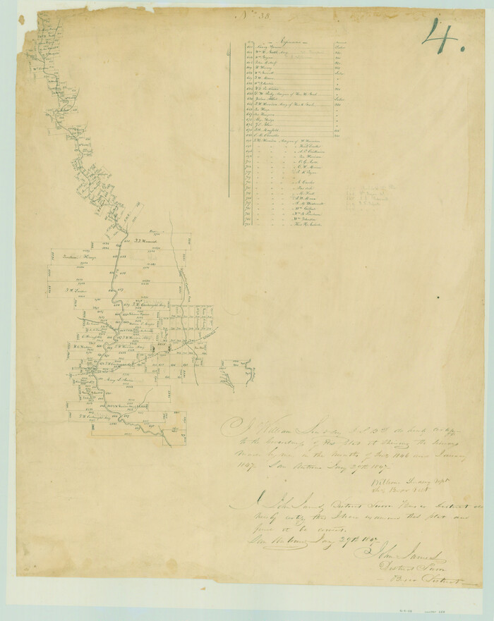
Edwards County Sketch File 4

Print $5.00
- Digital $50.00
Edwards County Sketch File 4
Size: 9.5 x 11.0 inches
21680
Edwards County Sketch File 5

Print $5.00
- Digital $50.00
Edwards County Sketch File 5
Size: 9.0 x 3.9 inches
21682
Edwards County Sketch File 11

Print $26.00
- Digital $50.00
Edwards County Sketch File 11
1887
Size: 13.7 x 8.8 inches
21687
Edwards County Sketch File 22

Print $8.00
- Digital $50.00
Edwards County Sketch File 22
1890
Size: 14.4 x 8.9 inches
21743
Edwards County Sketch File 27

Print $6.00
- Digital $50.00
Edwards County Sketch File 27
1913
Size: 10.5 x 16.5 inches
21755
[Surveys in the Bexar District along the Frio River and Commanche [sic] Creek]
Print $20.00
- Digital $50.00
[Surveys in the Bexar District along the Frio River and Commanche [sic] Creek]
1846
Size: 23.8 x 18.9 inches
228
Real County Sketch File 1

Print $6.00
- Digital $50.00
Real County Sketch File 1
1857
Size: 8.2 x 9.6 inches
35035
Real County Sketch File 2

Print $4.00
- Digital $50.00
Real County Sketch File 2
1884
Size: 13.4 x 8.5 inches
35037
Real County Sketch File 3

Print $16.00
- Digital $50.00
Real County Sketch File 3
1906
Size: 9.2 x 8.2 inches
35039
Real County Sketch File 4

Print $16.00
- Digital $50.00
Real County Sketch File 4
1913
Size: 7.3 x 8.9 inches
35047
Real County Sketch File 7

Print $8.00
- Digital $50.00
Real County Sketch File 7
1931
Size: 11.3 x 8.8 inches
35055
Real County Sketch File 9

Print $8.00
- Digital $50.00
Real County Sketch File 9
1931
Size: 11.2 x 8.8 inches
35059
Real County Sketch File 10

Print $6.00
- Digital $50.00
Real County Sketch File 10
1932
Size: 10.3 x 15.0 inches
35063
Real County Sketch File 11

Print $8.00
- Digital $50.00
Real County Sketch File 11
1932
Size: 11.2 x 8.8 inches
35065
Real County Sketch File 15

Print $8.00
- Digital $50.00
Real County Sketch File 15
1933
Size: 14.3 x 8.6 inches
35069
Edwards County Sketch File 9
Print $20.00
- Digital $50.00
Edwards County Sketch File 9
-
Size
16.9 x 37.8 inches
-
Map/Doc
10443
Edwards County Sketch File A13
Print $20.00
- Digital $50.00
Edwards County Sketch File A13
1901
-
Size
22.8 x 46.6 inches
-
Map/Doc
10444
-
Creation Date
1901
Edwards County Sketch File 6
Print $20.00
- Digital $50.00
Edwards County Sketch File 6
1880
-
Size
11.7 x 19.6 inches
-
Map/Doc
11419
-
Creation Date
1880
Edwards County Sketch File 8
Print $20.00
- Digital $50.00
Edwards County Sketch File 8
-
Size
36.7 x 18.5 inches
-
Map/Doc
11420
Edwards County Sketch File A
Print $20.00
- Digital $50.00
Edwards County Sketch File A
-
Size
25.3 x 35.5 inches
-
Map/Doc
11448
Real County Sketch File 5
Print $20.00
- Digital $50.00
Real County Sketch File 5
-
Size
16.9 x 20.9 inches
-
Map/Doc
12228
Real County Sketch File 6
Print $20.00
- Digital $50.00
Real County Sketch File 6
1931
-
Size
17.3 x 19.6 inches
-
Map/Doc
12229
-
Creation Date
1931
Real County Sketch File 8
Print $20.00
- Digital $50.00
Real County Sketch File 8
1931
-
Size
19.5 x 21.6 inches
-
Map/Doc
12230
-
Creation Date
1931
Real County Sketch File 12
Print $20.00
- Digital $50.00
Real County Sketch File 12
1932
-
Size
13.9 x 19.2 inches
-
Map/Doc
12231
-
Creation Date
1932
Real County Sketch File 13
Print $20.00
- Digital $50.00
Real County Sketch File 13
-
Size
23.2 x 17.9 inches
-
Map/Doc
12232
Real County Sketch File 14
Print $20.00
- Digital $50.00
Real County Sketch File 14
1933
-
Size
16.5 x 16.7 inches
-
Map/Doc
12233
-
Creation Date
1933
Real County Sketch File 16
Print $20.00
- Digital $50.00
Real County Sketch File 16
1934
-
Size
23.1 x 22.1 inches
-
Map/Doc
12234
-
Creation Date
1934
Uvalde County Sketch File 20a
Print $20.00
- Digital $50.00
Uvalde County Sketch File 20a
1911
-
Size
22.7 x 23.8 inches
-
Map/Doc
12532
-
Creation Date
1911
Bandera County Sketch File 35
Print $2.00
- Digital $50.00
Bandera County Sketch File 35
-
Size
11.2 x 8.7 inches
-
Map/Doc
14033
Real Co.

Print $20.00
- Digital $50.00
Real Co.
1915
-
Size
43.9 x 31.7 inches
-
Map/Doc
16795
-
Creation Date
1915
Edwards County Sketch File 4
Print $5.00
- Digital $50.00
Edwards County Sketch File 4
-
Size
9.5 x 11.0 inches
-
Map/Doc
21680
Edwards County Sketch File 5
Print $5.00
- Digital $50.00
Edwards County Sketch File 5
-
Size
9.0 x 3.9 inches
-
Map/Doc
21682
Edwards County Sketch File 11
Print $26.00
- Digital $50.00
Edwards County Sketch File 11
1887
-
Size
13.7 x 8.8 inches
-
Map/Doc
21687
-
Creation Date
1887
Edwards County Sketch File 22
Print $8.00
- Digital $50.00
Edwards County Sketch File 22
1890
-
Size
14.4 x 8.9 inches
-
Map/Doc
21743
-
Creation Date
1890
Edwards County Sketch File 27
Print $6.00
- Digital $50.00
Edwards County Sketch File 27
1913
-
Size
10.5 x 16.5 inches
-
Map/Doc
21755
-
Creation Date
1913
[Surveys in the Bexar District along the Frio River and Commanche [sic] Creek]
Print $20.00
- Digital $50.00
[Surveys in the Bexar District along the Frio River and Commanche [sic] Creek]
1846
-
Size
23.8 x 18.9 inches
-
Map/Doc
228
-
Creation Date
1846
Real County Sketch File 1
Print $6.00
- Digital $50.00
Real County Sketch File 1
1857
-
Size
8.2 x 9.6 inches
-
Map/Doc
35035
-
Creation Date
1857
Real County Sketch File 2
Print $4.00
- Digital $50.00
Real County Sketch File 2
1884
-
Size
13.4 x 8.5 inches
-
Map/Doc
35037
-
Creation Date
1884
Real County Sketch File 3
Print $16.00
- Digital $50.00
Real County Sketch File 3
1906
-
Size
9.2 x 8.2 inches
-
Map/Doc
35039
-
Creation Date
1906
Real County Sketch File 4
Print $16.00
- Digital $50.00
Real County Sketch File 4
1913
-
Size
7.3 x 8.9 inches
-
Map/Doc
35047
-
Creation Date
1913
Real County Sketch File 7
Print $8.00
- Digital $50.00
Real County Sketch File 7
1931
-
Size
11.3 x 8.8 inches
-
Map/Doc
35055
-
Creation Date
1931
Real County Sketch File 9
Print $8.00
- Digital $50.00
Real County Sketch File 9
1931
-
Size
11.2 x 8.8 inches
-
Map/Doc
35059
-
Creation Date
1931
Real County Sketch File 10
Print $6.00
- Digital $50.00
Real County Sketch File 10
1932
-
Size
10.3 x 15.0 inches
-
Map/Doc
35063
-
Creation Date
1932
Real County Sketch File 11
Print $8.00
- Digital $50.00
Real County Sketch File 11
1932
-
Size
11.2 x 8.8 inches
-
Map/Doc
35065
-
Creation Date
1932
Real County Sketch File 15
Print $8.00
- Digital $50.00
Real County Sketch File 15
1933
-
Size
14.3 x 8.6 inches
-
Map/Doc
35069
-
Creation Date
1933