Bandera County Rolled Sketch 9

Print $20.00
- Digital $50.00
Bandera County Rolled Sketch 9
Size: 21.2 x 24.2 inches
5120
Bandera County Sketch File 35

Print $2.00
- Digital $50.00
Bandera County Sketch File 35
Size: 11.2 x 8.7 inches
14033
Bandera County Working Sketch 33

Print $20.00
- Digital $50.00
Bandera County Working Sketch 33
1961
Size: 22.4 x 28.8 inches
67629
Bandera County Working Sketch 50

Print $20.00
- Digital $50.00
Bandera County Working Sketch 50
1985
Size: 34.1 x 31.6 inches
67646
Bandera County Working Sketch 57

Print $20.00
- Digital $50.00
Bandera County Working Sketch 57
1991
Size: 38.5 x 46.8 inches
67653
Bandera County Working Sketch 9

Print $20.00
- Digital $50.00
Bandera County Working Sketch 9
1920
Size: 15.2 x 17.1 inches
67602
Edwards County Sketch File 11

Print $26.00
- Digital $50.00
Edwards County Sketch File 11
1887
Size: 13.7 x 8.8 inches
21687
Edwards County Sketch File 22

Print $8.00
- Digital $50.00
Edwards County Sketch File 22
1890
Size: 14.4 x 8.9 inches
21743
Edwards County Sketch File 27

Print $6.00
- Digital $50.00
Edwards County Sketch File 27
1913
Size: 10.5 x 16.5 inches
21755
Edwards County Sketch File 4

Print $5.00
- Digital $50.00
Edwards County Sketch File 4
Size: 9.5 x 11.0 inches
21680
Edwards County Sketch File 5

Print $5.00
- Digital $50.00
Edwards County Sketch File 5
Size: 9.0 x 3.9 inches
21682
Edwards County Sketch File 6

Print $20.00
- Digital $50.00
Edwards County Sketch File 6
1880
Size: 11.7 x 19.6 inches
11419
Edwards County Sketch File 8

Print $20.00
- Digital $50.00
Edwards County Sketch File 8
Size: 36.7 x 18.5 inches
11420
Edwards County Sketch File 9

Print $20.00
- Digital $50.00
Edwards County Sketch File 9
Size: 16.9 x 37.8 inches
10443
Edwards County Sketch File A

Print $20.00
- Digital $50.00
Edwards County Sketch File A
Size: 25.3 x 35.5 inches
11448
Edwards County Sketch File A13

Print $20.00
- Digital $50.00
Edwards County Sketch File A13
1901
Size: 22.8 x 46.6 inches
10444
Edwards County Working Sketch 31

Print $20.00
- Digital $50.00
Edwards County Working Sketch 31
1947
Size: 33.5 x 47.5 inches
68907
Edwards County Working Sketch 35

Print $20.00
- Digital $50.00
Edwards County Working Sketch 35
1948
Size: 20.9 x 31.1 inches
68911
Edwards County Working Sketch 53

Print $40.00
- Digital $50.00
Edwards County Working Sketch 53
1951
Size: 40.8 x 48.5 inches
68929
Edwards County Working Sketch 62

Print $20.00
- Digital $50.00
Edwards County Working Sketch 62
1955
Size: 21.7 x 28.5 inches
68938
General Highway Map, Edwards County, Real County, Texas

Print $20.00
General Highway Map, Edwards County, Real County, Texas
1940
Size: 18.3 x 24.8 inches
79082
General Highway Map, Edwards County, Real County, Texas

Print $20.00
General Highway Map, Edwards County, Real County, Texas
1961
Size: 18.1 x 24.7 inches
79452
Nueces River, Water Shed [of the Nueces River]
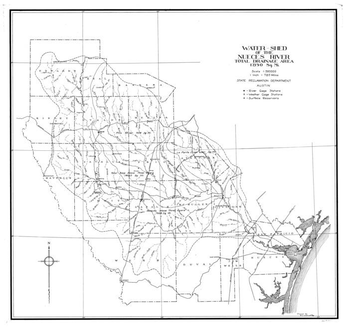
Print $6.00
- Digital $50.00
Nueces River, Water Shed [of the Nueces River]
1925
Size: 33.6 x 35.4 inches
65101
Real County Boundary File 1

Print $8.00
- Digital $50.00
Real County Boundary File 1
Size: 9.3 x 5.9 inches
58191
Bandera County Rolled Sketch 9
Print $20.00
- Digital $50.00
Bandera County Rolled Sketch 9
-
Size
21.2 x 24.2 inches
-
Map/Doc
5120
Bandera County Sketch File 35
Print $2.00
- Digital $50.00
Bandera County Sketch File 35
-
Size
11.2 x 8.7 inches
-
Map/Doc
14033
Bandera County Working Sketch 33
Print $20.00
- Digital $50.00
Bandera County Working Sketch 33
1961
-
Size
22.4 x 28.8 inches
-
Map/Doc
67629
-
Creation Date
1961
Bandera County Working Sketch 50
Print $20.00
- Digital $50.00
Bandera County Working Sketch 50
1985
-
Size
34.1 x 31.6 inches
-
Map/Doc
67646
-
Creation Date
1985
Bandera County Working Sketch 57
Print $20.00
- Digital $50.00
Bandera County Working Sketch 57
1991
-
Size
38.5 x 46.8 inches
-
Map/Doc
67653
-
Creation Date
1991
Bandera County Working Sketch 9
Print $20.00
- Digital $50.00
Bandera County Working Sketch 9
1920
-
Size
15.2 x 17.1 inches
-
Map/Doc
67602
-
Creation Date
1920
Edwards County Sketch File 11
Print $26.00
- Digital $50.00
Edwards County Sketch File 11
1887
-
Size
13.7 x 8.8 inches
-
Map/Doc
21687
-
Creation Date
1887
Edwards County Sketch File 22
Print $8.00
- Digital $50.00
Edwards County Sketch File 22
1890
-
Size
14.4 x 8.9 inches
-
Map/Doc
21743
-
Creation Date
1890
Edwards County Sketch File 27
Print $6.00
- Digital $50.00
Edwards County Sketch File 27
1913
-
Size
10.5 x 16.5 inches
-
Map/Doc
21755
-
Creation Date
1913
Edwards County Sketch File 4
Print $5.00
- Digital $50.00
Edwards County Sketch File 4
-
Size
9.5 x 11.0 inches
-
Map/Doc
21680
Edwards County Sketch File 5
Print $5.00
- Digital $50.00
Edwards County Sketch File 5
-
Size
9.0 x 3.9 inches
-
Map/Doc
21682
Edwards County Sketch File 6
Print $20.00
- Digital $50.00
Edwards County Sketch File 6
1880
-
Size
11.7 x 19.6 inches
-
Map/Doc
11419
-
Creation Date
1880
Edwards County Sketch File 8
Print $20.00
- Digital $50.00
Edwards County Sketch File 8
-
Size
36.7 x 18.5 inches
-
Map/Doc
11420
Edwards County Sketch File 9
Print $20.00
- Digital $50.00
Edwards County Sketch File 9
-
Size
16.9 x 37.8 inches
-
Map/Doc
10443
Edwards County Sketch File A
Print $20.00
- Digital $50.00
Edwards County Sketch File A
-
Size
25.3 x 35.5 inches
-
Map/Doc
11448
Edwards County Sketch File A13
Print $20.00
- Digital $50.00
Edwards County Sketch File A13
1901
-
Size
22.8 x 46.6 inches
-
Map/Doc
10444
-
Creation Date
1901
Edwards County Working Sketch 31
Print $20.00
- Digital $50.00
Edwards County Working Sketch 31
1947
-
Size
33.5 x 47.5 inches
-
Map/Doc
68907
-
Creation Date
1947
Edwards County Working Sketch 35
Print $20.00
- Digital $50.00
Edwards County Working Sketch 35
1948
-
Size
20.9 x 31.1 inches
-
Map/Doc
68911
-
Creation Date
1948
Edwards County Working Sketch 53
Print $40.00
- Digital $50.00
Edwards County Working Sketch 53
1951
-
Size
40.8 x 48.5 inches
-
Map/Doc
68929
-
Creation Date
1951
Edwards County Working Sketch 62
Print $20.00
- Digital $50.00
Edwards County Working Sketch 62
1955
-
Size
21.7 x 28.5 inches
-
Map/Doc
68938
-
Creation Date
1955
General Highway Map, Edwards County, Real County, Texas
Print $20.00
General Highway Map, Edwards County, Real County, Texas
1940
-
Size
18.3 x 24.8 inches
-
Map/Doc
79082
-
Creation Date
1940
General Highway Map, Edwards County, Real County, Texas
Print $20.00
General Highway Map, Edwards County, Real County, Texas
1961
-
Size
18.1 x 24.7 inches
-
Map/Doc
79452
-
Creation Date
1961
Nueces River, Water Shed [of the Nueces River]
Print $6.00
- Digital $50.00
Nueces River, Water Shed [of the Nueces River]
1925
-
Size
33.6 x 35.4 inches
-
Map/Doc
65101
-
Creation Date
1925
Real Co.

Print $20.00
- Digital $50.00
Real Co.
1915
-
Size
43.9 x 31.7 inches
-
Map/Doc
16795
-
Creation Date
1915
Real Co.

Print $20.00
- Digital $50.00
Real Co.
1915
-
Size
43.4 x 32.2 inches
-
Map/Doc
66991
-
Creation Date
1915
Real County

Print $20.00
- Digital $50.00
Real County
1915
-
Size
42.9 x 31.2 inches
-
Map/Doc
66992
-
Creation Date
1915
Real County

Print $20.00
- Digital $50.00
Real County
1972
-
Size
44.4 x 32.1 inches
-
Map/Doc
73271
-
Creation Date
1972
Real County

Print $20.00
- Digital $50.00
Real County
1972
-
Size
42.8 x 31.3 inches
-
Map/Doc
77404
-
Creation Date
1972
Real County

Print $20.00
- Digital $50.00
Real County
1972
-
Size
45.4 x 33.1 inches
-
Map/Doc
95622
-
Creation Date
1972
Real County Boundary File 1
Print $8.00
- Digital $50.00
Real County Boundary File 1
-
Size
9.3 x 5.9 inches
-
Map/Doc
58191