23 results

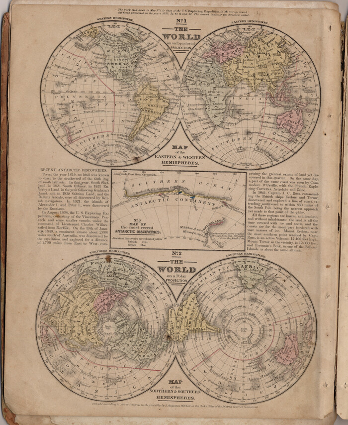
The World on an Equatorial Projection, Map of the Eastern and Western Hemispheres / The World on a Polar Projection, Map of the Northern and Southern Hemispheres / Inset: Map of the most recent Antarctic Discoveries
93492.tif
Print $20.00 - Digital $50.00

The World on an Equatorial Projection, Map of the Eastern and Western Hemispheres / The World on a Polar Projection, Map of the Northern and Southern Hemispheres / Inset: Map of the most recent Antarctic Discoveries

1839
Size: 11.8 x 9.5 inches
93492
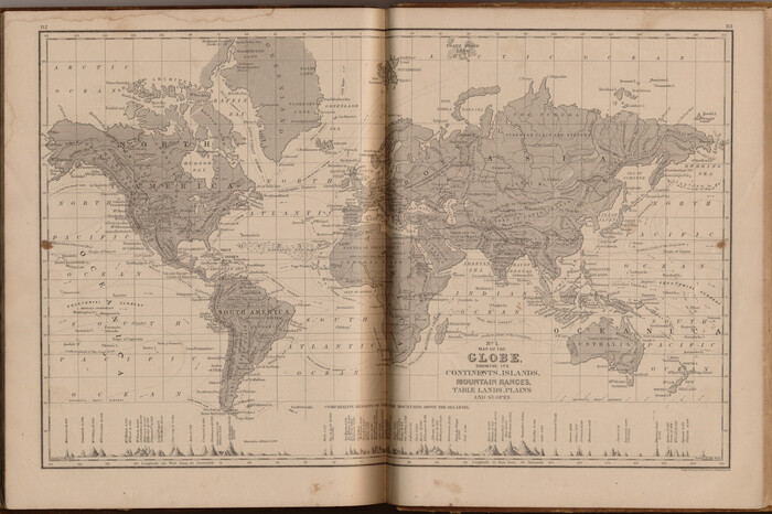
Map of the Globe showing its continents, islands, mountain ranges, table lands, plains and slopes
93532.tif
Print $20.00 - Digital $50.00

Map of the Globe showing its continents, islands, mountain ranges, table lands, plains and slopes

1885

Size: 12.2 x 18.5 inches
93532
Map of the World on a Globular Projection to illustrate Olney's school geography
93535.tif
Print $20.00 - Digital $50.00

Map of the World on a Globular Projection to illustrate Olney's school geography

1844

Size: 12.1 x 19.0 inches
93535
Map of the World: and chart exhibiting the size of each country, nation or kingdom, its population as a whole and to a square mile also the different states of society, forms of government, religion &c.
93882.tif
Print $20.00 - Digital $50.00

Map of the World: and chart exhibiting the size of each country, nation or kingdom, its population as a whole and to a square mile also the different states of society, forms of government, religion &c.

1850

Size: 12.2 x 19.4 inches
93882
Map of the World on Mercator's Projection, flags of all nations and cities of the United States
93914.tif
Print $40.00 - Digital $50.00

Map of the World on Mercator's Projection, flags of all nations and cities of the United States

1874

Size: 40.4 x 55.6 inches
93914
New Map of that portion of North America, exhibiting the United States and Territories, the Canadas, New Brunswick, Nova Scotia and Mexico, also Central America and the West India Islands compiled from the most recent surveys and authentic sources
93968.tif
Print $40.00 - Digital $50.00

New Map of that portion of North America, exhibiting the United States and Territories, the Canadas, New Brunswick, Nova Scotia and Mexico, also Central America and the West India Islands compiled from the most recent surveys and authentic sources

1854
Size: 59.4 x 63.0 inches
93968
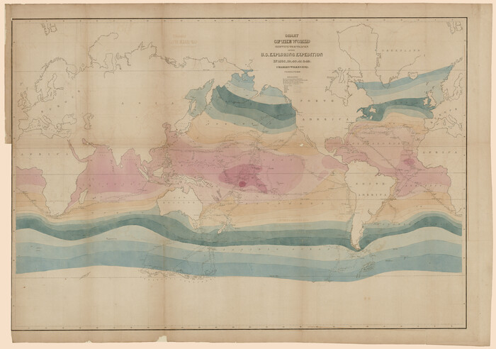
Chart of the World shewing the tracks of the U.S. Exploring Expedition in 1833, 39, 40, 41 & 42
94057.tif
Print $20.00 - Digital $50.00

Chart of the World shewing the tracks of the U.S. Exploring Expedition in 1833, 39, 40, 41 & 42

1842
Size: 26.3 x 37.4 inches
94057
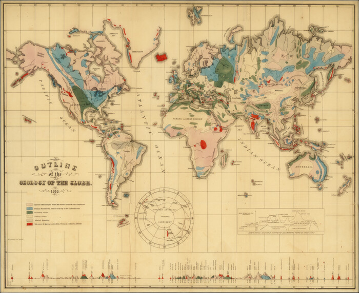
Outline of the Geology of the Globe
95282.tif
Print $20.00

Outline of the Geology of the Globe

1853
Size: 19.3 x 23.6 inches
95282
Millennium in Maps - Exploration
95931.tif

Millennium in Maps - Exploration

Size: 20.6 x 31.5 inches
95931
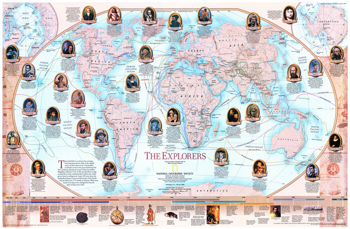
The Explorers
95932.tif

The Explorers

Size: 20.6 x 31.6 inches
95932
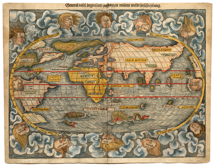
General tafel begreifend der gantzen undern weldt beschrenbung
96566.tif
Print $20.00 - Digital $50.00

General tafel begreifend der gantzen undern weldt beschrenbung

1545

Size: 11.3 x 14.7 inches
96566
Diefert Situs Orbis Hydrographorum ab eo quem Ptolomeus Posuit
96578.tif
Print $20.00 - Digital $50.00

Diefert Situs Orbis Hydrographorum ab eo quem Ptolomeus Posuit

1522

Size: 13.9 x 19.1 inches
96578
Typus Orbis Terrarum
96579.tif
Print $20.00 - Digital $50.00

Typus Orbis Terrarum

Size: 15.2 x 20.8 inches
96579
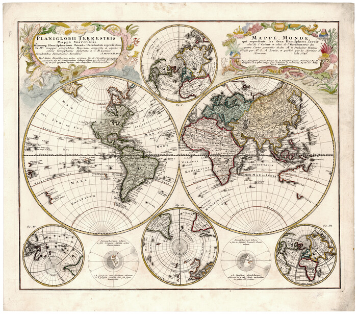
Planiglobii Terrestris Mappa Universalis Utrumqs Hemisphaerium Orient et Occidentale
96580.tif
Print $20.00 - Digital $50.00

Planiglobii Terrestris Mappa Universalis Utrumqs Hemisphaerium Orient et Occidentale

Size: 21.4 x 24.4 inches
96580
Carta Marina Nvova Tavola
97081.tif
Print $20.00 - Digital $50.00

Carta Marina Nvova Tavola

1574

Size: 9.0 x 12.4 inches
97081
Voyages Autour du Monde, et vers les deux poles par terre et par mer - Tome Premier
97085, Voyages Autour du Monde, et vers les deux poles par terre et par mer - Tome Premier

Voyages Autour du Monde, et vers les deux poles par terre et par mer - Tome Premier

1782

97085
Voyages Autour du Monde, et vers les deux poles par terre et par mer - Tome Second
97086, Voyages Autour du Monde, et vers les deux poles par terre et par mer - Tome Second

Voyages Autour du Monde, et vers les deux poles par terre et par mer - Tome Second

1782
97086
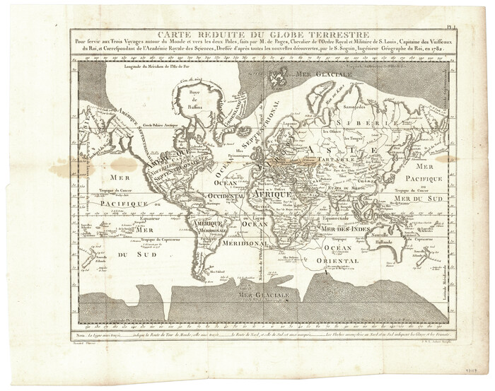
Carte Reduite du Globe Terrestre
97117.tif
Print $20.00 - Digital $50.00

Carte Reduite du Globe Terrestre

1782

Size: 13.5 x 17.1 inches
97117
Origin of Imports and Destination of Exports at Texas City, Tex., during 1921
97163.tif
Print $20.00 - Digital $50.00

Origin of Imports and Destination of Exports at Texas City, Tex., during 1921

1921

Size: 13.4 x 24.9 inches
97163
Origin of Imports and Destination of Exports at Galveston, Tex., during 1921
97169.tif
Print $20.00 - Digital $50.00

Origin of Imports and Destination of Exports at Galveston, Tex., during 1921

1921

Size: 13.1 x 24.6 inches
97169
Origins of Imports and Destination of Exports at Houston, Tex., during 1921
97171.tif
Print $20.00 - Digital $50.00

Origins of Imports and Destination of Exports at Houston, Tex., during 1921

1921
Size: 14.2 x 23.1 inches
97171
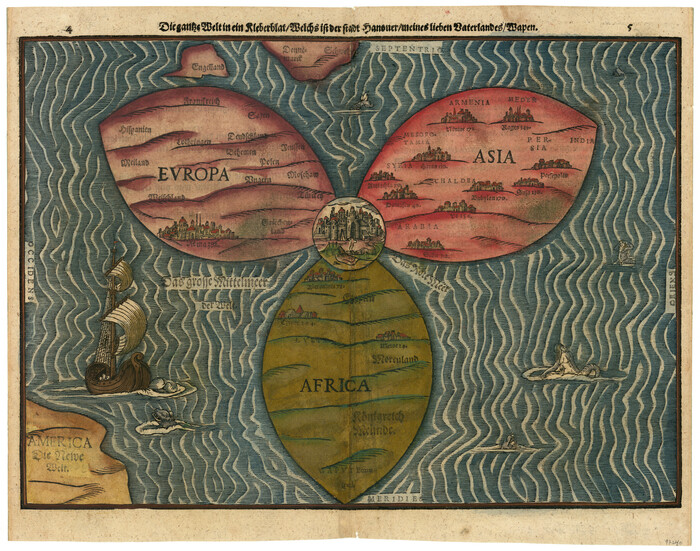
Die gantze Welt in ein Kleberblat, welches in der Stadt Hannover, meines lieben Vaterlandes Wapen
97240-1.tif
Print $20.00 - Digital $50.00

Die gantze Welt in ein Kleberblat, welches in der Stadt Hannover, meines lieben Vaterlandes Wapen

1581

Size: 11.9 x 15.2 inches
97240
A New Chart of the World on Mercator's Projection: Exhibiting the Tracks & Discoveries of the most Eminent Navigators, to the Present Period
97249.tif
Print $20.00 - Digital $50.00

A New Chart of the World on Mercator's Projection: Exhibiting the Tracks & Discoveries of the most Eminent Navigators, to the Present Period

1801

Size: 20.0 x 22.4 inches
97249
The World on an Equatorial Projection, Map of the Eastern and Western Hemispheres / The World on a Polar Projection, Map of the Northern and Southern Hemispheres / Inset: Map of the most recent Antarctic Discoveries
93492, The World on an Equatorial Projection, Map of the Eastern and Western Hemispheres / The World on a Polar Projection, Map of the Northern and Southern Hemispheres / Inset: Map of the most recent Antarctic Discoveries, General Map Collection
Print $20.00 - Digital $50.00

The World on an Equatorial Projection, Map of the Eastern and Western Hemispheres / The World on a Polar Projection, Map of the Northern and Southern Hemispheres / Inset: Map of the most recent Antarctic Discoveries

1839

  • Size

    11.8 x 9.5 inches

  • Map/Doc

    93492

  • Creation Date

    1839

Map of the Globe showing its continents, islands, mountain ranges, table lands, plains and slopes
93532, Map of the Globe showing its continents, islands, mountain ranges, table lands, plains and slopes, General Map Collection
Print $20.00 - Digital $50.00

Map of the Globe showing its continents, islands, mountain ranges, table lands, plains and slopes

1885

  • Size

    12.2 x 18.5 inches

  • Map/Doc

    93532

  • Creation Date

    1885

Map of the World on a Globular Projection to illustrate Olney's school geography
93535, Map of the World on a Globular Projection to illustrate Olney's school geography, General Map Collection
Print $20.00 - Digital $50.00

Map of the World on a Globular Projection to illustrate Olney's school geography

1844

  • Size

    12.1 x 19.0 inches

  • Map/Doc

    93535

  • Creation Date

    1844

Map of the World: and chart exhibiting the size of each country, nation or kingdom, its population as a whole and to a square mile also the different states of society, forms of government, religion &c.
93882, Map of the World: and chart exhibiting the size of each country, nation or kingdom, its population as a whole and to a square mile also the different states of society, forms of government, religion &c., Holcomb Digital Map Collection
Print $20.00 - Digital $50.00

Map of the World: and chart exhibiting the size of each country, nation or kingdom, its population as a whole and to a square mile also the different states of society, forms of government, religion &c.

1850

  • Size

    12.2 x 19.4 inches

  • Map/Doc

    93882

  • Creation Date

    1850

Map of the World on Mercator's Projection, flags of all nations and cities of the United States
93914, Map of the World on Mercator's Projection, flags of all nations and cities of the United States, Holcomb Digital Map Collection
Print $40.00 - Digital $50.00

Map of the World on Mercator's Projection, flags of all nations and cities of the United States

1874

  • Size

    40.4 x 55.6 inches

  • Map/Doc

    93914

  • Creation Date

    1874

New Map of that portion of North America, exhibiting the United States and Territories, the Canadas, New Brunswick, Nova Scotia and Mexico, also Central America and the West India Islands compiled from the most recent surveys and authentic sources
93968, New Map of that portion of North America, exhibiting the United States and Territories, the Canadas, New Brunswick, Nova Scotia and Mexico, also Central America and the West India Islands compiled from the most recent surveys and authentic sources, General Map Collection
Print $40.00 - Digital $50.00

New Map of that portion of North America, exhibiting the United States and Territories, the Canadas, New Brunswick, Nova Scotia and Mexico, also Central America and the West India Islands compiled from the most recent surveys and authentic sources

1854

  • Size

    59.4 x 63.0 inches

  • Map/Doc

    93968

  • Creation Date

    1854

Chart of the World shewing the tracks of the U.S. Exploring Expedition in 1833, 39, 40, 41 & 42
94057, Chart of the World shewing the tracks of the U.S. Exploring Expedition in 1833, 39, 40, 41 & 42, Rees-Jones Digital Map Collection
Print $20.00 - Digital $50.00

Chart of the World shewing the tracks of the U.S. Exploring Expedition in 1833, 39, 40, 41 & 42

1842

  • Size

    26.3 x 37.4 inches

  • Map/Doc

    94057

  • Creation Date

    1842

Outline of the Geology of the Globe
95282, Outline of the Geology of the Globe, Non-GLO Digital Images
Print $20.00

Outline of the Geology of the Globe

1853

  • Size

    19.3 x 23.6 inches

  • Map/Doc

    95282

  • Creation Date

    1853

Millennium in Maps - Exploration
95931, Millennium in Maps - Exploration, General Map Collection

Millennium in Maps - Exploration

  • Size

    20.6 x 31.5 inches

  • Map/Doc

    95931

The Explorers
95932, The Explorers, General Map Collection

The Explorers

  • Size

    20.6 x 31.6 inches

  • Map/Doc

    95932

General tafel begreifend der gantzen undern weldt beschrenbung
96566, General tafel begreifend der gantzen undern weldt beschrenbung, General Map Collection - 1
Print $20.00 - Digital $50.00

General tafel begreifend der gantzen undern weldt beschrenbung

1545

  • Size

    11.3 x 14.7 inches

  • Map/Doc

    96566

  • Creation Date

    1545

Diefert Situs Orbis Hydrographorum ab eo quem Ptolomeus Posuit
96578, Diefert Situs Orbis Hydrographorum ab eo quem Ptolomeus Posuit, General Map Collection - 1
Print $20.00 - Digital $50.00

Diefert Situs Orbis Hydrographorum ab eo quem Ptolomeus Posuit

1522

From the 1525 edition of "Claudii Ptolemaei Alexandrini Geographicae", first published in 1522.

  • Size

    13.9 x 19.1 inches

  • Map/Doc

    96578

  • Creation Date

    1522

Typus Orbis Terrarum
96579, Typus Orbis Terrarum, General Map Collection
Print $20.00 - Digital $50.00

Typus Orbis Terrarum

  • Size

    15.2 x 20.8 inches

  • Map/Doc

    96579

Planiglobii Terrestris Mappa Universalis Utrumqs Hemisphaerium Orient et Occidentale
96580, Planiglobii Terrestris Mappa Universalis Utrumqs Hemisphaerium Orient et Occidentale, General Map Collection
Print $20.00 - Digital $50.00

Planiglobii Terrestris Mappa Universalis Utrumqs Hemisphaerium Orient et Occidentale

  • Size

    21.4 x 24.4 inches

  • Map/Doc

    96580

Carta Marina Nvova Tavola
97081, Carta Marina Nvova Tavola - 97081, Carta Marina Nvova Tavola, General Map Collection
Print $20.00 - Digital $50.00

Carta Marina Nvova Tavola

1574

  • Size

    9.0 x 12.4 inches

  • Map/Doc

    97081

  • Creation Date

    1574

Voyages Autour du Monde, et vers les deux poles par terre et par mer - Tome Premier
97085, Voyages Autour du Monde, et vers les deux poles par terre et par mer - Tome Premier

Voyages Autour du Monde, et vers les deux poles par terre et par mer - Tome Premier

1782

Volume 1 of 2

  • Map/Doc

    97085

  • Creation Date

    1782

Voyages Autour du Monde, et vers les deux poles par terre et par mer - Tome Second
97086, Voyages Autour du Monde, et vers les deux poles par terre et par mer - Tome Second

Voyages Autour du Monde, et vers les deux poles par terre et par mer - Tome Second

1782

Volume 2 of 2

  • Map/Doc

    97086

  • Creation Date

    1782

Carte Reduite du Globe Terrestre
97117, Carte Reduite du Globe Terrestre, General Map Collection
Print $20.00 - Digital $50.00

Carte Reduite du Globe Terrestre

1782

Pour servir aux Trois Voyages autour du Monde et vers les deux Poles, faits par M. de Pages,...

  • Size

    13.5 x 17.1 inches

  • Map/Doc

    97117

  • Creation Date

    1782

Origin of Imports and Destination of Exports at Texas City, Tex., during 1921
97163, Origin of Imports and Destination of Exports at Texas City, Tex., during 1921, General Map Collection
Print $20.00 - Digital $50.00

Origin of Imports and Destination of Exports at Texas City, Tex., during 1921

1921

  • Size

    13.4 x 24.9 inches

  • Map/Doc

    97163

  • Creation Date

    1921

Origin of Imports and Destination of Exports at Galveston, Tex., during 1921
97169, Origin of Imports and Destination of Exports at Galveston, Tex., during 1921, General Map Collection
Print $20.00 - Digital $50.00

Origin of Imports and Destination of Exports at Galveston, Tex., during 1921

1921

  • Size

    13.1 x 24.6 inches

  • Map/Doc

    97169

  • Creation Date

    1921

Origins of Imports and Destination of Exports at Houston, Tex., during 1921
97171, Origins of Imports and Destination of Exports at Houston, Tex., during 1921, General Map Collection
Print $20.00 - Digital $50.00

Origins of Imports and Destination of Exports at Houston, Tex., during 1921

1921

  • Size

    14.2 x 23.1 inches

  • Map/Doc

    97171

  • Creation Date

    1921

Die gantze Welt in ein Kleberblat, welches in der Stadt Hannover, meines lieben Vaterlandes Wapen
97240, Die gantze Welt in ein Kleberblat, welches in der Stadt Hannover, meines lieben Vaterlandes Wapen, General Map Collection
Print $20.00 - Digital $50.00

Die gantze Welt in ein Kleberblat, welches in der Stadt Hannover, meines lieben Vaterlandes Wapen

1581

  • Size

    11.9 x 15.2 inches

  • Map/Doc

    97240

  • Creation Date

    1581

A New Chart of the World on Mercator's Projection: Exhibiting the Tracks & Discoveries of the most Eminent Navigators, to the Present Period
97249, A New Chart of the World on Mercator's Projection: Exhibiting the Tracks & Discoveries of the most Eminent Navigators, to the Present Period, Non-GLO Digital Images
Print $20.00 - Digital $50.00

A New Chart of the World on Mercator's Projection: Exhibiting the Tracks & Discoveries of the most Eminent Navigators, to the Present Period

1801

  • Size

    20.0 x 22.4 inches

  • Map/Doc

    97249

  • Creation Date

    1801