
de Leon Empresario Colony. April 30, 1829
2020

de Leon Empresario Colony. April 15, 1824
2020
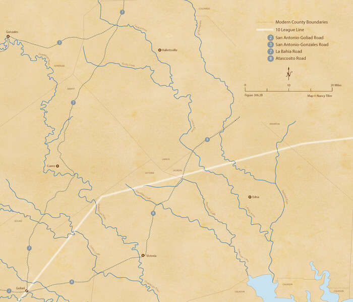
de Leon Empresario Colony. Absorbed by DeWitt Colony. April 15, 1825
2020

Zavala Empresario Colony. March 12, 1829
2020
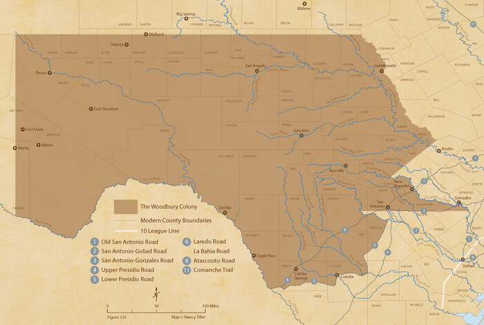
Woodbury Empresario Colony. November 14, 1826
2020
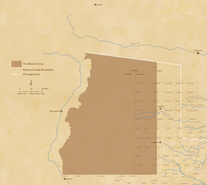
Wilson Empresario Colony. May 27, 1826
2020
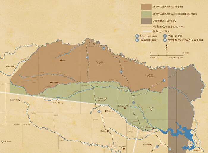
Wavell Empresario Colony. Proposed, March 9, 1826
2020
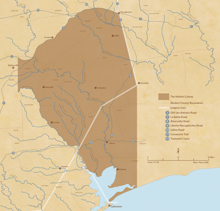
Vehlein and Company Empresario Colony. November 17, 1828
2020
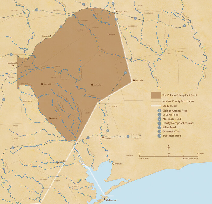
Vehlein and Company Empresario Colony. December 21, 1826
2020
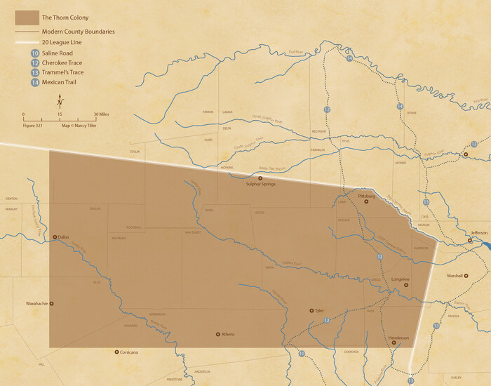
Thorn Empresario Colony. April 25, 1825
2020
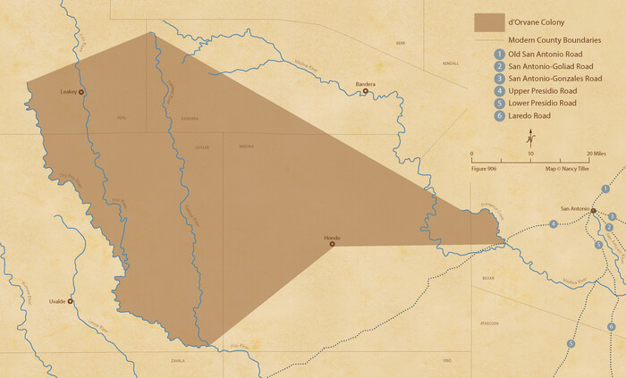
The d’Orvane Colony. June 3, 1842
2020
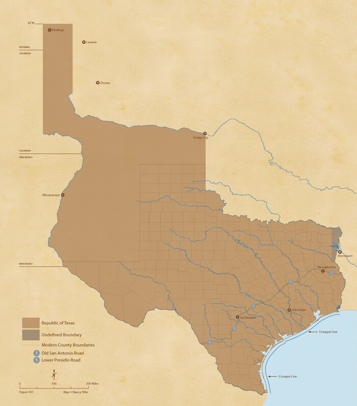
The Republic of Texas, Defined, December 19, 1836
2020
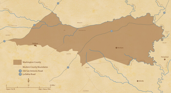
The Republic County of Washington. Spring 1842
2020

The Republic County of Washington. May 24, 1838
2020
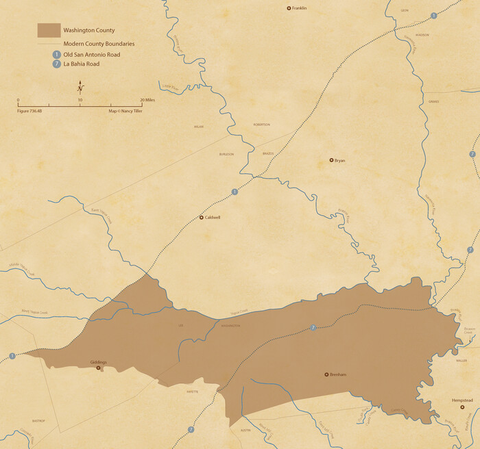
The Republic County of Washington. January 30, 1841
2020
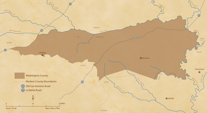
The Republic County of Washington. January 29, 1842
2020

The Republic County of Washington. January 15, 1842
2020
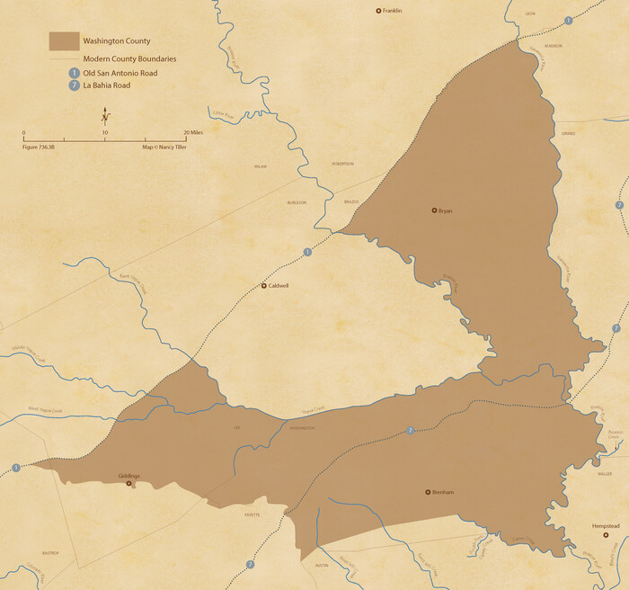
The Republic County of Washington. February 4, 1840
2020

The Republic County of Washington. February 1, 1844
2020

The Republic County of Washington. December 29, 1845
2020
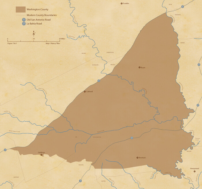
The Republic County of Washington. Boundaries Defined, December 14, 1837
2020
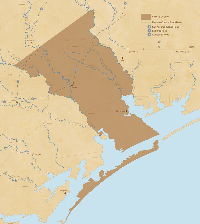
The Republic County of Victoria. Spring 1842
2020
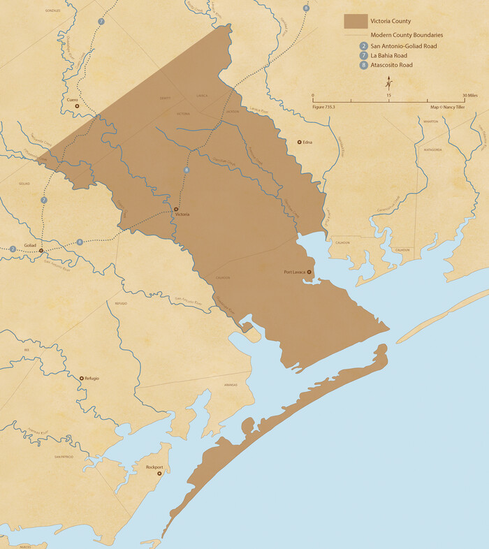
The Republic County of Victoria. September 18, 1838
2020
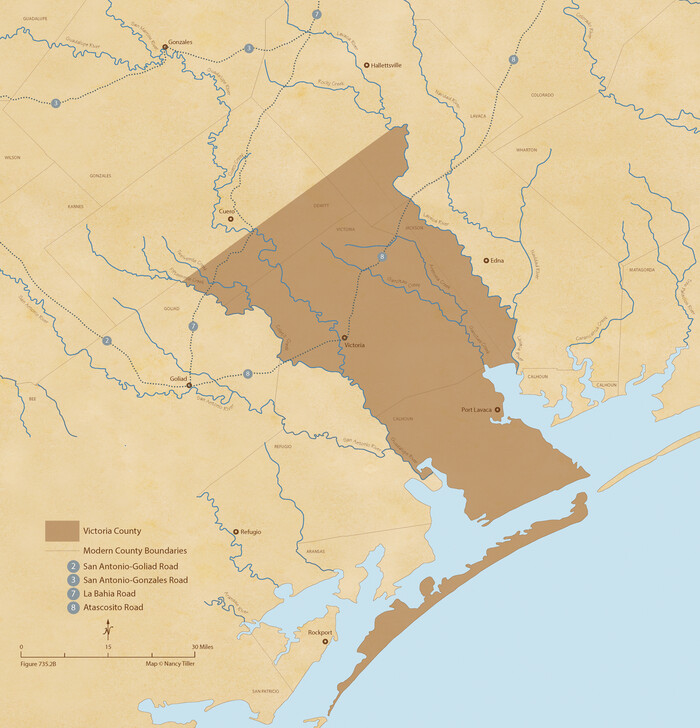
The Republic County of Victoria. Proposed, Late Fall 1837-September 18, 1838
2020

The Republic County of Victoria. Proposed, Late Fall 1837
2020
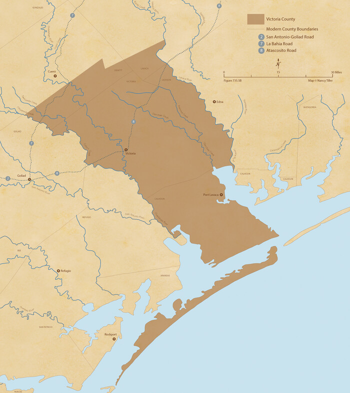
The Republic County of Victoria. January 29, 1842
2020

The Republic County of Victoria. February 2, 1842
2020
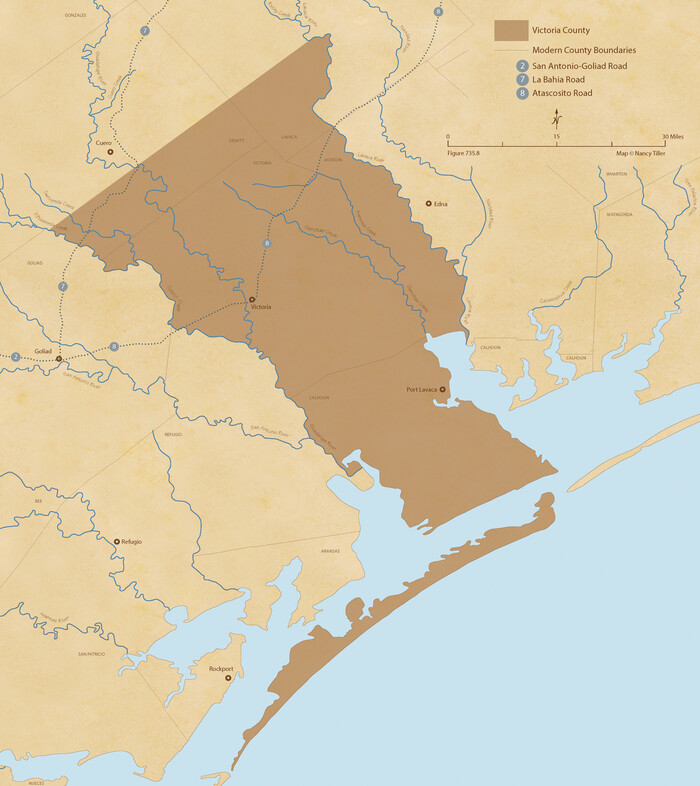
The Republic County of Victoria. December 29, 1845
2020
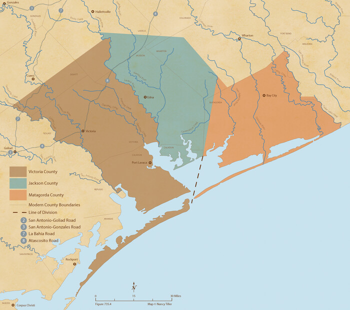
The Republic County of Victoria. Boundaries Refined, January 25, 1841
2020

The Republic County of Travis. Spring 1842
2020

de Leon Empresario Colony. April 30, 1829
2020
-
Size
18.5 x 21.7 inches
-
Map/Doc
95990
-
Creation Date
2020

de Leon Empresario Colony. April 15, 1824
2020
-
Size
18.5 x 21.7 inches
-
Map/Doc
95988
-
Creation Date
2020

de Leon Empresario Colony. Absorbed by DeWitt Colony. April 15, 1825
2020
-
Size
18.5 x 21.7 inches
-
Map/Doc
95989
-
Creation Date
2020

Zavala Empresario Colony. March 12, 1829
2020
-
Size
24.7 x 21.7 inches
-
Map/Doc
96012
-
Creation Date
2020

Woodbury Empresario Colony. November 14, 1826
2020
-
Size
14.7 x 21.8 inches
-
Map/Doc
96011
-
Creation Date
2020

Wilson Empresario Colony. May 27, 1826
2020
-
Size
19.4 x 21.6 inches
-
Map/Doc
96010
-
Creation Date
2020

Wavell Empresario Colony. Proposed, March 9, 1826
2020
-
Size
16.0 x 21.7 inches
-
Map/Doc
96009
-
Creation Date
2020

Vehlein and Company Empresario Colony. November 17, 1828
2020
-
Size
20.8 x 21.7 inches
-
Map/Doc
96008
-
Creation Date
2020

Vehlein and Company Empresario Colony. December 21, 1826
2020
-
Size
20.8 x 21.7 inches
-
Map/Doc
96007
-
Creation Date
2020

Thorn Empresario Colony. April 25, 1825
2020
-
Size
17.0 x 21.7 inches
-
Map/Doc
96006
-
Creation Date
2020

The d’Orvane Colony. June 3, 1842
2020
-
Size
13.1 x 21.7 inches
-
Map/Doc
96369
-
Creation Date
2020

The Republic of Texas, Defined, December 19, 1836
2020
-
Size
24.6 x 21.7 inches
-
Map/Doc
96036
-
Creation Date
2020

The Republic County of Washington. Spring 1842
2020
-
Size
11.8 x 21.7 inches
-
Map/Doc
96308
-
Creation Date
2020

The Republic County of Washington. May 24, 1838
2020
-
Size
20.3 x 21.7 inches
-
Map/Doc
96303
-
Creation Date
2020

The Republic County of Washington. January 30, 1841
2020
-
Size
20.3 x 21.7 inches
-
Map/Doc
96305
-
Creation Date
2020

The Republic County of Washington. January 29, 1842
2020
-
Size
11.8 x 21.7 inches
-
Map/Doc
96307
-
Creation Date
2020

The Republic County of Washington. January 15, 1842
2020
-
Size
11.8 x 21.7 inches
-
Map/Doc
96306
-
Creation Date
2020

The Republic County of Washington. February 4, 1840
2020
-
Size
20.3 x 21.7 inches
-
Map/Doc
96304
-
Creation Date
2020

The Republic County of Washington. February 1, 1844
2020
-
Size
11.8 x 21.7 inches
-
Map/Doc
96309
-
Creation Date
2020

The Republic County of Washington. December 29, 1845
2020
-
Size
11.8 x 21.7 inches
-
Map/Doc
96310
-
Creation Date
2020

The Republic County of Washington. Boundaries Defined, December 14, 1837
2020
-
Size
20.3 x 21.7 inches
-
Map/Doc
96302
-
Creation Date
2020

The Republic County of Victoria. Spring 1842
2020
-
Size
24.3 x 21.7 inches
-
Map/Doc
96300
-
Creation Date
2020

The Republic County of Victoria. September 18, 1838
2020
-
Size
24.3 x 21.7 inches
-
Map/Doc
96296
-
Creation Date
2020

The Republic County of Victoria. Proposed, Late Fall 1837-September 18, 1838
2020
-
Size
22.5 x 21.7 inches
-
Map/Doc
96295
-
Creation Date
2020

The Republic County of Victoria. Proposed, Late Fall 1837
2020
-
Size
22.5 x 21.7 inches
-
Map/Doc
96294
-
Creation Date
2020

The Republic County of Victoria. January 29, 1842
2020
-
Size
24.3 x 21.7 inches
-
Map/Doc
96298
-
Creation Date
2020

The Republic County of Victoria. February 2, 1842
2020
-
Size
24.3 x 21.7 inches
-
Map/Doc
96299
-
Creation Date
2020

The Republic County of Victoria. December 29, 1845
2020
-
Size
24.3 x 21.7 inches
-
Map/Doc
96301
-
Creation Date
2020

The Republic County of Victoria. Boundaries Refined, January 25, 1841
2020
-
Size
19.3 x 21.8 inches
-
Map/Doc
96297
-
Creation Date
2020

The Republic County of Travis. Spring 1842
2020
-
Size
20.8 x 21.6 inches
-
Map/Doc
96292
-
Creation Date
2020