[Surveys near Calaveras Creek]
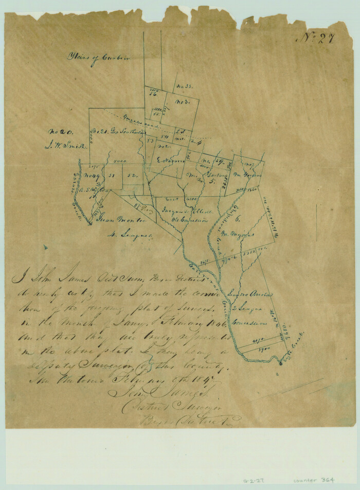
Print $2.00
- Digital $50.00
[Surveys near Calaveras Creek]
1846
Size: 10.9 x 8.0 inches
364
[Surveys in the Bexar and San Patricio Districts along the Nueces and Frio Rivers]
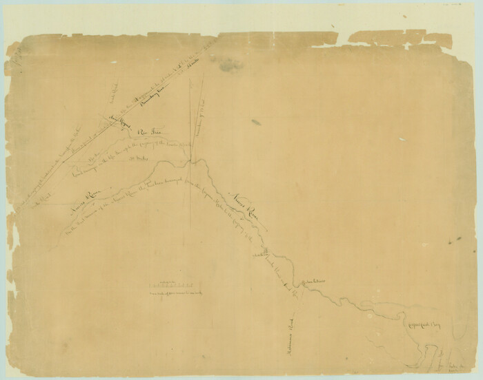
Print $20.00
- Digital $50.00
[Surveys in the Bexar and San Patricio Districts along the Nueces and Frio Rivers]
1830
Size: 21.5 x 27.3 inches
36
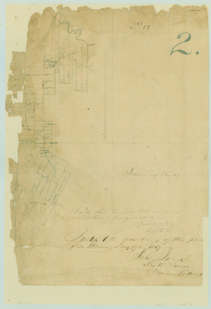
[Surveys in the Bexar District in the vicinity of Salado and Saltillo Creeks]
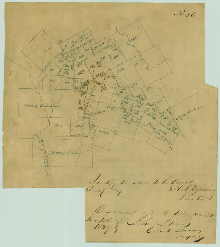
Print $2.00
- Digital $50.00
[Surveys in the Bexar District in the vicinity of Salado and Saltillo Creeks]
1847
Size: 10.3 x 9.1 inches
234
[Surveys in the Bexar District along the San Antonio River showing the position of the missions]
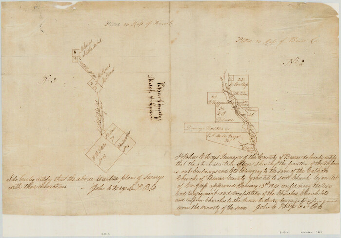
Print $3.00
- Digital $50.00
[Surveys in the Bexar District along the San Antonio River showing the position of the missions]
1841
Size: 11.2 x 16.0 inches
125
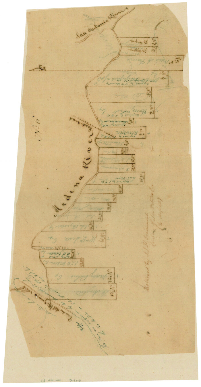
[Surveys in the Bexar District along the Medina River]
Print $20.00
- Digital $50.00
[Surveys in the Bexar District along the Medina River]
1841
Size: 23.0 x 16.8 inches
128
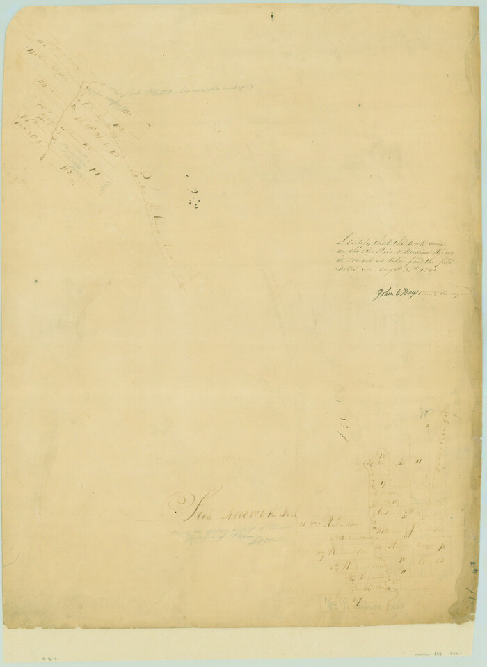
[Surveys in the Bexar District along the Medina River west of the San Antonio River]
Print $2.00
- Digital $50.00
[Surveys in the Bexar District along the Medina River west of the San Antonio River]
1842
Size: 8.0 x 15.2 inches
57
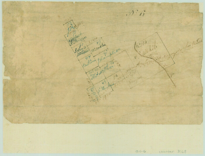
[Surveys in the Bexar District along the Cibolo Creek]
Print $2.00
- Digital $50.00
[Surveys in the Bexar District along the Cibolo Creek]
1846
Size: 5.1 x 6.7 inches
3168
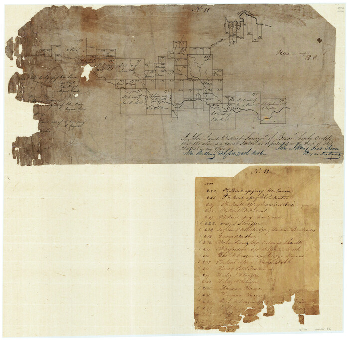
[Surveys in the Bexar District along the Cibolo Creek]
Print $20.00
- Digital $50.00
[Surveys in the Bexar District along the Cibolo Creek]
1846
Size: 17.0 x 17.8 inches
86
[Surveys in the Bexar District along the Cibolo Creek]
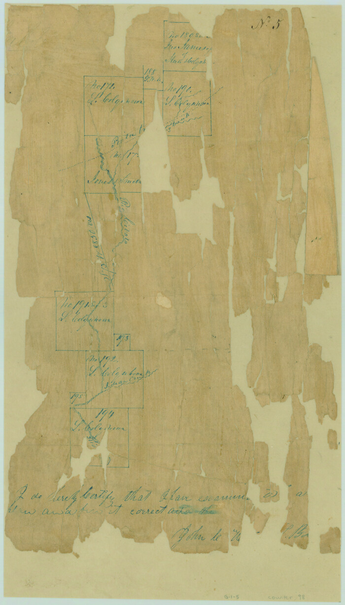
Print $2.00
- Digital $50.00
[Surveys in the Bexar District along the Cibolo Creek]
1847
Size: 13.0 x 7.4 inches
98
[Surveys in the Bexar District along the Balcones, Cibolo and Leon Creeks]
Print $3.00
- Digital $50.00
[Surveys in the Bexar District along the Balcones, Cibolo and Leon Creeks]
1842
Size: 10.6 x 12.4 inches
63
[Surveys in the Bexar District along the Atascosa Creek]
Print $3.00
- Digital $50.00
[Surveys in the Bexar District along the Atascosa Creek]
1847
Size: 16.9 x 11.6 inches
163
[Surveys in Bexar County]
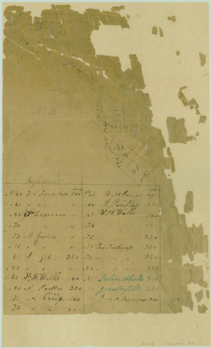
Print $2.00
- Digital $50.00
[Surveys in Bexar County]
Size: 11.3 x 6.9 inches
93
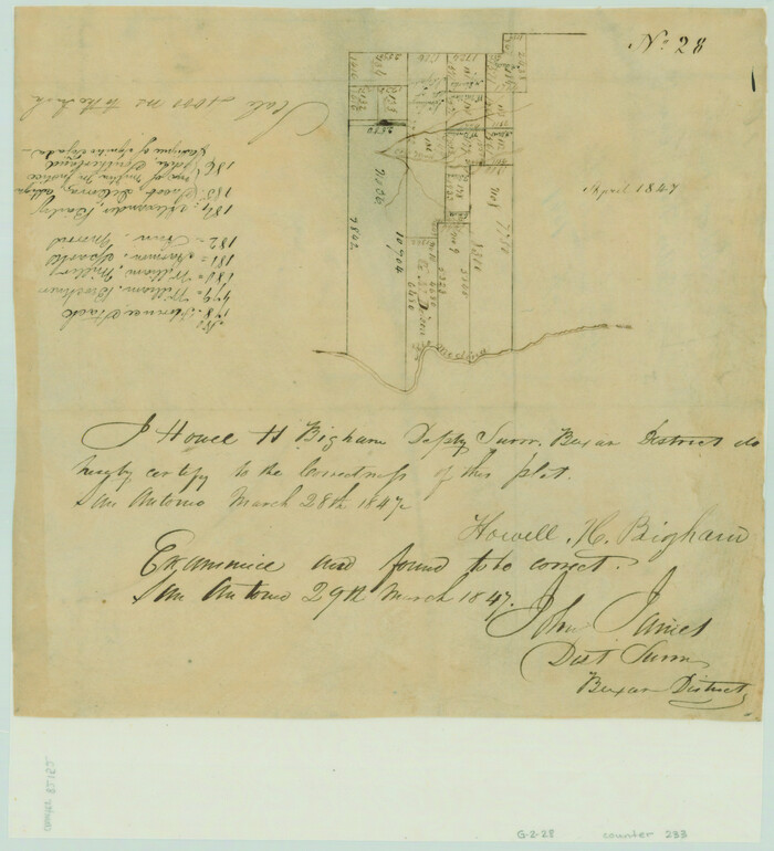
[Surveys along the San Antonio Road and Cottonwood Creek]
Print $2.00
- Digital $50.00
[Surveys along the San Antonio Road and Cottonwood Creek]
1847
Size: 9.1 x 8.3 inches
233
[Surveys along the Medina River]

Print $2.00
- Digital $50.00
[Surveys along the Medina River]
1840
Size: 8.2 x 14.3 inches
52
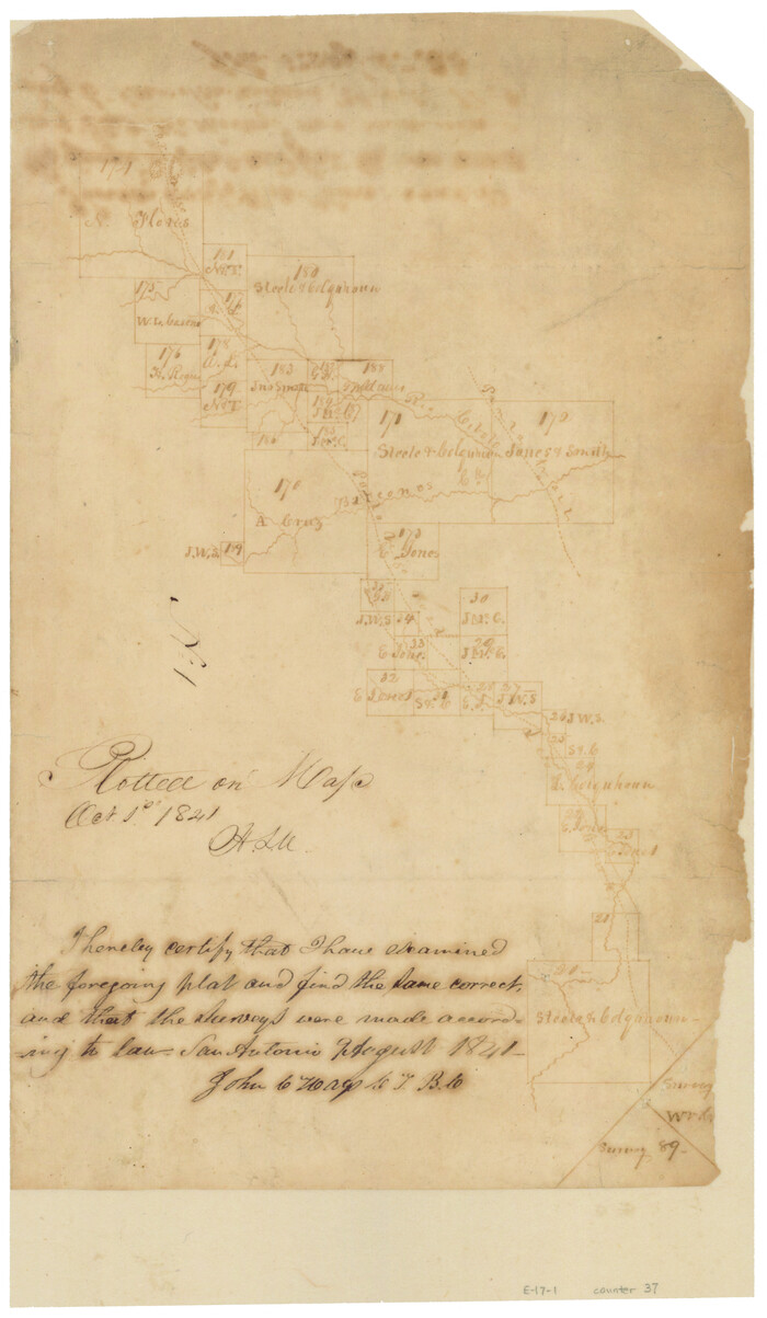
[Surveys along the Cibolo, Balcones and Leon Creeks]
Print $2.00
- Digital $50.00
[Surveys along the Cibolo, Balcones and Leon Creeks]
1841
Size: 13.3 x 7.8 inches
37
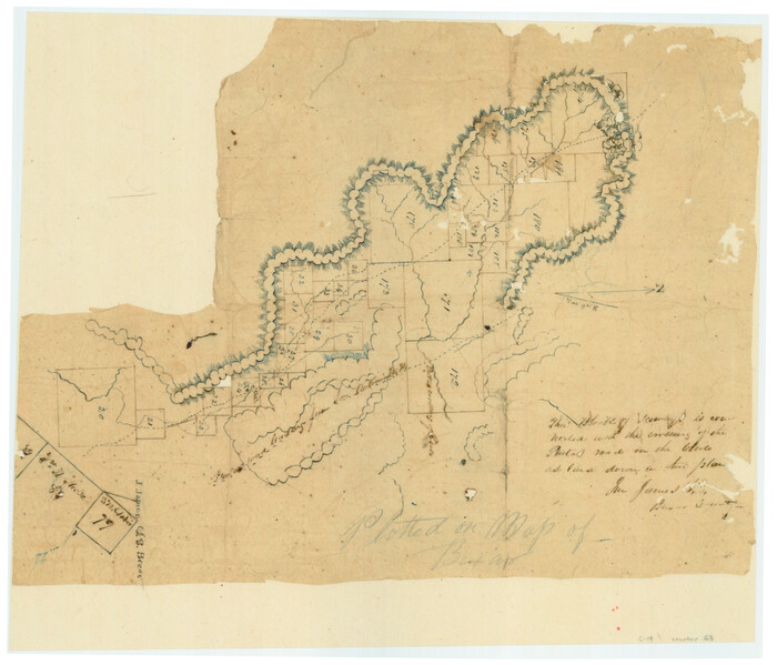
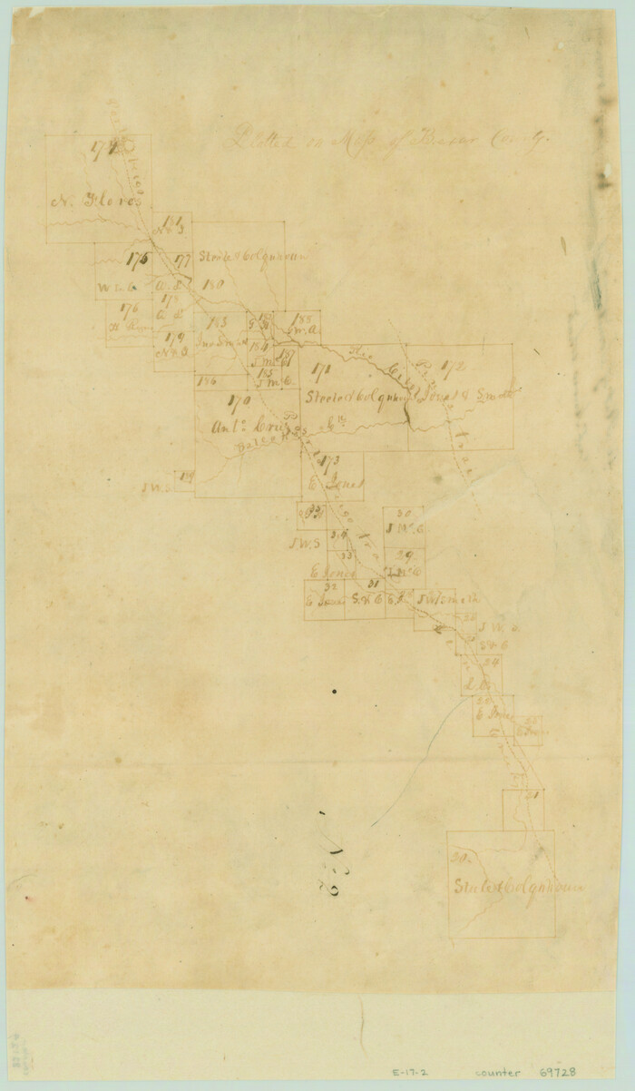
[Surveys along the Cibolo, Balcones and Leon Creeks]
Print $20.00
- Digital $50.00
[Surveys along the Cibolo, Balcones and Leon Creeks]
1841
Size: 14.5 x 21.0 inches
69728
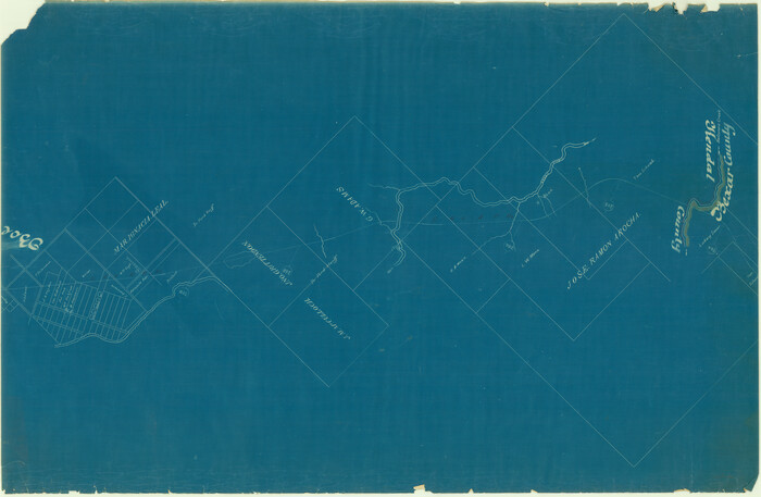
[San Antonio & Aransas Pass Railway Co.]
Print $20.00
- Digital $50.00
[San Antonio & Aransas Pass Railway Co.]
Size: 22.9 x 35.1 inches
64261
[San Antonio & Aransas Pass Railway Co.]
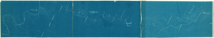
Print $40.00
- Digital $50.00
[San Antonio & Aransas Pass Railway Co.]
Size: 15.7 x 86.4 inches
64262
[Map showing S. A. & A. P. Ry. from San Antonio to Kendall County line]
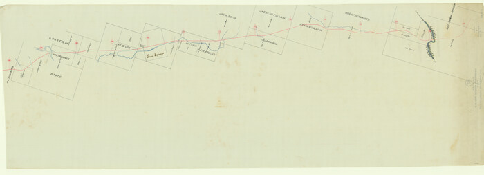
Print $40.00
- Digital $50.00
[Map showing S. A. & A. P. Ry. from San Antonio to Kendall County line]
1895
Size: 25.5 x 70.7 inches
64255
[Map of San Antonio, Texas]
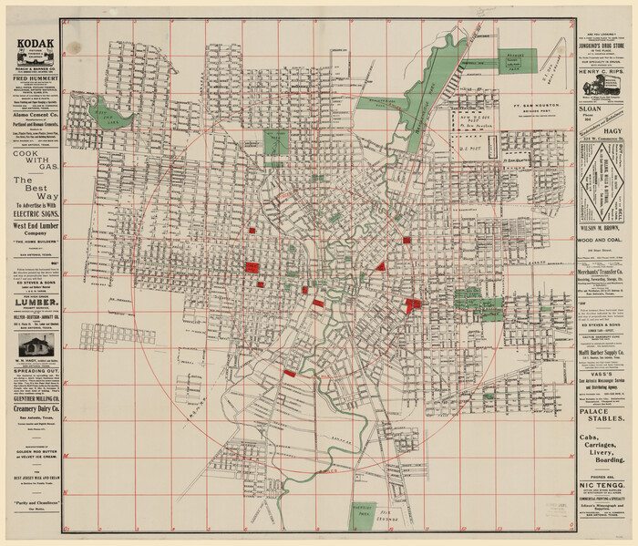
Print $20.00
- Digital $50.00
[Map of San Antonio, Texas]
1895
Size: 29.4 x 34.5 inches
93399
[Map of Area near Alamo showing proposed fortifications]
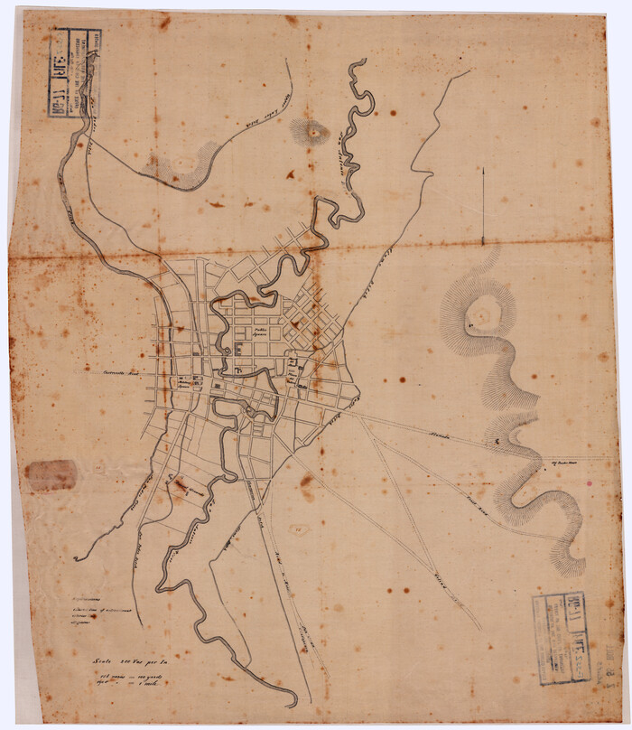
Print $20.00
[Map of Area near Alamo showing proposed fortifications]
1863
Size: 31.9 x 27.7 inches
88603
[General Highway Map of] Bexar County, Sheet 1 of 2
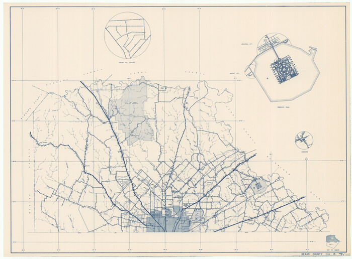
Print $20.00
[General Highway Map of] Bexar County, Sheet 1 of 2
1940
Size: 18.5 x 25.1 inches
76288
[General Highway Map Supplementary Sheet Showing Detail of Cities and Towns in Bexar County Texas]
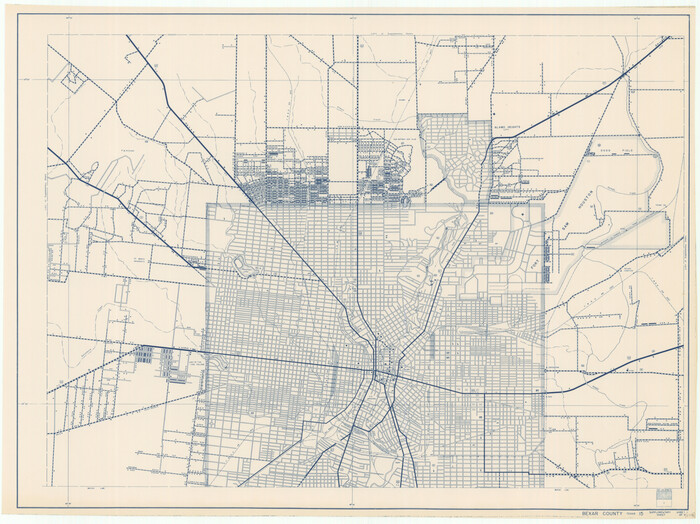
Print $20.00
[General Highway Map Supplementary Sheet Showing Detail of Cities and Towns in Bexar County Texas]
1936
Size: 18.7 x 24.9 inches
76289
[From the lower corner of the Juan Zambrano survey to the Medina River]
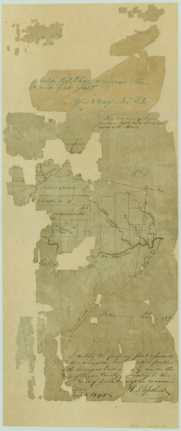
Print $20.00
- Digital $50.00
[From the lower corner of the Juan Zambrano survey to the Medina River]
1844
Size: 19.0 x 8.0 inches
97
Wilson County Working Sketch 14

Print $20.00
- Digital $50.00
Wilson County Working Sketch 14
1987
Size: 31.9 x 36.2 inches
72594
The Republic County of Bexar. Spring 1842

Print $20.00
The Republic County of Bexar. Spring 1842
2020
Size: 14.7 x 21.7 inches
96100
The Republic County of Bexar. South View. Proposed, Fall 1837-December 31, 1838

Print $20.00
The Republic County of Bexar. South View. Proposed, Fall 1837-December 31, 1838
2020
Size: 14.7 x 22.3 inches
96095
The Republic County of Bexar. Proposed, Late Fall 1837

Print $20.00
The Republic County of Bexar. Proposed, Late Fall 1837
2020
Size: 24.6 x 21.6 inches
96093
The Republic County of Bexar. November 28, 1839

Print $20.00
The Republic County of Bexar. November 28, 1839
2020
Size: 14.8 x 21.1 inches
96097
The Republic County of Bexar. North View. Proposed, Fall 1837-December 31, 1838

Print $20.00
The Republic County of Bexar. North View. Proposed, Fall 1837-December 31, 1838
2020
Size: 14.0 x 21.1 inches
96094
[Surveys near Calaveras Creek]
Print $2.00
- Digital $50.00
[Surveys near Calaveras Creek]
1846
-
Size
10.9 x 8.0 inches
-
Map/Doc
364
-
Creation Date
1846
[Surveys in the Bexar and San Patricio Districts along the Nueces and Frio Rivers]
Print $20.00
- Digital $50.00
[Surveys in the Bexar and San Patricio Districts along the Nueces and Frio Rivers]
1830
-
Size
21.5 x 27.3 inches
-
Map/Doc
36
-
Creation Date
1830
[Surveys in the Bexar District in the vicinity of Salado and Saltillo Creeks]
Print $2.00
- Digital $50.00
[Surveys in the Bexar District in the vicinity of Salado and Saltillo Creeks]
1847
-
Size
10.3 x 9.1 inches
-
Map/Doc
234
-
Creation Date
1847
[Surveys in the Bexar District along the San Antonio River showing the position of the missions]
Print $3.00
- Digital $50.00
[Surveys in the Bexar District along the San Antonio River showing the position of the missions]
1841
-
Size
11.2 x 16.0 inches
-
Map/Doc
125
-
Creation Date
1841
[Surveys in the Bexar District along the Medina River]
Print $20.00
- Digital $50.00
[Surveys in the Bexar District along the Medina River]
1841
-
Size
23.0 x 16.8 inches
-
Map/Doc
128
-
Creation Date
1841
[Surveys in the Bexar District along the Medina River west of the San Antonio River]
Print $2.00
- Digital $50.00
[Surveys in the Bexar District along the Medina River west of the San Antonio River]
1842
-
Size
8.0 x 15.2 inches
-
Map/Doc
57
-
Creation Date
1842
[Surveys in the Bexar District along the Cibolo Creek]
Print $2.00
- Digital $50.00
[Surveys in the Bexar District along the Cibolo Creek]
1846
-
Size
5.1 x 6.7 inches
-
Map/Doc
3168
-
Creation Date
1846
[Surveys in the Bexar District along the Cibolo Creek]
Print $20.00
- Digital $50.00
[Surveys in the Bexar District along the Cibolo Creek]
1846
-
Size
17.0 x 17.8 inches
-
Map/Doc
86
-
Creation Date
1846
[Surveys in the Bexar District along the Cibolo Creek]
Print $2.00
- Digital $50.00
[Surveys in the Bexar District along the Cibolo Creek]
1847
-
Size
13.0 x 7.4 inches
-
Map/Doc
98
-
Creation Date
1847
[Surveys in the Bexar District along the Balcones, Cibolo and Leon Creeks]
Print $3.00
- Digital $50.00
[Surveys in the Bexar District along the Balcones, Cibolo and Leon Creeks]
1842
-
Size
10.6 x 12.4 inches
-
Map/Doc
63
-
Creation Date
1842
[Surveys in the Bexar District along the Atascosa Creek]
Print $3.00
- Digital $50.00
[Surveys in the Bexar District along the Atascosa Creek]
1847
-
Size
16.9 x 11.6 inches
-
Map/Doc
163
-
Creation Date
1847
[Surveys in Bexar County]
Print $2.00
- Digital $50.00
[Surveys in Bexar County]
-
Size
11.3 x 6.9 inches
-
Map/Doc
93
[Surveys along the San Antonio Road and Cottonwood Creek]
Print $2.00
- Digital $50.00
[Surveys along the San Antonio Road and Cottonwood Creek]
1847
-
Size
9.1 x 8.3 inches
-
Map/Doc
233
-
Creation Date
1847
[Surveys along the Medina River]
Print $2.00
- Digital $50.00
[Surveys along the Medina River]
1840
-
Size
8.2 x 14.3 inches
-
Map/Doc
52
-
Creation Date
1840
[Surveys along the Cibolo, Balcones and Leon Creeks]
Print $2.00
- Digital $50.00
[Surveys along the Cibolo, Balcones and Leon Creeks]
1841
-
Size
13.3 x 7.8 inches
-
Map/Doc
37
-
Creation Date
1841
[Surveys along the Cibolo, Balcones and Leon Creeks]
Print $20.00
- Digital $50.00
[Surveys along the Cibolo, Balcones and Leon Creeks]
1841
-
Size
14.5 x 21.0 inches
-
Map/Doc
69728
-
Creation Date
1841
[San Antonio & Aransas Pass Railway Co.]
Print $20.00
- Digital $50.00
[San Antonio & Aransas Pass Railway Co.]
-
Size
22.9 x 35.1 inches
-
Map/Doc
64261
[San Antonio & Aransas Pass Railway Co.]
Print $40.00
- Digital $50.00
[San Antonio & Aransas Pass Railway Co.]
-
Size
15.7 x 86.4 inches
-
Map/Doc
64262
[Map showing S. A. & A. P. Ry. from San Antonio to Kendall County line]
Print $40.00
- Digital $50.00
[Map showing S. A. & A. P. Ry. from San Antonio to Kendall County line]
1895
-
Size
25.5 x 70.7 inches
-
Map/Doc
64255
-
Creation Date
1895
[Map of San Antonio, Texas]
Print $20.00
- Digital $50.00
[Map of San Antonio, Texas]
1895
-
Size
29.4 x 34.5 inches
-
Map/Doc
93399
-
Creation Date
1895
[Map of Area near Alamo showing proposed fortifications]
Print $20.00
[Map of Area near Alamo showing proposed fortifications]
1863
-
Size
31.9 x 27.7 inches
-
Map/Doc
88603
-
Creation Date
1863
[General Highway Map of] Bexar County, Sheet 1 of 2
Print $20.00
[General Highway Map of] Bexar County, Sheet 1 of 2
1940
-
Size
18.5 x 25.1 inches
-
Map/Doc
76288
-
Creation Date
1940
[General Highway Map Supplementary Sheet Showing Detail of Cities and Towns in Bexar County Texas]
Print $20.00
[General Highway Map Supplementary Sheet Showing Detail of Cities and Towns in Bexar County Texas]
1936
-
Size
18.7 x 24.9 inches
-
Map/Doc
76289
-
Creation Date
1936
[From the lower corner of the Juan Zambrano survey to the Medina River]
Print $20.00
- Digital $50.00
[From the lower corner of the Juan Zambrano survey to the Medina River]
1844
-
Size
19.0 x 8.0 inches
-
Map/Doc
97
-
Creation Date
1844
Wilson County Working Sketch 14
Print $20.00
- Digital $50.00
Wilson County Working Sketch 14
1987
-
Size
31.9 x 36.2 inches
-
Map/Doc
72594
-
Creation Date
1987
The Republic County of Bexar. Spring 1842
Print $20.00
The Republic County of Bexar. Spring 1842
2020
-
Size
14.7 x 21.7 inches
-
Map/Doc
96100
-
Creation Date
2020
The Republic County of Bexar. South View. Proposed, Fall 1837-December 31, 1838
Print $20.00
The Republic County of Bexar. South View. Proposed, Fall 1837-December 31, 1838
2020
-
Size
14.7 x 22.3 inches
-
Map/Doc
96095
-
Creation Date
2020
The Republic County of Bexar. Proposed, Late Fall 1837
Print $20.00
The Republic County of Bexar. Proposed, Late Fall 1837
2020
-
Size
24.6 x 21.6 inches
-
Map/Doc
96093
-
Creation Date
2020
The Republic County of Bexar. November 28, 1839
Print $20.00
The Republic County of Bexar. November 28, 1839
2020
-
Size
14.8 x 21.1 inches
-
Map/Doc
96097
-
Creation Date
2020
The Republic County of Bexar. North View. Proposed, Fall 1837-December 31, 1838
Print $20.00
The Republic County of Bexar. North View. Proposed, Fall 1837-December 31, 1838
2020
-
Size
14.0 x 21.1 inches
-
Map/Doc
96094
-
Creation Date
2020