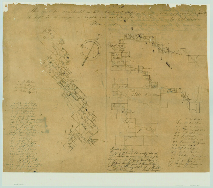
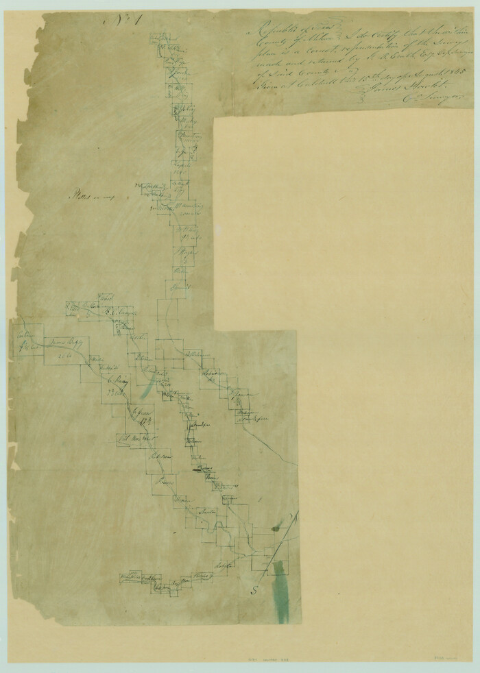
[Surveys in the Milam District on Coryell Creek and the Bosque River]
Print $20.00
- Digital $50.00
[Surveys in the Milam District on Coryell Creek and the Bosque River]
1846
Size: 14.0 x 15.8 inches
3171
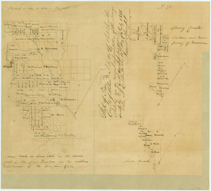
[Surveys in the Milam District on Bosque River and Spring Creek]
Print $20.00
- Digital $50.00
[Surveys in the Milam District on Bosque River and Spring Creek]
1846
Size: 13.3 x 14.7 inches
3170
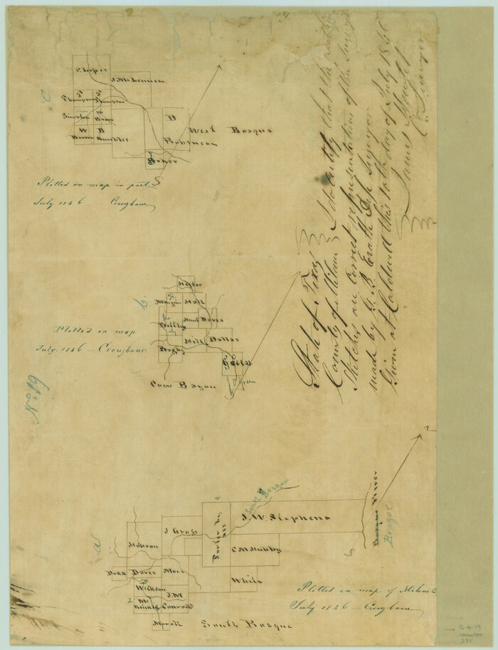
[Surveys in the Milam District along the Brazos River, North Bosque River, West Bosque River and Cow Bayou]
Print $2.00
- Digital $50.00
[Surveys in the Milam District along the Brazos River, North Bosque River, West Bosque River and Cow Bayou]
1846
Size: 11.7 x 8.9 inches
231
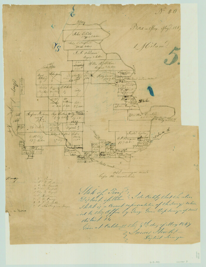
[Surveys in Milam District between the Bosque and Brazos Rivers]
Print $20.00
- Digital $50.00
[Surveys in Milam District between the Bosque and Brazos Rivers]
1847
Size: 15.8 x 12.2 inches
3
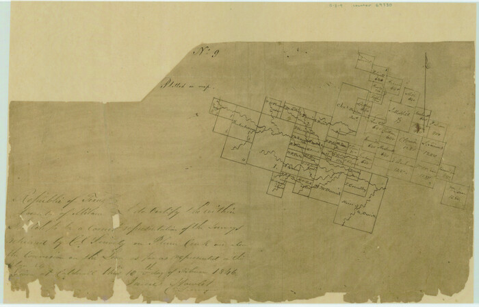
[Surveys along the Leon River and Plum Creek]
Print $2.00
- Digital $50.00
[Surveys along the Leon River and Plum Creek]
1846
Size: 9.0 x 14.0 inches
69730
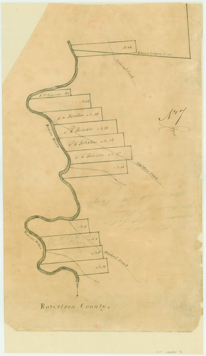
[Surveys along the Brazos River]
Print $3.00
- Digital $50.00
[Surveys along the Brazos River]
1840
Size: 16.2 x 9.4 inches
71
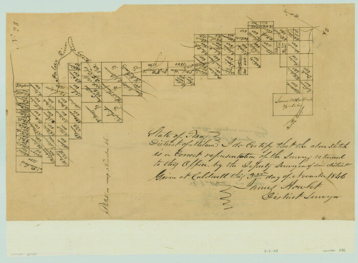
[Surveys along the Bosque River]
Print $3.00
- Digital $50.00
[Surveys along the Bosque River]
1846
Size: 9.4 x 12.8 inches
236
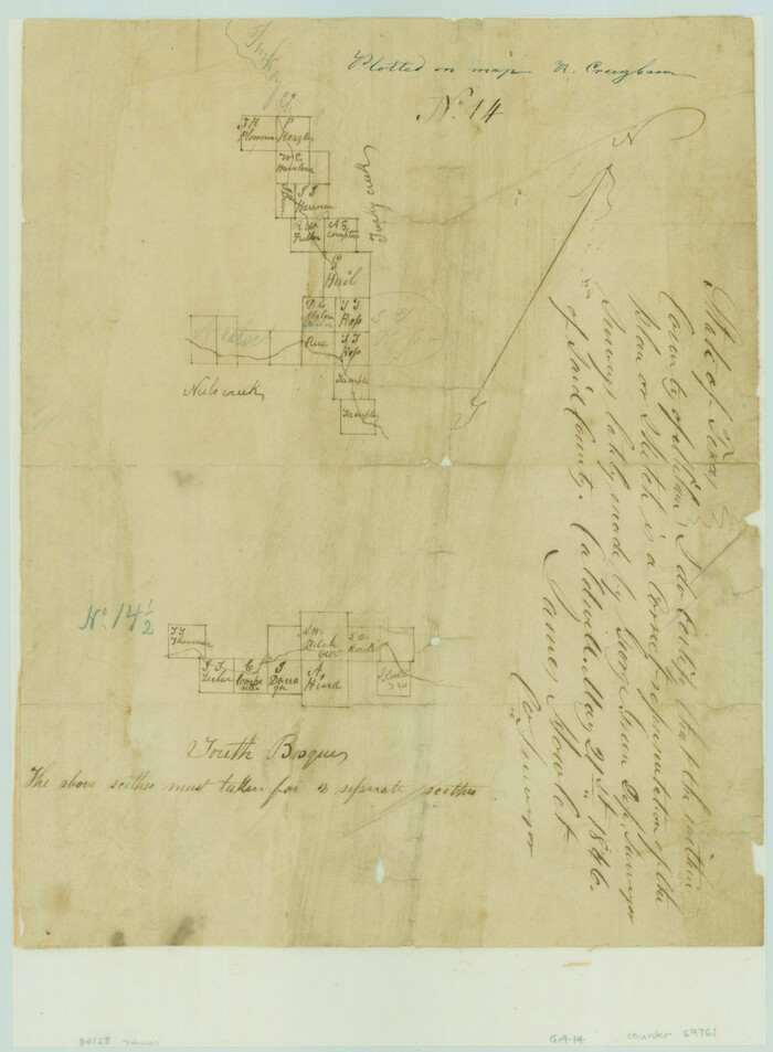
[Surveys along Neils and Turkey Creeks]
Print $2.00
- Digital $50.00
[Surveys along Neils and Turkey Creeks]
1846
Size: 10.8 x 7.9 inches
69761
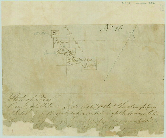
[Surveys along Meridian Creek]
Print $2.00
- Digital $50.00
[Surveys along Meridian Creek]
1846
Size: 6.4 x 7.7 inches
242
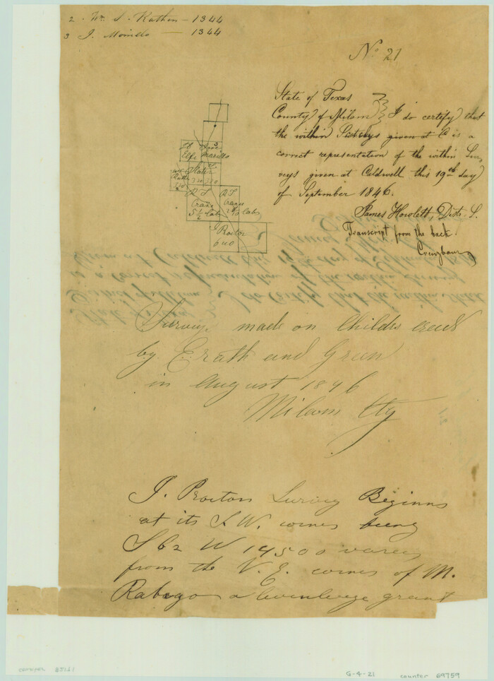
[Surveys along Childress Creek in Bosque County]
Print $2.00
- Digital $50.00
[Surveys along Childress Creek in Bosque County]
1846
Size: 11.6 x 8.5 inches
69759
[Surveys along Bosque and Hog Creek]
Print $20.00
- Digital $50.00
[Surveys along Bosque and Hog Creek]
1845
Size: 23.9 x 17.0 inches
238
[Gulf, Colorado & Santa Fe]
Print $40.00
- Digital $50.00
[Gulf, Colorado & Santa Fe]
Size: 31.9 x 71.7 inches
64575
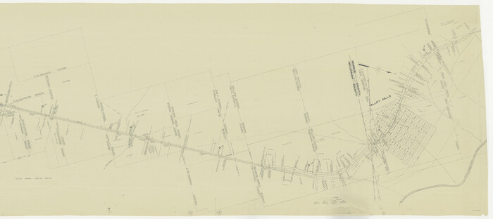
[G.C. and S. F. R.R. Co. Through Bosque County from McLennan Co. and E. to Hill Co. Station M. P. 259 to M. P. 297]
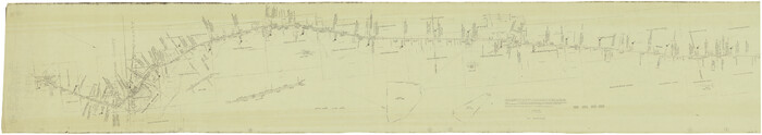
Print $40.00
- Digital $50.00
[G.C. and S. F. R.R. Co. Through Bosque County from McLennan Co. and E. to Hill Co. Station M. P. 259 to M. P. 297]
Size: 21.7 x 120.5 inches
64563
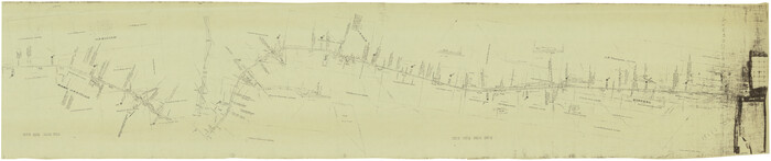
[G.C. and S. F. R.R. Co. Through Bosque County from McLennan Co. and E. to Hill Co. Station M. P. 259 to M. P. 297]
Print $40.00
- Digital $50.00
[G.C. and S. F. R.R. Co. Through Bosque County from McLennan Co. and E. to Hill Co. Station M. P. 259 to M. P. 297]
1898
Size: 22.4 x 101.5 inches
64564
Water-Shed of the Brazos River

Print $40.00
- Digital $50.00
Water-Shed of the Brazos River
1925
Size: 35.0 x 88.0 inches
65263
Somervell County Working Sketch 4

Print $20.00
- Digital $50.00
Somervell County Working Sketch 4
1975
Size: 38.3 x 29.7 inches
63908
Somervell County Sketch File 2

Print $20.00
- Digital $50.00
Somervell County Sketch File 2
1847
Size: 21.8 x 16.7 inches
12325
Neel's Creek of North Bosque

Print $2.00
- Digital $50.00
Neel's Creek of North Bosque
1847
Size: 8.9 x 7.9 inches
69755
McLennan County Working Sketch 8

Print $20.00
- Digital $50.00
McLennan County Working Sketch 8
1974
Size: 34.1 x 30.6 inches
70701
McLennan County Sketch File 2

Print $6.00
- Digital $50.00
McLennan County Sketch File 2
1856
Size: 11.5 x 7.7 inches
31230
Map of the Recognised Line, M. El. P. & P. RR. from Texas & Arkansas State Line to Milam & Bexar Land District Line

Print $40.00
- Digital $50.00
Map of the Recognised Line, M. El. P. & P. RR. from Texas & Arkansas State Line to Milam & Bexar Land District Line
Size: 15.3 x 89.4 inches
64638
Map of the Recognised Line M. EL. P. & P. R. R. from East Line of Bexar Land District to El Paso

Print $20.00
- Digital $50.00
Map of the Recognised Line M. EL. P. & P. R. R. from East Line of Bexar Land District to El Paso
1857
Size: 7.5 x 41.8 inches
2218
Map of the Recognised Line M. EL. P. & P. R. R. from East Line of Bexar Land District to El Paso

Print $40.00
- Digital $50.00
Map of the Recognised Line M. EL. P. & P. R. R. from East Line of Bexar Land District to El Paso
1857
Size: 20.0 x 50.4 inches
85322
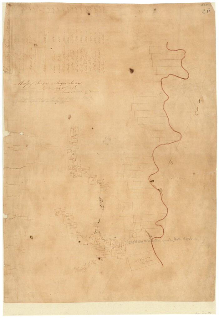
Map of Brassos [sic] & Bosque Surveys
Print $20.00
- Digital $50.00
Map of Brassos [sic] & Bosque Surveys
1841
Size: 27.7 x 18.9 inches
146
Map of Bosque County

Print $20.00
- Digital $50.00
Map of Bosque County
1869
Size: 24.1 x 23.7 inches
3313
Hill County Sketch file 28

Print $33.00
- Digital $50.00
Hill County Sketch file 28
1987
Size: 11.3 x 8.9 inches
26530
Hamilton County Working Sketch 36

Print $40.00
- Digital $50.00
Hamilton County Working Sketch 36
2008
Size: 36.9 x 57.3 inches
88996
Hamilton County Working Sketch 28

Print $20.00
- Digital $50.00
Hamilton County Working Sketch 28
1976
Size: 27.7 x 33.2 inches
63366
Hamilton County Sketch File 21

Print $4.00
- Digital $50.00
Hamilton County Sketch File 21
1851
Size: 12.9 x 8.2 inches
24945
Hamilton County Sketch File 1

Print $4.00
- Digital $50.00
Hamilton County Sketch File 1
Size: 12.5 x 8.2 inches
24897
[Surveys in the Milam District on Coryell Creek and the Bosque River]
Print $20.00
- Digital $50.00
[Surveys in the Milam District on Coryell Creek and the Bosque River]
1846
-
Size
14.0 x 15.8 inches
-
Map/Doc
3171
-
Creation Date
1846
[Surveys in the Milam District on Bosque River and Spring Creek]
Print $20.00
- Digital $50.00
[Surveys in the Milam District on Bosque River and Spring Creek]
1846
-
Size
13.3 x 14.7 inches
-
Map/Doc
3170
-
Creation Date
1846
[Surveys in the Milam District along the Brazos River, North Bosque River, West Bosque River and Cow Bayou]
Print $2.00
- Digital $50.00
[Surveys in the Milam District along the Brazos River, North Bosque River, West Bosque River and Cow Bayou]
1846
-
Size
11.7 x 8.9 inches
-
Map/Doc
231
-
Creation Date
1846
[Surveys in Milam District between the Bosque and Brazos Rivers]
Print $20.00
- Digital $50.00
[Surveys in Milam District between the Bosque and Brazos Rivers]
1847
-
Size
15.8 x 12.2 inches
-
Map/Doc
3
-
Creation Date
1847
[Surveys along the Leon River and Plum Creek]
Print $2.00
- Digital $50.00
[Surveys along the Leon River and Plum Creek]
1846
-
Size
9.0 x 14.0 inches
-
Map/Doc
69730
-
Creation Date
1846
[Surveys along the Brazos River]
Print $3.00
- Digital $50.00
[Surveys along the Brazos River]
1840
-
Size
16.2 x 9.4 inches
-
Map/Doc
71
-
Creation Date
1840
[Surveys along the Bosque River]
Print $3.00
- Digital $50.00
[Surveys along the Bosque River]
1846
-
Size
9.4 x 12.8 inches
-
Map/Doc
236
-
Creation Date
1846
[Surveys along Neils and Turkey Creeks]
Print $2.00
- Digital $50.00
[Surveys along Neils and Turkey Creeks]
1846
-
Size
10.8 x 7.9 inches
-
Map/Doc
69761
-
Creation Date
1846
[Surveys along Meridian Creek]
Print $2.00
- Digital $50.00
[Surveys along Meridian Creek]
1846
-
Size
6.4 x 7.7 inches
-
Map/Doc
242
-
Creation Date
1846
[Surveys along Childress Creek in Bosque County]
Print $2.00
- Digital $50.00
[Surveys along Childress Creek in Bosque County]
1846
-
Size
11.6 x 8.5 inches
-
Map/Doc
69759
-
Creation Date
1846
[Surveys along Bosque and Hog Creek]
Print $20.00
- Digital $50.00
[Surveys along Bosque and Hog Creek]
1845
-
Size
23.9 x 17.0 inches
-
Map/Doc
238
-
Creation Date
1845
[Gulf, Colorado & Santa Fe]
Print $40.00
- Digital $50.00
[Gulf, Colorado & Santa Fe]
-
Size
31.9 x 71.7 inches
-
Map/Doc
64575
[G.C. and S. F. R.R. Co. Through Bosque County from McLennan Co. and E. to Hill Co. Station M. P. 259 to M. P. 297]
Print $40.00
- Digital $50.00
[G.C. and S. F. R.R. Co. Through Bosque County from McLennan Co. and E. to Hill Co. Station M. P. 259 to M. P. 297]
-
Size
21.7 x 120.5 inches
-
Map/Doc
64563
[G.C. and S. F. R.R. Co. Through Bosque County from McLennan Co. and E. to Hill Co. Station M. P. 259 to M. P. 297]
Print $40.00
- Digital $50.00
[G.C. and S. F. R.R. Co. Through Bosque County from McLennan Co. and E. to Hill Co. Station M. P. 259 to M. P. 297]
1898
-
Size
22.4 x 101.5 inches
-
Map/Doc
64564
-
Creation Date
1898
Water-Shed of the Brazos River
Print $40.00
- Digital $50.00
Water-Shed of the Brazos River
1925
-
Size
35.0 x 88.0 inches
-
Map/Doc
65263
-
Creation Date
1925
Somervell County Working Sketch 4
Print $20.00
- Digital $50.00
Somervell County Working Sketch 4
1975
-
Size
38.3 x 29.7 inches
-
Map/Doc
63908
-
Creation Date
1975
Somervell County Sketch File 2
Print $20.00
- Digital $50.00
Somervell County Sketch File 2
1847
-
Size
21.8 x 16.7 inches
-
Map/Doc
12325
-
Creation Date
1847
Neel's Creek of North Bosque
Print $2.00
- Digital $50.00
Neel's Creek of North Bosque
1847
-
Size
8.9 x 7.9 inches
-
Map/Doc
69755
-
Creation Date
1847
McLennan County Working Sketch 8
Print $20.00
- Digital $50.00
McLennan County Working Sketch 8
1974
-
Size
34.1 x 30.6 inches
-
Map/Doc
70701
-
Creation Date
1974
McLennan County Sketch File 2
Print $6.00
- Digital $50.00
McLennan County Sketch File 2
1856
-
Size
11.5 x 7.7 inches
-
Map/Doc
31230
-
Creation Date
1856
Map of the Recognised Line, M. El. P. & P. RR. from Texas & Arkansas State Line to Milam & Bexar Land District Line
Print $40.00
- Digital $50.00
Map of the Recognised Line, M. El. P. & P. RR. from Texas & Arkansas State Line to Milam & Bexar Land District Line
-
Size
15.3 x 89.4 inches
-
Map/Doc
64638
Map of the Recognised Line M. EL. P. & P. R. R. from East Line of Bexar Land District to El Paso
Print $20.00
- Digital $50.00
Map of the Recognised Line M. EL. P. & P. R. R. from East Line of Bexar Land District to El Paso
1857
-
Size
7.5 x 41.8 inches
-
Map/Doc
2218
-
Creation Date
1857
Map of the Recognised Line M. EL. P. & P. R. R. from East Line of Bexar Land District to El Paso
Print $40.00
- Digital $50.00
Map of the Recognised Line M. EL. P. & P. R. R. from East Line of Bexar Land District to El Paso
1857
-
Size
20.0 x 50.4 inches
-
Map/Doc
85322
-
Creation Date
1857
Map of Brassos [sic] & Bosque Surveys
Print $20.00
- Digital $50.00
Map of Brassos [sic] & Bosque Surveys
1841
-
Size
27.7 x 18.9 inches
-
Map/Doc
146
-
Creation Date
1841
Map of Bosque County
Print $20.00
- Digital $50.00
Map of Bosque County
1869
-
Size
24.1 x 23.7 inches
-
Map/Doc
3313
-
Creation Date
1869
Hill County Sketch file 28
Print $33.00
- Digital $50.00
Hill County Sketch file 28
1987
-
Size
11.3 x 8.9 inches
-
Map/Doc
26530
-
Creation Date
1987
Hamilton County Working Sketch 36
Print $40.00
- Digital $50.00
Hamilton County Working Sketch 36
2008
-
Size
36.9 x 57.3 inches
-
Map/Doc
88996
-
Creation Date
2008
Hamilton County Working Sketch 28
Print $20.00
- Digital $50.00
Hamilton County Working Sketch 28
1976
-
Size
27.7 x 33.2 inches
-
Map/Doc
63366
-
Creation Date
1976
Hamilton County Sketch File 21
Print $4.00
- Digital $50.00
Hamilton County Sketch File 21
1851
-
Size
12.9 x 8.2 inches
-
Map/Doc
24945
-
Creation Date
1851
Hamilton County Sketch File 1
Print $4.00
- Digital $50.00
Hamilton County Sketch File 1
-
Size
12.5 x 8.2 inches
-
Map/Doc
24897