Gray County Working Sketch 8

Print $20.00
- Digital $50.00
Gray County Working Sketch 8
1983
Size: 18.3 x 22.8 inches
63239
Gray County Working Sketch 7

Print $20.00
- Digital $50.00
Gray County Working Sketch 7
1971
Size: 41.3 x 28.7 inches
63238
General Highway Map, Gray County, Texas

Print $20.00
General Highway Map, Gray County, Texas
1961
Size: 18.1 x 24.7 inches
79483
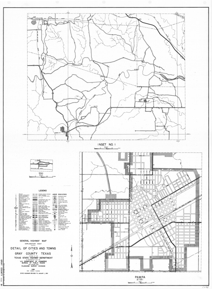
General Highway Map. Detail of Cities and Towns in Gray County, Texas. [Pampa and vicinity]
Print $20.00
General Highway Map. Detail of Cities and Towns in Gray County, Texas. [Pampa and vicinity]
1961
Size: 24.7 x 18.1 inches
79484
Gray County Working Sketch 6

Print $20.00
- Digital $50.00
Gray County Working Sketch 6
1960
Size: 28.8 x 23.2 inches
63237
Gray County Working Sketch 5

Print $20.00
- Digital $50.00
Gray County Working Sketch 5
1959
Size: 28.6 x 27.5 inches
63236
Gray County Working Sketch 4

Print $40.00
- Digital $50.00
Gray County Working Sketch 4
1958
Size: 31.5 x 53.4 inches
63235
Donley County Working Sketch 4

Print $20.00
- Digital $50.00
Donley County Working Sketch 4
1958
Size: 44.0 x 39.8 inches
68737
Gray County Working Sketch 3

Print $20.00
- Digital $50.00
Gray County Working Sketch 3
1958
Size: 36.4 x 31.8 inches
63234
Gray County Working Sketch 2

Print $20.00
- Digital $50.00
Gray County Working Sketch 2
1957
Size: 26.7 x 27.8 inches
63233
Donley County Working Sketch 5

Print $40.00
- Digital $50.00
Donley County Working Sketch 5
1957
Size: 54.8 x 32.2 inches
62185
Gray County Working Sketch 1

Print $20.00
- Digital $50.00
Gray County Working Sketch 1
1957
Size: 37.3 x 17.4 inches
62196
Gray County Sketch File 14

Print $4.00
- Digital $50.00
Gray County Sketch File 14
1946
Size: 11.3 x 8.9 inches
24457
Gray County Sketch File 13

Print $20.00
- Digital $50.00
Gray County Sketch File 13
1946
Size: 16.7 x 15.9 inches
11578
[Sketch for Mineral Application 20124, North Fork of Red River]
Print $20.00
- Digital $50.00
[Sketch for Mineral Application 20124, North Fork of Red River]
1943
Size: 18.5 x 26.0 inches
2826
[Sketch for Mineral Application 20124, North Fork of Red River]
Print $20.00
- Digital $50.00
[Sketch for Mineral Application 20124, North Fork of Red River]
1943
Size: 18.8 x 25.8 inches
2828
General Highway Map, Gray County, Texas

Print $20.00
General Highway Map, Gray County, Texas
1940
Size: 25.0 x 18.4 inches
79103
Houston & Great Northern Railroad, Block 2

Print $20.00
- Digital $50.00
Houston & Great Northern Railroad, Block 2
1921
Size: 20.4 x 22.7 inches
90720
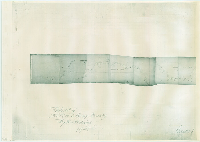
Sketch in Gray County

Print $20.00
- Digital $50.00
Sketch in Gray County
1910
Size: 15.1 x 18.5 inches
90741
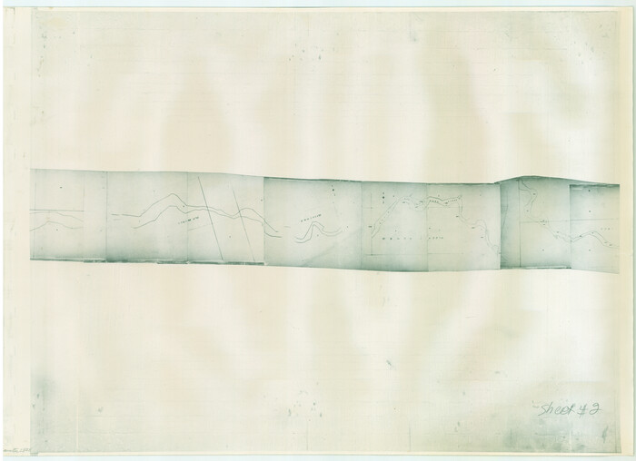
Working Sketch in Gray and Donley Counties

Print $20.00
- Digital $50.00
Working Sketch in Gray and Donley Counties
1910
Size: 28.4 x 26.7 inches
90707
Working Sketch in Gray, Donley, and Carson Counties, Texas

Print $20.00
- Digital $50.00
Working Sketch in Gray, Donley, and Carson Counties, Texas
1909
Size: 22.7 x 27.0 inches
90779
Map Showing North and West Boundaries of Gray County, Texas

Print $20.00
- Digital $50.00
Map Showing North and West Boundaries of Gray County, Texas
1906
Size: 42.4 x 38.9 inches
89942
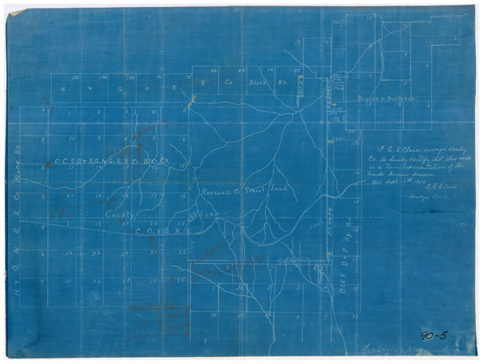
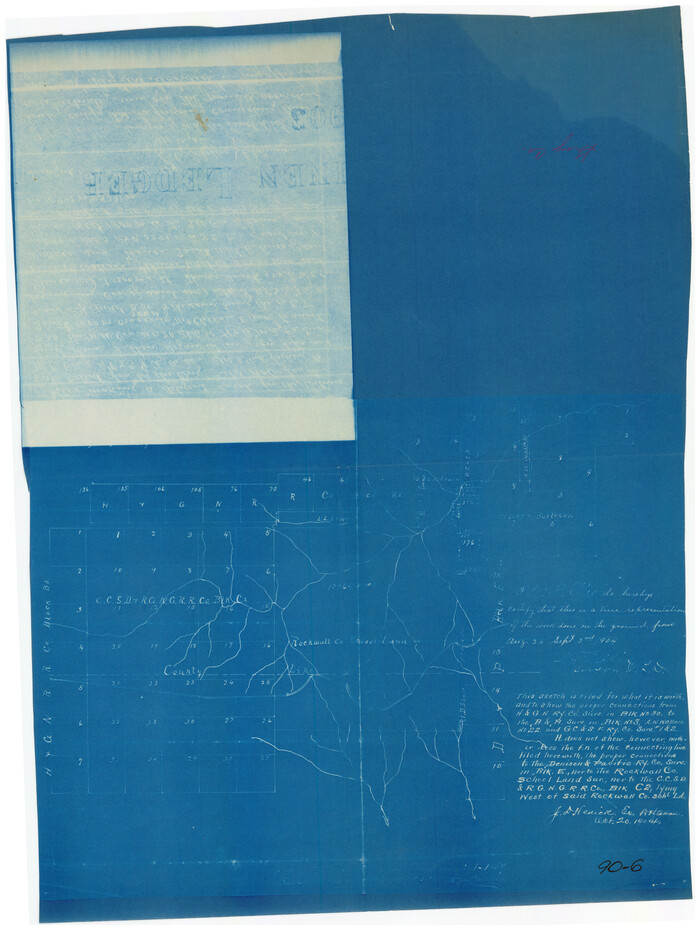
[Rockwall County School Land and adjacent Blocks]
Print $20.00
- Digital $50.00
[Rockwall County School Land and adjacent Blocks]
1904
Size: 16.2 x 12.6 inches
90759
[Rockwall County School Land and adjacent Blocks]
Print $20.00
- Digital $50.00
[Rockwall County School Land and adjacent Blocks]
1904
Size: 17.5 x 23.2 inches
90758
Donley County Boundary File 9

Print $50.00
- Digital $50.00
Donley County Boundary File 9
1903
Size: 13.0 x 8.1 inches
62233
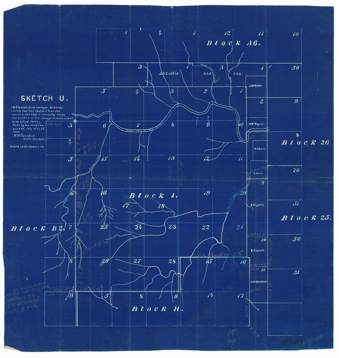
[Block 1 and surrounding blocks]
Print $20.00
- Digital $50.00
[Block 1 and surrounding blocks]
1903
Size: 18.8 x 19.8 inches
90755
Working Sketch in Gray County

Print $3.00
- Digital $50.00
Working Sketch in Gray County
1903
Size: 10.9 x 15.5 inches
90753
Gray County Working Sketch 8
Print $20.00
- Digital $50.00
Gray County Working Sketch 8
1983
-
Size
18.3 x 22.8 inches
-
Map/Doc
63239
-
Creation Date
1983
Gray County Working Sketch 7
Print $20.00
- Digital $50.00
Gray County Working Sketch 7
1971
-
Size
41.3 x 28.7 inches
-
Map/Doc
63238
-
Creation Date
1971
General Highway Map, Gray County, Texas
Print $20.00
General Highway Map, Gray County, Texas
1961
-
Size
18.1 x 24.7 inches
-
Map/Doc
79483
-
Creation Date
1961
General Highway Map. Detail of Cities and Towns in Gray County, Texas. [Pampa and vicinity]
Print $20.00
General Highway Map. Detail of Cities and Towns in Gray County, Texas. [Pampa and vicinity]
1961
-
Size
24.7 x 18.1 inches
-
Map/Doc
79484
-
Creation Date
1961
Gray County Working Sketch 6
Print $20.00
- Digital $50.00
Gray County Working Sketch 6
1960
-
Size
28.8 x 23.2 inches
-
Map/Doc
63237
-
Creation Date
1960
Gray County Working Sketch 5
Print $20.00
- Digital $50.00
Gray County Working Sketch 5
1959
-
Size
28.6 x 27.5 inches
-
Map/Doc
63236
-
Creation Date
1959
Gray County Working Sketch 4
Print $40.00
- Digital $50.00
Gray County Working Sketch 4
1958
-
Size
31.5 x 53.4 inches
-
Map/Doc
63235
-
Creation Date
1958
Donley County Working Sketch 4
Print $20.00
- Digital $50.00
Donley County Working Sketch 4
1958
-
Size
44.0 x 39.8 inches
-
Map/Doc
68737
-
Creation Date
1958
Gray County Working Sketch 3
Print $20.00
- Digital $50.00
Gray County Working Sketch 3
1958
-
Size
36.4 x 31.8 inches
-
Map/Doc
63234
-
Creation Date
1958
Gray County Working Sketch 2
Print $20.00
- Digital $50.00
Gray County Working Sketch 2
1957
-
Size
26.7 x 27.8 inches
-
Map/Doc
63233
-
Creation Date
1957
Donley County Working Sketch 5
Print $40.00
- Digital $50.00
Donley County Working Sketch 5
1957
-
Size
54.8 x 32.2 inches
-
Map/Doc
62185
-
Creation Date
1957
Gray County Working Sketch 1
Print $20.00
- Digital $50.00
Gray County Working Sketch 1
1957
-
Size
37.3 x 17.4 inches
-
Map/Doc
62196
-
Creation Date
1957
Gray County Sketch File 14
Print $4.00
- Digital $50.00
Gray County Sketch File 14
1946
-
Size
11.3 x 8.9 inches
-
Map/Doc
24457
-
Creation Date
1946
Gray County Sketch File 13
Print $20.00
- Digital $50.00
Gray County Sketch File 13
1946
-
Size
16.7 x 15.9 inches
-
Map/Doc
11578
-
Creation Date
1946
[Sketch for Mineral Application 20124, North Fork of Red River]
Print $20.00
- Digital $50.00
[Sketch for Mineral Application 20124, North Fork of Red River]
1943
-
Size
18.5 x 26.0 inches
-
Map/Doc
2826
-
Creation Date
1943
[Sketch for Mineral Application 20124, North Fork of Red River]
Print $20.00
- Digital $50.00
[Sketch for Mineral Application 20124, North Fork of Red River]
1943
-
Size
18.8 x 25.8 inches
-
Map/Doc
2828
-
Creation Date
1943
General Highway Map, Gray County, Texas
Print $20.00
General Highway Map, Gray County, Texas
1940
-
Size
25.0 x 18.4 inches
-
Map/Doc
79103
-
Creation Date
1940
Gray County

Print $20.00
- Digital $50.00
Gray County
1932
-
Size
42.4 x 38.6 inches
-
Map/Doc
73161
-
Creation Date
1932
Gray County

Print $20.00
- Digital $50.00
Gray County
1932
-
Size
40.3 x 36.7 inches
-
Map/Doc
77293
-
Creation Date
1932
Houston & Great Northern Railroad, Block 2
Print $20.00
- Digital $50.00
Houston & Great Northern Railroad, Block 2
1921
-
Size
20.4 x 22.7 inches
-
Map/Doc
90720
-
Creation Date
1921
Sketch in Gray County
Print $20.00
- Digital $50.00
Sketch in Gray County
1910
-
Size
15.1 x 18.5 inches
-
Map/Doc
90741
-
Creation Date
1910
Working Sketch in Gray and Donley Counties
Print $20.00
- Digital $50.00
Working Sketch in Gray and Donley Counties
1910
-
Size
28.4 x 26.7 inches
-
Map/Doc
90707
-
Creation Date
1910
Working Sketch in Gray, Donley, and Carson Counties, Texas
Print $20.00
- Digital $50.00
Working Sketch in Gray, Donley, and Carson Counties, Texas
1909
-
Size
22.7 x 27.0 inches
-
Map/Doc
90779
-
Creation Date
1909
Map Showing North and West Boundaries of Gray County, Texas
Print $20.00
- Digital $50.00
Map Showing North and West Boundaries of Gray County, Texas
1906
-
Size
42.4 x 38.9 inches
-
Map/Doc
89942
-
Creation Date
1906
[Rockwall County School Land and adjacent Blocks]
Print $20.00
- Digital $50.00
[Rockwall County School Land and adjacent Blocks]
1904
-
Size
16.2 x 12.6 inches
-
Map/Doc
90759
-
Creation Date
1904
[Rockwall County School Land and adjacent Blocks]
Print $20.00
- Digital $50.00
[Rockwall County School Land and adjacent Blocks]
1904
-
Size
17.5 x 23.2 inches
-
Map/Doc
90758
-
Creation Date
1904
Donley County Boundary File 9
Print $50.00
- Digital $50.00
Donley County Boundary File 9
1903
-
Size
13.0 x 8.1 inches
-
Map/Doc
62233
-
Creation Date
1903
[Block 1 and surrounding blocks]
Print $20.00
- Digital $50.00
[Block 1 and surrounding blocks]
1903
-
Size
18.8 x 19.8 inches
-
Map/Doc
90755
-
Creation Date
1903
Working Sketch in Gray County
Print $3.00
- Digital $50.00
Working Sketch in Gray County
1903
-
Size
10.9 x 15.5 inches
-
Map/Doc
90753
-
Creation Date
1903
Gray County

Print $20.00
- Digital $50.00
Gray County
1900
-
Size
42.6 x 38.3 inches
-
Map/Doc
4705
-
Creation Date
1900