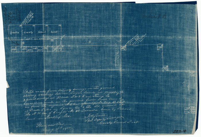
[Tie Line, Zavala County School Land to North Line of Block D11, East and South to Double Lakes Corner]
Print $20.00
- Digital $50.00
[Tie Line, Zavala County School Land to North Line of Block D11, East and South to Double Lakes Corner]
1900
Size: 18.5 x 12.6 inches
91868
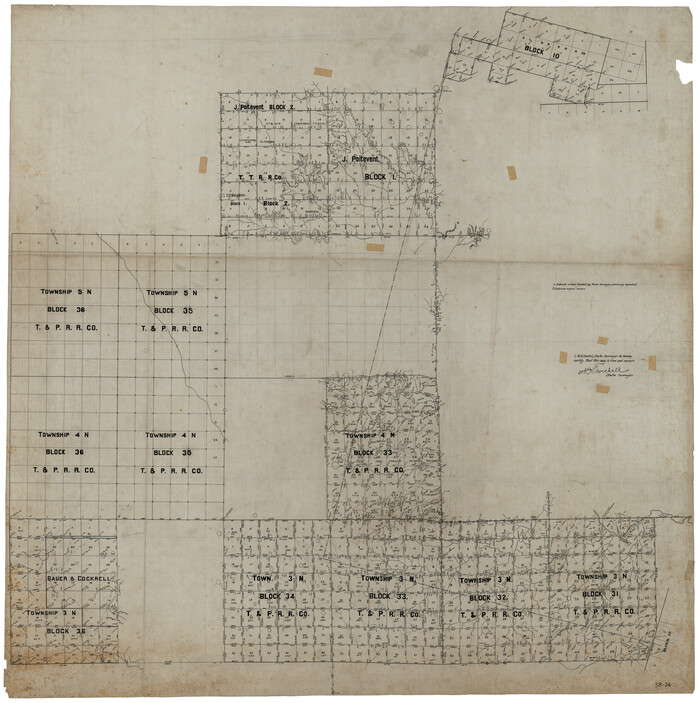
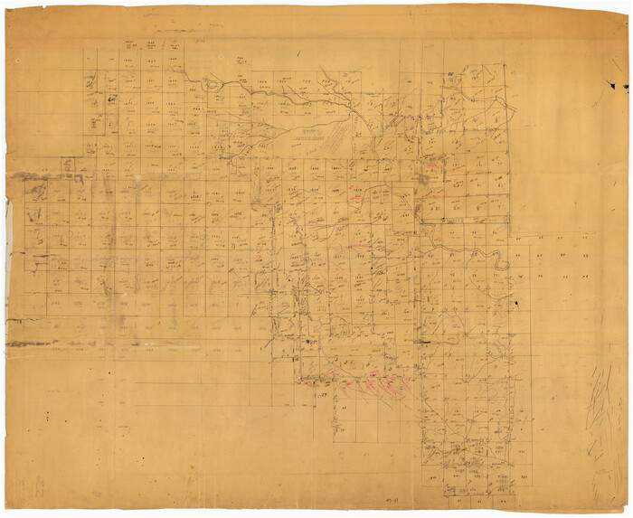
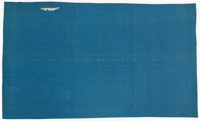
[T. & P. RR. Co. Blocks 31-36, Townships 3N, 4N and 5N and surrounding area]
Print $40.00
- Digital $50.00
[T. & P. RR. Co. Blocks 31-36, Townships 3N, 4N and 5N and surrounding area]
Size: 51.3 x 51.5 inches
93135
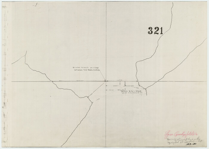
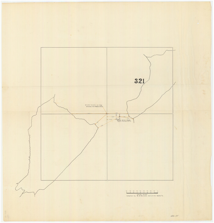
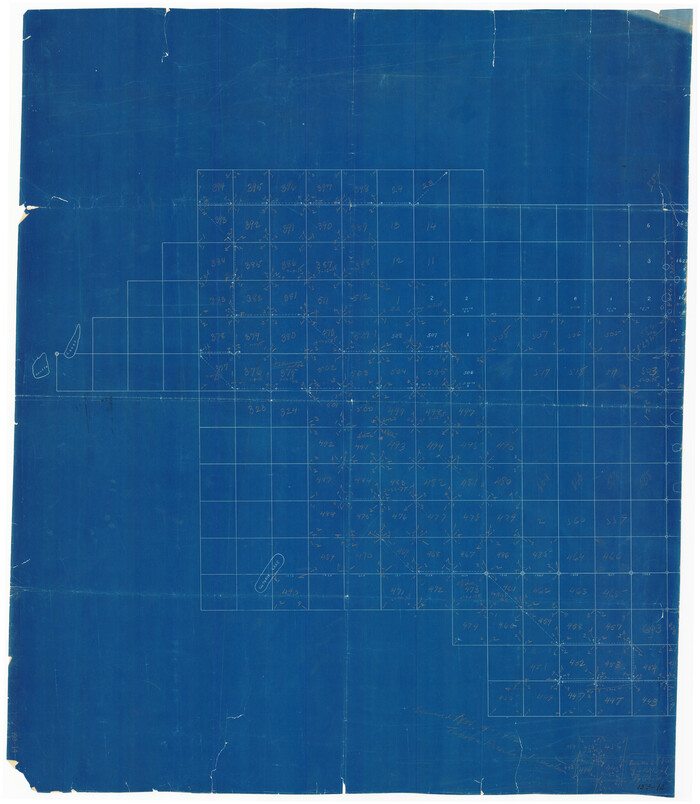
[Survey 321, Double Lakes Area, Northwest of Tohoka]
Print $20.00
- Digital $50.00
[Survey 321, Double Lakes Area, Northwest of Tohoka]
Size: 26.9 x 19.5 inches
91299
[Survey 321, Double Lakes Area Northwest of Tohoka]
Print $20.00
- Digital $50.00
[Survey 321, Double Lakes Area Northwest of Tohoka]
Size: 35.0 x 32.2 inches
91347
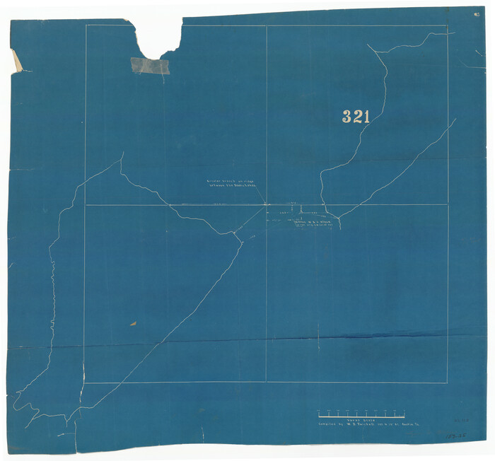
[Survey 321, Double Lakes Area Northwest of Tahoka]
Print $20.00
- Digital $50.00
[Survey 321, Double Lakes Area Northwest of Tahoka]
Size: 41.3 x 43.0 inches
89962
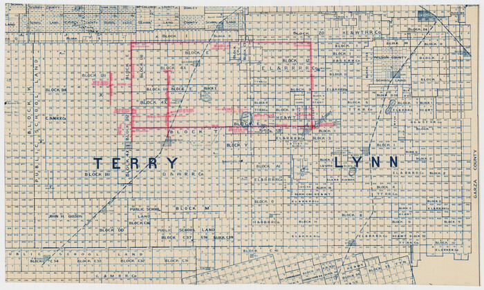
[Southwest Portion of Lynn County, Southeast Portion of Terry County]
Print $20.00
- Digital $50.00
[Southwest Portion of Lynn County, Southeast Portion of Terry County]
1952
Size: 34.3 x 35.1 inches
91305
[Sketch showing correct location of the North and East lines of the Nave McCord pasture fence]
Print $20.00
- Digital $50.00
[Sketch showing correct location of the North and East lines of the Nave McCord pasture fence]
1900
Size: 20.3 x 11.8 inches
90896
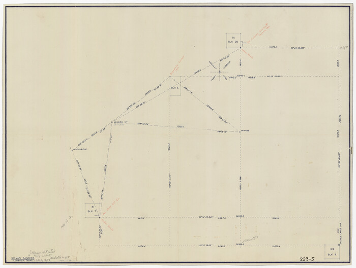
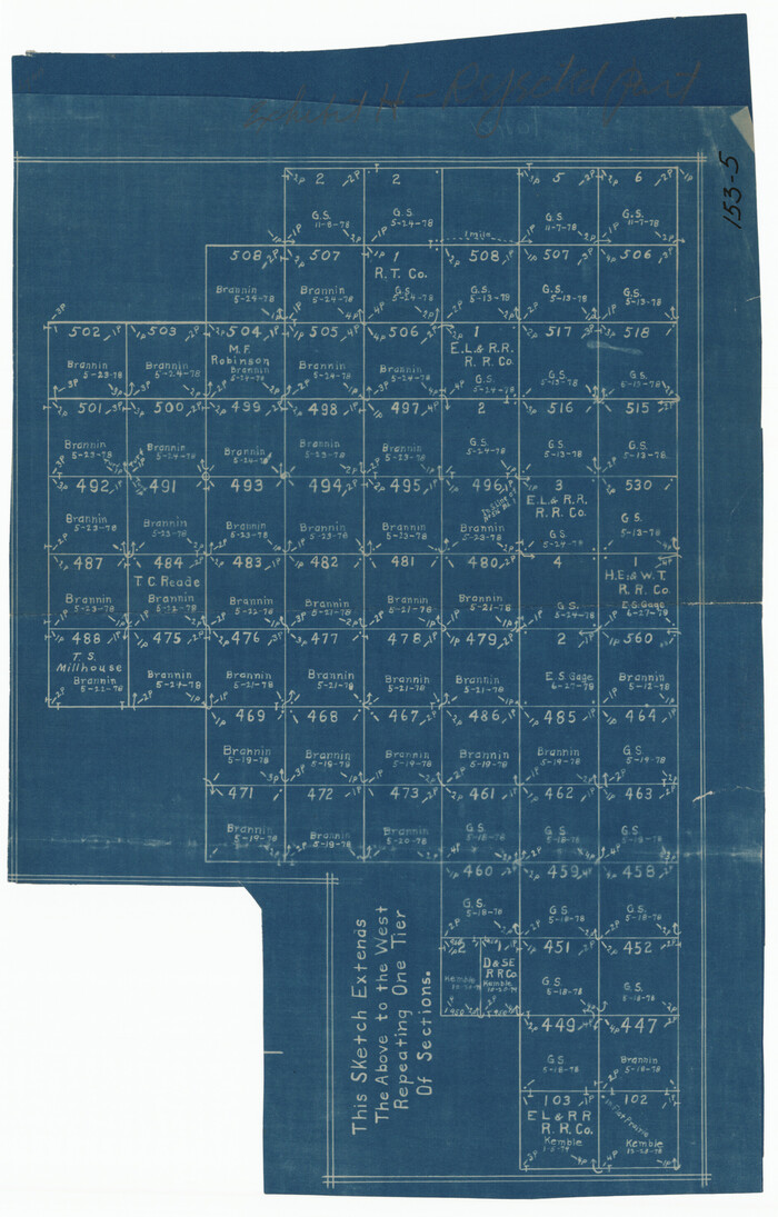
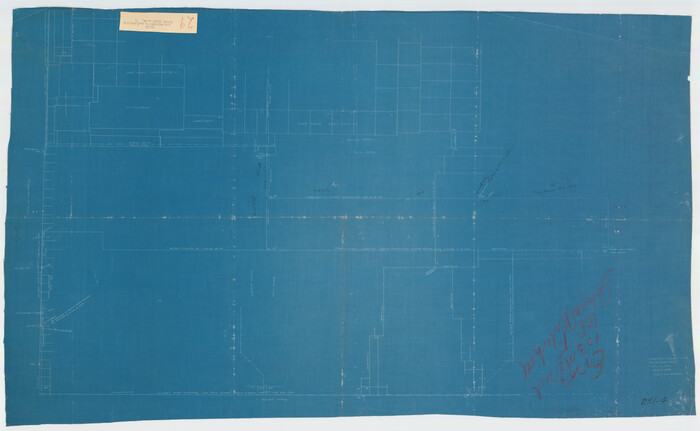
[Sketch showing Connecting Lines]
Print $20.00
- Digital $50.00
[Sketch showing Connecting Lines]
Size: 24.3 x 18.3 inches
91938
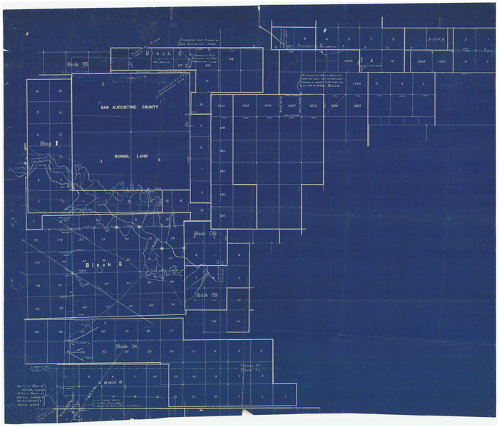
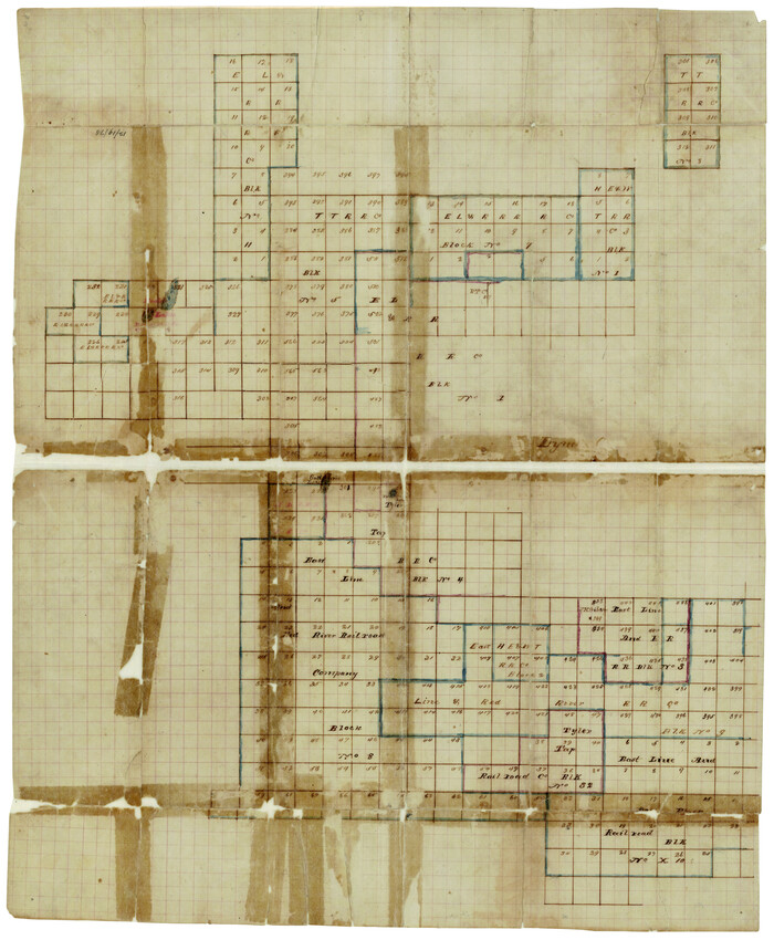
[Sketch showing Blocks 1, B18 and E.L. & RR. Co. Blocks 2, 8 and 97]
Print $40.00
- Digital $50.00
[Sketch showing Blocks 1, B18 and E.L. & RR. Co. Blocks 2, 8 and 97]
Size: 55.1 x 44.9 inches
89950
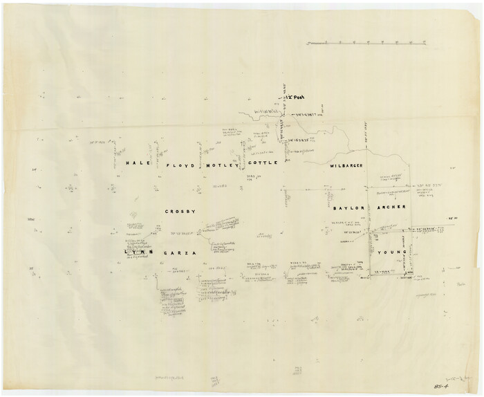
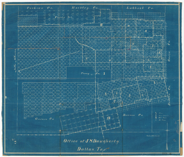
[Sketch of counties just south of the Panhandle]
Print $20.00
- Digital $50.00
[Sketch of counties just south of the Panhandle]
Size: 42.7 x 34.8 inches
90913
[Sketch of E.L. RR. Blks. 1, 2, 7]
Print $20.00
- Digital $50.00
[Sketch of E.L. RR. Blks. 1, 2, 7]
Size: 36.8 x 42.8 inches
89963
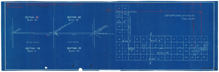
[Sketch of Blocks 4X, E, T, C42, and Y with Double Lake Corner tie to Rhoads Fisher Corners]
Print $20.00
- Digital $50.00
[Sketch of Blocks 4X, E, T, C42, and Y with Double Lake Corner tie to Rhoads Fisher Corners]
Size: 34.0 x 11.5 inches
91940
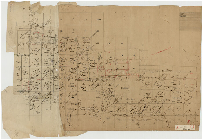
[Sketch focused on Southeast corner of Lubbock County]
Print $20.00
- Digital $50.00
[Sketch focused on Southeast corner of Lubbock County]
Size: 42.8 x 36.9 inches
89899
[Section 70, Block 8, Dawson and Lynn Counties, Texas]
Print $20.00
- Digital $50.00
[Section 70, Block 8, Dawson and Lynn Counties, Texas]
Size: 23.9 x 19.6 inches
92562
[SW Corner of Lynn County]
Print $20.00
- Digital $50.00
[SW Corner of Lynn County]
1954
Size: 32.2 x 31.1 inches
92903
[Portions of E. L. & R. R. and G. C. & S. F. Block 1]
Print $3.00
- Digital $50.00
[Portions of E. L. & R. R. and G. C. & S. F. Block 1]
Size: 9.7 x 15.2 inches
91337
[Portions of Blocks 20, 24, S, and the West Lone of Wilson County School Land]
Print $20.00
- Digital $50.00
[Portions of Blocks 20, 24, S, and the West Lone of Wilson County School Land]
1910
Size: 27.9 x 15.7 inches
91326
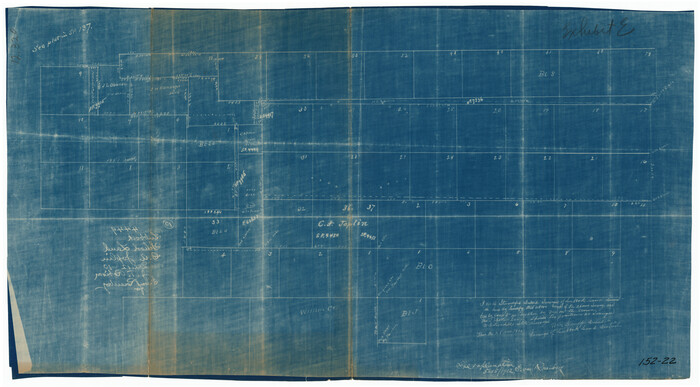
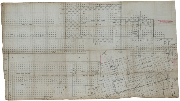
[Portion of Terry & Lynn County Lines]
Print $20.00
- Digital $50.00
[Portion of Terry & Lynn County Lines]
Size: 22.6 x 14.0 inches
92906
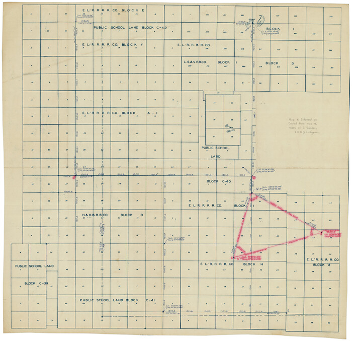
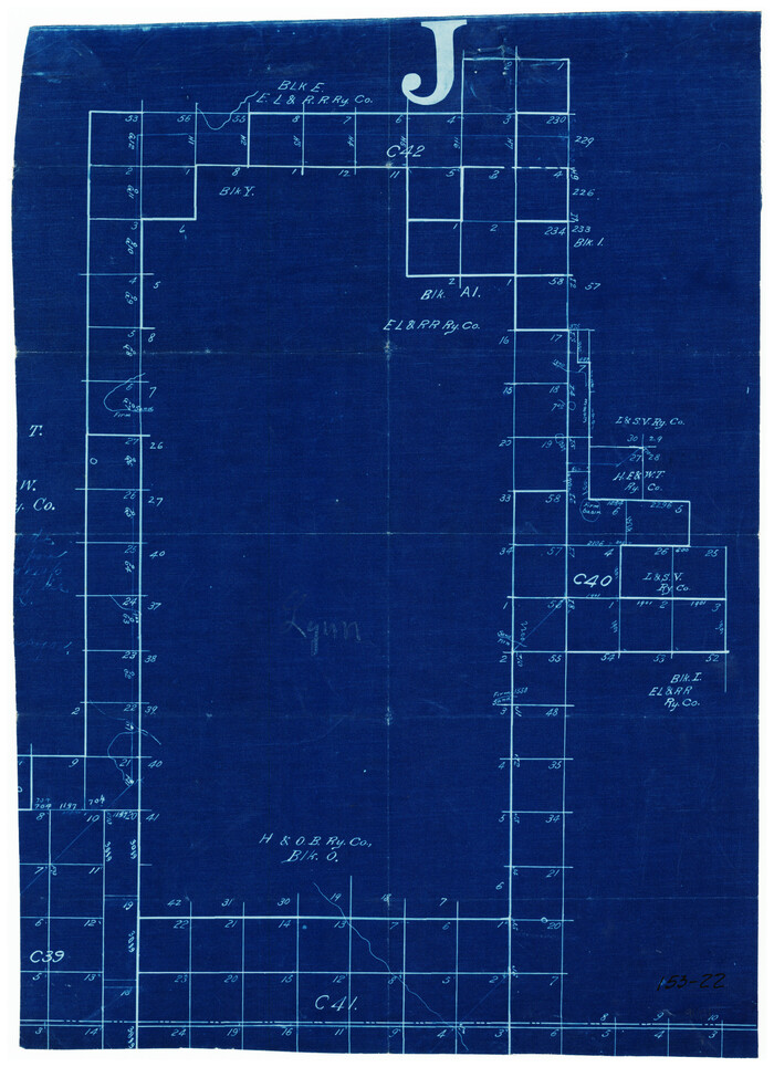
[Parts of Public School Land Blocks 39, 31, C-40, C-42, E. L. & R. R. Blocks H, I]
Print $20.00
- Digital $50.00
[Parts of Public School Land Blocks 39, 31, C-40, C-42, E. L. & R. R. Blocks H, I]
Size: 14.2 x 19.5 inches
91271
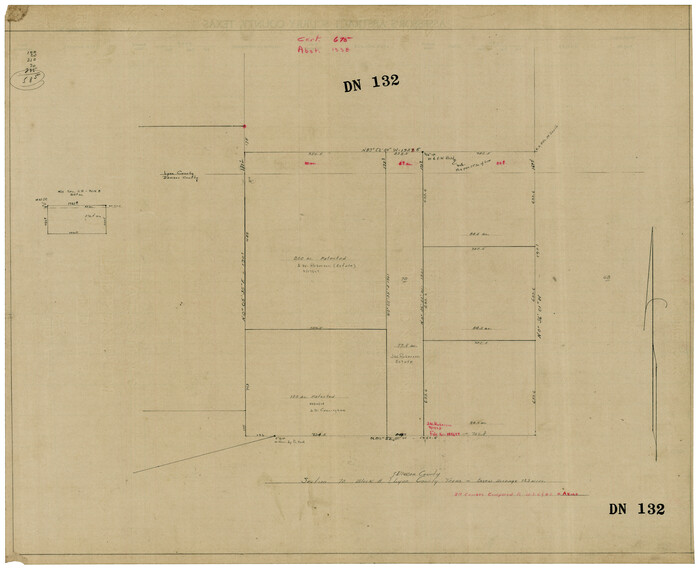
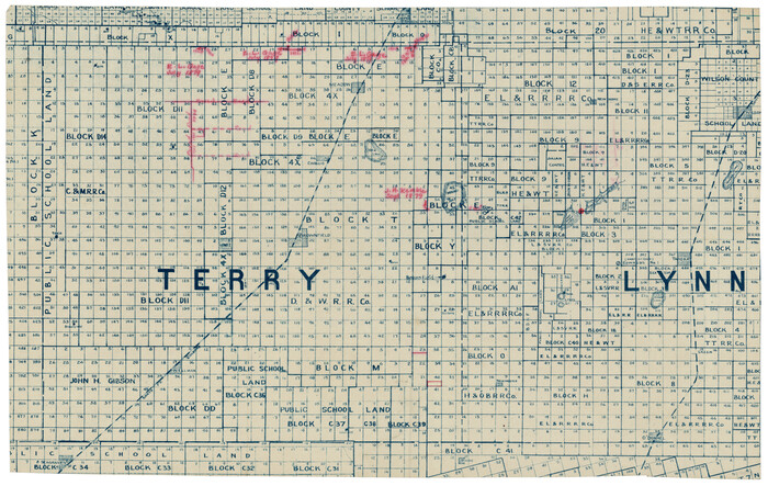
[Part of Map Showing Terry & Lynn County Line Highlighting Parts of Blocks D8, E, 9]
Print $20.00
- Digital $50.00
[Part of Map Showing Terry & Lynn County Line Highlighting Parts of Blocks D8, E, 9]
Size: 18.2 x 10.9 inches
92264
[Northwest part of County]
Print $20.00
- Digital $50.00
[Northwest part of County]
Size: 32.3 x 22.3 inches
90865
[Northwest corner of the County]
Print $20.00
- Digital $50.00
[Northwest corner of the County]
1903
Size: 19.1 x 21.5 inches
90873
[North half Dawson County, southwest quarter Lynn County, south half of Terry County, southeast quarter Yoakum County, north half Gaines County]
Print $40.00
- Digital $50.00
[North half Dawson County, southwest quarter Lynn County, south half of Terry County, southeast quarter Yoakum County, north half Gaines County]
Size: 79.8 x 45.3 inches
93133
[Map showing connecting line from New Mexico to Double Lakes]
Print $20.00
- Digital $50.00
[Map showing connecting line from New Mexico to Double Lakes]
1913
Size: 39.3 x 24.2 inches
91997
[Map showing connecting line from New Mexico to Double Lakes]
Print $20.00
- Digital $50.00
[Map showing connecting line from New Mexico to Double Lakes]
1913
Size: 39.6 x 24.2 inches
91998
[Map showing J. H. Gibson Blocks D and DD and Double Lake Corner]
Print $20.00
- Digital $50.00
[Map showing J. H. Gibson Blocks D and DD and Double Lake Corner]
Size: 31.3 x 15.9 inches
91996
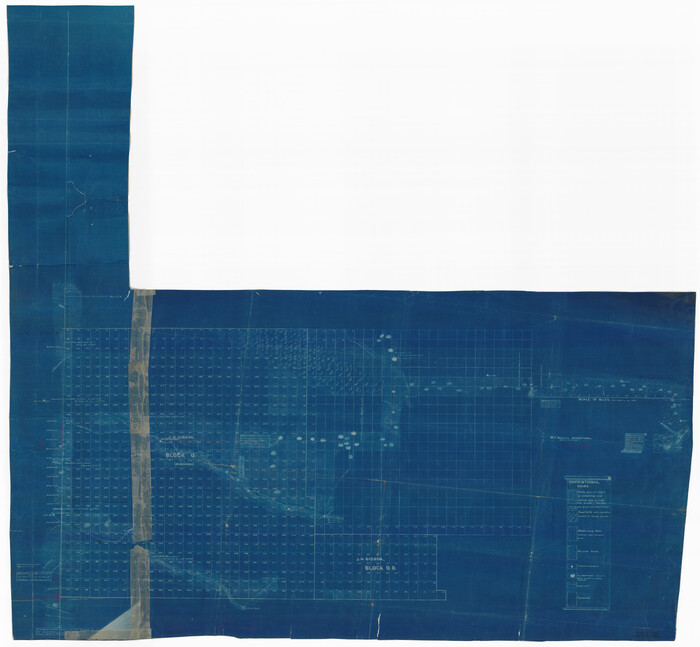
[Map showing J. H. Gibson Blocks D and DD and Double Lake Corner]
Print $20.00
- Digital $50.00
[Map showing J. H. Gibson Blocks D and DD and Double Lake Corner]
Size: 31.4 x 20.4 inches
92014
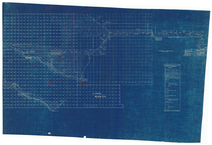
[Map showing J. H. Gibson Blocks D and DD and Double Lake Corner]
Print $20.00
- Digital $50.00
[Map showing J. H. Gibson Blocks D and DD and Double Lake Corner]
Size: 36.4 x 33.6 inches
92015
[Map showing Gaines, Dawson, Yoakum, Terry and Lynn Counties]
Print $20.00
- Digital $50.00
[Map showing Gaines, Dawson, Yoakum, Terry and Lynn Counties]
Size: 24.2 x 20.7 inches
92007
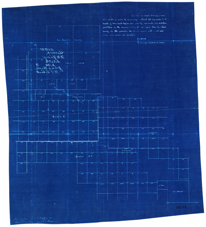
[Map of Lynn County]
Print $20.00
- Digital $50.00
[Map of Lynn County]
Size: 22.4 x 17.8 inches
4586
[Tie Line, Zavala County School Land to North Line of Block D11, East and South to Double Lakes Corner]
Print $20.00
- Digital $50.00
[Tie Line, Zavala County School Land to North Line of Block D11, East and South to Double Lakes Corner]
1900
-
Size
18.5 x 12.6 inches
-
Map/Doc
91868
-
Creation Date
1900
[T. & P. RR. Co. Blocks 31-36, Townships 3N, 4N and 5N and surrounding area]
Print $40.00
- Digital $50.00
[T. & P. RR. Co. Blocks 31-36, Townships 3N, 4N and 5N and surrounding area]
-
Size
51.3 x 51.5 inches
-
Map/Doc
93135
[Survey 321, Double Lakes Area, Northwest of Tohoka]
Print $20.00
- Digital $50.00
[Survey 321, Double Lakes Area, Northwest of Tohoka]
-
Size
26.9 x 19.5 inches
-
Map/Doc
91299
[Survey 321, Double Lakes Area Northwest of Tohoka]
Print $20.00
- Digital $50.00
[Survey 321, Double Lakes Area Northwest of Tohoka]
-
Size
35.0 x 32.2 inches
-
Map/Doc
91347
[Survey 321, Double Lakes Area Northwest of Tahoka]
Print $20.00
- Digital $50.00
[Survey 321, Double Lakes Area Northwest of Tahoka]
-
Size
41.3 x 43.0 inches
-
Map/Doc
89962
[Southwest Portion of Lynn County, Southeast Portion of Terry County]
Print $20.00
- Digital $50.00
[Southwest Portion of Lynn County, Southeast Portion of Terry County]
1952
-
Size
34.3 x 35.1 inches
-
Map/Doc
91305
-
Creation Date
1952
[Sketch showing correct location of the North and East lines of the Nave McCord pasture fence]
Print $20.00
- Digital $50.00
[Sketch showing correct location of the North and East lines of the Nave McCord pasture fence]
1900
-
Size
20.3 x 11.8 inches
-
Map/Doc
90896
-
Creation Date
1900
[Sketch showing Connecting Lines]
Print $20.00
- Digital $50.00
[Sketch showing Connecting Lines]
-
Size
24.3 x 18.3 inches
-
Map/Doc
91938
[Sketch showing Blocks 1, B18 and E.L. & RR. Co. Blocks 2, 8 and 97]
Print $40.00
- Digital $50.00
[Sketch showing Blocks 1, B18 and E.L. & RR. Co. Blocks 2, 8 and 97]
-
Size
55.1 x 44.9 inches
-
Map/Doc
89950
[Sketch of counties just south of the Panhandle]
Print $20.00
- Digital $50.00
[Sketch of counties just south of the Panhandle]
-
Size
42.7 x 34.8 inches
-
Map/Doc
90913
[Sketch of E.L. RR. Blks. 1, 2, 7]
Print $20.00
- Digital $50.00
[Sketch of E.L. RR. Blks. 1, 2, 7]
-
Size
36.8 x 42.8 inches
-
Map/Doc
89963
[Sketch of Blocks 4X, E, T, C42, and Y with Double Lake Corner tie to Rhoads Fisher Corners]
Print $20.00
- Digital $50.00
[Sketch of Blocks 4X, E, T, C42, and Y with Double Lake Corner tie to Rhoads Fisher Corners]
-
Size
34.0 x 11.5 inches
-
Map/Doc
91940
[Sketch focused on Southeast corner of Lubbock County]
Print $20.00
- Digital $50.00
[Sketch focused on Southeast corner of Lubbock County]
-
Size
42.8 x 36.9 inches
-
Map/Doc
89899
[Section 70, Block 8, Dawson and Lynn Counties, Texas]
Print $20.00
- Digital $50.00
[Section 70, Block 8, Dawson and Lynn Counties, Texas]
-
Size
23.9 x 19.6 inches
-
Map/Doc
92562
[SW Corner of Lynn County]
Print $20.00
- Digital $50.00
[SW Corner of Lynn County]
1954
-
Size
32.2 x 31.1 inches
-
Map/Doc
92903
-
Creation Date
1954
[Portions of E. L. & R. R. and G. C. & S. F. Block 1]
Print $3.00
- Digital $50.00
[Portions of E. L. & R. R. and G. C. & S. F. Block 1]
-
Size
9.7 x 15.2 inches
-
Map/Doc
91337
[Portions of Blocks 20, 24, S, and the West Lone of Wilson County School Land]
Print $20.00
- Digital $50.00
[Portions of Blocks 20, 24, S, and the West Lone of Wilson County School Land]
1910
-
Size
27.9 x 15.7 inches
-
Map/Doc
91326
-
Creation Date
1910
[Portion of Terry & Lynn County Lines]
Print $20.00
- Digital $50.00
[Portion of Terry & Lynn County Lines]
-
Size
22.6 x 14.0 inches
-
Map/Doc
92906
[Parts of Public School Land Blocks 39, 31, C-40, C-42, E. L. & R. R. Blocks H, I]
Print $20.00
- Digital $50.00
[Parts of Public School Land Blocks 39, 31, C-40, C-42, E. L. & R. R. Blocks H, I]
-
Size
14.2 x 19.5 inches
-
Map/Doc
91271
[Part of Map Showing Terry & Lynn County Line Highlighting Parts of Blocks D8, E, 9]
Print $20.00
- Digital $50.00
[Part of Map Showing Terry & Lynn County Line Highlighting Parts of Blocks D8, E, 9]
-
Size
18.2 x 10.9 inches
-
Map/Doc
92264
[Northwest part of County]
Print $20.00
- Digital $50.00
[Northwest part of County]
-
Size
32.3 x 22.3 inches
-
Map/Doc
90865
[Northwest corner of the County]
Print $20.00
- Digital $50.00
[Northwest corner of the County]
1903
-
Size
19.1 x 21.5 inches
-
Map/Doc
90873
-
Creation Date
1903
[North half Dawson County, southwest quarter Lynn County, south half of Terry County, southeast quarter Yoakum County, north half Gaines County]
Print $40.00
- Digital $50.00
[North half Dawson County, southwest quarter Lynn County, south half of Terry County, southeast quarter Yoakum County, north half Gaines County]
-
Size
79.8 x 45.3 inches
-
Map/Doc
93133
[Map showing connecting line from New Mexico to Double Lakes]
Print $20.00
- Digital $50.00
[Map showing connecting line from New Mexico to Double Lakes]
1913
-
Size
39.3 x 24.2 inches
-
Map/Doc
91997
-
Creation Date
1913
[Map showing connecting line from New Mexico to Double Lakes]
Print $20.00
- Digital $50.00
[Map showing connecting line from New Mexico to Double Lakes]
1913
-
Size
39.6 x 24.2 inches
-
Map/Doc
91998
-
Creation Date
1913
[Map showing J. H. Gibson Blocks D and DD and Double Lake Corner]
Print $20.00
- Digital $50.00
[Map showing J. H. Gibson Blocks D and DD and Double Lake Corner]
-
Size
31.3 x 15.9 inches
-
Map/Doc
91996
[Map showing J. H. Gibson Blocks D and DD and Double Lake Corner]
Print $20.00
- Digital $50.00
[Map showing J. H. Gibson Blocks D and DD and Double Lake Corner]
-
Size
31.4 x 20.4 inches
-
Map/Doc
92014
[Map showing J. H. Gibson Blocks D and DD and Double Lake Corner]
Print $20.00
- Digital $50.00
[Map showing J. H. Gibson Blocks D and DD and Double Lake Corner]
-
Size
36.4 x 33.6 inches
-
Map/Doc
92015
[Map showing Gaines, Dawson, Yoakum, Terry and Lynn Counties]
Print $20.00
- Digital $50.00
[Map showing Gaines, Dawson, Yoakum, Terry and Lynn Counties]
-
Size
24.2 x 20.7 inches
-
Map/Doc
92007
[Map of Lynn County]
Print $20.00
- Digital $50.00
[Map of Lynn County]
-
Size
22.4 x 17.8 inches
-
Map/Doc
4586