McLennan County Working Sketch 9

Print $20.00
- Digital $50.00
McLennan County Working Sketch 9
2008
Size: 23.0 x 28.9 inches
88768
Bosque County Working Sketch 24

Print $20.00
- Digital $50.00
Bosque County Working Sketch 24
1994
Size: 34.4 x 47.4 inches
67457
Bosque County Working Sketch 24

Print $20.00
- Digital $50.00
Bosque County Working Sketch 24
1994
Size: 34.6 x 47.3 inches
67458
McLennan County Working Sketch 8

Print $20.00
- Digital $50.00
McLennan County Working Sketch 8
1974
Size: 34.1 x 30.6 inches
70701
Belton and Stillhouse Hollow Reservoirs (Recto)

Belton and Stillhouse Hollow Reservoirs (Recto)
1972
Size: 29.1 x 22.6 inches
94172
Belton and Stillhouse Hollow Reservoirs (Verso)

Belton and Stillhouse Hollow Reservoirs (Verso)
1972
Size: 29.3 x 22.7 inches
94173
McLennan County Sketch File 41

Print $44.00
- Digital $50.00
McLennan County Sketch File 41
1963
Size: 11.1 x 8.6 inches
31319
General Highway Map, McLennan County, Texas

Print $20.00
General Highway Map, McLennan County, Texas
1961
Size: 18.2 x 24.6 inches
79589
General Highway Map. Detail of Cities and Towns in McLennan County, Texas [Waco and vicinity]
Print $20.00
General Highway Map. Detail of Cities and Towns in McLennan County, Texas [Waco and vicinity]
1961
Size: 18.1 x 24.6 inches
79590
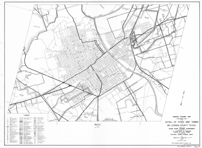
General Highway Map. Detail of Cities and Towns in McLennan County, Texas

Print $20.00
General Highway Map. Detail of Cities and Towns in McLennan County, Texas
1961
Size: 18.2 x 24.6 inches
79591
McLennan County Working Sketch 7

Print $20.00
- Digital $50.00
McLennan County Working Sketch 7
1959
Size: 22.6 x 23.9 inches
70700
McLennan County Working Sketch 6

Print $20.00
- Digital $50.00
McLennan County Working Sketch 6
1957
Size: 26.7 x 24.8 inches
70699
McLennan County Sketch File 40

Print $8.00
- Digital $50.00
McLennan County Sketch File 40
1950
Size: 14.2 x 8.7 inches
31315
McLennan County Working Sketch Graphic Index

Print $20.00
- Digital $50.00
McLennan County Working Sketch Graphic Index
1946
Size: 41.8 x 44.8 inches
76637
McLennan County Working Sketch 5

Print $20.00
- Digital $50.00
McLennan County Working Sketch 5
1943
Size: 14.6 x 12.8 inches
70698
McLennan County Working Sketch 4

Print $20.00
- Digital $50.00
McLennan County Working Sketch 4
1941
Size: 19.2 x 27.9 inches
70697
McLennan County Working Sketch 3

Print $20.00
- Digital $50.00
McLennan County Working Sketch 3
1941
Size: 18.0 x 17.9 inches
70696
McLennan County Working Sketch 1

Print $20.00
- Digital $50.00
McLennan County Working Sketch 1
1941
Size: 21.5 x 29.6 inches
70694
McLennan County Working Sketch 2

Print $20.00
- Digital $50.00
McLennan County Working Sketch 2
1941
Size: 21.8 x 30.0 inches
70695
General Highway Map, McLennan County, Texas

Print $20.00
General Highway Map, McLennan County, Texas
1940
Size: 18.3 x 24.6 inches
79191
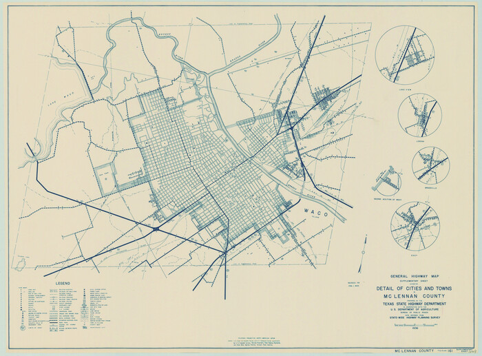
General Highway Map. Detail of Cities and Towns in McLennan County, Texas [Waco and vicinity]
Print $20.00
General Highway Map. Detail of Cities and Towns in McLennan County, Texas [Waco and vicinity]
1940
Size: 18.2 x 24.7 inches
79192
Brazos River, Gurley Sheet

Print $6.00
- Digital $50.00
Brazos River, Gurley Sheet
1929
Size: 33.1 x 30.2 inches
65282
Brazos River, East Waco Sheet

Print $6.00
- Digital $50.00
Brazos River, East Waco Sheet
1928
Size: 31.6 x 25.9 inches
65283
Map of University Land in McLennan County

Print $20.00
- Digital $50.00
Map of University Land in McLennan County
1905
Size: 35.1 x 32.9 inches
2432
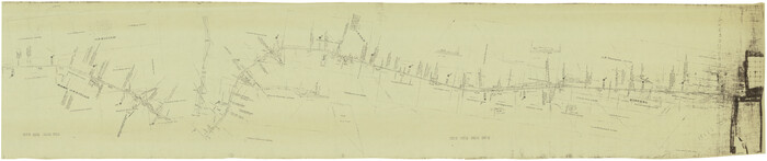
[G.C. and S. F. R.R. Co. Through Bosque County from McLennan Co. and E. to Hill Co. Station M. P. 259 to M. P. 297]
Print $40.00
- Digital $50.00
[G.C. and S. F. R.R. Co. Through Bosque County from McLennan Co. and E. to Hill Co. Station M. P. 259 to M. P. 297]
1898
Size: 22.4 x 101.5 inches
64564
Map of McLennan County

Print $40.00
- Digital $50.00
Map of McLennan County
1896
Size: 48.8 x 53.7 inches
7952
McLennan County Working Sketch 9
Print $20.00
- Digital $50.00
McLennan County Working Sketch 9
2008
-
Size
23.0 x 28.9 inches
-
Map/Doc
88768
-
Creation Date
2008
Bosque County Working Sketch 24
Print $20.00
- Digital $50.00
Bosque County Working Sketch 24
1994
-
Size
34.4 x 47.4 inches
-
Map/Doc
67457
-
Creation Date
1994
Bosque County Working Sketch 24
Print $20.00
- Digital $50.00
Bosque County Working Sketch 24
1994
-
Size
34.6 x 47.3 inches
-
Map/Doc
67458
-
Creation Date
1994
McLennan County Working Sketch 8
Print $20.00
- Digital $50.00
McLennan County Working Sketch 8
1974
-
Size
34.1 x 30.6 inches
-
Map/Doc
70701
-
Creation Date
1974
Belton and Stillhouse Hollow Reservoirs (Recto)
Belton and Stillhouse Hollow Reservoirs (Recto)
1972
-
Size
29.1 x 22.6 inches
-
Map/Doc
94172
-
Creation Date
1972
Belton and Stillhouse Hollow Reservoirs (Verso)
Belton and Stillhouse Hollow Reservoirs (Verso)
1972
-
Size
29.3 x 22.7 inches
-
Map/Doc
94173
-
Creation Date
1972
McLennan County Sketch File 41
Print $44.00
- Digital $50.00
McLennan County Sketch File 41
1963
-
Size
11.1 x 8.6 inches
-
Map/Doc
31319
-
Creation Date
1963
General Highway Map, McLennan County, Texas
Print $20.00
General Highway Map, McLennan County, Texas
1961
-
Size
18.2 x 24.6 inches
-
Map/Doc
79589
-
Creation Date
1961
General Highway Map. Detail of Cities and Towns in McLennan County, Texas [Waco and vicinity]
Print $20.00
General Highway Map. Detail of Cities and Towns in McLennan County, Texas [Waco and vicinity]
1961
-
Size
18.1 x 24.6 inches
-
Map/Doc
79590
-
Creation Date
1961
General Highway Map. Detail of Cities and Towns in McLennan County, Texas
Print $20.00
General Highway Map. Detail of Cities and Towns in McLennan County, Texas
1961
-
Size
18.2 x 24.6 inches
-
Map/Doc
79591
-
Creation Date
1961
McLennan County Working Sketch 7
Print $20.00
- Digital $50.00
McLennan County Working Sketch 7
1959
-
Size
22.6 x 23.9 inches
-
Map/Doc
70700
-
Creation Date
1959
McLennan County Working Sketch 6
Print $20.00
- Digital $50.00
McLennan County Working Sketch 6
1957
-
Size
26.7 x 24.8 inches
-
Map/Doc
70699
-
Creation Date
1957
McLennan County Sketch File 40
Print $8.00
- Digital $50.00
McLennan County Sketch File 40
1950
-
Size
14.2 x 8.7 inches
-
Map/Doc
31315
-
Creation Date
1950
McLennan County

Print $20.00
- Digital $50.00
McLennan County
1946
-
Size
42.3 x 45.1 inches
-
Map/Doc
77362
-
Creation Date
1946
McLennan County

Print $20.00
- Digital $50.00
McLennan County
1946
-
Size
43.9 x 46.8 inches
-
Map/Doc
1887
-
Creation Date
1946
McLennan County

Print $20.00
- Digital $50.00
McLennan County
1946
-
Size
42.5 x 45.8 inches
-
Map/Doc
73235
-
Creation Date
1946
McLennan County Working Sketch Graphic Index
Print $20.00
- Digital $50.00
McLennan County Working Sketch Graphic Index
1946
-
Size
41.8 x 44.8 inches
-
Map/Doc
76637
-
Creation Date
1946
McLennan County

Print $20.00
- Digital $50.00
McLennan County
1946
-
Size
43.8 x 46.9 inches
-
Map/Doc
95585
-
Creation Date
1946
McLennan County Working Sketch 5
Print $20.00
- Digital $50.00
McLennan County Working Sketch 5
1943
-
Size
14.6 x 12.8 inches
-
Map/Doc
70698
-
Creation Date
1943
McLennan County Working Sketch 4
Print $20.00
- Digital $50.00
McLennan County Working Sketch 4
1941
-
Size
19.2 x 27.9 inches
-
Map/Doc
70697
-
Creation Date
1941
McLennan County Working Sketch 3
Print $20.00
- Digital $50.00
McLennan County Working Sketch 3
1941
-
Size
18.0 x 17.9 inches
-
Map/Doc
70696
-
Creation Date
1941
McLennan County Working Sketch 1
Print $20.00
- Digital $50.00
McLennan County Working Sketch 1
1941
-
Size
21.5 x 29.6 inches
-
Map/Doc
70694
-
Creation Date
1941
McLennan County Working Sketch 2
Print $20.00
- Digital $50.00
McLennan County Working Sketch 2
1941
-
Size
21.8 x 30.0 inches
-
Map/Doc
70695
-
Creation Date
1941
General Highway Map, McLennan County, Texas
Print $20.00
General Highway Map, McLennan County, Texas
1940
-
Size
18.3 x 24.6 inches
-
Map/Doc
79191
-
Creation Date
1940
General Highway Map. Detail of Cities and Towns in McLennan County, Texas [Waco and vicinity]
Print $20.00
General Highway Map. Detail of Cities and Towns in McLennan County, Texas [Waco and vicinity]
1940
-
Size
18.2 x 24.7 inches
-
Map/Doc
79192
-
Creation Date
1940
Brazos River, Gurley Sheet
Print $6.00
- Digital $50.00
Brazos River, Gurley Sheet
1929
-
Size
33.1 x 30.2 inches
-
Map/Doc
65282
-
Creation Date
1929
Brazos River, East Waco Sheet
Print $6.00
- Digital $50.00
Brazos River, East Waco Sheet
1928
-
Size
31.6 x 25.9 inches
-
Map/Doc
65283
-
Creation Date
1928
Map of University Land in McLennan County
Print $20.00
- Digital $50.00
Map of University Land in McLennan County
1905
-
Size
35.1 x 32.9 inches
-
Map/Doc
2432
-
Creation Date
1905
[G.C. and S. F. R.R. Co. Through Bosque County from McLennan Co. and E. to Hill Co. Station M. P. 259 to M. P. 297]
Print $40.00
- Digital $50.00
[G.C. and S. F. R.R. Co. Through Bosque County from McLennan Co. and E. to Hill Co. Station M. P. 259 to M. P. 297]
1898
-
Size
22.4 x 101.5 inches
-
Map/Doc
64564
-
Creation Date
1898
Map of McLennan County
Print $40.00
- Digital $50.00
Map of McLennan County
1896
-
Size
48.8 x 53.7 inches
-
Map/Doc
7952
-
Creation Date
1896