[Surveys in Vehlein's Colony along the San Jacinto River]
Print $20.00
- Digital $50.00
[Surveys in Vehlein's Colony along the San Jacinto River]
1837
Size: 19.4 x 15.7 inches
27
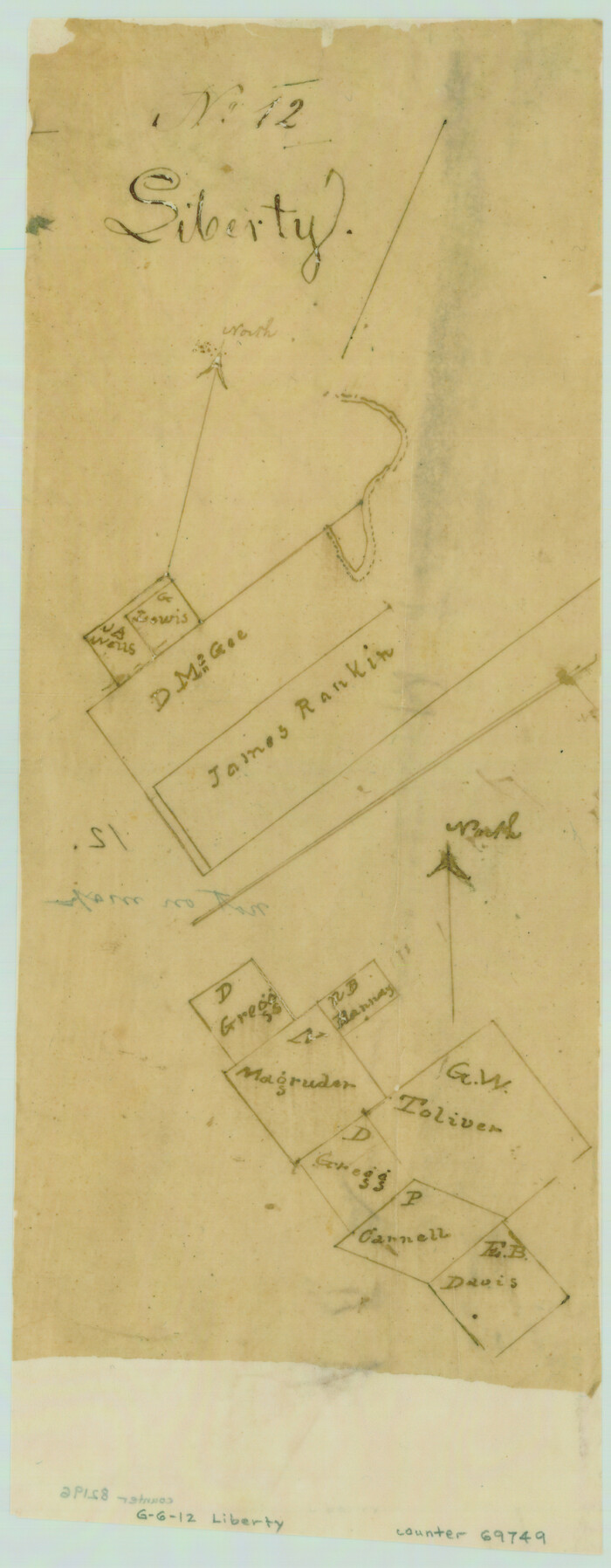
[Surveys in San Jacinto and Polk Counties]
Print $2.00
- Digital $50.00
[Surveys in San Jacinto and Polk Counties]
Size: 9.8 x 3.8 inches
69749
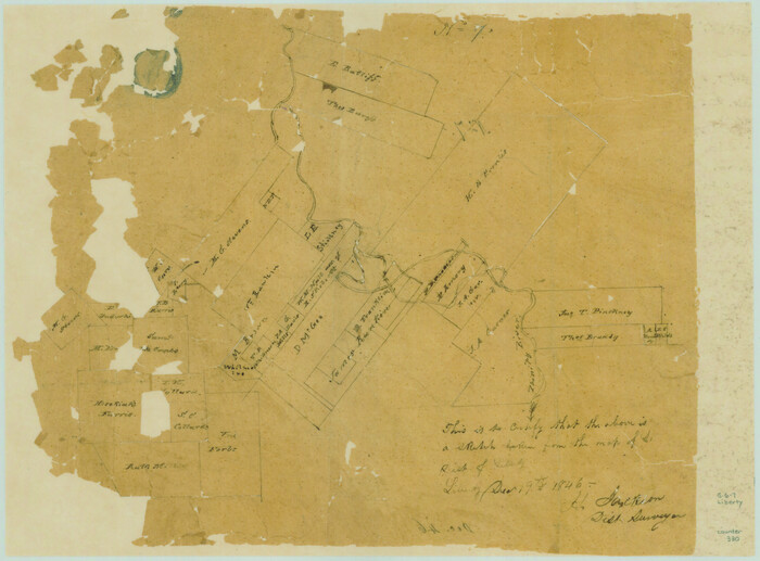
[Surveys along the Trinity River]
Print $2.00
- Digital $50.00
[Surveys along the Trinity River]
1846
Size: 9.0 x 12.2 inches
330
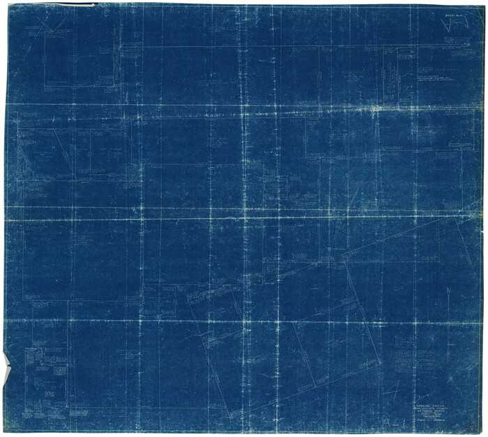
Walker County Working Sketch 8

Print $20.00
- Digital $50.00
Walker County Working Sketch 8
1935
Size: 40.8 x 41.7 inches
72288
Walker County Working Sketch 7

Print $20.00
- Digital $50.00
Walker County Working Sketch 7
1935
Size: 38.3 x 43.2 inches
72287
Walker County Working Sketch 6

Print $20.00
- Digital $50.00
Walker County Working Sketch 6
1935
Size: 30.8 x 40.6 inches
72286
Walker County Working Sketch 5

Print $20.00
- Digital $50.00
Walker County Working Sketch 5
1934
Size: 24.5 x 30.8 inches
72285
Walker County Working Sketch 19

Print $3.00
- Digital $50.00
Walker County Working Sketch 19
Size: 9.3 x 16.1 inches
72299
Walker County Sketch File 5

Print $4.00
- Digital $50.00
Walker County Sketch File 5
Size: 13.5 x 8.3 inches
39555
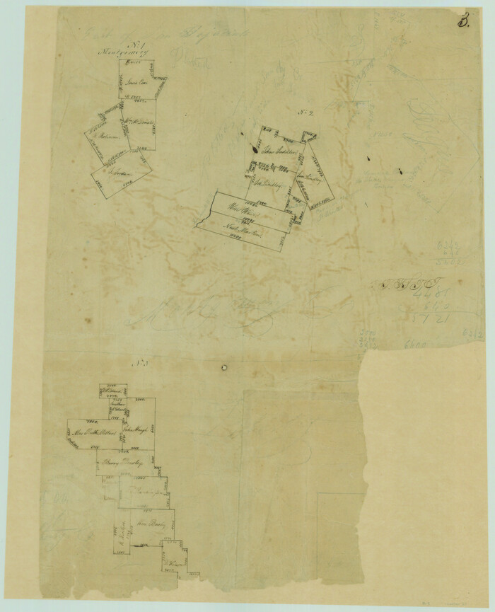
Sketches of Surveys in Montgomery Co.

Print $2.00
- Digital $50.00
Sketches of Surveys in Montgomery Co.
1845
Size: 10.2 x 8.0 inches
69731
San Jacinto River, Water Sheds of the San Jacinto River and Buffalo Bayou

Print $4.00
- Digital $50.00
San Jacinto River, Water Sheds of the San Jacinto River and Buffalo Bayou
Size: 28.8 x 20.0 inches
65149
San Jacinto County Working Sketch Graphic Index

Print $20.00
- Digital $50.00
San Jacinto County Working Sketch Graphic Index
1942
Size: 44.9 x 40.6 inches
76691
San Jacinto County Working Sketch 9
Print $20.00
- Digital $50.00
San Jacinto County Working Sketch 9
1935
Size: 36.1 x 42.1 inches
63722
San Jacinto County Working Sketch 8
Print $20.00
- Digital $50.00
San Jacinto County Working Sketch 8
1935
Size: 38.4 x 42.9 inches
63721
San Jacinto County Working Sketch 7

Print $20.00
- Digital $50.00
San Jacinto County Working Sketch 7
1935
Size: 32.0 x 41.4 inches
63720
San Jacinto County Working Sketch 6

Print $20.00
- Digital $50.00
San Jacinto County Working Sketch 6
1934
Size: 37.1 x 42.5 inches
63719
San Jacinto County Working Sketch 5

Print $20.00
- Digital $50.00
San Jacinto County Working Sketch 5
1934
Size: 16.5 x 21.2 inches
63718
San Jacinto County Working Sketch 45

Print $20.00
- Digital $50.00
San Jacinto County Working Sketch 45
1986
Size: 41.0 x 46.7 inches
63759
San Jacinto County Working Sketch 44

Print $20.00
- Digital $50.00
San Jacinto County Working Sketch 44
1981
Size: 20.6 x 11.4 inches
63758
San Jacinto County Working Sketch 43

Print $20.00
- Digital $50.00
San Jacinto County Working Sketch 43
1981
Size: 36.4 x 45.5 inches
63757
San Jacinto County Working Sketch 42b

Print $3.00
- Digital $50.00
San Jacinto County Working Sketch 42b
1979
Size: 10.7 x 14.4 inches
63756
San Jacinto County Working Sketch 42a

Print $20.00
- Digital $50.00
San Jacinto County Working Sketch 42a
1979
Size: 20.2 x 39.2 inches
63755
San Jacinto County Working Sketch 41

Print $20.00
- Digital $50.00
San Jacinto County Working Sketch 41
1979
Size: 44.6 x 35.2 inches
63754
San Jacinto County Working Sketch 40

Print $40.00
- Digital $50.00
San Jacinto County Working Sketch 40
1971
Size: 43.9 x 59.8 inches
63753
San Jacinto County Working Sketch 4

Print $20.00
- Digital $50.00
San Jacinto County Working Sketch 4
1934
Size: 16.2 x 20.8 inches
63717
San Jacinto County Working Sketch 39

Print $20.00
- Digital $50.00
San Jacinto County Working Sketch 39
1971
Size: 41.3 x 44.2 inches
63752
San Jacinto County Working Sketch 38

Print $40.00
- Digital $50.00
San Jacinto County Working Sketch 38
1966
Size: 41.5 x 55.9 inches
63751
San Jacinto County Working Sketch 37

Print $20.00
- Digital $50.00
San Jacinto County Working Sketch 37
1965
Size: 32.7 x 42.6 inches
63750
San Jacinto County Working Sketch 36

Print $40.00
- Digital $50.00
San Jacinto County Working Sketch 36
1964
Size: 33.0 x 57.2 inches
63749
San Jacinto County Working Sketch 35

Print $20.00
- Digital $50.00
San Jacinto County Working Sketch 35
1955
Size: 31.3 x 32.1 inches
63748
[Surveys in Vehlein's Colony along the San Jacinto River]
Print $20.00
- Digital $50.00
[Surveys in Vehlein's Colony along the San Jacinto River]
1837
-
Size
19.4 x 15.7 inches
-
Map/Doc
27
-
Creation Date
1837
[Surveys in San Jacinto and Polk Counties]
Print $2.00
- Digital $50.00
[Surveys in San Jacinto and Polk Counties]
-
Size
9.8 x 3.8 inches
-
Map/Doc
69749
[Surveys along the Trinity River]
Print $2.00
- Digital $50.00
[Surveys along the Trinity River]
1846
-
Size
9.0 x 12.2 inches
-
Map/Doc
330
-
Creation Date
1846
Walker County Working Sketch 8
Print $20.00
- Digital $50.00
Walker County Working Sketch 8
1935
-
Size
40.8 x 41.7 inches
-
Map/Doc
72288
-
Creation Date
1935
Walker County Working Sketch 7
Print $20.00
- Digital $50.00
Walker County Working Sketch 7
1935
-
Size
38.3 x 43.2 inches
-
Map/Doc
72287
-
Creation Date
1935
Walker County Working Sketch 6
Print $20.00
- Digital $50.00
Walker County Working Sketch 6
1935
-
Size
30.8 x 40.6 inches
-
Map/Doc
72286
-
Creation Date
1935
Walker County Working Sketch 5
Print $20.00
- Digital $50.00
Walker County Working Sketch 5
1934
-
Size
24.5 x 30.8 inches
-
Map/Doc
72285
-
Creation Date
1934
Walker County Working Sketch 19
Print $3.00
- Digital $50.00
Walker County Working Sketch 19
-
Size
9.3 x 16.1 inches
-
Map/Doc
72299
Walker County Sketch File 5
Print $4.00
- Digital $50.00
Walker County Sketch File 5
-
Size
13.5 x 8.3 inches
-
Map/Doc
39555
Sketches of Surveys in Montgomery Co.
Print $2.00
- Digital $50.00
Sketches of Surveys in Montgomery Co.
1845
-
Size
10.2 x 8.0 inches
-
Map/Doc
69731
-
Creation Date
1845
San Jacinto River, Water Sheds of the San Jacinto River and Buffalo Bayou
Print $4.00
- Digital $50.00
San Jacinto River, Water Sheds of the San Jacinto River and Buffalo Bayou
-
Size
28.8 x 20.0 inches
-
Map/Doc
65149
San Jacinto County Working Sketch Graphic Index
Print $20.00
- Digital $50.00
San Jacinto County Working Sketch Graphic Index
1942
-
Size
44.9 x 40.6 inches
-
Map/Doc
76691
-
Creation Date
1942
San Jacinto County Working Sketch 9
Print $20.00
- Digital $50.00
San Jacinto County Working Sketch 9
1935
-
Size
36.1 x 42.1 inches
-
Map/Doc
63722
-
Creation Date
1935
San Jacinto County Working Sketch 8
Print $20.00
- Digital $50.00
San Jacinto County Working Sketch 8
1935
-
Size
38.4 x 42.9 inches
-
Map/Doc
63721
-
Creation Date
1935
San Jacinto County Working Sketch 7
Print $20.00
- Digital $50.00
San Jacinto County Working Sketch 7
1935
-
Size
32.0 x 41.4 inches
-
Map/Doc
63720
-
Creation Date
1935
San Jacinto County Working Sketch 6
Print $20.00
- Digital $50.00
San Jacinto County Working Sketch 6
1934
-
Size
37.1 x 42.5 inches
-
Map/Doc
63719
-
Creation Date
1934
San Jacinto County Working Sketch 5
Print $20.00
- Digital $50.00
San Jacinto County Working Sketch 5
1934
-
Size
16.5 x 21.2 inches
-
Map/Doc
63718
-
Creation Date
1934
San Jacinto County Working Sketch 45
Print $20.00
- Digital $50.00
San Jacinto County Working Sketch 45
1986
-
Size
41.0 x 46.7 inches
-
Map/Doc
63759
-
Creation Date
1986
San Jacinto County Working Sketch 44
Print $20.00
- Digital $50.00
San Jacinto County Working Sketch 44
1981
-
Size
20.6 x 11.4 inches
-
Map/Doc
63758
-
Creation Date
1981
San Jacinto County Working Sketch 43
Print $20.00
- Digital $50.00
San Jacinto County Working Sketch 43
1981
-
Size
36.4 x 45.5 inches
-
Map/Doc
63757
-
Creation Date
1981
San Jacinto County Working Sketch 42b
Print $3.00
- Digital $50.00
San Jacinto County Working Sketch 42b
1979
-
Size
10.7 x 14.4 inches
-
Map/Doc
63756
-
Creation Date
1979
San Jacinto County Working Sketch 42a
Print $20.00
- Digital $50.00
San Jacinto County Working Sketch 42a
1979
-
Size
20.2 x 39.2 inches
-
Map/Doc
63755
-
Creation Date
1979
San Jacinto County Working Sketch 41
Print $20.00
- Digital $50.00
San Jacinto County Working Sketch 41
1979
-
Size
44.6 x 35.2 inches
-
Map/Doc
63754
-
Creation Date
1979
San Jacinto County Working Sketch 40
Print $40.00
- Digital $50.00
San Jacinto County Working Sketch 40
1971
-
Size
43.9 x 59.8 inches
-
Map/Doc
63753
-
Creation Date
1971
San Jacinto County Working Sketch 4
Print $20.00
- Digital $50.00
San Jacinto County Working Sketch 4
1934
-
Size
16.2 x 20.8 inches
-
Map/Doc
63717
-
Creation Date
1934
San Jacinto County Working Sketch 39
Print $20.00
- Digital $50.00
San Jacinto County Working Sketch 39
1971
-
Size
41.3 x 44.2 inches
-
Map/Doc
63752
-
Creation Date
1971
San Jacinto County Working Sketch 38
Print $40.00
- Digital $50.00
San Jacinto County Working Sketch 38
1966
-
Size
41.5 x 55.9 inches
-
Map/Doc
63751
-
Creation Date
1966
San Jacinto County Working Sketch 37
Print $20.00
- Digital $50.00
San Jacinto County Working Sketch 37
1965
-
Size
32.7 x 42.6 inches
-
Map/Doc
63750
-
Creation Date
1965
San Jacinto County Working Sketch 36
Print $40.00
- Digital $50.00
San Jacinto County Working Sketch 36
1964
-
Size
33.0 x 57.2 inches
-
Map/Doc
63749
-
Creation Date
1964
San Jacinto County Working Sketch 35
Print $20.00
- Digital $50.00
San Jacinto County Working Sketch 35
1955
-
Size
31.3 x 32.1 inches
-
Map/Doc
63748
-
Creation Date
1955