[Surveying Test and Answer Key]
Print $20.00
- Digital $50.00
[Surveying Test and Answer Key]
Size: 17.5 x 19.9 inches
76001
Stremme General Land Office Drawings, side view

Print $20.00
Stremme General Land Office Drawings, side view
Size: 27.0 x 21.8 inches
79739
Stremme General Land Office Drawings, front view

Print $20.00
Stremme General Land Office Drawings, front view
Size: 14.0 x 20.8 inches
79738
Stremme General Land Office Drawings, front door

Print $20.00
Stremme General Land Office Drawings, front door
Size: 27.4 x 21.9 inches
79737
Roundabout The Nation's Capital with Descriptive Notes

Roundabout The Nation's Capital with Descriptive Notes
1956
Size: 35.0 x 29.8 inches
92362
Oldham County Surveyor's Oath of Office

Print $3.00
Oldham County Surveyor's Oath of Office
1881
Size: 15.2 x 9.7 inches
47716
Old Miscellaneous File 38

Print $40.00
- Digital $50.00
Old Miscellaneous File 38
Size: 58.2 x 33.7 inches
75283
Old Miscellaneous File 33

Print $4.00
- Digital $50.00
Old Miscellaneous File 33
1874
Size: 9.8 x 8.1 inches
75753
Old Miscellaneous File 31

Print $8.00
- Digital $50.00
Old Miscellaneous File 31
1845
Size: 8.6 x 5.6 inches
75748
Old Miscellaneous File 10

Print $4.00
- Digital $50.00
Old Miscellaneous File 10
Size: 9.6 x 8.2 inches
75435
Map of the Roman Empire to illustrate Ancient History, engraved for Olney's school atlas

Print $20.00
- Digital $50.00
Map of the Roman Empire to illustrate Ancient History, engraved for Olney's school atlas
1845
Size: 12.1 x 19.0 inches
93550
Map of East Texas Oil Field

Print $20.00
- Digital $50.00
Map of East Texas Oil Field
1933
Size: 16.5 x 17.8 inches
93949
Main Line Routes of the Santa Fe Lines

Main Line Routes of the Santa Fe Lines
Size: 12.1 x 18.1 inches
94157
Gulf Oil Corp. Fishgide - Port O'Connor

Gulf Oil Corp. Fishgide - Port O'Connor
1960
Size: 12.0 x 22.0 inches
75982
Gulf Oil Corp. Fishgide - Port O'Connor

Gulf Oil Corp. Fishgide - Port O'Connor
1960
Size: 12.2 x 22.3 inches
75983
Gulf Oil Corp. Fishgide - Port Isabel

Gulf Oil Corp. Fishgide - Port Isabel
1960
Size: 22.0 x 11.9 inches
75980
Gulf Oil Corp. Fishgide - Port Isabel

Gulf Oil Corp. Fishgide - Port Isabel
1960
Size: 12.1 x 22.4 inches
75981
Gulf Oil Corp. Fishgide - Matagorda

Gulf Oil Corp. Fishgide - Matagorda
1960
Size: 12.4 x 22.4 inches
75976
Gulf Oil Corp. Fishgide - Matagorda

Gulf Oil Corp. Fishgide - Matagorda
1960
Size: 12.5 x 22.4 inches
75977
Gulf Oil Corp. Fishgide - Freeport

Gulf Oil Corp. Fishgide - Freeport
1960
Size: 12.3 x 22.4 inches
75978
Gulf Oil Corp. Fishgide - Freeport

Gulf Oil Corp. Fishgide - Freeport
1960
Size: 12.1 x 22.1 inches
75979
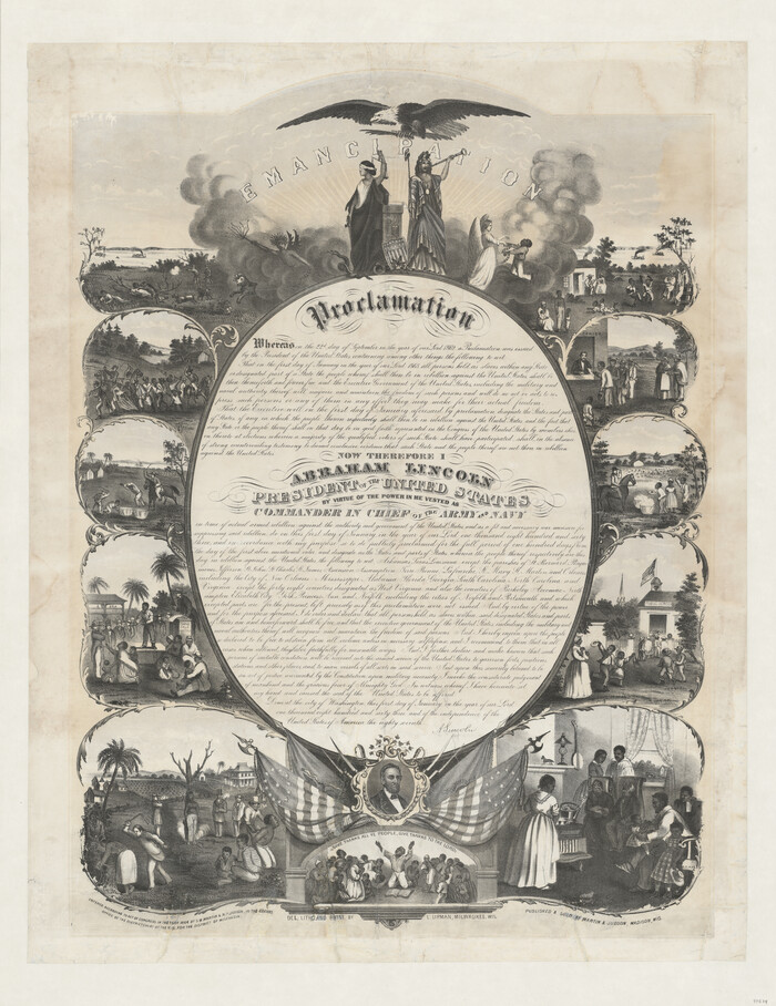
Emancipation Proclamation
Print $20.00
- Digital $50.00
Emancipation Proclamation
1864
Size: 29.5 x 22.7 inches
97534
Current Miscellaneous File 99

Print $32.00
- Digital $50.00
Current Miscellaneous File 99
1984
Size: 11.2 x 8.7 inches
74340
Current Miscellaneous File 94

Print $3.00
- Digital $50.00
Current Miscellaneous File 94
1851
Size: 11.2 x 17.1 inches
74268
Current Miscellaneous File 87

Print $8.00
- Digital $50.00
Current Miscellaneous File 87
Size: 11.3 x 8.6 inches
74243
Current Miscellaneous File 82

Print $4.00
- Digital $50.00
Current Miscellaneous File 82
Size: 12.0 x 8.8 inches
74224
Current Miscellaneous File 77

Print $10.00
- Digital $50.00
Current Miscellaneous File 77
1900
Size: 11.0 x 8.8 inches
74194
Current Miscellaneous File 7

Print $6.00
- Digital $50.00
Current Miscellaneous File 7
1838
Size: 13.8 x 8.5 inches
73733
Current Miscellaneous File 68

Print $22.00
- Digital $50.00
Current Miscellaneous File 68
Size: 11.2 x 8.8 inches
74134
Current Miscellaneous File 61

Print $4.00
- Digital $50.00
Current Miscellaneous File 61
1956
Size: 9.3 x 13.6 inches
74066
[Surveying Test and Answer Key]
Print $20.00
- Digital $50.00
[Surveying Test and Answer Key]
-
Size
17.5 x 19.9 inches
-
Map/Doc
76001
Stremme General Land Office Drawings, side view
Print $20.00
Stremme General Land Office Drawings, side view
-
Size
27.0 x 21.8 inches
-
Map/Doc
79739
Stremme General Land Office Drawings, front view
Print $20.00
Stremme General Land Office Drawings, front view
-
Size
14.0 x 20.8 inches
-
Map/Doc
79738
Stremme General Land Office Drawings, front door
Print $20.00
Stremme General Land Office Drawings, front door
-
Size
27.4 x 21.9 inches
-
Map/Doc
79737
Roundabout The Nation's Capital with Descriptive Notes
Roundabout The Nation's Capital with Descriptive Notes
1956
-
Size
35.0 x 29.8 inches
-
Map/Doc
92362
-
Creation Date
1956
Oldham County Surveyor's Oath of Office
Print $3.00
Oldham County Surveyor's Oath of Office
1881
Oath of Office by W.S. Mabry for the role of Surveyor of Oldham County and Oldham Land District.
-
Size
15.2 x 9.7 inches
-
Map/Doc
47716
-
Creation Date
1881
Old Miscellaneous File 38
Print $40.00
- Digital $50.00
Old Miscellaneous File 38
-
Size
58.2 x 33.7 inches
-
Map/Doc
75283
Old Miscellaneous File 33
Print $4.00
- Digital $50.00
Old Miscellaneous File 33
1874
-
Size
9.8 x 8.1 inches
-
Map/Doc
75753
-
Creation Date
1874
Old Miscellaneous File 31
Print $8.00
- Digital $50.00
Old Miscellaneous File 31
1845
-
Size
8.6 x 5.6 inches
-
Map/Doc
75748
-
Creation Date
1845
Old Miscellaneous File 10
Print $4.00
- Digital $50.00
Old Miscellaneous File 10
-
Size
9.6 x 8.2 inches
-
Map/Doc
75435
Map of the Roman Empire to illustrate Ancient History, engraved for Olney's school atlas
Print $20.00
- Digital $50.00
Map of the Roman Empire to illustrate Ancient History, engraved for Olney's school atlas
1845
-
Size
12.1 x 19.0 inches
-
Map/Doc
93550
-
Creation Date
1845
Map of East Texas Oil Field
Print $20.00
- Digital $50.00
Map of East Texas Oil Field
1933
-
Size
16.5 x 17.8 inches
-
Map/Doc
93949
-
Creation Date
1933
Main Line Routes of the Santa Fe Lines
Main Line Routes of the Santa Fe Lines
-
Size
12.1 x 18.1 inches
-
Map/Doc
94157
Gulf Oil Corp. Fishgide - Port O'Connor
Print $20.00
Gulf Oil Corp. Fishgide - Port O'Connor
1960
-
Size
12.0 x 22.0 inches
-
Map/Doc
75982
-
Creation Date
1960
Gulf Oil Corp. Fishgide - Port O'Connor
Print $20.00
Gulf Oil Corp. Fishgide - Port O'Connor
1960
-
Size
12.2 x 22.3 inches
-
Map/Doc
75983
-
Creation Date
1960
Gulf Oil Corp. Fishgide - Port Isabel
Print $20.00
Gulf Oil Corp. Fishgide - Port Isabel
1960
-
Size
22.0 x 11.9 inches
-
Map/Doc
75980
-
Creation Date
1960
Gulf Oil Corp. Fishgide - Port Isabel
Print $20.00
Gulf Oil Corp. Fishgide - Port Isabel
1960
-
Size
12.1 x 22.4 inches
-
Map/Doc
75981
-
Creation Date
1960
Gulf Oil Corp. Fishgide - Matagorda
Print $20.00
Gulf Oil Corp. Fishgide - Matagorda
1960
-
Size
12.4 x 22.4 inches
-
Map/Doc
75976
-
Creation Date
1960
Gulf Oil Corp. Fishgide - Matagorda
Print $20.00
Gulf Oil Corp. Fishgide - Matagorda
1960
-
Size
12.5 x 22.4 inches
-
Map/Doc
75977
-
Creation Date
1960
Gulf Oil Corp. Fishgide - Freeport
Print $20.00
Gulf Oil Corp. Fishgide - Freeport
1960
-
Size
12.3 x 22.4 inches
-
Map/Doc
75978
-
Creation Date
1960
Gulf Oil Corp. Fishgide - Freeport
Print $20.00
Gulf Oil Corp. Fishgide - Freeport
1960
-
Size
12.1 x 22.1 inches
-
Map/Doc
75979
-
Creation Date
1960
Emancipation Proclamation
Print $20.00
- Digital $50.00
Emancipation Proclamation
1864
-
Size
29.5 x 22.7 inches
-
Map/Doc
97534
-
Creation Date
1864
Current Miscellaneous File 99
Print $32.00
- Digital $50.00
Current Miscellaneous File 99
1984
-
Size
11.2 x 8.7 inches
-
Map/Doc
74340
-
Creation Date
1984
Current Miscellaneous File 94
Print $3.00
- Digital $50.00
Current Miscellaneous File 94
1851
-
Size
11.2 x 17.1 inches
-
Map/Doc
74268
-
Creation Date
1851
Current Miscellaneous File 87
Print $8.00
- Digital $50.00
Current Miscellaneous File 87
-
Size
11.3 x 8.6 inches
-
Map/Doc
74243
Current Miscellaneous File 82
Print $4.00
- Digital $50.00
Current Miscellaneous File 82
-
Size
12.0 x 8.8 inches
-
Map/Doc
74224
Current Miscellaneous File 77
Print $10.00
- Digital $50.00
Current Miscellaneous File 77
1900
-
Size
11.0 x 8.8 inches
-
Map/Doc
74194
-
Creation Date
1900
Current Miscellaneous File 7
Print $6.00
- Digital $50.00
Current Miscellaneous File 7
1838
-
Size
13.8 x 8.5 inches
-
Map/Doc
73733
-
Creation Date
1838
Current Miscellaneous File 68
Print $22.00
- Digital $50.00
Current Miscellaneous File 68
-
Size
11.2 x 8.8 inches
-
Map/Doc
74134
Current Miscellaneous File 61
Print $4.00
- Digital $50.00
Current Miscellaneous File 61
1956
-
Size
9.3 x 13.6 inches
-
Map/Doc
74066
-
Creation Date
1956