
Energy Map of Texas Ornament
2021

Energy Map of Texas
2020

Alamo Defenders Heritage Map of Texas
2025

The Gnome of Kimble County
2019

Lay's Eagle of the United States
2020

The Compass Rose of Austin's Colony
2016
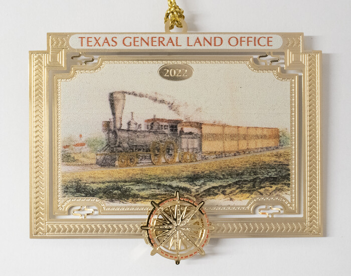
Bien & Sterner’s New Rail Road Map of the United States
2022

Map of Kimble County, 1860
1860

Guide map of the Great Texas Cattle Trail from Red River crossing to the Old Reliable Kansas Pacific Railway
1873

Lay's Map of the United States
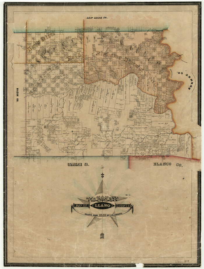
Map of Llano County
1859

Connected Map of Austin's Colony
1837

Connected Map of Austin's Colony
1837

Energy Map of Texas Ornament
2021
This ornament is inspired by Commissioner George P. Bush’s Energy Map of Texas. Featuring a...
-
Size
2.5 x 2.5 inches
-
Map/Doc
96574
-
Creation Date
2021

Energy Map of Texas
2020
-
Size
36.0 x 36.0 inches
-
Map/Doc
96436
-
Creation Date
2020

Alamo Defenders Heritage Map of Texas
2025
The Alamo is a sacred place where history, sacrifice, and pride come together to tell the powerful...
-
Size
36.0 x 24.0 inches
-
Map/Doc
97433
-
Creation Date
2025

The Gnome of Kimble County
2019
The Gnome of Kimble County is the fourth ornament produced by the Texas General Land Office Save...
-
Size
3.5 x 3.0 inches
-
Map/Doc
95706
-
Creation Date
2019

Lay's Eagle of the United States
2020
Lay’s Eagle of the United States is the fifth ornament produced by the Texas General Land Office...
-
Size
3.6 x 4.9 inches
-
Map/Doc
95952
-
Creation Date
2020

The Star of Llano County
2023
F.H. Arlitt made a bright and highly ornate Lone Star the center piece of his 1859 map of Llano...
-
Size
3.3 x 2.8 inches
-
Map/Doc
97175
-
Creation Date
2023

The Texas Longhorn
2024
Appearing on an 1873 map that the Kansas Pacific Railway Co. produced during the height of the Texas...
-
Size
3.0 x 3.2 inches
-
Map/Doc
97344
-
Creation Date
2024

The Yellow Rose Compass
2025
This year's General Land Office (GLO) ornament supporting the Save Texas History Program is inspired...
-
Size
3.5 x 2.8 inches
-
Map/Doc
97508
-
Creation Date
2025

The Compass Rose of Austin's Colony
2016
The Compass Rose of Austin’s Colony is the first ornament produced by the Texas General Land...
-
Size
4.0 x 3.5 inches
-
Map/Doc
94443
-
Creation Date
2016

Bien & Sterner’s New Rail Road Map of the United States
2022
Featuring a colorful locomotive chugging along the countryside on one side and Bien & Sterner’s...
-
Size
3.6 x 4.9 inches
-
Map/Doc
97020
-
Creation Date
2022

Map of Kimble County, 1860
1860
-
Size
20.7 x 30.5 inches
-
Map/Doc
3769
-
Creation Date
1860

Guide map of the Great Texas Cattle Trail from Red River crossing to the Old Reliable Kansas Pacific Railway
1873
-
Size
23.4 x 17.6 inches
-
Map/Doc
93938
-
Creation Date
1873

Lay's Map of the United States
-
Size
55.0 x 61.7 inches
-
Map/Doc
95693

Map of Llano County
1859
-
Size
28.6 x 21.7 inches
-
Map/Doc
3826
-
Creation Date
1859

Connected Map of Austin's Colony
1837
1892 certified tracing of 1833-1837 original
-
Size
90.8 x 85.6 inches
-
Map/Doc
1944
-
Creation Date
1837

Connected Map of Austin's Colony
1837
-
Size
90.6 x 80.9 inches
-
Map/Doc
1943
-
Creation Date
1837