![152, [Surveys along the San Marcos River], General Map Collection](https://historictexasmaps.com/wmedia_w1800h1800/maps/152.tif.jpg)
[Surveys along the San Marcos River]
Atlas E, Page 5, Sketch 11 (E-5-11)
E-5-11
-
Map/Doc
152
-
Collection
General Map Collection
-
Counties
Guadalupe
-
Subjects
Atlas
-
Height x Width
9.6 x 8.0 inches
24.4 x 20.3 cm
-
Medium
paper, manuscript
-
Comments
Conserved in 2004.
-
Features
San Marcos River
Part of: General Map Collection
Flight Mission No. DAG-26K, Frame 60, Matagorda County

Print $20.00
- Digital $50.00
Flight Mission No. DAG-26K, Frame 60, Matagorda County
1953
Size 18.7 x 22.7 inches
Map/Doc 86580
Jeff Davis County Working Sketch 47

Print $20.00
- Digital $50.00
Jeff Davis County Working Sketch 47
2000
Size 30.1 x 40.1 inches
Map/Doc 66542
Kimble County Working Sketch 57

Print $20.00
- Digital $50.00
Kimble County Working Sketch 57
1958
Size 20.3 x 30.5 inches
Map/Doc 70125
Edwards County Working Sketch 10

Print $20.00
- Digital $50.00
Edwards County Working Sketch 10
1920
Size 21.9 x 18.3 inches
Map/Doc 68886
Edwards County Sketch File 34

Print $20.00
- Digital $50.00
Edwards County Sketch File 34
Size 16.8 x 19.0 inches
Map/Doc 11434
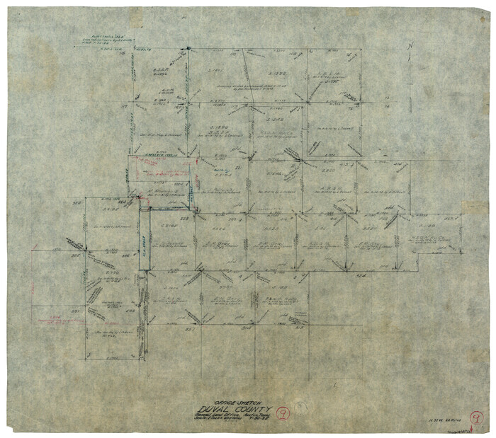
Duval County Working Sketch 9
Print $20.00
- Digital $50.00
Duval County Working Sketch 9
1935
Size 25.8 x 29.1 inches
Map/Doc 68722
[Sketch of surveys in the Bexar District along the Pedernales River]
![103, [Sketch of surveys in the Bexar District along the Pedernales River], General Map Collection](https://historictexasmaps.com/wmedia_w700/maps/103-1.tif.jpg)
Print $2.00
- Digital $50.00
[Sketch of surveys in the Bexar District along the Pedernales River]
1847
Size 13.6 x 8.3 inches
Map/Doc 103

Motley County Rolled Sketch 1

Print $20.00
- Digital $50.00
Motley County Rolled Sketch 1
1989
Size 39.0 x 47.6 inches
Map/Doc 9552
Matagorda County NRC Article 33.136 Sketch 13

Print $22.00
- Digital $50.00
Matagorda County NRC Article 33.136 Sketch 13
Size 24.2 x 36.0 inches
Map/Doc 95720
McMullen County Working Sketch 28

Print $20.00
- Digital $50.00
McMullen County Working Sketch 28
1954
Size 25.6 x 22.4 inches
Map/Doc 70729
Crane County Sketch File 6

Print $20.00
- Digital $50.00
Crane County Sketch File 6
Size 18.7 x 22.8 inches
Map/Doc 11207
You may also like
Stonewall County Working Sketch 34

Print $20.00
- Digital $50.00
Stonewall County Working Sketch 34
1985
Size 34.0 x 33.9 inches
Map/Doc 62341
Presidio County Rolled Sketch 125

Print $20.00
- Digital $50.00
Presidio County Rolled Sketch 125
Size 37.3 x 37.9 inches
Map/Doc 9799
Flight Mission No. DCL-7C, Frame 119, Kenedy County

Print $20.00
- Digital $50.00
Flight Mission No. DCL-7C, Frame 119, Kenedy County
1943
Size 18.5 x 22.3 inches
Map/Doc 86084
Map of Portland, Texas in San Patricio County

Print $20.00
- Digital $50.00
Map of Portland, Texas in San Patricio County
Size 39.8 x 46.0 inches
Map/Doc 48886
Liberty County Sketch File 3

Print $2.00
- Digital $50.00
Liberty County Sketch File 3
1847
Size 13.7 x 8.3 inches
Map/Doc 29884
Reagan County Rolled Sketch 9

Print $20.00
- Digital $50.00
Reagan County Rolled Sketch 9
1937
Size 29.7 x 30.9 inches
Map/Doc 7437
The Republic County of Robertson. November 28, 1839

Print $20.00
The Republic County of Robertson. November 28, 1839
2020
Size 18.9 x 21.6 inches
Map/Doc 96260
Llano County Working Sketch 4

Print $40.00
- Digital $50.00
Llano County Working Sketch 4
1954
Size 33.4 x 54.0 inches
Map/Doc 70622
Runnels County

Print $40.00
- Digital $50.00
Runnels County
1948
Size 48.8 x 38.8 inches
Map/Doc 73278
Map of Central Texas Oil Fields

Print $20.00
Map of Central Texas Oil Fields
1918
Size 27.1 x 21.5 inches
Map/Doc 76295
General Highway Map. Detail of Cities and Towns in Kinney County, Uvalde County [Uvalde and vicinity, Sabinal, and Brackettville and vicinity]
![79163, General Highway Map. Detail of Cities and Towns in Kinney County, Uvalde County [Uvalde and vicinity, Sabinal, and
Brackettville and vicinity], Texas State Library and Archives](https://historictexasmaps.com/wmedia_w700/maps/79163.tif.jpg)
Print $20.00
General Highway Map. Detail of Cities and Towns in Kinney County, Uvalde County [Uvalde and vicinity, Sabinal, and Brackettville and vicinity]
1940
Size 18.5 x 24.7 inches
Map/Doc 79163
