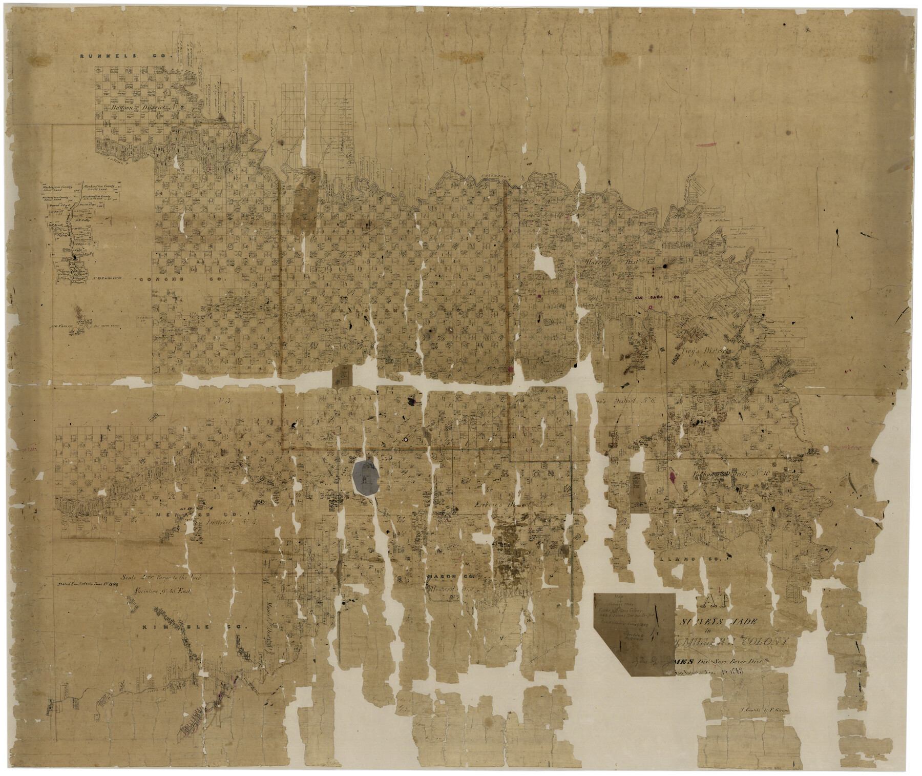
Map of Surveys made in Fisher and Miller's Colony
-
Map/Doc
16830
-
Collection
General Map Collection
-
Object Dates
6/1/1848 (Creation Date)
-
People and Organizations
T. Gentile (Compiler)
John G. James (Surveyor/Engineer)
F. Giraud (Compiler)
-
Subjects
Colony
-
Height x Width
48.4 x 57.7 inches
122.9 x 146.6 cm
-
Comments
Conservation funded in 2002 with donation from Carson and Bush Professional Surveyors, Inc.
Part of: General Map Collection
Travis County Rolled Sketch 37

Print $20.00
- Digital $50.00
Travis County Rolled Sketch 37
1942
Size 33.6 x 32.7 inches
Map/Doc 10737
[St. L. S-W. Ry. of Texas Map of Lufkin Branch in Angelina County, Texas]
![64561, [St. L. S-W. Ry. of Texas Map of Lufkin Branch in Angelina County, Texas], General Map Collection](https://historictexasmaps.com/wmedia_w700/maps/64561-1.tif.jpg)
Print $40.00
- Digital $50.00
[St. L. S-W. Ry. of Texas Map of Lufkin Branch in Angelina County, Texas]
1913
Size 25.4 x 121.3 inches
Map/Doc 64561
Trinity County Sketch File 20

Print $20.00
- Digital $50.00
Trinity County Sketch File 20
Size 21.3 x 27.9 inches
Map/Doc 12485
Calhoun County Working Sketch 12

Print $20.00
- Digital $50.00
Calhoun County Working Sketch 12
1976
Size 35.2 x 47.7 inches
Map/Doc 67828
Houston County Rolled Sketch 4

Print $40.00
- Digital $50.00
Houston County Rolled Sketch 4
Size 42.2 x 52.1 inches
Map/Doc 9181
Burnet County Boundary File 2

Print $28.00
- Digital $50.00
Burnet County Boundary File 2
Size 12.7 x 8.1 inches
Map/Doc 50858
Wichita County Working Sketch 6

Print $20.00
- Digital $50.00
Wichita County Working Sketch 6
1919
Size 24.6 x 21.4 inches
Map/Doc 72515
Hutchinson County Sketch File 39

Print $20.00
- Digital $50.00
Hutchinson County Sketch File 39
1938
Size 23.5 x 19.0 inches
Map/Doc 11822
Kerr County Working Sketch 31

Print $20.00
- Digital $50.00
Kerr County Working Sketch 31
1973
Size 43.6 x 29.0 inches
Map/Doc 70062
Rio Grande, McAllen Sheet

Print $20.00
- Digital $50.00
Rio Grande, McAllen Sheet
1937
Size 37.4 x 37.5 inches
Map/Doc 65118

Robertson County Sketch File 12

Print $18.00
Robertson County Sketch File 12
1987
Size 11.4 x 8.8 inches
Map/Doc 35404
You may also like
Dickens County Sketch File 1

Print $20.00
- Digital $50.00
Dickens County Sketch File 1
1879
Size 18.2 x 15.5 inches
Map/Doc 11315
Crosby County Sketch File 16

Print $20.00
- Digital $50.00
Crosby County Sketch File 16
1904
Size 31.7 x 9.6 inches
Map/Doc 11251

Crockett County Working Sketch 24

Print $20.00
- Digital $50.00
Crockett County Working Sketch 24
1920
Size 43.0 x 17.7 inches
Map/Doc 68357
Armstrong County Sketch File 4

Print $40.00
- Digital $50.00
Armstrong County Sketch File 4
1887
Size 17.9 x 20.1 inches
Map/Doc 10840
Castro County

Print $20.00
- Digital $50.00
Castro County
1932
Size 44.2 x 38.7 inches
Map/Doc 95451
Crockett County Working Sketch 62

Print $40.00
- Digital $50.00
Crockett County Working Sketch 62
1956
Size 35.4 x 66.1 inches
Map/Doc 63760
Wood County Sketch File 6

Print $8.00
- Digital $50.00
Wood County Sketch File 6
1877
Size 8.2 x 5.4 inches
Map/Doc 40641
Denton County Working Sketch 34

Print $20.00
- Digital $50.00
Denton County Working Sketch 34
2005
Size 22.2 x 27.3 inches
Map/Doc 83570
Foard County Rolled Sketch 14 1/2

Print $20.00
- Digital $50.00
Foard County Rolled Sketch 14 1/2
1888
Size 20.8 x 37.4 inches
Map/Doc 5889
Wilbarger County Working Sketch 14

Print $20.00
- Digital $50.00
Wilbarger County Working Sketch 14
1955
Size 24.8 x 21.7 inches
Map/Doc 72552
Grayson County Working Sketch 17

Print $20.00
- Digital $50.00
Grayson County Working Sketch 17
1955
Size 16.0 x 42.5 inches
Map/Doc 63256