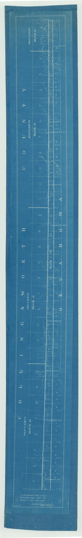
Texas Panhandle East Boundary Line
Between Oklahoma and Collingsworth County
-
Map/Doc
1702
-
Collection
General Map Collection
-
Object Dates
1898 (Creation Date)
-
People and Organizations
W.D. Twichell (Surveyor/Engineer)
-
Counties
Collingsworth
-
Subjects
Texas Boundaries
-
Height x Width
65.3 x 10.0 inches
165.9 x 25.4 cm
-
Medium
blueprint
-
Scale
N/A
-
Comments
Houston and Great Northern Railroad Company, Blocks 10, 11, 12, and 13 See counter no. 1716 for K.7.40b.
Part of: General Map Collection
Denton County Working Sketch 7

Print $20.00
- Digital $50.00
Denton County Working Sketch 7
1958
Size 26.0 x 28.8 inches
Map/Doc 68612
Hudspeth County Rolled Sketch 55

Print $49.00
- Digital $50.00
Hudspeth County Rolled Sketch 55
1977
Size 10.0 x 15.0 inches
Map/Doc 45968
Walker County Working Sketch 7

Print $20.00
- Digital $50.00
Walker County Working Sketch 7
1935
Size 38.3 x 43.2 inches
Map/Doc 72287
Edwards County Working Sketch 78

Print $20.00
- Digital $50.00
Edwards County Working Sketch 78
1962
Size 26.5 x 22.1 inches
Map/Doc 68954
Walker County Sketch File 3

Print $4.00
- Digital $50.00
Walker County Sketch File 3
1853
Size 12.8 x 8.2 inches
Map/Doc 39551
Schleicher County Working Sketch 23

Print $20.00
- Digital $50.00
Schleicher County Working Sketch 23
1953
Size 42.6 x 40.6 inches
Map/Doc 63825
Webb County Sketch File 19

Print $15.00
- Digital $50.00
Webb County Sketch File 19
1902
Size 9.2 x 17.0 inches
Map/Doc 39822
Flight Mission No. BRA-7M, Frame 125, Jefferson County

Print $20.00
- Digital $50.00
Flight Mission No. BRA-7M, Frame 125, Jefferson County
1953
Size 16.3 x 16.1 inches
Map/Doc 85519
Trinity River, East Fork of Trinity River Levee Improvement Districts/Widths of Floodways as Established by Approved Plans

Print $4.00
- Digital $50.00
Trinity River, East Fork of Trinity River Levee Improvement Districts/Widths of Floodways as Established by Approved Plans
1919
Size 28.4 x 18.5 inches
Map/Doc 65248
Kimble County Working Sketch 68

Print $20.00
- Digital $50.00
Kimble County Working Sketch 68
1965
Size 23.1 x 31.5 inches
Map/Doc 70136
Floyd County Working Sketch 1

Print $20.00
- Digital $50.00
Floyd County Working Sketch 1
1949
Size 24.5 x 24.1 inches
Map/Doc 69180
Leon County Working Sketch 61

Print $20.00
- Digital $50.00
Leon County Working Sketch 61
2010
Size 35.8 x 38.7 inches
Map/Doc 89986
You may also like
Wise County Sketch File 24

Print $4.00
- Digital $50.00
Wise County Sketch File 24
1860
Size 12.3 x 7.8 inches
Map/Doc 40570
Newton County Rolled Sketch 25

Print $20.00
- Digital $50.00
Newton County Rolled Sketch 25
1893
Size 22.3 x 18.6 inches
Map/Doc 6852
Howard County Sketch File 14

Print $8.00
- Digital $50.00
Howard County Sketch File 14
1940
Size 11.3 x 8.8 inches
Map/Doc 26871

Flight Mission No. CGI-3N, Frame 99, Cameron County

Print $20.00
- Digital $50.00
Flight Mission No. CGI-3N, Frame 99, Cameron County
1954
Size 18.5 x 22.1 inches
Map/Doc 84579
Presidio County Working Sketch 89

Print $20.00
- Digital $50.00
Presidio County Working Sketch 89
1972
Size 28.8 x 37.5 inches
Map/Doc 71766
Angelina County, Nacogdoches District

Print $20.00
- Digital $50.00
Angelina County, Nacogdoches District
1882
Size 20.0 x 27.6 inches
Map/Doc 3234
Flight Mission No. BRA-7M, Frame 196, Jefferson County

Print $20.00
- Digital $50.00
Flight Mission No. BRA-7M, Frame 196, Jefferson County
1953
Size 18.5 x 22.3 inches
Map/Doc 85564
Arlancy the Land of Plenty Farms

Print $20.00
- Digital $50.00
Arlancy the Land of Plenty Farms
1925
Size 10.9 x 16.6 inches
Map/Doc 96737
Jeff Davis County Sketch File 18a

Print $14.00
- Digital $50.00
Jeff Davis County Sketch File 18a
Size 9.3 x 6.0 inches
Map/Doc 27966
Atascosa County Rolled Sketch 12

Print $40.00
- Digital $50.00
Atascosa County Rolled Sketch 12
1944
Size 33.3 x 68.8 inches
Map/Doc 8429
Terrell County Working Sketch 75

Print $20.00
- Digital $50.00
Terrell County Working Sketch 75
1982
Size 41.4 x 43.7 inches
Map/Doc 69596