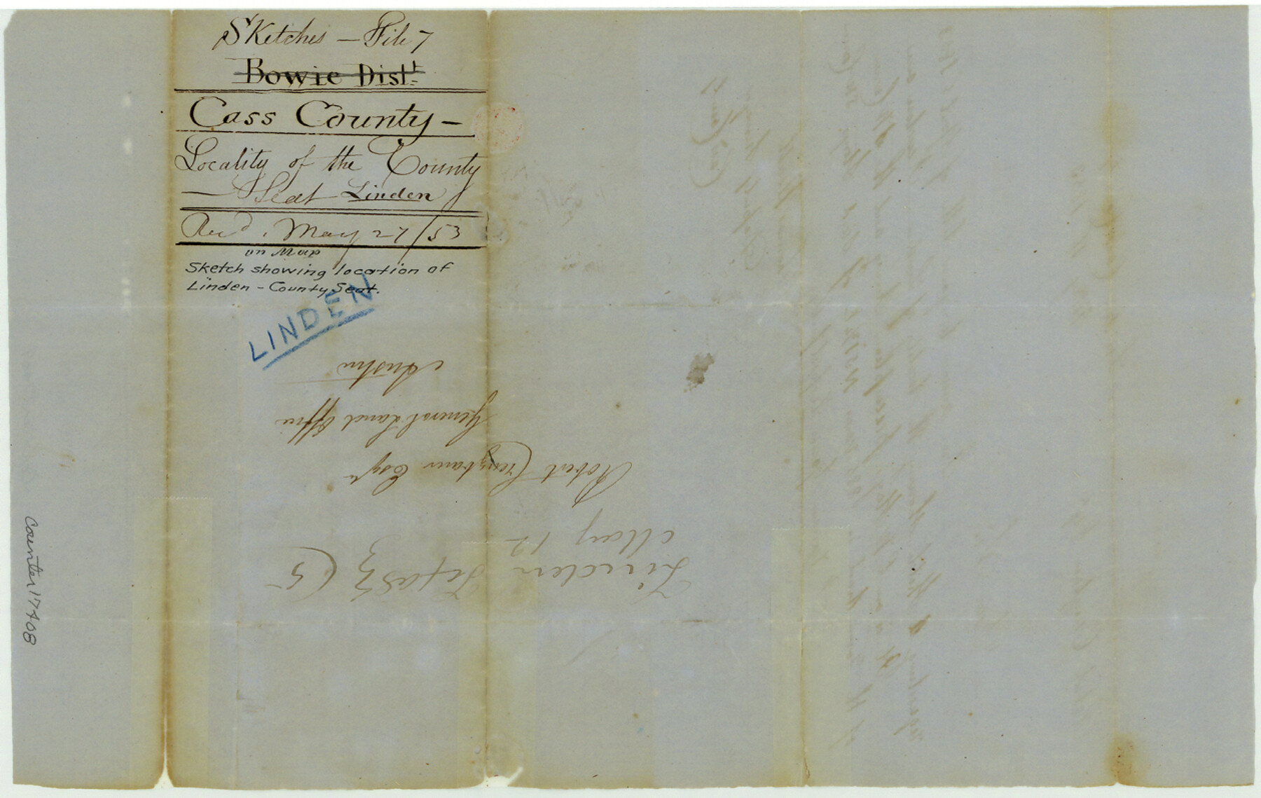
Cass County Sketch File 7
[Sketch showing location of Linden, the county seat of Cass County]
-
Map/Doc
17408
-
Collection
General Map Collection
-
Object Dates
1853/5/11 (Creation Date)
1853/5/27 (File Date)
-
People and Organizations
Thomas Heath (Surveyor/Engineer)
-
Counties
Cass
-
Subjects
Surveying Sketch File
-
Height x Width
8.0 x 12.6 inches
20.3 x 32.0 cm
-
Medium
paper, manuscript
Part of: General Map Collection
Lee County Working Sketch 19
![70398, Lee County Working Sketch 19, General Map Collection](https://historictexasmaps.com/wmedia_w700/maps/70398.tif.jpg)
Print $6.00
- Digital $50.00
Lee County Working Sketch 19
Size 33.1 x 20.1 inches
Map/Doc 70398
Mitchell County Sketch File 8
![12098, Mitchell County Sketch File 8, General Map Collection](https://historictexasmaps.com/wmedia_w700/pdf_converted_jpg/qi_pdf_thumbnail_8441.jpg)
Print $20.00
- Digital $50.00
Mitchell County Sketch File 8
1909
Size 26.9 x 20.9 inches
Map/Doc 12098
Flight Mission No. DQO-2K, Frame 133, Galveston County
![85030, Flight Mission No. DQO-2K, Frame 133, Galveston County, General Map Collection](https://historictexasmaps.com/wmedia_w700/pdf_converted_jpg/qi_pdf_thumbnail_32242.jpg)
Print $20.00
- Digital $50.00
Flight Mission No. DQO-2K, Frame 133, Galveston County
1952
Size 18.7 x 22.5 inches
Map/Doc 85030
Marion County Working Sketch 31
![70807, Marion County Working Sketch 31, General Map Collection](https://historictexasmaps.com/wmedia_w700/maps/70807.tif.jpg)
Print $20.00
- Digital $50.00
Marion County Working Sketch 31
Size 35.4 x 40.0 inches
Map/Doc 70807
Map of the Southern Pacific Rail Road through Harrison County, Texas
![64140, Map of the Southern Pacific Rail Road through Harrison County, Texas, General Map Collection](https://historictexasmaps.com/wmedia_w700/maps/64140-GC.tif.jpg)
Print $40.00
- Digital $50.00
Map of the Southern Pacific Rail Road through Harrison County, Texas
1860
Size 26.8 x 76.6 inches
Map/Doc 64140
Howard County Sketch File 2
![26846, Howard County Sketch File 2, General Map Collection](https://historictexasmaps.com/wmedia_w700/pdf_converted_jpg/qi_pdf_thumbnail_12015.jpg)
Print $18.00
- Digital $50.00
Howard County Sketch File 2
1909
Size 9.3 x 8.2 inches
Map/Doc 26846
PSF Field Notes for Blocks 42 1/2 and 43 in Culberson and Hudspeth Counties, and Blocks 30 through 41 in Hudspeth County
![81660, PSF Field Notes for Blocks 42 1/2 and 43 in Culberson and Hudspeth Counties, and Blocks 30 through 41 in Hudspeth County, General Map Collection](https://historictexasmaps.com/wmedia_w700/pdf_converted_jpg/qi_pdf_thumbnail_30423.jpg)
PSF Field Notes for Blocks 42 1/2 and 43 in Culberson and Hudspeth Counties, and Blocks 30 through 41 in Hudspeth County
Map/Doc 81660
Flight Mission No. DQN-1K, Frame 70, Calhoun County
![84157, Flight Mission No. DQN-1K, Frame 70, Calhoun County, General Map Collection](https://historictexasmaps.com/wmedia_w700/pdf_converted_jpg/qi_pdf_thumbnail_31374.jpg)
Print $20.00
- Digital $50.00
Flight Mission No. DQN-1K, Frame 70, Calhoun County
1953
Size 18.6 x 22.3 inches
Map/Doc 84157
Travis County Appraisal District Plat Map 2_0803
![94239, Travis County Appraisal District Plat Map 2_0803, General Map Collection](https://historictexasmaps.com/wmedia_w700/maps/94239.tif.jpg)
Print $20.00
- Digital $50.00
Travis County Appraisal District Plat Map 2_0803
Size 21.5 x 26.4 inches
Map/Doc 94239
Pecos County Rolled Sketch 32
![7214, Pecos County Rolled Sketch 32, General Map Collection](https://historictexasmaps.com/wmedia_w700/maps/7214.tif.jpg)
Print $20.00
- Digital $50.00
Pecos County Rolled Sketch 32
1890
Size 21.0 x 14.1 inches
Map/Doc 7214
Sutton County Sketch File J
![37505, Sutton County Sketch File J, General Map Collection](https://historictexasmaps.com/wmedia_w700/pdf_converted_jpg/qi_pdf_thumbnail_14378.jpg)
Print $4.00
- Digital $50.00
Sutton County Sketch File J
Size 14.5 x 8.8 inches
Map/Doc 37505
Dallam County Sketch File 3
![20337, Dallam County Sketch File 3, General Map Collection](https://historictexasmaps.com/wmedia_w700/pdf_converted_jpg/qi_pdf_thumbnail_10596.jpg)
Print $4.00
- Digital $50.00
Dallam County Sketch File 3
Size 14.6 x 9.0 inches
Map/Doc 20337
You may also like
Galveston County NRC Article 33.136 Sketch 82
![94601, Galveston County NRC Article 33.136 Sketch 82, General Map Collection](https://historictexasmaps.com/wmedia_w700/pdf_converted_jpg/qi_pdf_thumbnail_39168.jpg)
Print $82.00
- Digital $50.00
Galveston County NRC Article 33.136 Sketch 82
2015
Size 24.0 x 36.0 inches
Map/Doc 94601
Map of lands owned by R.E. Montgomery in Martin and Andrews County, Texas
![75764, Map of lands owned by R.E. Montgomery in Martin and Andrews County, Texas, Maddox Collection](https://historictexasmaps.com/wmedia_w700/maps/75764.tif.jpg)
Print $20.00
- Digital $50.00
Map of lands owned by R.E. Montgomery in Martin and Andrews County, Texas
Size 20.0 x 24.5 inches
Map/Doc 75764
Starr County Sketch File 28
![36948, Starr County Sketch File 28, General Map Collection](https://historictexasmaps.com/wmedia_w700/pdf_converted_jpg/qi_pdf_thumbnail_14264.jpg)
Print $12.00
- Digital $50.00
Starr County Sketch File 28
1933
Size 11.2 x 8.8 inches
Map/Doc 36948
Travis County Working Sketch 11
![69395, Travis County Working Sketch 11, General Map Collection](https://historictexasmaps.com/wmedia_w700/maps/69395.tif.jpg)
Print $20.00
- Digital $50.00
Travis County Working Sketch 11
Size 28.3 x 22.3 inches
Map/Doc 69395
Burleson County Working Sketch 46
![67765, Burleson County Working Sketch 46, General Map Collection](https://historictexasmaps.com/wmedia_w700/maps/67765.tif.jpg)
Print $20.00
- Digital $50.00
Burleson County Working Sketch 46
Size 30.6 x 36.9 inches
Map/Doc 67765
Flight Mission No. DQO-8K, Frame79, Galveston County
![85183, Flight Mission No. DQO-8K, Frame79, Galveston County, General Map Collection](https://historictexasmaps.com/wmedia_w700/pdf_converted_jpg/qi_pdf_thumbnail_32391.jpg)
Print $20.00
- Digital $50.00
Flight Mission No. DQO-8K, Frame79, Galveston County
1952
Size 18.7 x 22.5 inches
Map/Doc 85183
Flight Mission No. BRE-1P, Frame 113, Nueces County
![86679, Flight Mission No. BRE-1P, Frame 113, Nueces County, General Map Collection](https://historictexasmaps.com/wmedia_w700/pdf_converted_jpg/qi_pdf_thumbnail_33818.jpg)
Print $20.00
- Digital $50.00
Flight Mission No. BRE-1P, Frame 113, Nueces County
1956
Size 18.6 x 22.6 inches
Map/Doc 86679
Aransas County NRC Article 33.136 Sketch 9
![94469, Aransas County NRC Article 33.136 Sketch 9, General Map Collection](https://historictexasmaps.com/wmedia_w700/pdf_converted_jpg/qi_pdf_thumbnail_39103.jpg)
Print $24.00
- Digital $50.00
Aransas County NRC Article 33.136 Sketch 9
2013
Size 24.0 x 36.0 inches
Map/Doc 94469
Flight Mission No. DQN-2K, Frame 66, Calhoun County
![84258, Flight Mission No. DQN-2K, Frame 66, Calhoun County, General Map Collection](https://historictexasmaps.com/wmedia_w700/pdf_converted_jpg/qi_pdf_thumbnail_31475.jpg)
Print $20.00
- Digital $50.00
Flight Mission No. DQN-2K, Frame 66, Calhoun County
1953
Size 18.9 x 22.3 inches
Map/Doc 84258
Flight Mission No. CRK-3P, Frame 131, Refugio County
![86919, Flight Mission No. CRK-3P, Frame 131, Refugio County, General Map Collection](https://historictexasmaps.com/wmedia_w700/pdf_converted_jpg/qi_pdf_thumbnail_34053.jpg)
Print $20.00
- Digital $50.00
Flight Mission No. CRK-3P, Frame 131, Refugio County
1956
Size 18.5 x 22.4 inches
Map/Doc 86919
Callahan County Working Sketch 5
![67887, Callahan County Working Sketch 5, General Map Collection](https://historictexasmaps.com/wmedia_w700/maps/67887.tif.jpg)
Print $20.00
- Digital $50.00
Callahan County Working Sketch 5
Size 24.3 x 33.8 inches
Map/Doc 67887
Cottle County Sketch File AA1
![19398, Cottle County Sketch File AA1, General Map Collection](https://historictexasmaps.com/wmedia_w700/pdf_converted_jpg/qi_pdf_thumbnail_10418.jpg)
Print $95.00
- Digital $50.00
Cottle County Sketch File AA1
1895
Size 9.4 x 4.2 inches
Map/Doc 19398