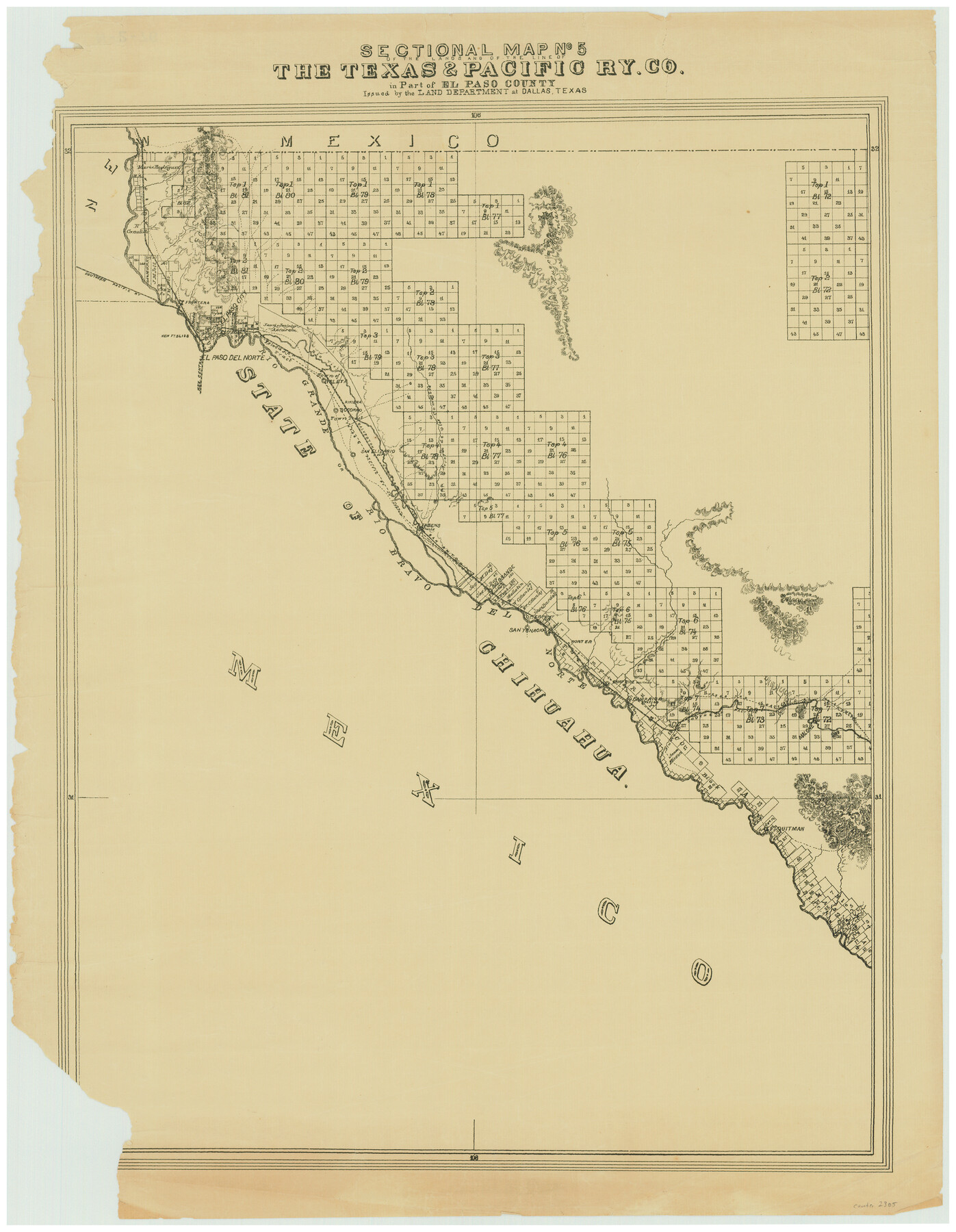
Sectional Map No. 5 of the lands and of the line of the Texas & Pacific Ry. Co. in part of El Paso County
N-2-76
-
Map/Doc
2305
-
Collection
General Map Collection
-
Object Dates
1885 (Creation Date)
-
People and Organizations
T. & P. RY. CO. (Author)
-
Counties
El Paso
-
Subjects
County
-
Height x Width
22.5 x 17.9 inches
57.2 x 45.5 cm
-
Comments
Shows lands sold and available for sale.
Part of: General Map Collection
Roberts County Working Sketch 22

Print $20.00
- Digital $50.00
Roberts County Working Sketch 22
1978
Size 31.0 x 42.9 inches
Map/Doc 63548
Texas, San Antonio Bay, Panther Point

Print $40.00
- Digital $50.00
Texas, San Antonio Bay, Panther Point
1934
Size 33.2 x 48.3 inches
Map/Doc 69995
Jasper County Working Sketch 19

Print $20.00
- Digital $50.00
Jasper County Working Sketch 19
1939
Size 15.8 x 15.8 inches
Map/Doc 66481
Mason County Working Sketch 12

Print $20.00
- Digital $50.00
Mason County Working Sketch 12
1951
Size 28.1 x 23.6 inches
Map/Doc 70848
Flight Mission No. DAH-10M, Frame 40, Orange County

Print $20.00
- Digital $50.00
Flight Mission No. DAH-10M, Frame 40, Orange County
1953
Size 18.8 x 22.6 inches
Map/Doc 86875
Map of the United States, Canada and a part of Mexico to illustrate Olney's school geography

Print $20.00
- Digital $50.00
Map of the United States, Canada and a part of Mexico to illustrate Olney's school geography
1844
Size 12.1 x 19.0 inches
Map/Doc 93537
Travis County Working Sketch 32

Print $20.00
- Digital $50.00
Travis County Working Sketch 32
1965
Size 28.0 x 40.0 inches
Map/Doc 69416
Mitchell County Sketch File 13

Print $20.00
- Digital $50.00
Mitchell County Sketch File 13
1925
Size 19.3 x 16.3 inches
Map/Doc 12100
Crockett County Working Sketch 30

Print $20.00
- Digital $50.00
Crockett County Working Sketch 30
1924
Size 30.1 x 22.1 inches
Map/Doc 68363
Hardin County Sketch File 50

Print $5.00
- Digital $50.00
Hardin County Sketch File 50
Size 13.5 x 9.2 inches
Map/Doc 25204
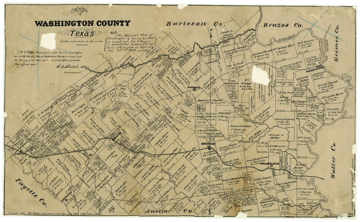
Washington County Texas
Print $20.00
- Digital $50.00
Washington County Texas
1879
Size 13.2 x 21.3 inches
Map/Doc 4124
Bastrop County Working Sketch 8

Print $20.00
- Digital $50.00
Bastrop County Working Sketch 8
1937
Size 23.9 x 43.1 inches
Map/Doc 67308
You may also like
Morris County Rolled Sketch 2A

Print $20.00
- Digital $50.00
Morris County Rolled Sketch 2A
Size 24.3 x 18.7 inches
Map/Doc 10675
Archer County Working Sketch 14

Print $20.00
- Digital $50.00
Archer County Working Sketch 14
1940
Size 23.3 x 24.3 inches
Map/Doc 67155
Typical Scenes of Wichita Falls and District

Print $20.00
- Digital $50.00
Typical Scenes of Wichita Falls and District
1927
Size 13.7 x 16.6 inches
Map/Doc 96761
Map of the Lands Surveyed by the Memphis, El Paso & Pacific R.R. Company

Print $20.00
- Digital $50.00
Map of the Lands Surveyed by the Memphis, El Paso & Pacific R.R. Company
1860
Size 18.6 x 19.0 inches
Map/Doc 4846
Map of Trinity County

Print $20.00
- Digital $50.00
Map of Trinity County
Size 17.8 x 24.8 inches
Map/Doc 760
Kinney County Working Sketch 38

Print $20.00
- Digital $50.00
Kinney County Working Sketch 38
1971
Size 28.9 x 30.6 inches
Map/Doc 70220
Pecos County Sketch File 51

Print $16.00
- Digital $50.00
Pecos County Sketch File 51
1881
Size 12.8 x 8.4 inches
Map/Doc 33773
Pecos County Sketch File 25

Print $20.00
- Digital $50.00
Pecos County Sketch File 25
Size 17.6 x 24.9 inches
Map/Doc 12164
The Republic County of Milam. December 29, 1845

Print $20.00
The Republic County of Milam. December 29, 1845
2020
Size 17.4 x 21.6 inches
Map/Doc 96233
Lavaca County Working Sketch 9

Print $20.00
- Digital $50.00
Lavaca County Working Sketch 9
1949
Size 24.7 x 33.9 inches
Map/Doc 70362
Galveston County Sketch File 70

Print $26.00
- Digital $50.00
Galveston County Sketch File 70
1983
Size 11.3 x 8.7 inches
Map/Doc 23928
Blanco County Boundary File 5

Print $100.00
- Digital $50.00
Blanco County Boundary File 5
Size 17.1 x 14.1 inches
Map/Doc 50555