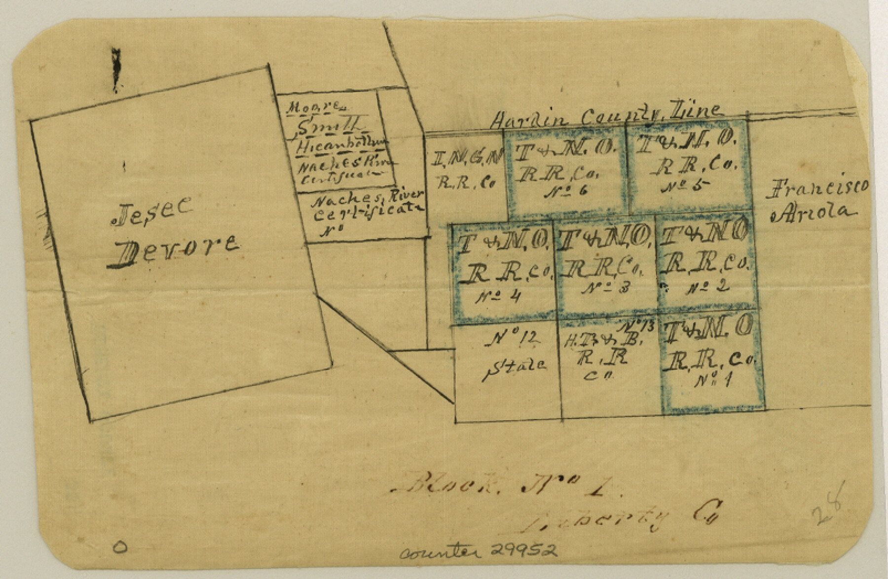
Liberty County Sketch File 28
[Sketch of T. & N. O. R.R. Co. surveys between the Jesse Devore and Francisco Ariola surveys in the east part of the county]
-
Map/Doc
29952
-
Collection
General Map Collection
-
Counties
Liberty
-
Subjects
Surveying Sketch File
-
Height x Width
5.2 x 8.0 inches
13.2 x 20.3 cm
-
Medium
paper, manuscript
Part of: General Map Collection
Borden County Working Sketch Graphic Index

Print $20.00
- Digital $50.00
Borden County Working Sketch Graphic Index
1977
Size 45.7 x 34.8 inches
Map/Doc 76468
Parker County

Print $20.00
- Digital $50.00
Parker County
1942
Size 45.7 x 37.8 inches
Map/Doc 66972
Colorado County Rolled Sketch 7

Print $20.00
- Digital $50.00
Colorado County Rolled Sketch 7
1997
Size 26.2 x 19.1 inches
Map/Doc 5534
Orange County Boundary File 9

Print $16.00
- Digital $50.00
Orange County Boundary File 9
Size 11.2 x 8.7 inches
Map/Doc 57782
Cass County Sketch File 22

Print $8.00
- Digital $50.00
Cass County Sketch File 22
1849
Size 12.8 x 7.8 inches
Map/Doc 17427
Wilson County Working Sketch 10

Print $20.00
- Digital $50.00
Wilson County Working Sketch 10
1980
Size 16.6 x 11.7 inches
Map/Doc 72590
Stephens County Sketch File 28

Print $14.00
- Digital $50.00
Stephens County Sketch File 28
1996
Size 14.2 x 8.6 inches
Map/Doc 37104
Flight Mission No. DAG-23K, Frame 165, Matagorda County

Print $20.00
- Digital $50.00
Flight Mission No. DAG-23K, Frame 165, Matagorda County
1953
Size 17.0 x 19.0 inches
Map/Doc 86503
Van Zandt County Sketch File 21

Print $4.00
- Digital $50.00
Van Zandt County Sketch File 21
1858
Size 12.1 x 7.7 inches
Map/Doc 39430
Harris County Historic Topographic 11

Print $20.00
- Digital $50.00
Harris County Historic Topographic 11
1915
Size 29.2 x 22.6 inches
Map/Doc 65821
Map of Armstrong County

Print $20.00
- Digital $50.00
Map of Armstrong County
1886
Size 23.0 x 18.6 inches
Map/Doc 3244
Garza County Rolled Sketch 17

Print $20.00
- Digital $50.00
Garza County Rolled Sketch 17
1959
Size 32.3 x 37.6 inches
Map/Doc 6003
You may also like
Right of Way & Track Map, St. Louis, Brownsville & Mexico Ry. operated by St. Louis, Brownsville & Mexico Ry. Co.

Print $40.00
- Digital $50.00
Right of Way & Track Map, St. Louis, Brownsville & Mexico Ry. operated by St. Louis, Brownsville & Mexico Ry. Co.
1919
Size 25.8 x 56.9 inches
Map/Doc 64620
Navarro County Boundary File 1

Print $66.00
- Digital $50.00
Navarro County Boundary File 1
Size 10.3 x 8.2 inches
Map/Doc 57582
Connected Map of Austin's Colony (1892 tracing)

Print $40.00
- Digital $50.00
Connected Map of Austin's Colony (1892 tracing)
1837
Size 90.8 x 46.5 inches
Map/Doc 93359
Brazos Island Harbor, Texas - Dredging Entrance Channel Plan

Print $20.00
- Digital $50.00
Brazos Island Harbor, Texas - Dredging Entrance Channel Plan
1990
Size 14.6 x 20.0 inches
Map/Doc 83337
Wichita County Sketch File H

Print $4.00
- Digital $50.00
Wichita County Sketch File H
1884
Size 12.8 x 8.2 inches
Map/Doc 40089
Atascosa County Working Sketch 16

Print $20.00
- Digital $50.00
Atascosa County Working Sketch 16
1943
Size 16.3 x 20.2 inches
Map/Doc 67212
Real County Working Sketch 67

Print $20.00
- Digital $50.00
Real County Working Sketch 67
1970
Size 21.2 x 16.4 inches
Map/Doc 71959
Crane County Working Sketch 25

Print $20.00
- Digital $50.00
Crane County Working Sketch 25
1969
Size 33.0 x 26.3 inches
Map/Doc 68302
Crockett County Sketch File 72

Print $14.00
- Digital $50.00
Crockett County Sketch File 72
Size 14.0 x 8.6 inches
Map/Doc 19862
Harbor of Brazos Santiago, Texas

Print $20.00
- Digital $50.00
Harbor of Brazos Santiago, Texas
1887
Size 27.1 x 18.3 inches
Map/Doc 72994
Nueces County NRC Article 33.136 Sketch 25

Print $36.00
Nueces County NRC Article 33.136 Sketch 25
2025
Map/Doc 97513
Anderson County Sketch File 9

Print $8.00
- Digital $50.00
Anderson County Sketch File 9
Size 12.5 x 8.2 inches
Map/Doc 12761