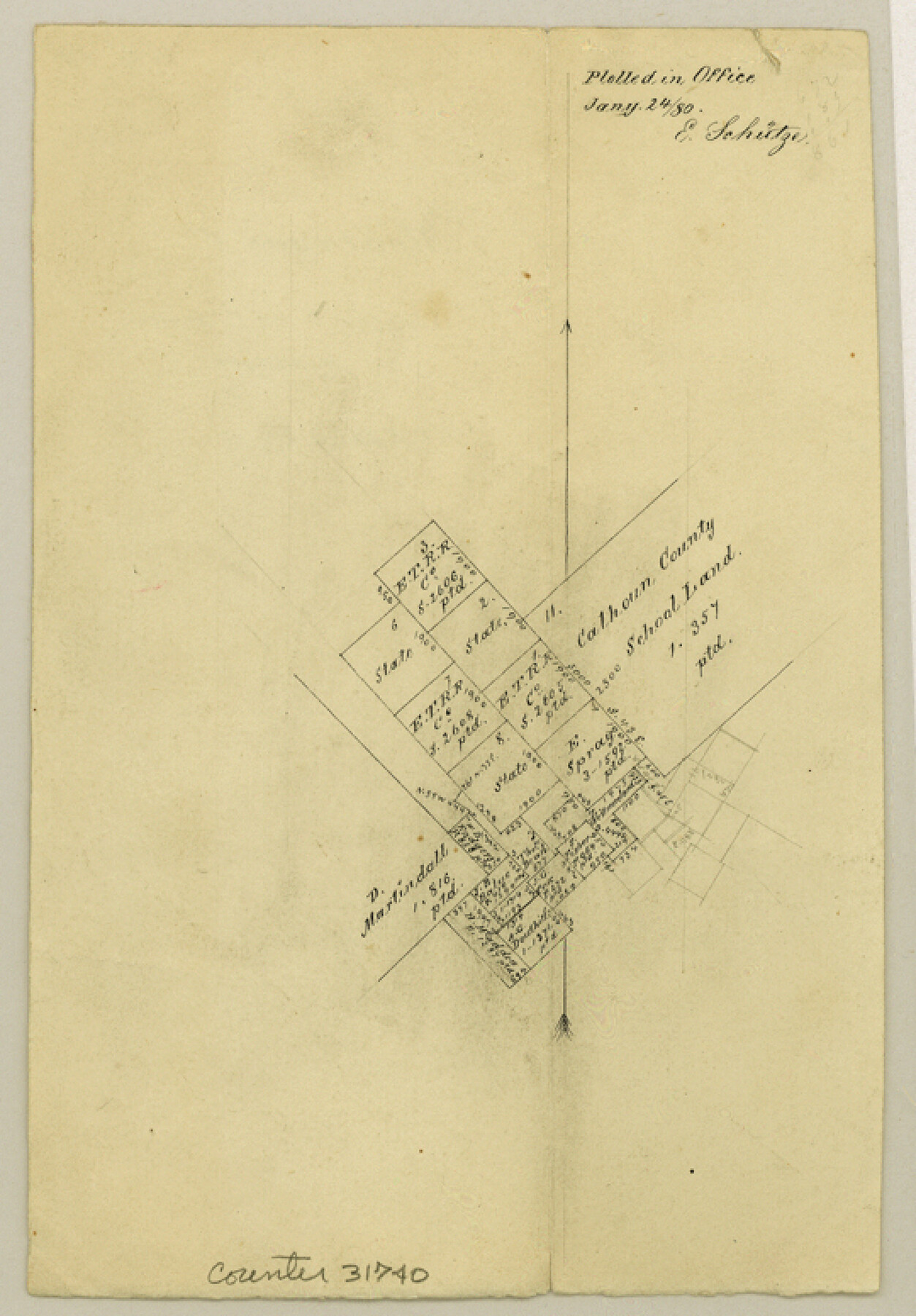
Montague County Sketch File 14
[Office sketch of surveys southeast from Montague]
-
Map/Doc
31740
-
Collection
General Map Collection
-
Object Dates
1/24/1880 (Creation Date)
-
People and Organizations
E. Schutze (Draftsman)
-
Counties
Montague
-
Subjects
Surveying Sketch File
-
Height x Width
7.8 x 5.4 inches
19.8 x 13.7 cm
-
Medium
paper, manuscript
Part of: General Map Collection
United States - Gulf Coast Texas - Northern part of Laguna Madre

Print $20.00
- Digital $50.00
United States - Gulf Coast Texas - Northern part of Laguna Madre
1923
Size 26.9 x 18.4 inches
Map/Doc 72929
Loving County Working Sketch 8

Print $40.00
- Digital $50.00
Loving County Working Sketch 8
1952
Size 21.9 x 56.6 inches
Map/Doc 70640
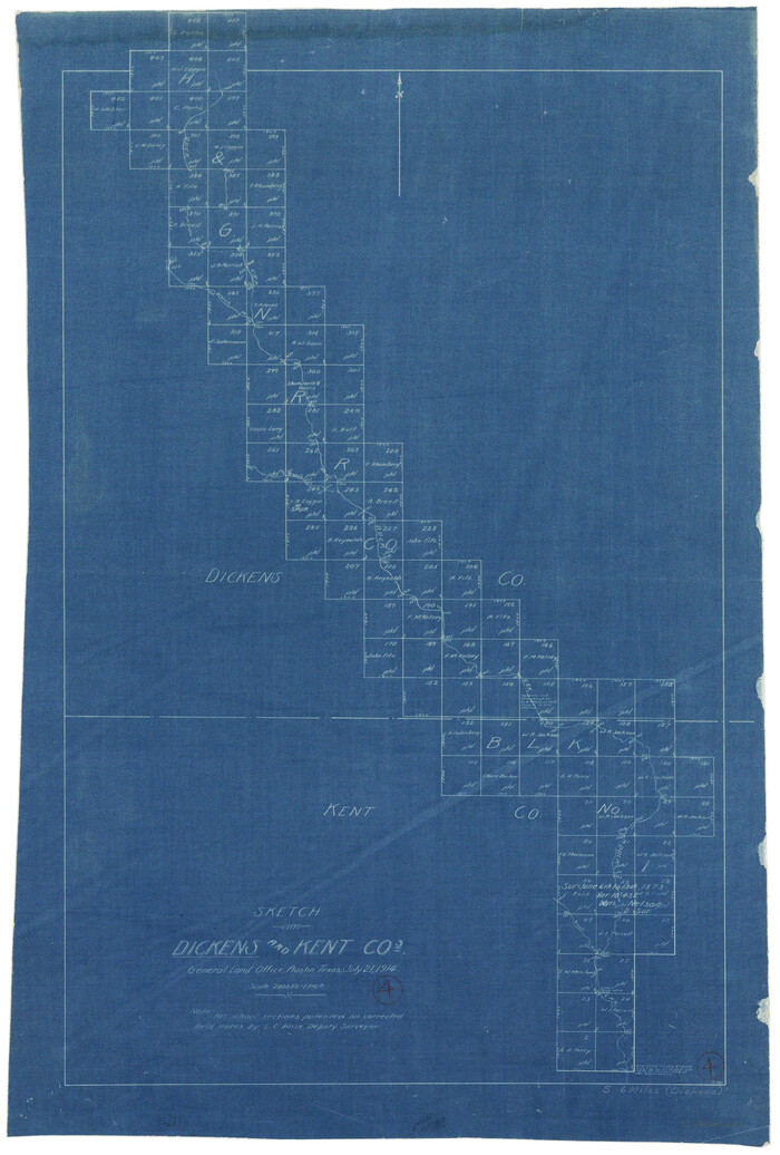
Dickens County Working Sketch 4
Print $20.00
- Digital $50.00
Dickens County Working Sketch 4
1914
Size 27.9 x 18.8 inches
Map/Doc 68651
Marion County Rolled Sketch 9A

Print $20.00
- Digital $50.00
Marion County Rolled Sketch 9A
2001
Size 22.9 x 22.9 inches
Map/Doc 76419
Flight Mission No. DAG-24K, Frame 124, Matagorda County

Print $20.00
- Digital $50.00
Flight Mission No. DAG-24K, Frame 124, Matagorda County
1953
Size 18.4 x 22.3 inches
Map/Doc 86542
Schleicher County Sketch File 44

Print $4.00
- Digital $50.00
Schleicher County Sketch File 44
1950
Size 8.9 x 14.4 inches
Map/Doc 36550
Hudspeth County Working Sketch 19

Print $20.00
- Digital $50.00
Hudspeth County Working Sketch 19
1959
Size 21.5 x 24.3 inches
Map/Doc 66301
Lampasas County Working Sketch 3

Print $20.00
- Digital $50.00
Lampasas County Working Sketch 3
1941
Size 25.0 x 14.6 inches
Map/Doc 70280
Matagorda County Working Sketch 19

Print $20.00
- Digital $50.00
Matagorda County Working Sketch 19
1961
Size 31.7 x 42.3 inches
Map/Doc 70877
Galveston County NRC Article 33.136 Sketch 92

Print $62.00
Galveston County NRC Article 33.136 Sketch 92
2021
Map/Doc 97179
Harris County Sketch File 62

Print $14.00
- Digital $50.00
Harris County Sketch File 62
1930
Size 11.4 x 8.7 inches
Map/Doc 25486
[Surveys made in Peters Colony by Dennis Corwin]
![1985, [Surveys made in Peters Colony by Dennis Corwin], General Map Collection](https://historictexasmaps.com/wmedia_w700/maps/1985.tif.jpg)
Print $20.00
- Digital $50.00
[Surveys made in Peters Colony by Dennis Corwin]
1859
Size 24.6 x 16.2 inches
Map/Doc 1985
You may also like
Flight Mission No. BRA-7M, Frame 150, Jefferson County

Print $20.00
- Digital $50.00
Flight Mission No. BRA-7M, Frame 150, Jefferson County
1953
Size 18.7 x 22.4 inches
Map/Doc 85544
Flight Mission No. DAG-21K, Frame 127, Matagorda County

Print $20.00
- Digital $50.00
Flight Mission No. DAG-21K, Frame 127, Matagorda County
1952
Size 18.5 x 22.4 inches
Map/Doc 86453
General Highway Map, Franklin County, Morris County, Titus County, Camp County

Print $20.00
General Highway Map, Franklin County, Morris County, Titus County, Camp County
1940
Size 18.4 x 25.1 inches
Map/Doc 79040
Johnson County Sketch File 24

Print $4.00
- Digital $50.00
Johnson County Sketch File 24
1873
Size 9.9 x 7.9 inches
Map/Doc 28457
Map showing survey for proposed ship channel from Brownsville to Brazos Santiago Pass

Print $20.00
- Digital $50.00
Map showing survey for proposed ship channel from Brownsville to Brazos Santiago Pass
1912
Size 18.4 x 28.8 inches
Map/Doc 72903
General Highway Map Bailey County, Texas

Print $20.00
- Digital $50.00
General Highway Map Bailey County, Texas
1948
Size 18.7 x 25.8 inches
Map/Doc 92533
Harrison County Sketch File 18

Print $20.00
- Digital $50.00
Harrison County Sketch File 18
1954
Size 23.2 x 26.9 inches
Map/Doc 11691
Kaufman County Sketch File 10a

Print $20.00
- Digital $50.00
Kaufman County Sketch File 10a
1871
Size 18.3 x 14.6 inches
Map/Doc 11906
Kenedy County Rolled Sketch 4

Print $40.00
- Digital $50.00
Kenedy County Rolled Sketch 4
1904
Size 39.4 x 57.6 inches
Map/Doc 10654
E. N. Gustafson's survey of Northern Portion of Lake Austin, Matagorda Co., TX

Print $40.00
- Digital $50.00
E. N. Gustafson's survey of Northern Portion of Lake Austin, Matagorda Co., TX
1926
Size 43.0 x 52.5 inches
Map/Doc 2068
[Sketch showing surveys in Sutton and Val Verde Counties, Texas]
![10779, [Sketch showing surveys in Sutton and Val Verde Counties, Texas], Maddox Collection](https://historictexasmaps.com/wmedia_w700/maps/10779-1.tif.jpg)
Print $20.00
- Digital $50.00
[Sketch showing surveys in Sutton and Val Verde Counties, Texas]
1880
Size 28.0 x 14.5 inches
Map/Doc 10779
[Map showing resurvey of Capitol Leagues, Hartley County, Texas]
![1760, [Map showing resurvey of Capitol Leagues, Hartley County, Texas], General Map Collection](https://historictexasmaps.com/wmedia_w700/maps/1760-1.tif.jpg)
Print $20.00
- Digital $50.00
[Map showing resurvey of Capitol Leagues, Hartley County, Texas]
1918
Size 30.6 x 47.8 inches
Map/Doc 1760