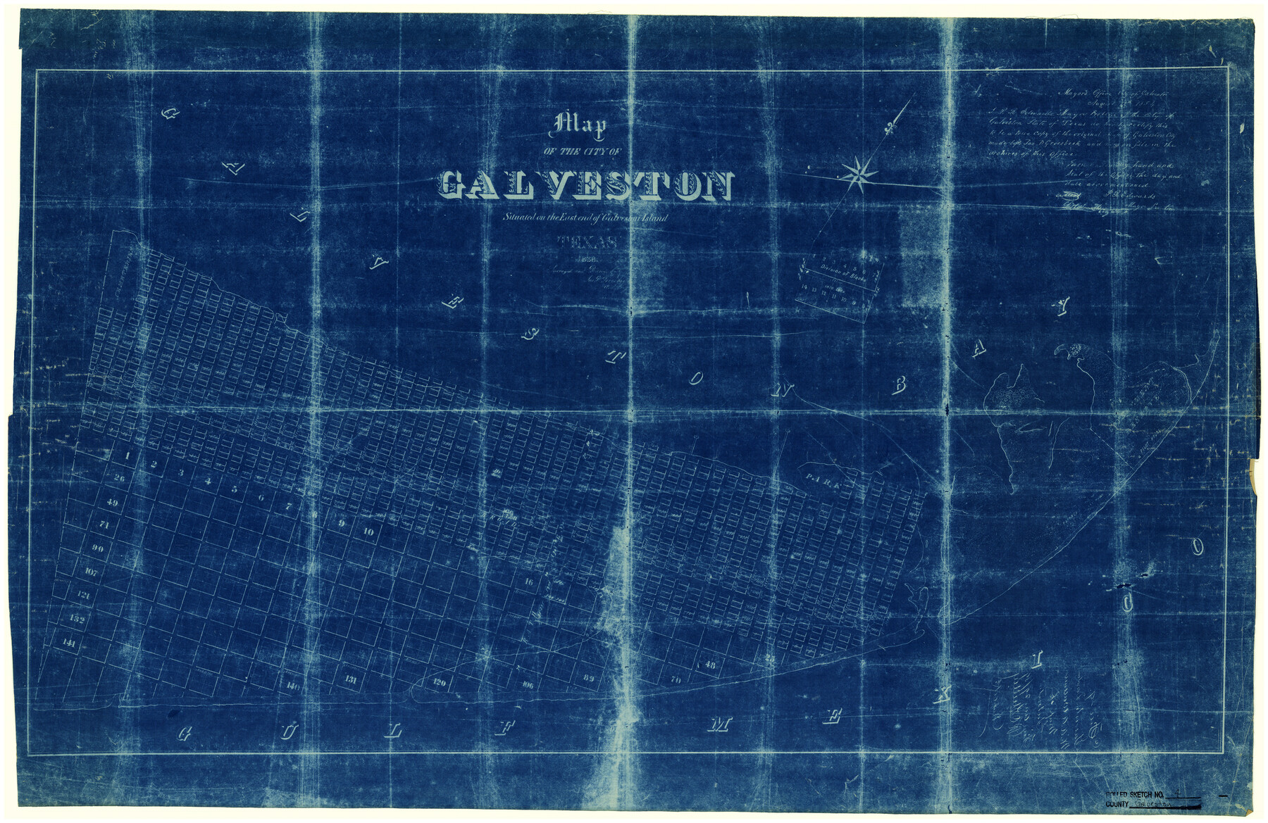
Galveston County Rolled Sketch 4
Map of the City of Galveston situated on the east end of Galveston Island
-
Map/Doc
5949
-
Collection
General Map Collection
-
Object Dates
1838 (Creation Date)
-
Counties
Galveston
-
Subjects
City Surveying Rolled Sketch
-
Height x Width
26.0 x 40.1 inches
66.0 x 101.9 cm
-
Medium
blueprint/diazo
Part of: General Map Collection
Flight Mission No. DIX-10P, Frame 169, Aransas County

Print $20.00
- Digital $50.00
Flight Mission No. DIX-10P, Frame 169, Aransas County
1956
Size 18.7 x 22.3 inches
Map/Doc 83959
Kimble County Working Sketch 52

Print $20.00
- Digital $50.00
Kimble County Working Sketch 52
1953
Size 31.1 x 16.7 inches
Map/Doc 70120
Galveston County

Print $40.00
- Digital $50.00
Galveston County
1939
Size 45.0 x 56.5 inches
Map/Doc 95505
McMullen County Sketch File 35

Print $10.00
- Digital $50.00
McMullen County Sketch File 35
Size 9.7 x 8.5 inches
Map/Doc 31402
Kleberg County Rolled Sketch 10-7

Print $20.00
- Digital $50.00
Kleberg County Rolled Sketch 10-7
1953
Size 37.3 x 34.5 inches
Map/Doc 9401
Flight Mission No. BQR-9K, Frame 42, Brazoria County

Print $20.00
- Digital $50.00
Flight Mission No. BQR-9K, Frame 42, Brazoria County
1952
Size 18.6 x 22.2 inches
Map/Doc 84046
Reeves County

Print $40.00
- Digital $50.00
Reeves County
1915
Size 48.4 x 38.7 inches
Map/Doc 66999
Lavaca County Working Sketch 4

Print $20.00
- Digital $50.00
Lavaca County Working Sketch 4
1938
Size 27.7 x 42.4 inches
Map/Doc 70357
Galveston County NRC Article 33.136 Sketch 29

Print $21.00
- Digital $50.00
Galveston County NRC Article 33.136 Sketch 29
2005
Size 22.4 x 31.9 inches
Map/Doc 83282
Brazos Santiago, Texas

Print $20.00
- Digital $50.00
Brazos Santiago, Texas
1900
Size 18.3 x 26.7 inches
Map/Doc 73032
Gulf Oil Corp. Fishgide - Freeport

Gulf Oil Corp. Fishgide - Freeport
1960
Size 12.3 x 22.4 inches
Map/Doc 75978
Stephens County Sketch File 24

Print $5.00
- Digital $50.00
Stephens County Sketch File 24
1952
Size 24.5 x 32.5 inches
Map/Doc 12354
You may also like
Atascosa County Rolled Sketch 12

Print $40.00
- Digital $50.00
Atascosa County Rolled Sketch 12
1944
Size 33.3 x 68.8 inches
Map/Doc 8429
Newton County Sketch File 4a

Print $4.00
- Digital $50.00
Newton County Sketch File 4a
Size 12.6 x 8.0 inches
Map/Doc 32362
Dietzgen "Federal" 986 Proportional Divider Drafting Tool

Dietzgen "Federal" 986 Proportional Divider Drafting Tool
Size 1.0 x 8.3 inches
Map/Doc 97307
Smith County Rolled Sketch 6C

Print $20.00
- Digital $50.00
Smith County Rolled Sketch 6C
1943
Size 25.7 x 34.4 inches
Map/Doc 10701
Map of Jack County

Print $20.00
- Digital $50.00
Map of Jack County
1896
Size 20.3 x 17.7 inches
Map/Doc 3699
Glasscock County Working Sketch 13

Print $20.00
- Digital $50.00
Glasscock County Working Sketch 13
1981
Size 17.5 x 19.5 inches
Map/Doc 63186
Andrews County Working Sketch 16

Print $20.00
- Digital $50.00
Andrews County Working Sketch 16
1957
Size 36.3 x 44.6 inches
Map/Doc 67062
Flight Mission No. DQN-1K, Frame 66, Calhoun County

Print $20.00
- Digital $50.00
Flight Mission No. DQN-1K, Frame 66, Calhoun County
1953
Size 18.7 x 22.3 inches
Map/Doc 84153
Victoria County Working Sketch 4

Print $20.00
- Digital $50.00
Victoria County Working Sketch 4
1944
Size 37.0 x 47.6 inches
Map/Doc 72274
Val Verde County Working Sketch 36

Print $20.00
- Digital $50.00
Val Verde County Working Sketch 36
1942
Size 34.5 x 44.9 inches
Map/Doc 72171

Presidio County Rolled Sketch MS

Print $20.00
- Digital $50.00
Presidio County Rolled Sketch MS
1910
Size 31.7 x 18.1 inches
Map/Doc 7411