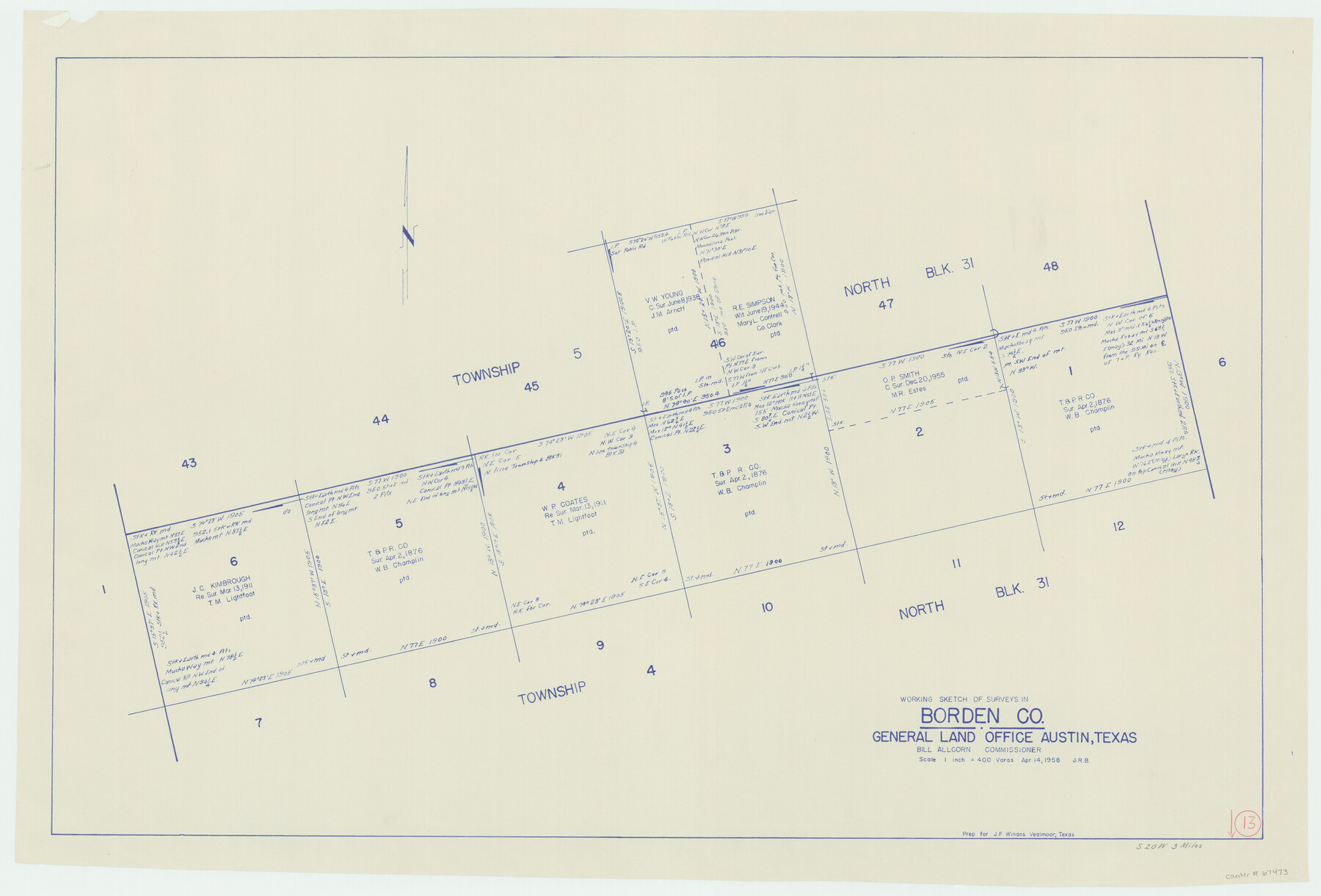
Borden County Working Sketch 13
-
Map/Doc
67473
-
Collection
General Map Collection
-
Object Dates
4/14/1958 (Creation Date)
-
People and Organizations
Bill Allcorn (GLO Commissioner)
-
Counties
Borden
-
Subjects
Surveying Working Sketch
-
Height x Width
24.1 x 35.6 inches
61.2 x 90.4 cm
-
Scale
1" = 400 varas
-
Comments
Surveys located about three miles South 20 degrees West of Gail, Texas.
Part of: General Map Collection
Hamilton County Sketch File 23

Print $20.00
- Digital $50.00
Hamilton County Sketch File 23
1955
Size 25.8 x 24.8 inches
Map/Doc 11618
[Surveys in Austin's Colony along New Year's Creek and near the Brazos River]
![218, [Surveys in Austin's Colony along New Year's Creek and near the Brazos River], General Map Collection](https://historictexasmaps.com/wmedia_w700/maps/218.tif.jpg)
Print $20.00
- Digital $50.00
[Surveys in Austin's Colony along New Year's Creek and near the Brazos River]
1821
Size 17.4 x 14.9 inches
Map/Doc 218
Comal County Working Sketch 11

Print $20.00
- Digital $50.00
Comal County Working Sketch 11
1978
Size 33.2 x 35.2 inches
Map/Doc 68177
Red River County

Print $20.00
- Digital $50.00
Red River County
1860
Size 23.0 x 20.8 inches
Map/Doc 3980
Jefferson County Sketch File 48

Print $20.00
- Digital $50.00
Jefferson County Sketch File 48
1875
Size 19.8 x 21.0 inches
Map/Doc 11882
Hays County Boundary File 4

Print $4.00
- Digital $50.00
Hays County Boundary File 4
Size 5.1 x 8.9 inches
Map/Doc 54607
Westliches - Nordamerica

Print $20.00
- Digital $50.00
Westliches - Nordamerica
1867
Size 25.3 x 20.7 inches
Map/Doc 93753
Flight Mission No. DQO-7K, Frame 106, Galveston County

Print $20.00
- Digital $50.00
Flight Mission No. DQO-7K, Frame 106, Galveston County
1952
Size 18.5 x 22.6 inches
Map/Doc 85121
Flight Mission No. DIX-3P, Frame 172, Aransas County

Print $20.00
- Digital $50.00
Flight Mission No. DIX-3P, Frame 172, Aransas County
1956
Size 17.7 x 18.3 inches
Map/Doc 83778
Austin County Sketch File 8

Print $40.00
- Digital $50.00
Austin County Sketch File 8
1894
Size 19.3 x 19.9 inches
Map/Doc 10873
Asher and Adams' Texas - Western Portion

Print $20.00
- Digital $50.00
Asher and Adams' Texas - Western Portion
1874
Size 24.6 x 18.1 inches
Map/Doc 93787
McCulloch County

Print $20.00
- Digital $50.00
McCulloch County
1949
Size 41.0 x 31.1 inches
Map/Doc 77361
You may also like
Jefferson County Sketch File 8a

Print $42.00
- Digital $50.00
Jefferson County Sketch File 8a
Size 8.6 x 7.8 inches
Map/Doc 28120
Brewster County Working Sketch 9

Print $20.00
- Digital $50.00
Brewster County Working Sketch 9
1910
Size 14.3 x 14.4 inches
Map/Doc 67542
Baylor County Aerial Photograph Index Sheet 2

Print $20.00
- Digital $50.00
Baylor County Aerial Photograph Index Sheet 2
1950
Size 22.2 x 15.4 inches
Map/Doc 83664
Map of Uvalde County

Print $20.00
- Digital $50.00
Map of Uvalde County
1862
Size 27.4 x 20.7 inches
Map/Doc 4109
Van Zandt County Sketch File 15a

Print $4.00
- Digital $50.00
Van Zandt County Sketch File 15a
1858
Size 6.7 x 8.1 inches
Map/Doc 39406
Harris County Sketch File 13

Print $40.00
- Digital $50.00
Harris County Sketch File 13
Size 14.4 x 12.2 inches
Map/Doc 25355
Wood County Sketch File 9

Print $4.00
- Digital $50.00
Wood County Sketch File 9
1852
Size 7.4 x 8.9 inches
Map/Doc 40656
English Field Notes of the Spanish Archives - Books GMP, FH, SCH, and JAV

English Field Notes of the Spanish Archives - Books GMP, FH, SCH, and JAV
1835
Map/Doc 96545
Kimble County Sketch File 39

Print $12.00
- Digital $50.00
Kimble County Sketch File 39
1885
Size 14.1 x 8.6 inches
Map/Doc 28997
[Blocks C-3, A-2, 29, GG and I]
![91612, [Blocks C-3, A-2, 29, GG and I], Twichell Survey Records](https://historictexasmaps.com/wmedia_w700/maps/91612-1.tif.jpg)
Print $20.00
- Digital $50.00
[Blocks C-3, A-2, 29, GG and I]
Size 26.0 x 18.8 inches
Map/Doc 91612

Turner 23 Acres in Lee County

Print $20.00
- Digital $50.00
Turner 23 Acres in Lee County
Size 27.0 x 20.2 inches
Map/Doc 91081